


Meatyorologist
-
Posts
8950 -
Joined
-
Last visited
-
Days Won
13
Posts posted by Meatyorologist
-
-
3 hours ago, MossMan said:

That's my sleep paralysis demon
-
 1
1
-
 1
1
-
-
5 hours ago, Cascadia_Wx said:
Actually you didn’t. Looks like nicknames for Richard are censored here.
I'll have to fix that when I get home!
-
3
-
-
In n Out is great. Imagine Dick's drive in, but everywhere across the SW instead of just the Seattle area. I had my first burger from them at the central Hollywood location on a road trip just out of high school. It's impressively good for a fast food joint.
-
 5
5
-
-
5 hours ago, Cold Snap said:
One record I think is absolutely insane is the 14.3” of snow Bozeman got on June 13, 2001. The fact that happened during meteorological summer is crazy. Though it was recorded on the MSU campus weather station and not at the airport.
I think their 2" on August 24th 1992 is absoluetly f****** absurd. At least in June there is just enough residual wintertime cold left over at the poles to drop snow levels down to 5k feet should it be displaced south, and enough of a poleward thermal gradient still in tact to spawn strong-ish cutoff lows around the meridian line. Mid-late August is a joke of a time to get a snowstorm, even at their somewhat high elevation. They pretty much combined the strongest weather system possible at that time of year with the coldest air possible... Neither factors being very impressive nonetheless. But enough is enough. The only month I doubt they could pull off a snowstorm at all would be during July, and even then I bet the first week holds some out-there potential in the right setup. July 15-August 15 is off the table though. I think....
-
4
-
1
-
 1
1
-
-
1 hour ago, Sunriver Snow Zone said:
00z GFS gives me a foot of snow, ITTTTTSSSS COMIIIINGGG!! (I refuse to look at the kuchera map)
.thumb.png.db394dec03f2da22c396f13216d7e450.png)
How deep into the year can you see snow? Seattle proper has arguably seen flurries as deep into the Spring as May 1st (at night w/o accumulation and probably a precip mix of course), so I imagine May is no issue up there.
-
1
-
1
-
-
3 hours ago, GHweatherChris said:
MAGA MAGA
Please stop.
-
4
-
 4
4
-
 1
1
-
 1
1
-
-
26 minutes ago, Cascadia_Wx said:
The change between 1pm and 4pm was pretty fun. Would have been nice to have a little more precip with and a more robust cold pool in the wake of the front.
I hate calling people out. It makes me feel evil. But between all the constant negative reacts and the constant replies it feels like you're trying to act as forum police.
I get the climate anxiety. I get it. I feel it too.
-
2
-
 1
1
-
 1
1
-
-
43 minutes ago, Cascadia_Wx said:
Seems like alot’s been made of today’s front, but we’ve seen drops throughout the day like this multiple times during our more active springs
You are such a wet blanket sometimes. Geez
-
3
-
2
-
-
Mom and I went to get my car's engine replaced today. At the start of the appt it was 73F and slightly breezy with mostly sunny skies. By the end it was 55F and cloudy with drizzle, and gusts of wind blowing dust into our eyes. Love the meatyorology today.
-
3
-
1
-
-
1 hour ago, TT-SEA said:
Not sure there will be much rain in Seattle... maybe none.
I'm more or less focused on the temperature crash. Even if it doesn't rain the evaporative cooling from rain in the vicinity will cool things off quickly and substantially.
-
3
-
-
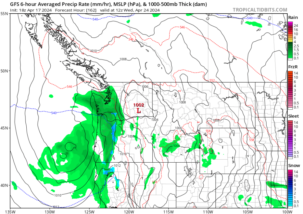
Tomorrow's gonna be wild. More akin to what you would see east of the Rockies. Not so sure I've ever seen such a quick pattern progression outside of the summer.
6am: Upper 30s and calm after a clear night. Warmer on the hilltops exposed to east winds, but in the usual sheltered cold spots it should decouple fine.
Noon: Low-mid 70s and increasingly breezy out of the east. Main ridge axis overhead. Some filtered sunshine, with fast moving high clouds. It'll be a beautiful morning.
6pm: 50s with increasing rain as a cold front absolutely violates the westside. Some pockets of heavier showers embedded given the warm air ahead of the front. Crazy crash.
Midnight: Mid 40s and showery. Not even twelve hours after the main ridge axis passes over does the main axis of our trough glide through. Already starting to warm again above 700mb.
-
2
-
 1
1
-
 1
1
-
-
He's gonna love this run.
-
9 hours ago, Phil said:
Maybe if we get this pattern out of the way in spring it’ll reverse during the summer.

Or maybe by force of habit it LOCKS IN PERMANENTLY
-
6 hours ago, ChrisEl Elyon said:
Wonder if it might trigger thunderstorms for some areas?
Not enough instability. If the trough were arriving more from the SW, then perhaps.
-
2 hours ago, Phil said:
The 00z CMC and GEFS both have that zonal/onshore flow pattern establishing during week-2. A J***e delight.
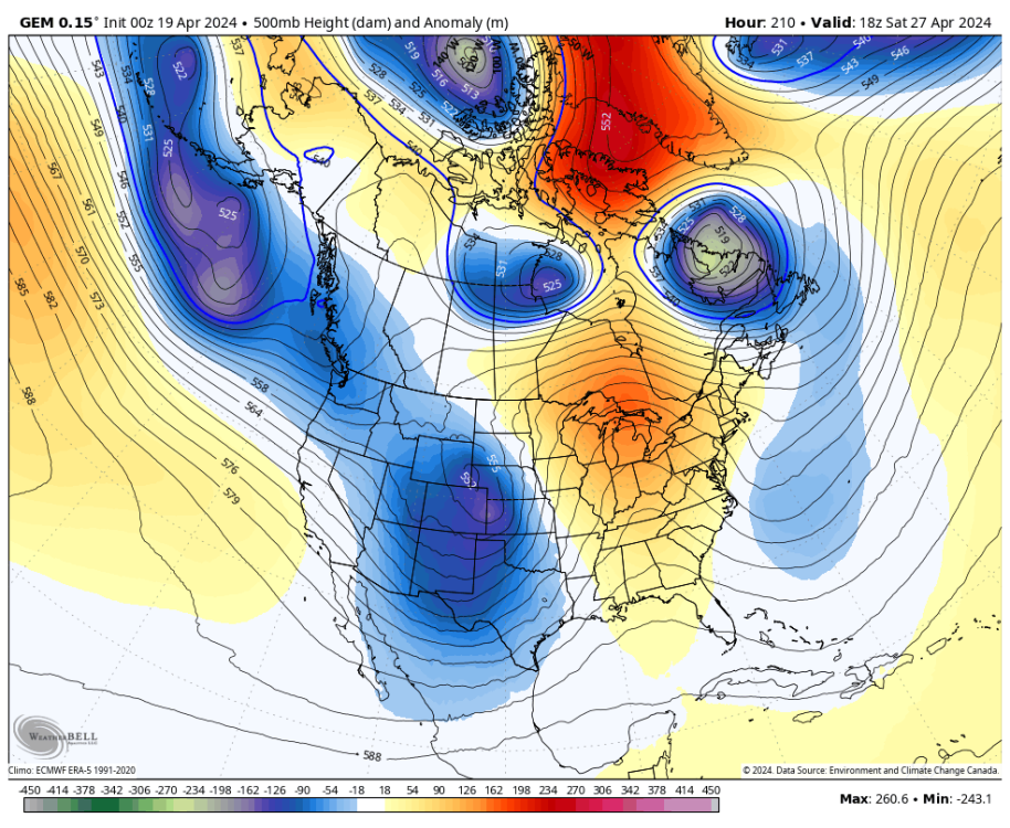
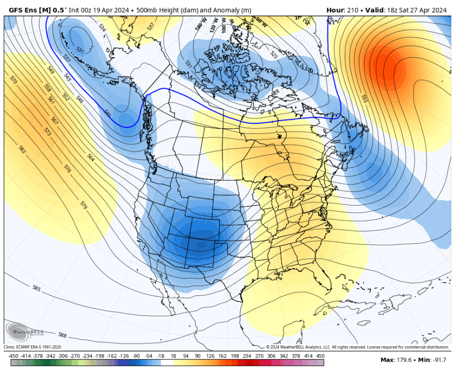
Beautiful pattern here. Looks whet.
-
1
-
 1
1
-
-
Snowing at a rate of around 0"/hr here
-
1
-
1
-
1
-
 2
2
-
1
-
-
1 hour ago, Cascadia_Wx said:
The fact that those are the two analogs you remember most readily for that sort of thing says more about the sad state of our climate than it does anything. 2019 actually had a top tier warm and dry May and an averagish June followed by a reasonable if not mild summer. 2022 had a coolish and wettish May followed by an averagish June, after which we descended directly into summer hellfire and didn’t look back until November.
They’re getting pretty ancient now, but a couple better examples of a classic cool and wet May/June would be 2010 and 2012.
It actually says more about how old I am, Jesse (22).
Unfortunatley I can't share your memories of being serenaded with blessings in May 1998!
edit: my main point was about green grass those two years were pretty green through mid July here, 2022 especially. Definitely not the norm of the last decade or so
-
1
-
-
I really hope May and June are a soaker. That usually keeps things lush into the early Summer.
Already starting to see some brown in the backyard. Running out of time to save it before our wet season is used up. Nothing is worse than entering ASO browntown three months ahead of schedule and staying that way. The majority of 2014-18 were tinder dry and sickly colored. Hoping we go the route of 2019, or especially 2022.
-
1
-
-
3 hours ago, MossMan said:
The breeze smelled quite clean today!
It was absolutely stellar. Taking out the trash at work was a treat.
-
1
-
1
-
-
I got a nice little weekend off coming up for me. Warm and breezy Friday, a bipolar Saturday with a warm morning crashing to onshore flow and drizzle by dinnertime, and a fairly cool Sunday. Might even nab one of those sub 50F highs which are rapidly becoming harder and harder to get.
-
2
-
1
-
-
10 minutes ago, Cascadia_Wx said:
Gorgeous day here. Morning frost then afternoon sunshine with a cool breeze, reasonable temps and some decorative puffy clouds around.
64/34 spread.
Today's thermal profile is pretty much dry adiabatic all the way up to 700mb, thanks to some descending easterlies above 5000'. We worked extra hard to reach the 60s today, despite the chilly air aloft. Side note...Unless they knicked it just after 5pm, it looks like KSEA avoided the 60F mark by a hair.
No matter what though the dry air is making it feel much cooler. And as an ode to how deeply mixed today was, despite dewpoints in the mid 20s, there were still some tufts of cumulus about this afternoon; way up high of course at the very top of the boundary layer where the particularly precocious lifted parcels nudged just barely high enough to saturate, probably around 7000'+.
-
2
-
-
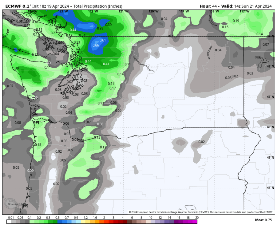
The Euro has a beast of a trough for Maine late next week with highs in the 20s all the way down to the coast.
-
3
-
1
-
-
Starting to get to that time of year where we look out for warm core convection. Next week looks like our classic mid-Spring +ENSO cutoff bonanza with lots of potential outcomes, including negtaively tilted troughing. Could be something to grab onto. Haven't had a really good thunderstorm setup since May 2020.
-
7
-
1
-
-
16 minutes ago, TT-SEA said:
Beautiful day for the Mariners in Seattle...
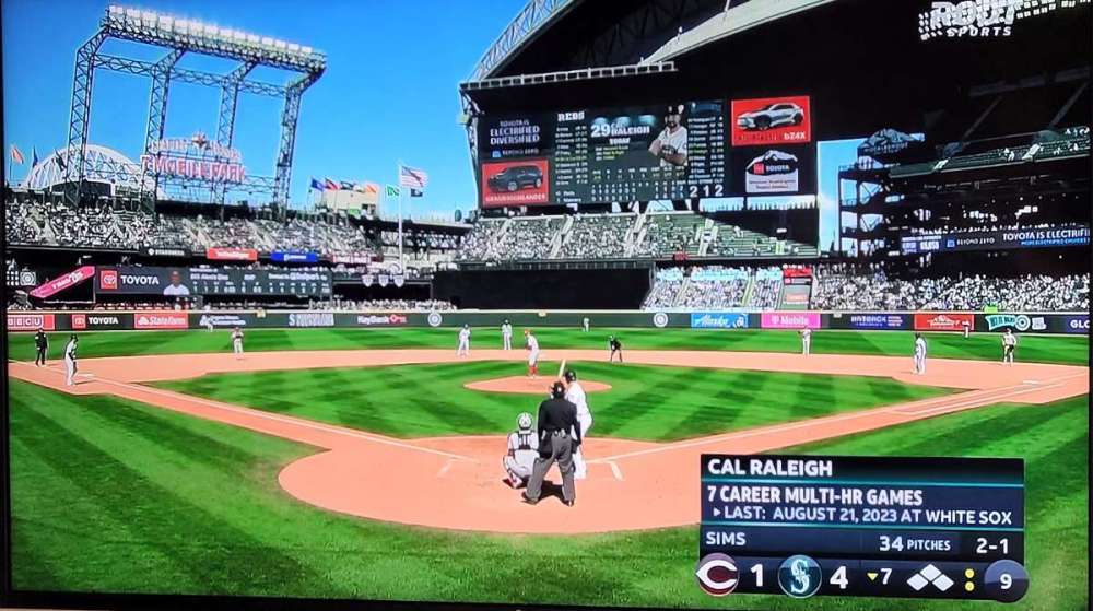
In a few ways!
-
1
-
 1
1
-
.png.adef18d54aee895f2fa17d13a1f5298a.png)


April 2024 Weather in the PNW
in West of the Rockies
Posted
Kind of works out perfectly. You don't have to miss out on any beautiful weather here, while I get to enjoy the late season cold rain. It also ensures the grass will stay green deeper into the Spring and summer here, which while that may not be so difficult in North Bend, down in Seattle I'm already seeing brown spots in the most exposed parts of my lawn.
Okay! I keep hearing this over and over! My roommate and I were just talking about it the other night. Is it really that good??