


Meatyorologist
-
Posts
8950 -
Joined
-
Last visited
-
Days Won
13
Posts posted by Meatyorologist
-
-
6 hours ago, T-Town said:
Some good clouds this evening.
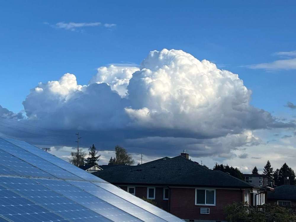
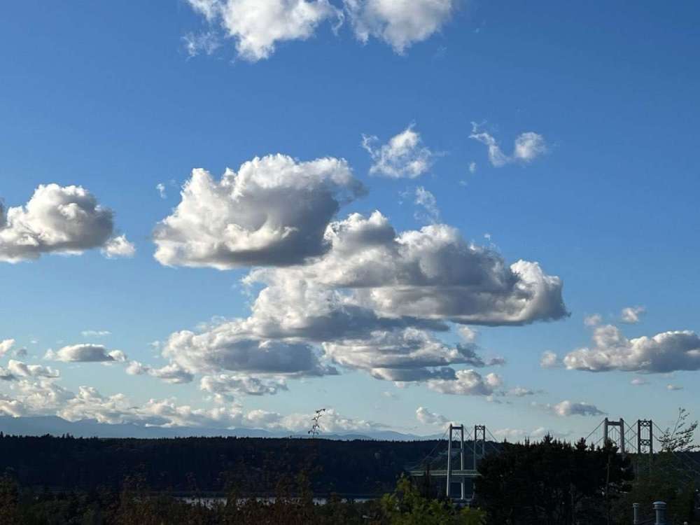
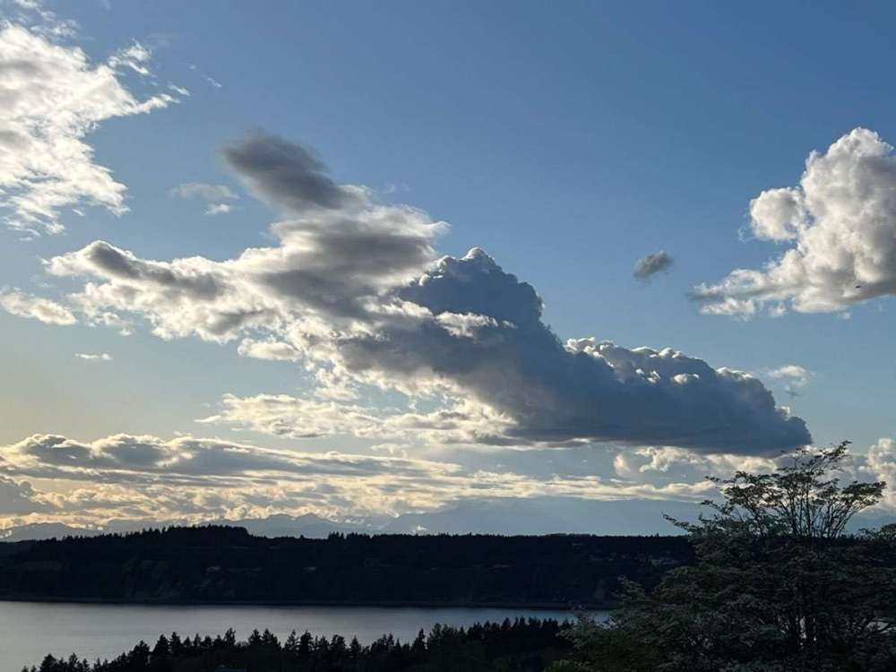
These are the posts I can appreciate.
-
 3
3
-
-
37 minutes ago, Deweydog said:
It’s in the bottom four on my list too:
It's on my top four, but not top three.
-
1 minute ago, Phil said:
Lmaoooooo. I’ll cut off my left pinkie with a butter knife if that happens.
Quite the escalation there!
-
 1
1
-
 1
1
-
-
17 minutes ago, Omegaraptor said:
Dubai just got 5” of rain in one day!
Seattle's done that
-
4
-
-
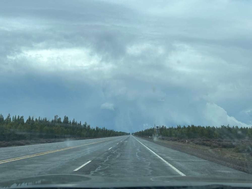
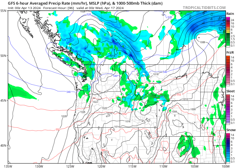
Thursday-Saturday will feature similar setups with clear skies and low DP's at night, but with the air aloft steadily moderating Wednesday morning will be the only shot at the freezing mark. There's only so much you can do with clear skies halfay through April, you need that extra upper level support to take the load off.
-
 1
1
-
-
Wednesday's record low is 33F from 1964. With heights increasing, offshore winds, and 1000-500mb thickness less than 528dm I think we could pull off a freeze under clear skies, if we're lucky. Kind of a long shot. But KSEA has thrown some surprises when nighttime inversions grow deep enough.
-
2
-
1
-
1
-
-
26 minutes ago, TT-SEA said:
Now that the ECMWF got on board with the weekend system... the 18Z GFS decides to wash it out before arrival.
Given that the Euro is buying it and the GFS has been consistent, I'd say it's probably coming. EPS is overwhelmingly on board. The 18z is probably just some typical midrange GFS flailing.
-
1
-
 1
1
-
-
Eugene got over half an inch of rain today. Solid.
-
6
-
1
-
 1
1
-
 1
1
-
-
10 minutes ago, Frontal Snowsquall said:
Unfortunately it looks like the moisture didn’t quite make it up north. We will have another chance on Monday and Tuesday but it looks like we might be too far south. It looks like PDX is in the donut hole at the moment.

So far PDX is running 43% of normal precipitation about halfway through the month of April.


Salem should be grateful.
-
2
-
-
Buddy and I went on a walk to enjoy the catastrophe today. Saw some cumulus shrouding Mt. Rainier, lots of high clouds, sunny, mild weather.
Him and I are both science nerds so we got to talking about adiabatic cooling and how it works... Neither of us really knew the exact answer, and none of the information we read online felt comprehensive or satisfying. After some shared thought my buddy tossed me a theory that I think makes the most sense. As he guessed, as a parcel rises, and the volume of that parcel increases, the fastest moving ("hottest") molecules in that parcel travel outwards towards the edge first, since they are faster. Those "hot" molecules, being the first of the parcel to make direct contact with the environent surrounding it, transfer their heat out via conduction. It's essentially a molecule sorting process, where the hottest molecules are most likely to conduct their thermal energy to the surroundings, since they are faster than the rest of the molecules, and fill in the expanding parcel first. As you can imagine, transferring heat out of the parcel via the warmest particales preferentially will cool off the parcel, and at a fixed, predictable rate, too.
Any seasoned mets want to pitch in? Are we onto something or shooting blanks? Don't know where else to ask. Maybe Reid Wolcott knows.
-
4
-
1
-
-
3 hours ago, SilverFallsAndrew said:

#neverstopchasing
-
2
-
-
4 hours ago, Cascadia_Wx said:
We’ve probably had a dozen or more iterations of this exact same discussion over the years and August keeps getting hotter.
Jinx’s and superstition don’t do a lot to circumvent a rapidly warming region/planet, sadly

Not if I pour ice water on KPDX's thermometer every hour for the next five months.
-
 1
1
-
1
-
 1
1
-
-
It would be totally on theme to run a -4F at KPDX this August after all this talk.
-
1
-
-
8 minutes ago, BLI snowman said:
Recently I would say that the "start" of summer, if we're defining that as reliably sunny, warm, and dry weather, has broadly coincided with the annual death of the polar jet across the CONUS, which is usually at the very end of April or during the first half of May.
Whereas in historic terms the PNW often keeps the cut-off low factory going well enough into June that spring-like climo still persists, with cooler temps and showery weather hanging around. Anecdotally it just feels like those patterns during that stretch of calendar have had a lot less teeth in the last decade while also being a little fewer and further between. Perhaps owing to the stronger flexing of the 4CH. In any case it seems pronounced enough to be a trend and it does feel like it correlates pretty soundly with our midsummer climate changes.
Never thought about the inception of our annual warm season in that way. Good insight.
-
4
-
1
-
-
At its core, it's a 4CH issue. Something about the decaying Niño and the wonderful state the current western US snowpack situation is in gives me some hope we might be able to avoid a bloated western ridge via thermal heating runaway.
2019 would have been a cool summer if it weren't for the ridge that popped overhead mid July-September. It was a wasted opportunity, the only other opportunity we've had since 2012.
-
1
-
-
28 minutes ago, TT-SEA said:
So focusing on just April... since 2017 Portland has averaged 3.26 inches of rain in April compared to the long term average of 2.53 inches. Significantly wetter than average.
Also in Portland since 2017... April has averaged 52.8 degrees compared to normal of 52.8 degrees. Exactly normal overall in recent years. In addition... the last 2 years April was colder and much wetter than normal.
I think its more of the usual irrational doom and gloom to say April is becoming more of a summer month in recent years. Its been normal in terms of temps and quite a bit wetter than normal in terms of precip.
Those are just straight statistics. Not much room for debate there.
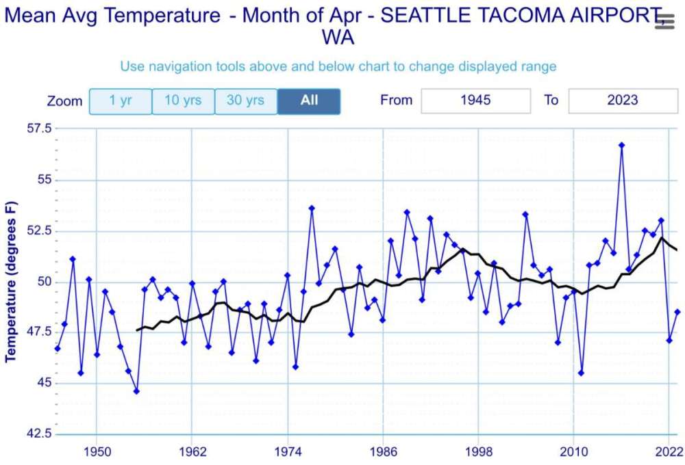
I don't want to pour gasoline on the fire, but you are pretty conveniently cutting off April 2016 and it's juicy 90-burger. Just peep at that spike, yowzers!
But looking at the graph again, you can see we're simply making up for the dip during the 2000s, amidst an overall warming trend since records began. We're probably just oscillating back into a slightly shallower low point than the 2000s dip. April might be a little cooler for the next decade. Or probably not. Who knows.
-
1
-
-
Could squeeze out a subfreezing low Wednesday morning. Timing is perfect.
-
2
-
 1
1
-
 1
1
-
1
-
-
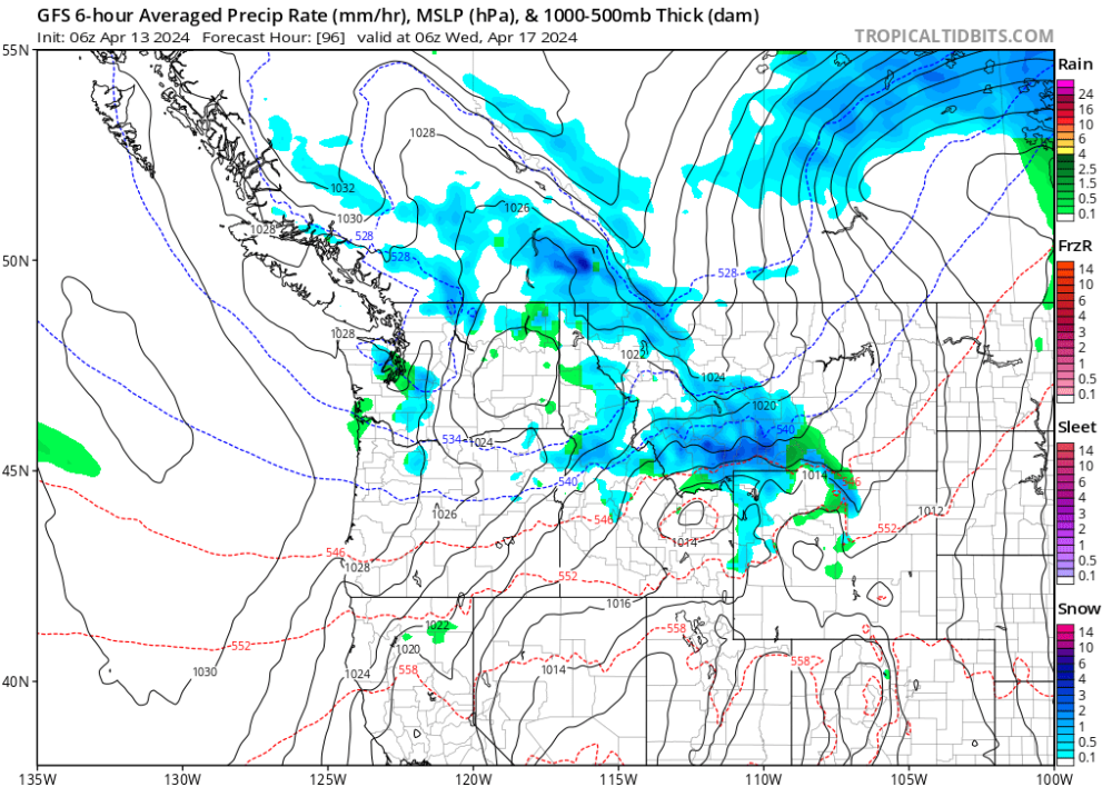
'Nuther nudge south on the 06z. It even gives our pal in North Bend some late season magic...
-
5
-
 1
1
-
1
-
 1
1
-
-
The 00z GFS is actually a little further south again with the trough and brings some convective showers back to Seattle with lows in the mid 30s. Hopefully it's the start of a last minute trend.
-
5
-
1
-
-
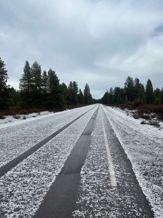
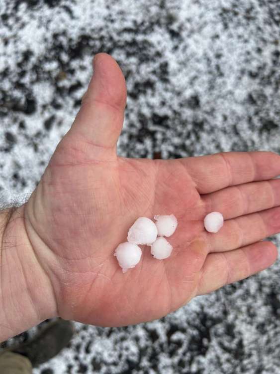
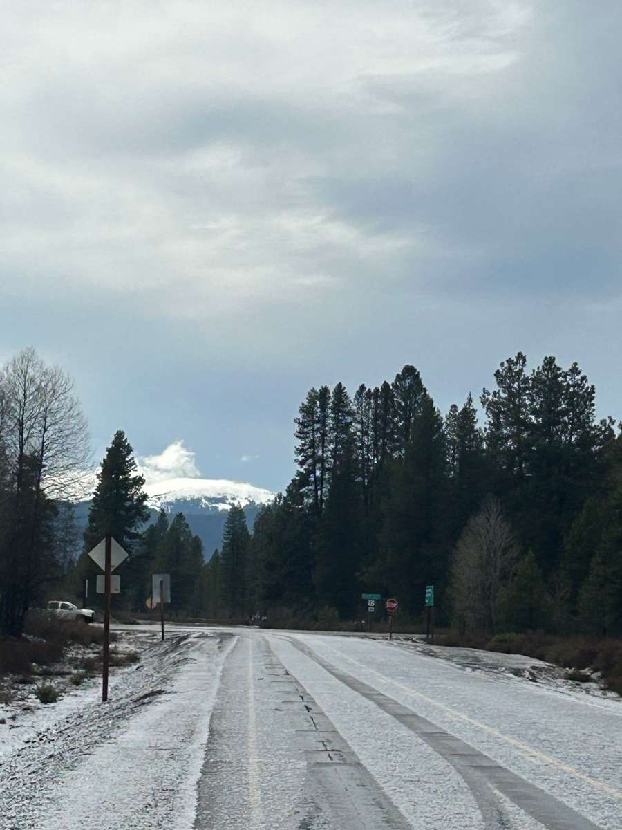
Klamath Falls is going to have a very interesting Saturday night. Bands of thundersnow out of the northeast. Can't say that's a common weather occurence in the PNW.
-
3
-
1
-
1
-
-
28 minutes ago, Cascadia_Wx said:
Canada has an all-time warm winter any time California gets some storms. No big deal. At least it’s been nice here!
To be fair, California absolutely needed these last couple years. They were in a really bad way as recently as Fall 2021.
-
2
-
1
-
-
Annoying last minute trend to send this week's clipping trough into BC. Given their snowpack situation though it's probably for the best. I think someone said the other day that the snowpack situation there is the worst in recorded history? I had no idea. Canada has seriously torched this winter.
-
33 minutes ago, Phil said:
Interesting. I assume you’re to the north of said hills?
Yep! NNE. Directly in the lee of Maple Leaf hill.
-
51 minutes ago, Phil said:
Interesting, that’s kind of similar to here, then (w/rt the “instant” start time and lack of precip). Are the winds more sustained out there or are they more gusty?
Out this way the big league windstorms are driven by mountain waves and downsloping under post-frontal CAA/pressure rises. So winds usually manifest as strong, pulsing gusts that come in sets of 2-3 (except in exceptional events, which can rip nonstop, but that is uncommon).
It's pretty gusty in nature here, though I'm in the lee of some ~450' hills, so short timescale wind patterns could be more stochastic in nature right where I am due to lee turbulence. Could be much different in a more exposed location such as the top of Magnolia near Discovery Park, at 300' overlooking the Puget Sound.
-
1
-


April 2024 Weather in the PNW
in West of the Rockies
Posted
It's absolutely embarrassing how delayed the Euro is on Tropical Tidbits. It's also very low in resolution and has limited filters. No other weather model site has any of those issues with the Euro, not anymore at least, not since the ECMWF eased back on their premiums in 2022. I wouldn't even mind the limited filters if it weren't for the three hour offset.