OmahaSnowFan
-
Posts
2693 -
Joined
-
Last visited
-
Days Won
1
Everything posted by OmahaSnowFan
-
May or December 15th?

-
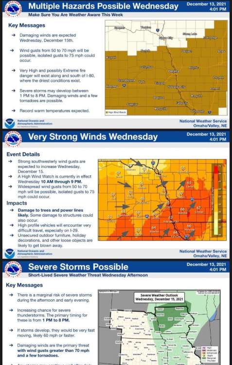
Holy sh*t we have a moderate risk in Iowa and Minnesota…. ON DECEMBER 15TH! 10% tornado 45% significant wind


-
-
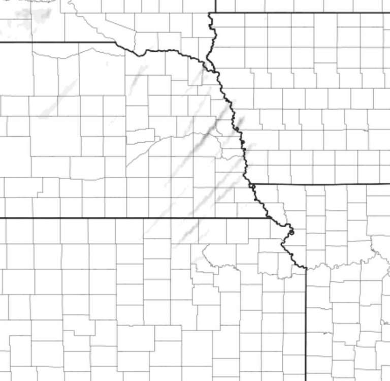
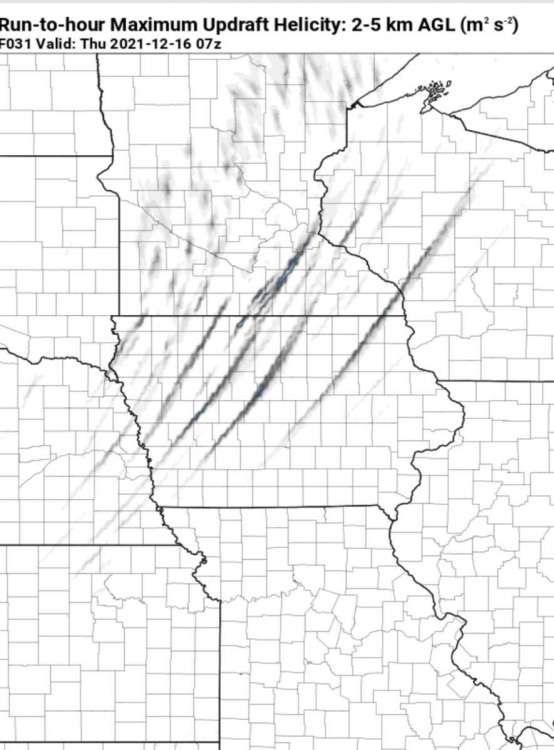
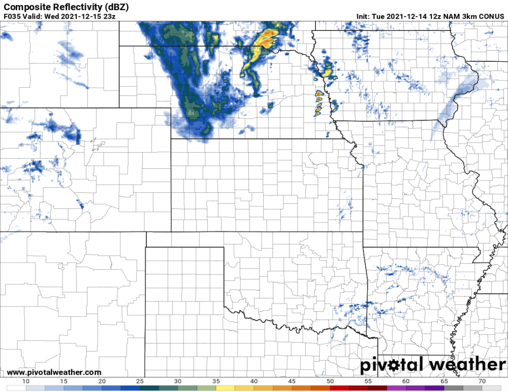
Pulled some images off of the 0Z 3km NAM. Continues to be the most ominous I would say both for Omaha and into Iowa as well. Starting to show much stronger Helicity tracks as well🌪🌪


-
If nothing else, I'm hoping to document whatever I can, whether that be storms or just the extreme wind. I have an anemometer that I can put onto the roof of my car with heavy duty magnets so I'm hoping to measure some crazy wind gusts.
-
yeah my biggest concern is not being able to get out of the way of something on the ground moving at 80 mph!!
-
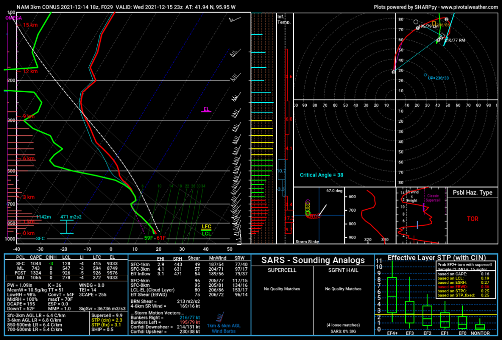
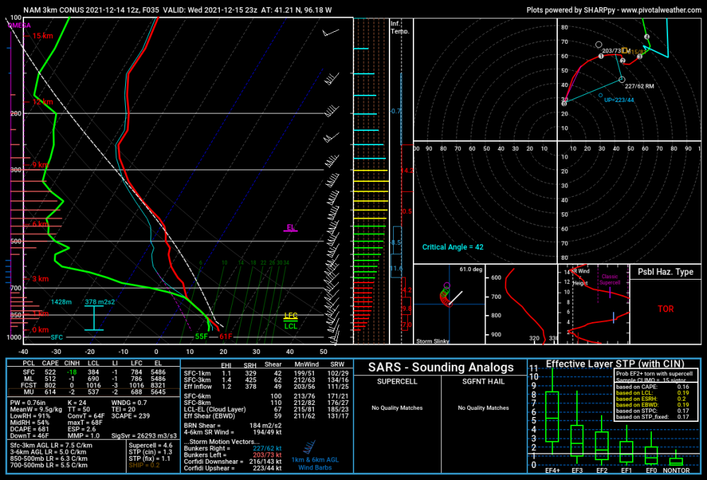
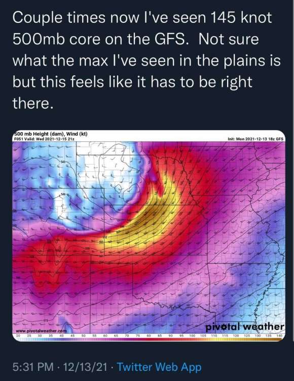
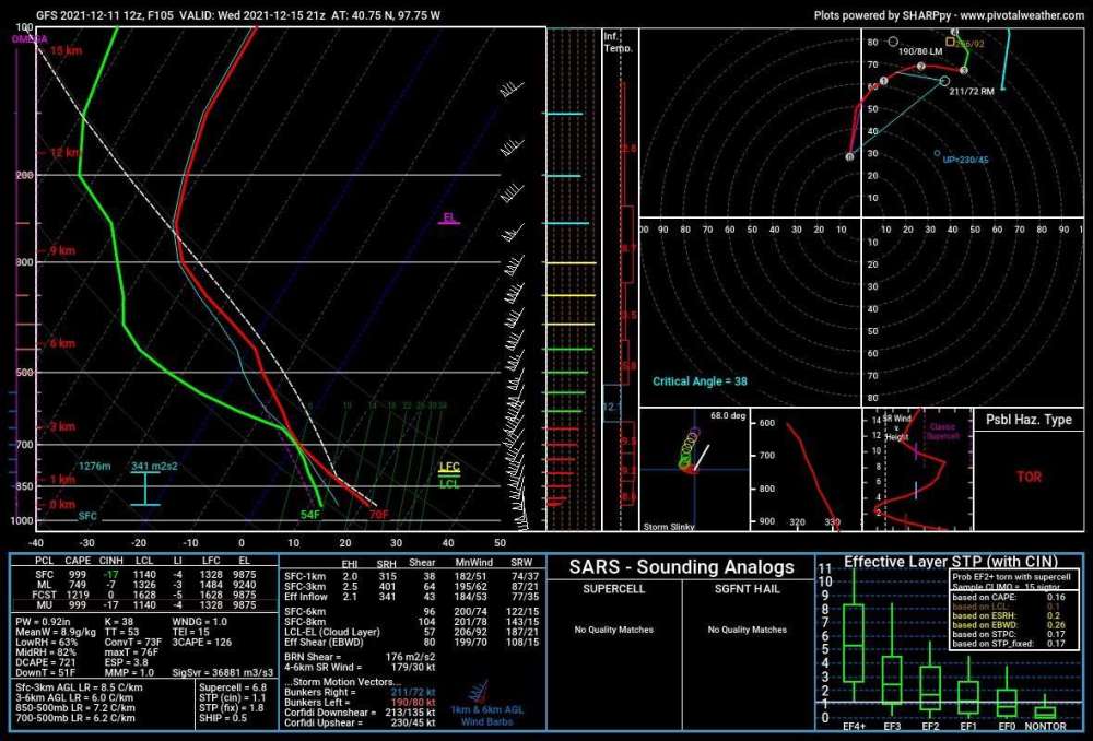
STP on the 18Z 3km NAM up over 2 now. Clicked on the map for a sounding and this is what it shows there: 1km shear: 49 kts(!) Bulk shear: 96 kts(!) SBCAPE: 1044 3CAPE: 255(!) Insane numbers. It's going to be a matter of whether there is too much shear and everything gets sheared apart right away before it can sustain any updrafts. I'm probably going to head to Onawa, IA along I29 and go from there.
.thumb.png.77ffacf52d2c9980066fa99b51c803cd.png)
-
Omaha Public Schools just cancelled in school learning tomorrow and is going to have a remote day!!
-
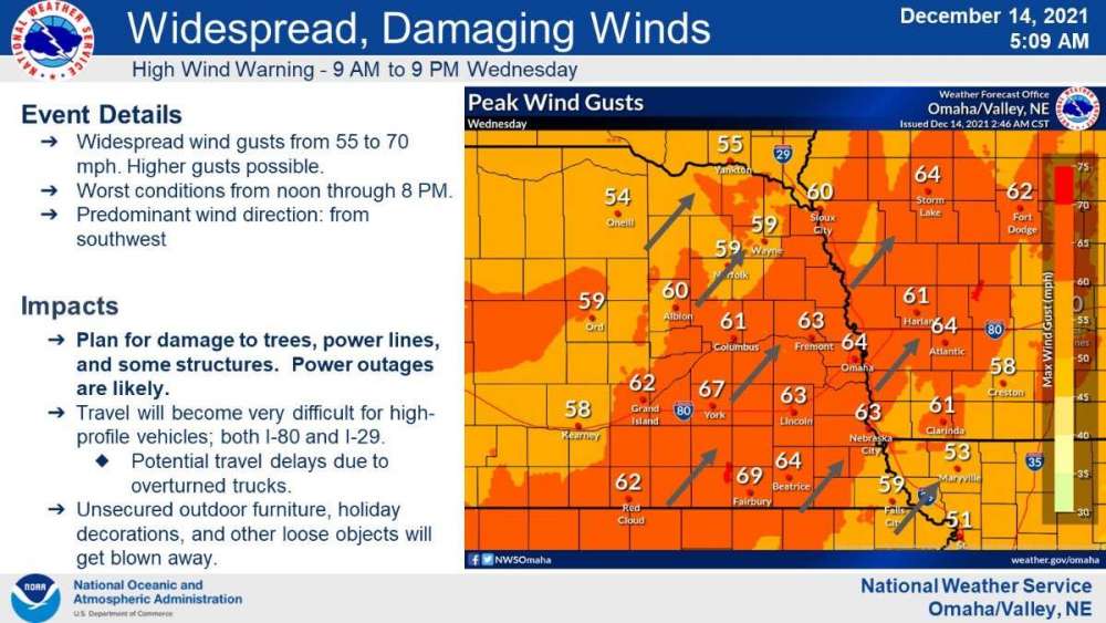
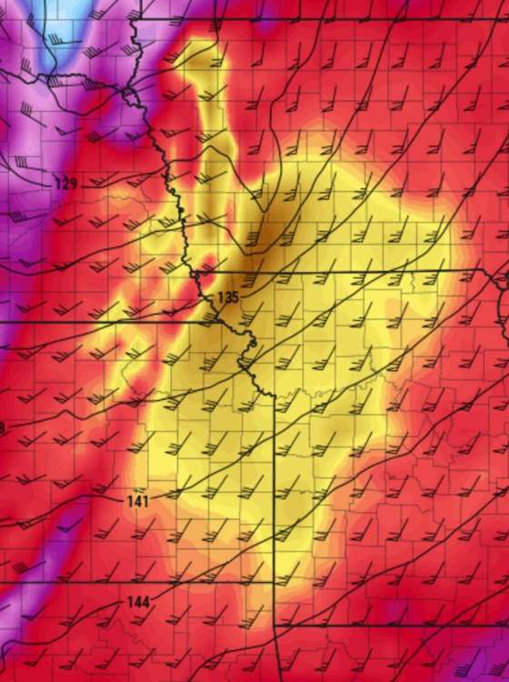
Update from Omaha. Storm motions at 60-90 mph!
-
I'm planning on "chasing" tomorrow. Going to be a very hard chase with storm motions, but with all the extreme weather this system is going to produce tomorrow, I don't want to be sitting in my basement working all day and missing out on what mother nature is going to do.
-
December 2021 Observations and Discussion
OmahaSnowFan replied to Tom's topic in East of the Rockies
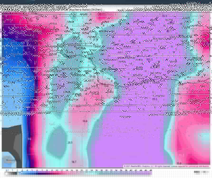
I'm not seeing a white Christmas here or really any winter yet. That's a lot of red and the cold just stays up in Canada or out west for the most part.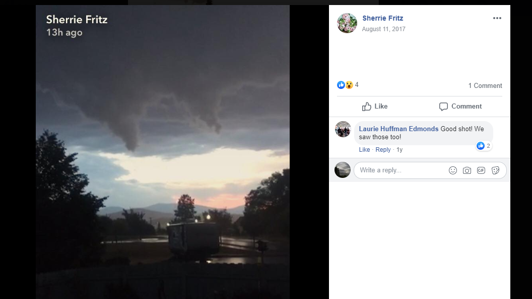

-
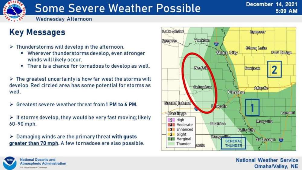
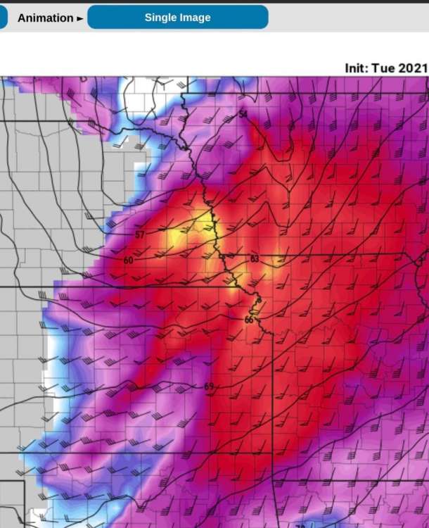
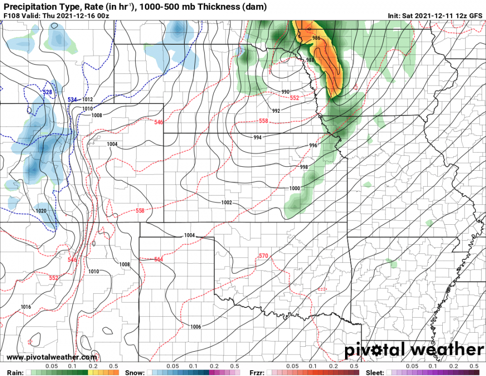
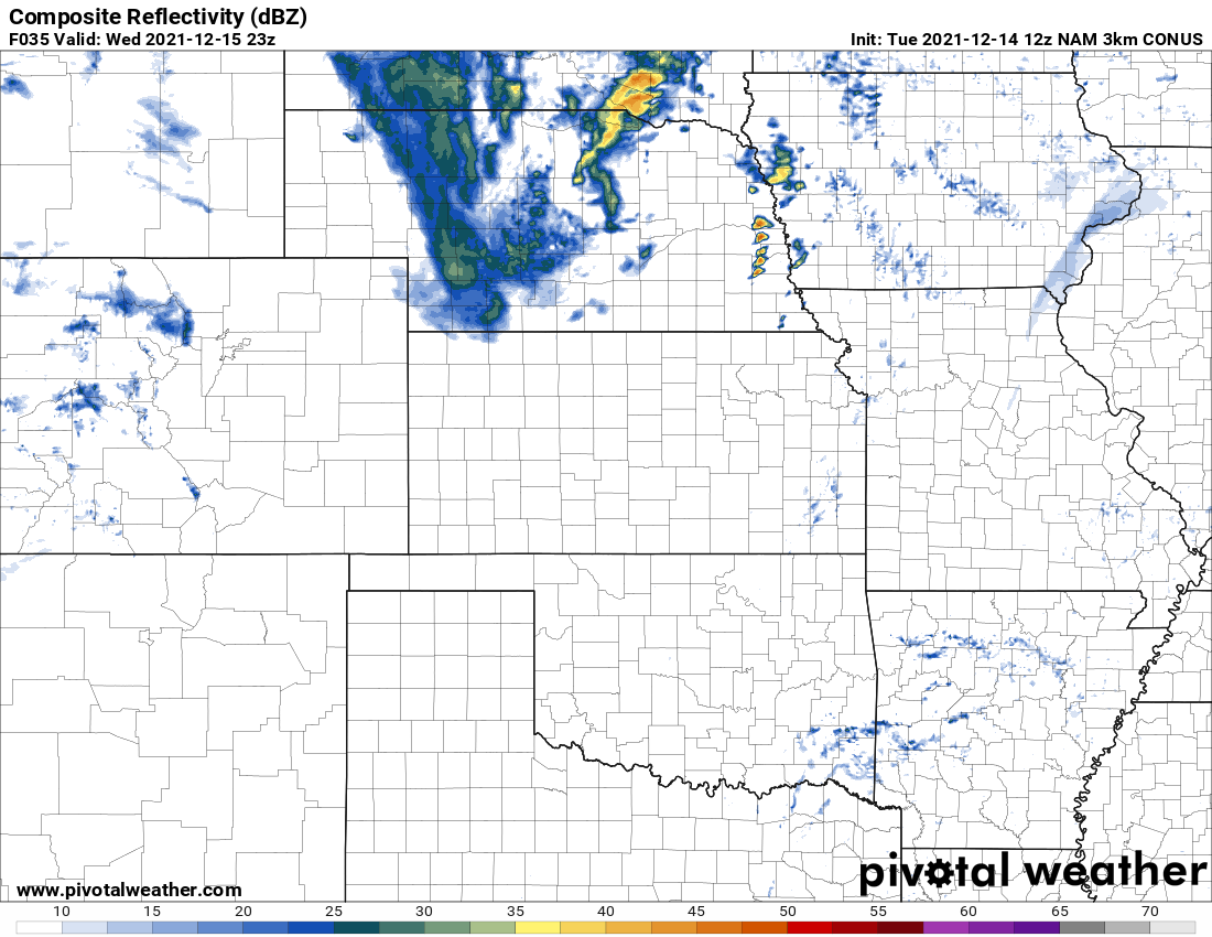
Still some timing differences with tomorrow's set up and where the storms form, etc. 12Z 3km NAM is perhaps the most ominous for Omaha. Shows storms moving through between 5-6p and keeps things semi discrete. Also has a ton of low level CAPE. In fact almost half of the CAPE is found in the low levels which is huge for possible tornado production. Normally 100+ is decent on a day with large CAPE in the spring. Forecast soundings show 239 j/kg tomorrow over Omaha if this verifies.
.thumb.png.089c9bd8dd67d72e913a35a633516331.png)
-
-
December 2021 Observations and Discussion
OmahaSnowFan replied to Tom's topic in East of the Rockies
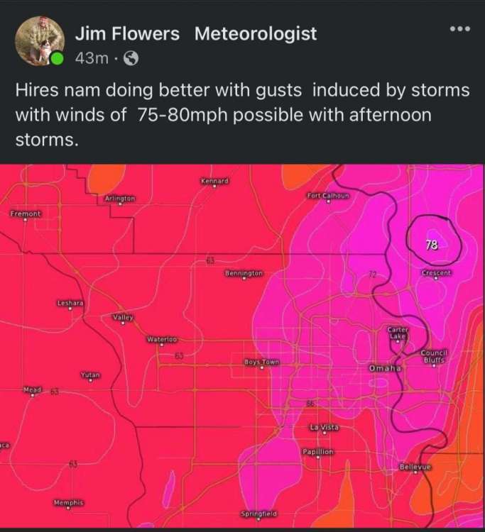
GFS has us hitting 70+ AGAIN!! This time on 12/23 3 previous times total in past 135 years? How about going for 3 times this month alone?!! -
0Z Thursday at Omaha shows 65/12 T/Td with 11% humidity and 925pa level winds at 66knots (76 mph).

-
-
Holy cow!!
-
And unfortunately seems to go until April too when everyone is ready for spring
-
This is some forecast discussion from Omaha WFO.

-
December 2021 Observations and Discussion
OmahaSnowFan replied to Tom's topic in East of the Rockies
Wednesday evening -
December 2021 Observations and Discussion
OmahaSnowFan replied to Tom's topic in East of the Rockies
🌪🌪
-
December 2021 Observations and Discussion
OmahaSnowFan replied to Tom's topic in East of the Rockies
I know it’s the GFS but… it keeps being correct on no winter.
-
December 2021 Observations and Discussion
OmahaSnowFan replied to Tom's topic in East of the Rockies
I’m getting more concerned about next Wednesday. Still 5 days away but models have been pretty consistent…
-
December 2021 Observations and Discussion
OmahaSnowFan replied to Tom's topic in East of the Rockies
Yep, same storm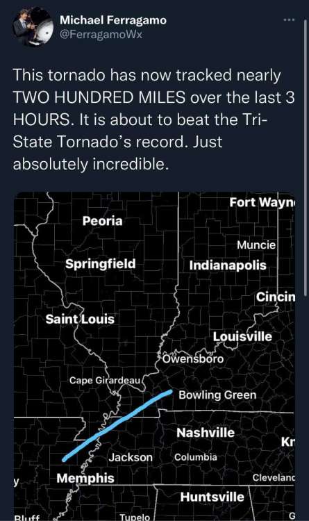
-
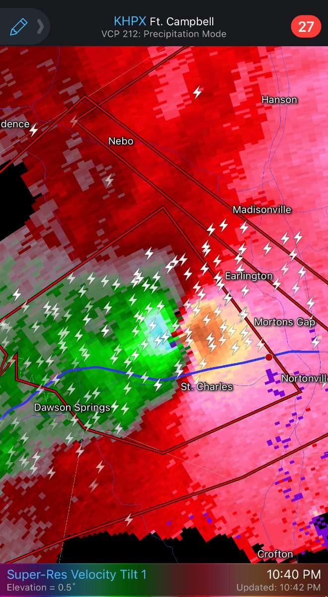
December 2021 Observations and Discussion
OmahaSnowFan replied to Tom's topic in East of the Rockies
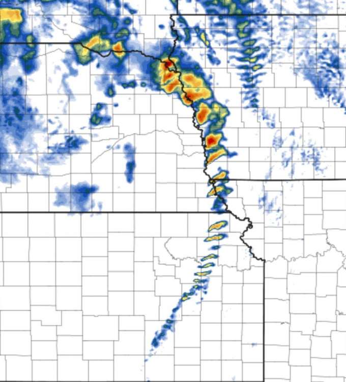
Same storm producing violent tornadoes for over 4 hours now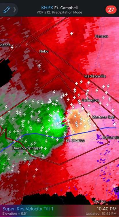


.png.6164ec492561f26166c60abdb85d9a0d.png)


.png.f9a2e58fc5a2a77481345ff370470939.png)