Gummy
-
Posts
426 -
Joined
-
Last visited
Everything posted by Gummy
-
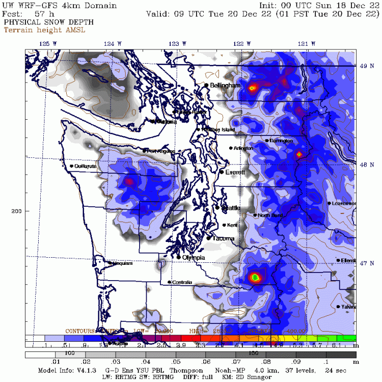
lol Seattle is such for snow
-
lol it is pretty much the opposite of the WRF map.
-
Appears some light snowfall should reach Seattle soon yes but the main precip is not set to arrive until 4 AM give or take.
-
That is true, I definitely felt the temp change going from the north part of town down to U.Village today. Evidenced by the high temps so far.
-
Really? Bigger than the dumping in February 2021? That system had a ton of moisture with it. I guess it is possible when you factor in that this storm may have more convergence enhancement involved.
-
Reference to that crazy April 2007 convergence snowstorm where Clearview had like 12"?
-
I am really hoping for a 'let's take a look at the WRF map - told ya so' blog post from Cliff tomorrow.
-
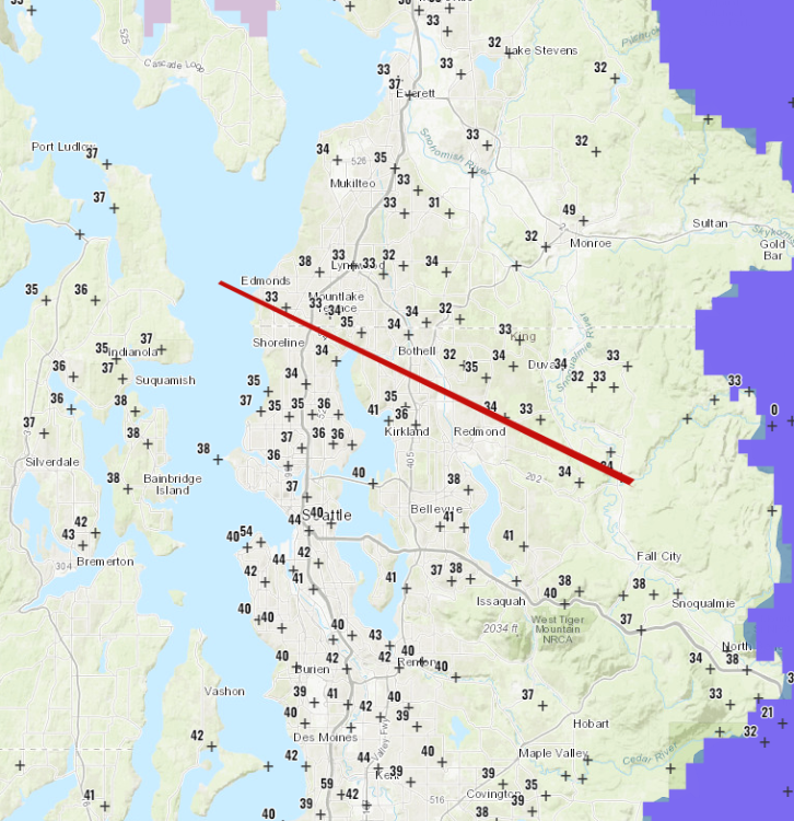
The one I was looking it is a different read out I guess, elevation is only listed at 20ft. It has since dropped back to 33. Boeing Field - King County International Airport, WA (ASOS/AWOS - SEW) Elev: 20 ft; Lat/Lon: 47.54548/-122.31470
-
SEA is up to 34 now, looks like the Euro is likely on the mark. Went from 30 to 34 in about 60 minutes.
-
Barry Sanders is my all-time favorite sports athlete, I approve of your tab.
-
What were the snow totals with the Thursday/Friday system according to the Euro?
-
Isn't that actually better than the 00z for Seattle?
-
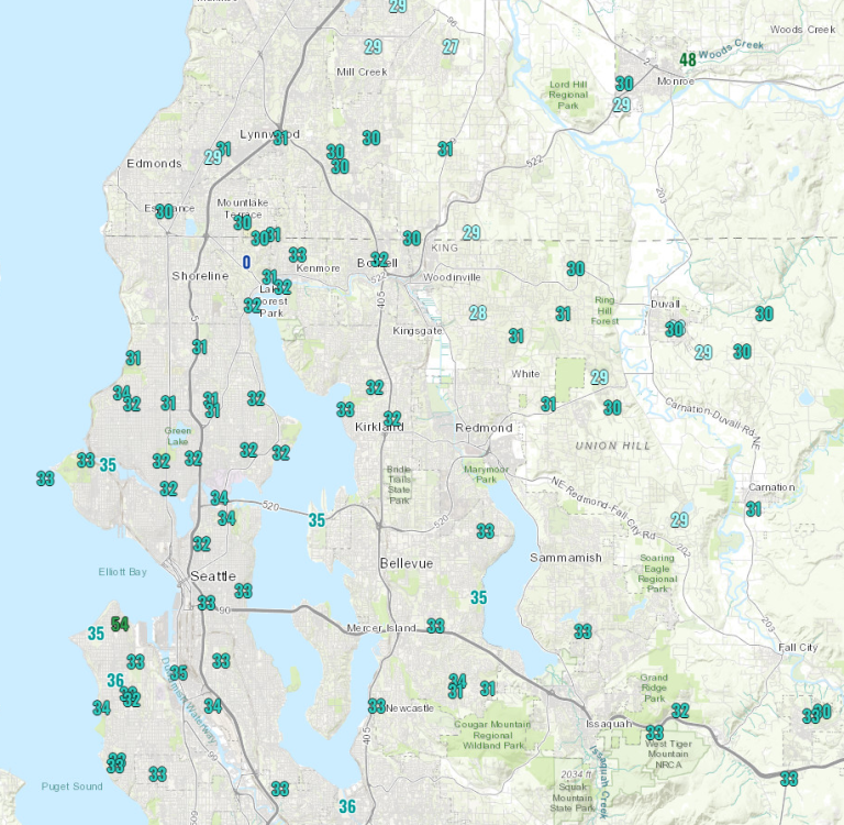
Yea, SEA for example was supposed to be around 32 at this point I believe and they are still stuck at 30.
-
Populated areas Seattle south haven't had a dumping of snow this season yet. Lynnwood north? They will get dumped on again.
-
I am just south of North Seattle College. Seems to be a lot of us in the North / NE part of the city.
-
Is the low placement with the Euro pretty much the same?
-
Ugh, being stuck in the snow hole is still better than the Euro solution.
-
HRRR is based off the GFS, RGEM is based off the CMC?
-
CMC is also improved
-
Might get burned again if the ECMWF keeps trending that low north on Tuesday. The EPS looks better, just have to hope it is off a bit on the placement.
-
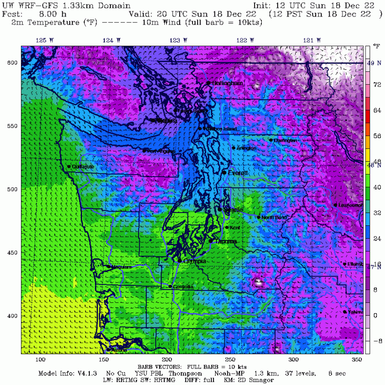
You can see the cold air filtering in on the temp map.
-
From a selfish standpoint I would almost prefer that. Stronger CAA for a better shot at a nice overrunning event later in the week, as I am off of work on Friday. Dump a few inches on Portland with the first system.
-
Temps are definitely not dropping as fast as modeled by the WRF, not a big shocker.
-
Yep, it is just so tough to get a real push of arctic air. This happens more often then not as it stays bottled up in the northern portion of the Puget Sound, and doesn't make it sound of Everett. Hitting around 40 as a high on Tuesday in the central sound is a huge pullback if that goes as modeled and doesn't bode well for the next system being more than just some light frozen precip before a transition.
-
Cliff Mass likes this one. Maybe it takes roadway temps into account?