

bainbridgekid
-
Posts
6886 -
Joined
-
Last visited
-
Days Won
24
Everything posted by bainbridgekid
-

February 2024 Weather in the PNW
bainbridgekid replied to TigerWoodsLibido's topic in West of the Rockies
Anecdotal, but it feels like the Winter jet stream has been weaker and the Four Corners High in the Summer has been stronger the last decade or so. That would make some sense with a warmer Arctic weakening the Jet Stream and more warmth building in the lower latitudes in the Summer. -
February 2024 Weather in the PNW
bainbridgekid replied to TigerWoodsLibido's topic in West of the Rockies
Forecasting this week will be particularly hard because there are several disorganized systems and blobs of moisture rotating through and tracking the exact strength, location, and timing of each of them will be nearly impossible. Wouldn't matter if temps weren't going to be near freezing some of the time, but as it is any of them could drop a quick 1-3" of snow just about anywhere if timed right during the night. Thursday night and Saturday night look like the most real threats at this point to me. -
February 2024 Weather in the PNW
bainbridgekid replied to TigerWoodsLibido's topic in West of the Rockies
6z Euro 10:1 ratio map gives you 7" Thursday night. Kuchera gives you 1". -
February 2024 Weather in the PNW
bainbridgekid replied to TigerWoodsLibido's topic in West of the Rockies
WRF Thursday night snow.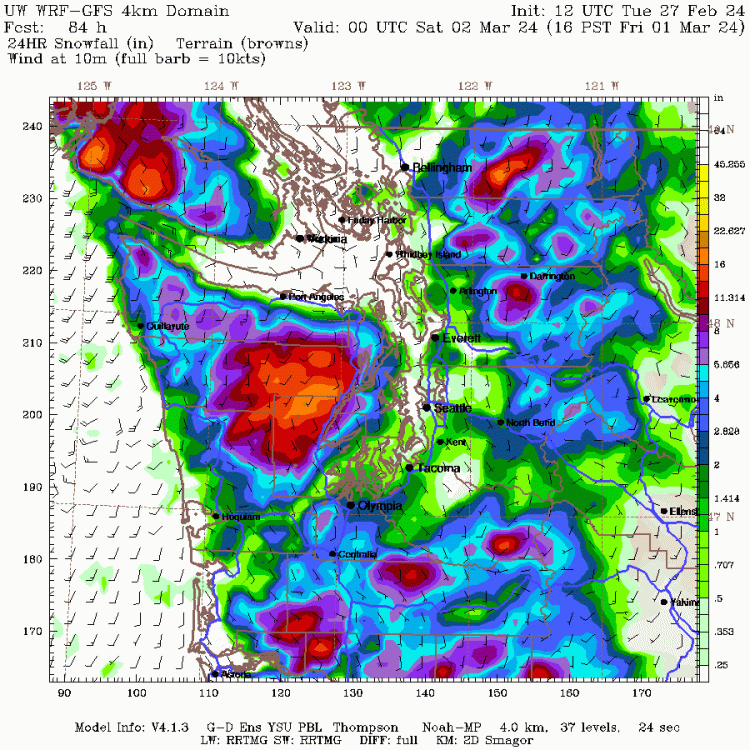
-
February 2024 Weather in the PNW
bainbridgekid replied to TigerWoodsLibido's topic in West of the Rockies
.gif.acf2f2188e05e54cf32c6b6b0da4dba7.gif)
-
February 2024 Weather in the PNW
bainbridgekid replied to TigerWoodsLibido's topic in West of the Rockies
Interesting setup over the weekend with this weak low tracking South of Seattle. 12z GFS hammers the South and Central Sound with a narrow band of heavy wet snow. Kuchera map gives SEA 7".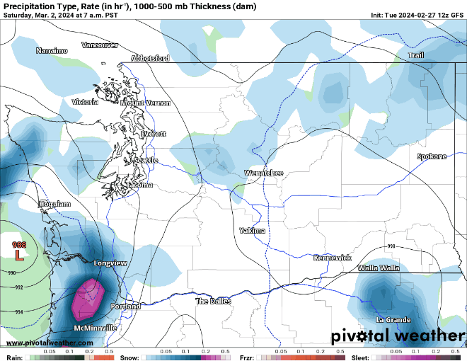
- 8823 replies
-
- 10
-

-
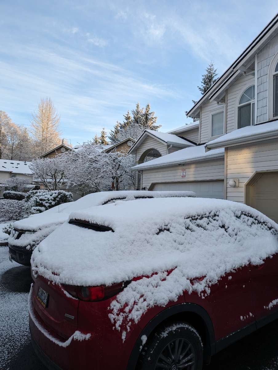
February 2024 Weather in the PNW
bainbridgekid replied to TigerWoodsLibido's topic in West of the Rockies
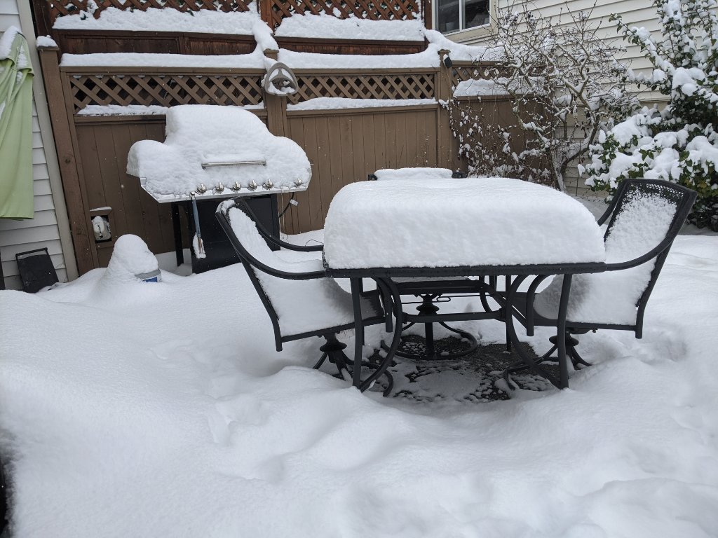
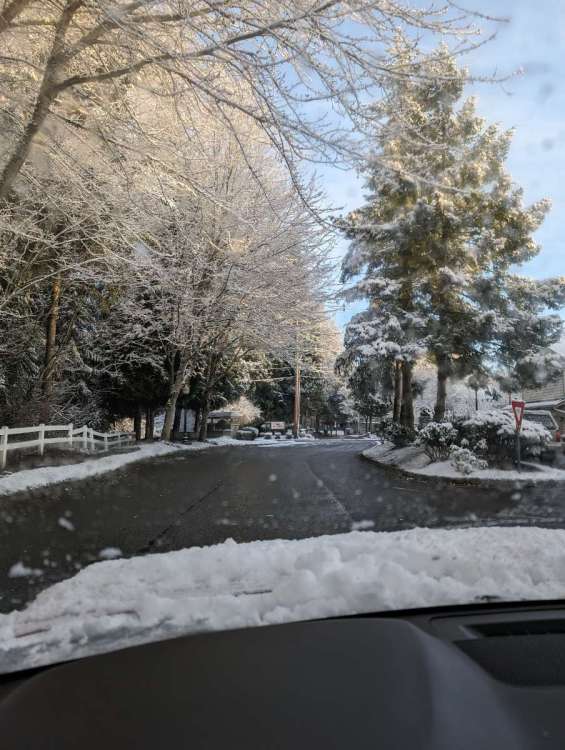
Ended up with 2.5" in South Everett near Paine Field. Reports of 4-5" just a few miles North of me which makes sense based on the radar last night. Takes my seasonal snowfall to 5.5". Really pretty morning.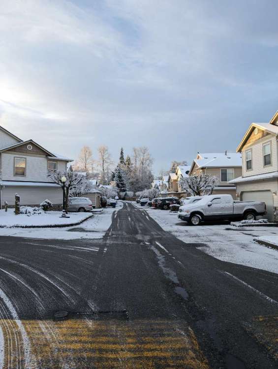

- 8823 replies
-
- 14
-
-

-
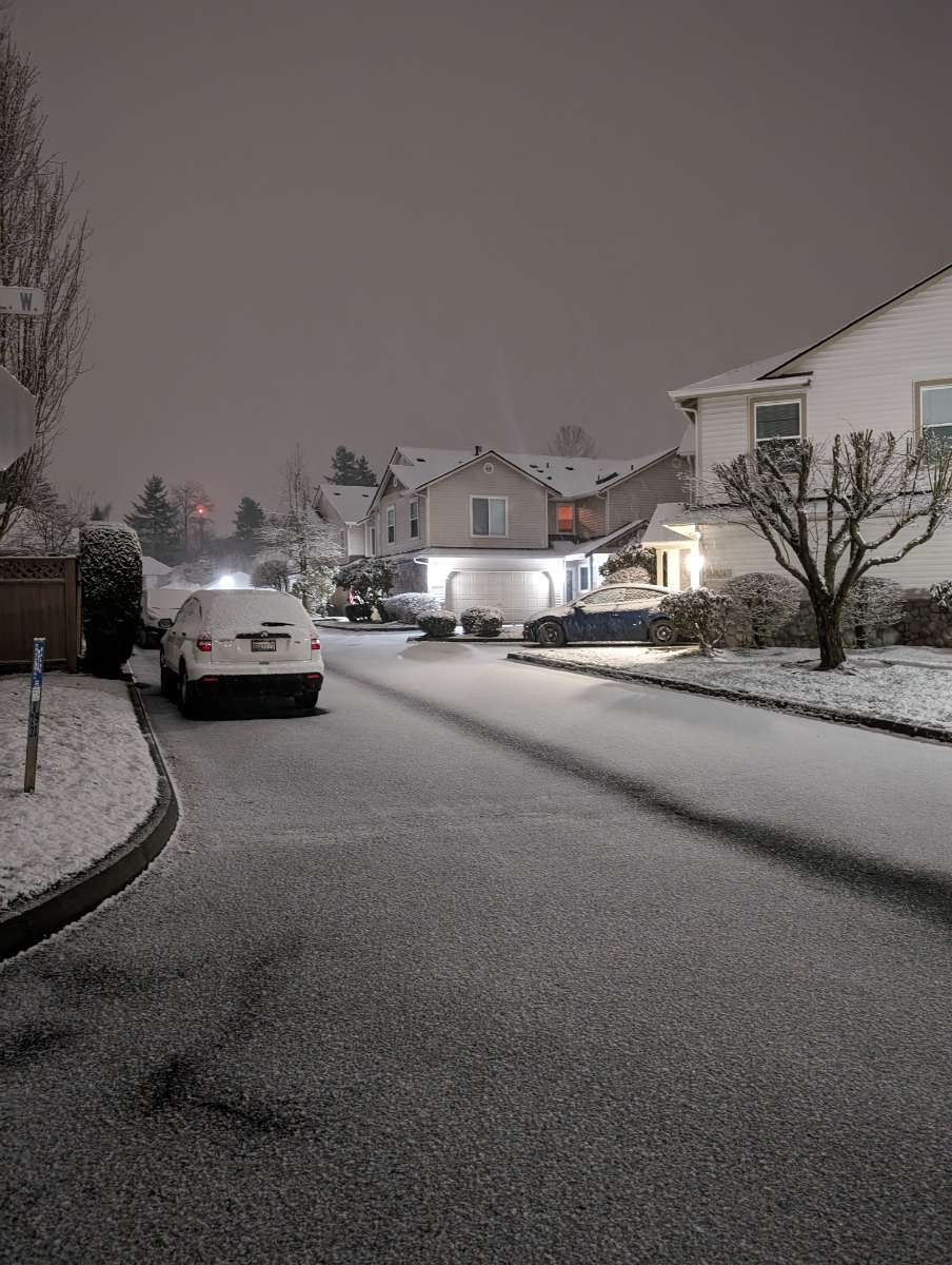
February 2024 Weather in the PNW
bainbridgekid replied to TigerWoodsLibido's topic in West of the Rockies
Roads are really bad in the CZ around Everett. It's been on and off here but has been dumping just a couple miles North of me for hours. Just measured 3/4 of an inch here.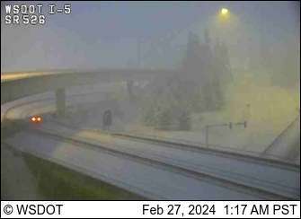
-
February 2024 Weather in the PNW
bainbridgekid replied to TigerWoodsLibido's topic in West of the Rockies
Snowing pretty good here right at the Southern edge of the CZ with what looks like about half an inch new on the ground including pavement. Looks like it's about to stop for now but hopefully another band will slide South off Whidbey soon. 32.0 degrees.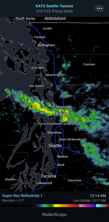
-
February 2024 Weather in the PNW
bainbridgekid replied to TigerWoodsLibido's topic in West of the Rockies
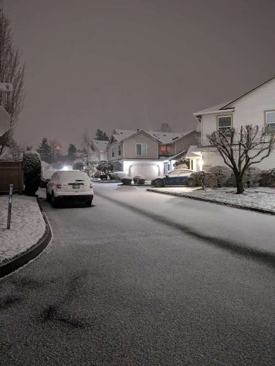
I-5 covered again in South Everett.
-
February 2024 Weather in the PNW
bainbridgekid replied to TigerWoodsLibido's topic in West of the Rockies
CZ firing up over the Sound on Kitsap and West of Edmonds now. -
February 2024 Weather in the PNW
bainbridgekid replied to TigerWoodsLibido's topic in West of the Rockies
The 3km NAM has 4 distinct areas of Convergence over the next 24 hours. Clearer on the QPF map than the snowfall map..thumb.png.e8628a4fabf809533e8feea0c2e0c813.png)
-
February 2024 Weather in the PNW
bainbridgekid replied to TigerWoodsLibido's topic in West of the Rockies
That thing meant business.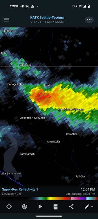
-
February 2024 Weather in the PNW
bainbridgekid replied to TigerWoodsLibido's topic in West of the Rockies
How in the world can you tell with such a sharp elevation/rain shadow based cutoff there? -
February 2024 Weather in the PNW
bainbridgekid replied to TigerWoodsLibido's topic in West of the Rockies
I'm not home, but am missing out on a very heavy snow shower there. I-5 suddenly turning white right by my house..jpg.1910dae6db594be12c2cb44b8d504352.jpg)
-
February 2024 Weather in the PNW
bainbridgekid replied to TigerWoodsLibido's topic in West of the Rockies
Snowing and sticking to the highway near Paine Field in South Everett.
-
February 2024 Weather in the PNW
bainbridgekid replied to TigerWoodsLibido's topic in West of the Rockies
High-res WRF for tonight.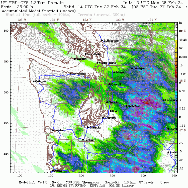
-
February 2024 Weather in the PNW
bainbridgekid replied to TigerWoodsLibido's topic in West of the Rockies
What is he even talking about bringing up man made? Do people think we towed a giant iceberg up to the Equator? -
February 2024 Weather in the PNW
bainbridgekid replied to TigerWoodsLibido's topic in West of the Rockies
Possible, but the Euro has been really consistent with a bullseye of heavy snow North of Everett near you..thumb.png.d4967b5ce20061ea9833a428db35bf98.png)
-
February 2024 Weather in the PNW
bainbridgekid replied to TigerWoodsLibido's topic in West of the Rockies
4km WRF for tonight. Most of this falls between 6PM and Midnight..thumb.gif.4457672e0ce34b4e368a56f23489d02e.gif)
-
February 2024 Weather in the PNW
bainbridgekid replied to TigerWoodsLibido's topic in West of the Rockies
Got 1" here in South Everett.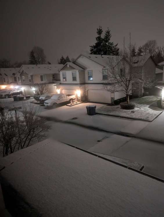
- 8823 replies
-
- 14
-
-

-
February 2024 Weather in the PNW
bainbridgekid replied to TigerWoodsLibido's topic in West of the Rockies
Groupel just started a few minutes ago here and cars, driveway and roofs are already turning white. Also just heard two rumbles of thunder. Glad I stayed up!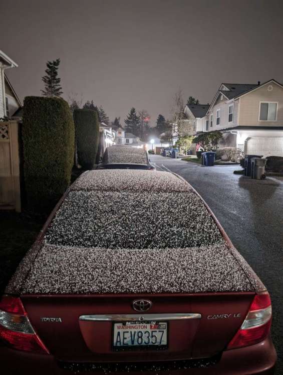
-
February 2024 Weather in the PNW
bainbridgekid replied to TigerWoodsLibido's topic in West of the Rockies
Crazy how suddenly this intensified. Will be very curious to see if it holds together here. Sometimes the interaction of these showers coming off the Strait can be really funky and hard to predict..thumb.gif.7fe803e5e7064a87917057dba36ccec4.gif)
-
February 2024 Weather in the PNW
bainbridgekid replied to TigerWoodsLibido's topic in West of the Rockies
Shower activity firing up in the North Sound now. Just enough to keep me from going to bed.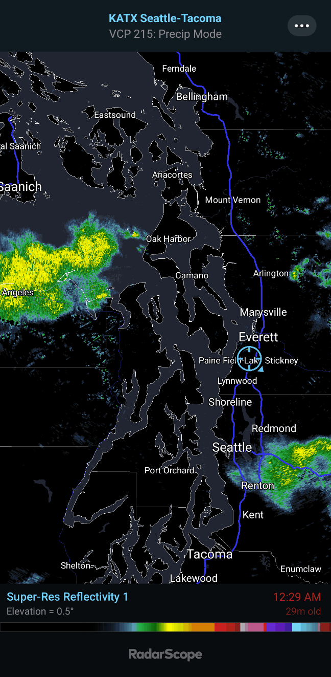
-
February 2024 Weather in the PNW
bainbridgekid replied to TigerWoodsLibido's topic in West of the Rockies
High-res WRF slams much of Snohomish County with CZ snow Monday evening. Most of this falls between 7-10pm..thumb.gif.b16d49a5b755990d41df67d1325177c0.gif)


.png.8ee0e25a400758482027bcfe65009b21.png)


.png.2632b74182b9c2332801259bc40400dd.png)
.gif.a5d990bca32b598bf51f1c84657d277f.gif)


.gif.ef832c1b146acf30324201565796d005.gif)

.gif.33c413c3882bee28aab7e42cdcf2f30c.gif)