

Gradient Keeper
-
Posts
27986 -
Joined
-
Last visited
-
Days Won
164
Posts posted by Gradient Keeper
-
-
- Popular Post
- Popular Post
Yeah. Let's put the kabosh on any and ALL political talk or jabs at others immediately. F*** politics.
-
 10
10
-
 1
1
-
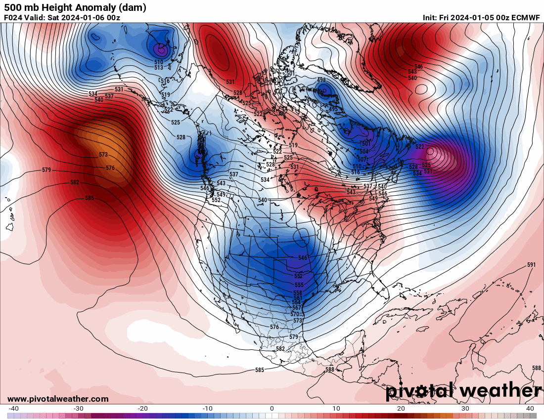
Day 1 - ECMWF, GEM, GFS
-
Just now, Christensen87 said:
Icon looks fine
Icon looks fine
-
2 minutes ago, iFred said:
If this plays out and by next week we still have something historic, I'll buy a round of drinks for anyone that attends the Seattle meet up.
Seattle meet-up? Is this really planned?
-
1
-
-
5 minutes ago, Ken in Wood Village said:
I need to go to bed but what an incredible GFS run. I know things probably will change but hopefully we can see some of what shows. This is what it could look like from the 00Z GFS. Have fun with the Euro model
 🌨
🌨
With snow cover you can drop the temps even further.
-
1
-
-
1 minute ago, SouthHillFrosty said:
A generation of kids will grow in the PNW thinking El Niños are needed for snow. We are f*cked.

-
1
-
-
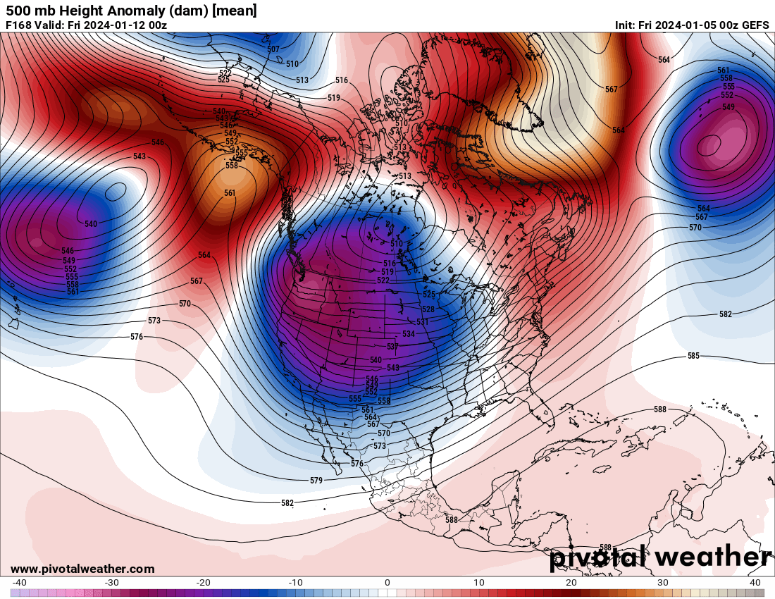
00z GEFS Day 8.5. That is near perfection minus a strong SE ridge.
-
7
-
-
Pattern develops upstream in 3 1/2 days FCST HR 84
-
7
-
-
I really just can't believe the GEFS improvements.00z ECMWF in 25 minutes. The first BIG Euro run since last February.
-
4
-
-
I just got home. 00z GFS. Much improved run. Ridge really strengthens nicely and persists for days and days. There is reload potential as well. AND...
00z GEFS significant improvement! Okay then! Timing really moving ahead.

-
6
-
 1
1
-
-
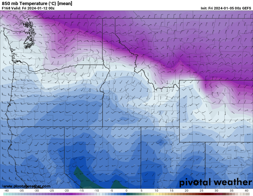
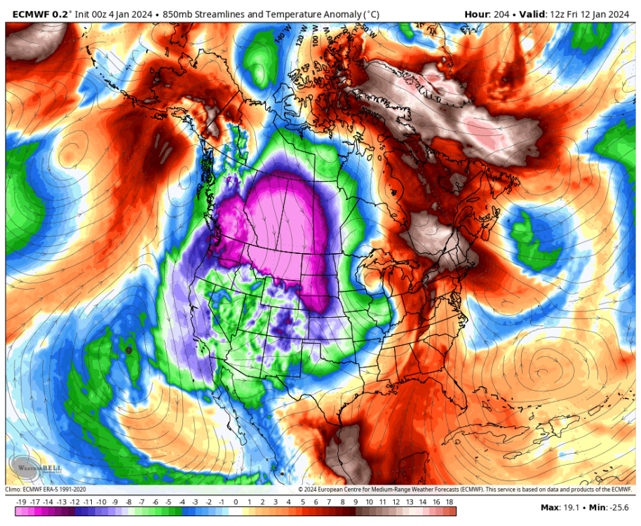
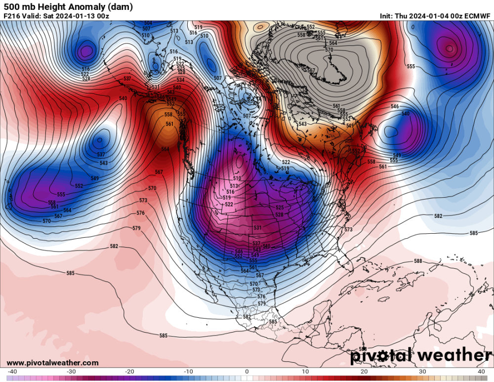
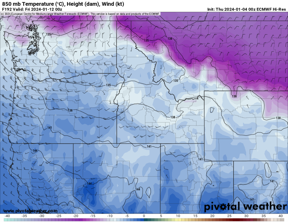
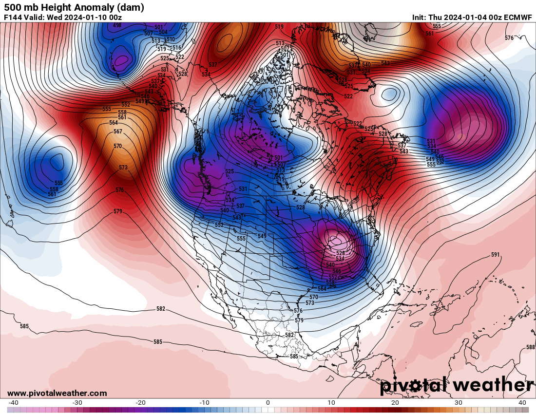
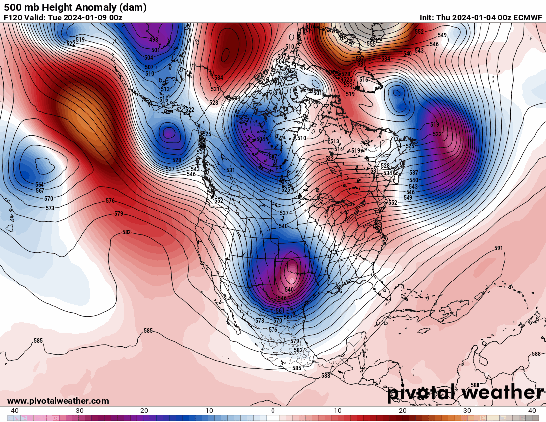
I wasn't available this morning. When I look at 12z runs I always view the GFS and GEFS first. Then GEM/CMCE. Finally EC and EPS when its available on Pivotal.Today's GFS was not inspiring not holding the ridge and that important ridge merger never takes place. That results in the ridge having no support sliding east towards us shunting the bitter cold to the east. The GEFS was similar to previous runs with modified arctic air making it into the Columbia Basin.The Canadian was remarkable. It strengthens the ridge and the high pressure cell moving through the Aleutians merges Day 8 to 8.5 really fortifies the ridge into a solid block with excellent upper level support allowing cold, arctic air to blast south out of British Columbia/Alberta. Big league cold! CMCE wasn't remarkable, but it was quite a bit colder than 00z.The EC was incredible with a very similar pattern progression. This ridge evolves into a strong blocking high with the similar ridge merger at Day 7.5. This results in a major blast from first the north around Day 7 and Day 8 into the Columbia Basin. It then blasts very quickly down over us. I would say remarkably so. WOW. 850s over PDX plummet to around -19c/-20c which would put this in a top tier blast. For The Dalles -28c which I believe is the coldest ever modeled. EPS trending colder. Nice.With the pattern/ridge developing at Day 4 I would say we need to see 7-8 more Euro runs Sunday 00z/Monday 12z with a similar progression and the EPS following suit trending colder to really build some confidence for this potential. The energy south of the ridge Day 5.5 to 7 could become problematic we need that shoved further south. We have long ways to go. A lot of model runs and crazy model riding ahead. Onto 00z!18z GFS in 1 hour 31 minutes
00z GFS in 7 hours 31 minutes
00z ECMWF in 9 hours 41 minutes-
5
-
-
-
-
-
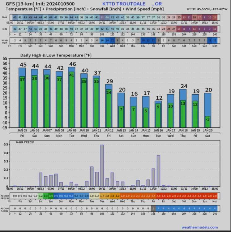
High temps in the 20s for PDX. Not bad.
-
2
-
-
Real cold backdoor shot. Imagine if the ridge had been stronger though.
-
3
-
-
1 minute ago, Mid Valley Duck said:
Hopefully we can manage this.
-
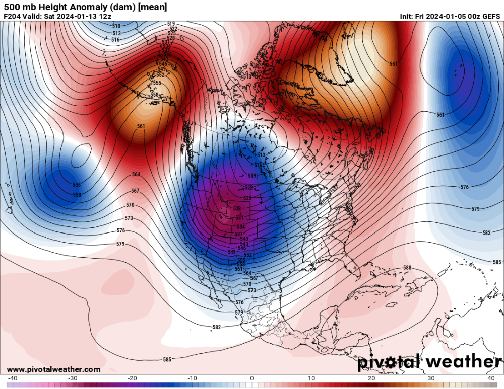
Day 9'er - Well, that's unfortunate. Maybe the EPS will be more stout with the ridge.

-
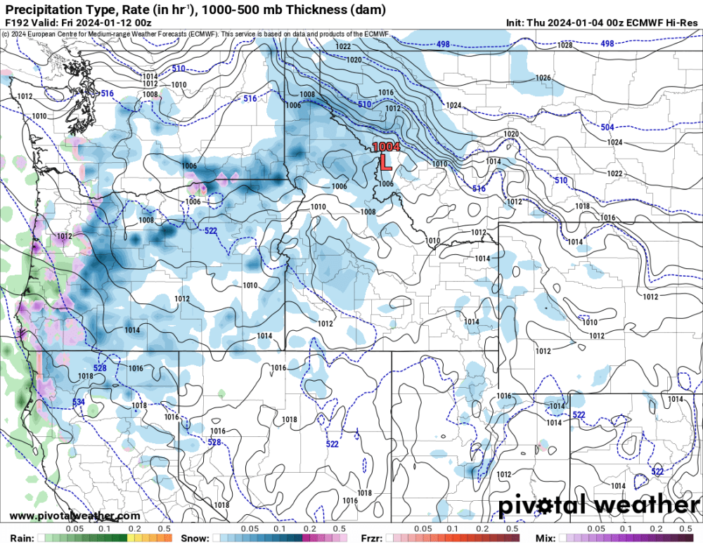
Day 8 850s, 1000-500mb Thickness/MSLP/Precip
-
-
Puny ridge....
-
Day 7 - ECMWF, GEM, GFS
.thumb.gif.b28fbd4a5239e3dfd53d920cd890c7e7.gif)
-
1
-
-
Day 6 - ECMWF, GEM, GFS
-
1
-
-
Day 5 - ECMWF, GEM, GFS
-
1
-


.gif.28c36d0c166266c0fb50c39f479834ef.gif)


January 2024 Weather in the PNW (Part I)
in West of the Rockies
Posted
Day 2 - ECMWF, GEM, GFS