Gradient Keeper
-
Posts
28149 -
Joined
-
Last visited
-
Days Won
164
Everything posted by Gradient Keeper
-

October 2024 PNW Weather Discussion
Gradient Keeper replied to TigerWoodsLibido's topic in West of the Rockies
Hopefully the EPS will look starkly different Day 6+. Night Shift 6z GFS in 3 hours 12 minutes. I will not be here for that I'm leaving early Saturday heading up to Ocean Shores, WA to visit family. Good night all. -
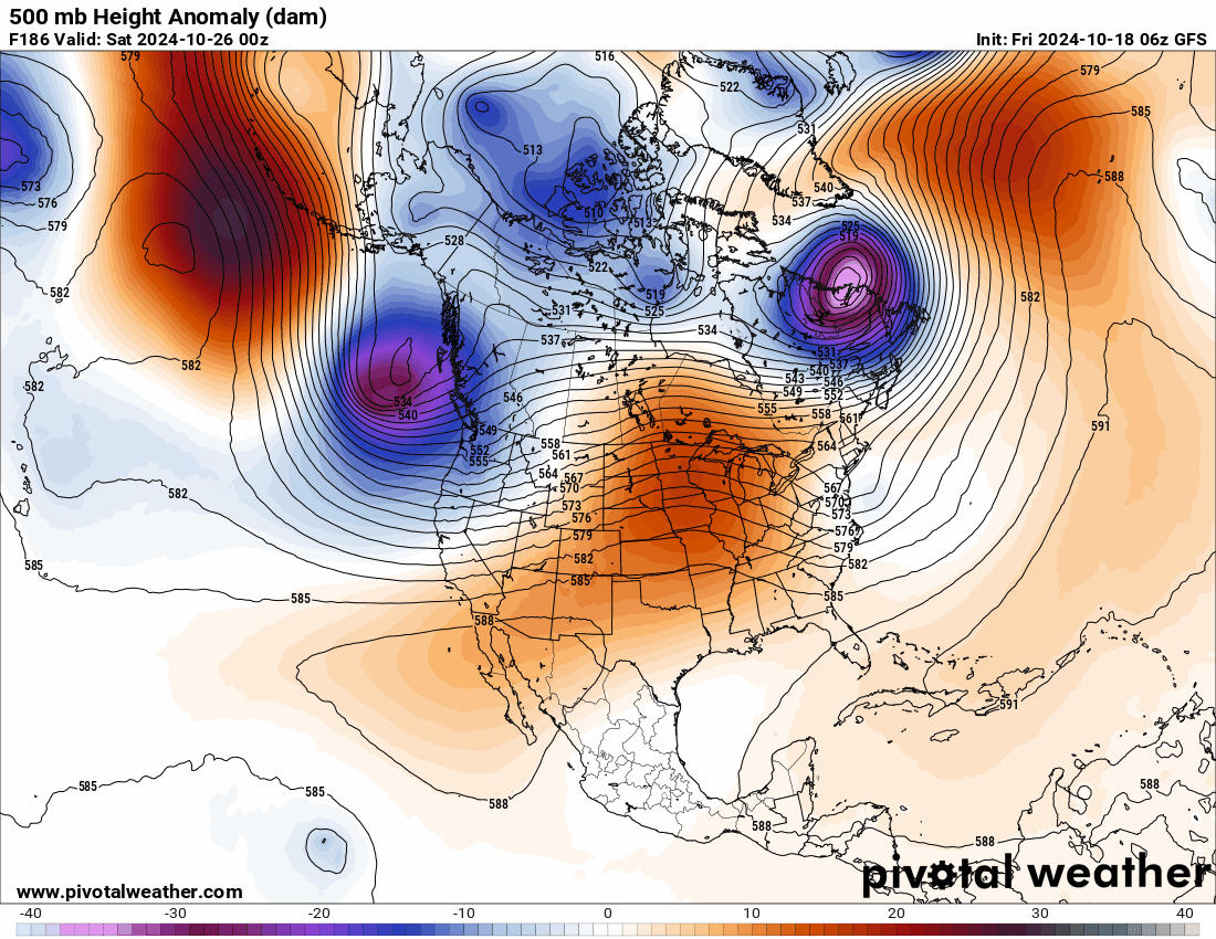
October 2024 PNW Weather Discussion
Gradient Keeper replied to TigerWoodsLibido's topic in West of the Rockies
00z ECMWF 10 Day Rainfall, Snowfall totals

-
October 2024 PNW Weather Discussion
Gradient Keeper replied to TigerWoodsLibido's topic in West of the Rockies
00z ECMWF re-cap. 10 Day GIFs: 500mb Height Anomaly, 850mb Temps, 1000-500mb Thickness/MSLP/Precip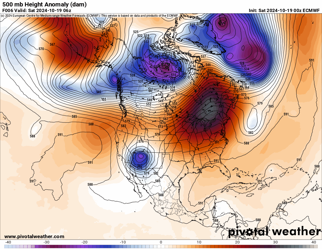

-
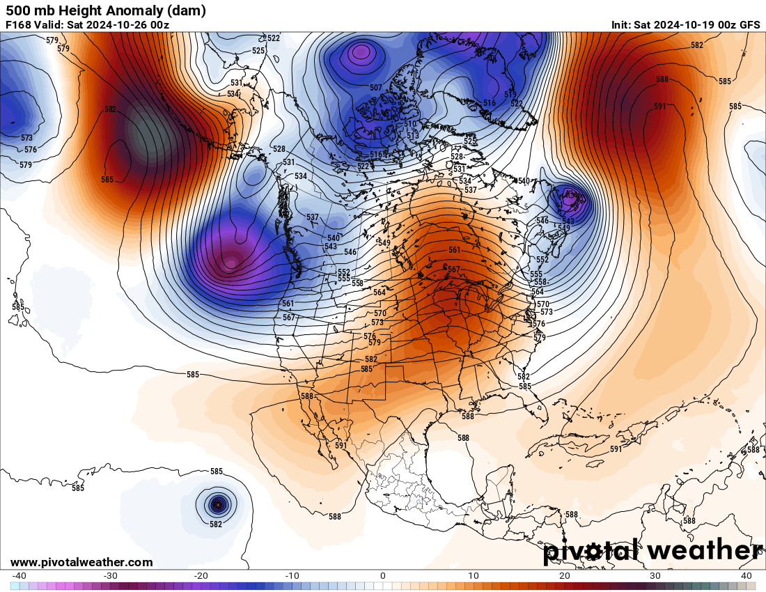
October 2024 PNW Weather Discussion
Gradient Keeper replied to TigerWoodsLibido's topic in West of the Rockies
Day 10 kind of wet, but this run sucks otherwise.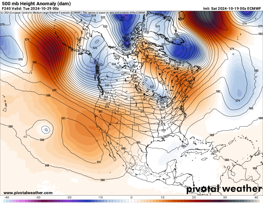
-
October 2024 PNW Weather Discussion
Gradient Keeper replied to TigerWoodsLibido's topic in West of the Rockies
Day 9'er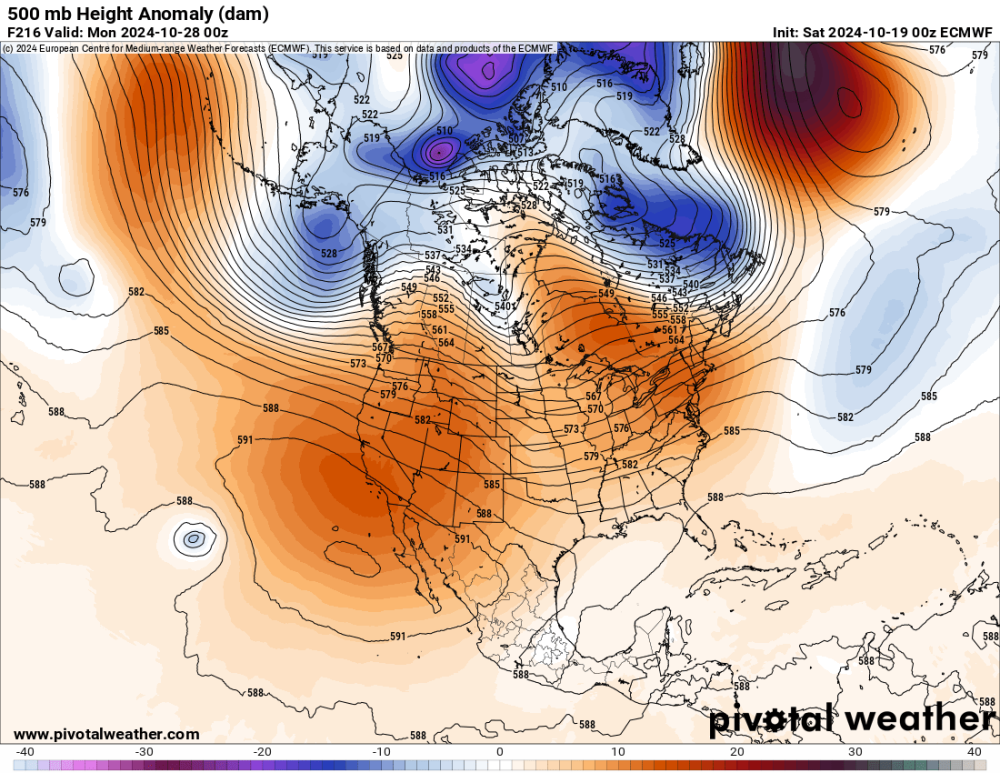

-
October 2024 PNW Weather Discussion
Gradient Keeper replied to TigerWoodsLibido's topic in West of the Rockies
Day 8 meh
-
October 2024 PNW Weather Discussion
Gradient Keeper replied to TigerWoodsLibido's topic in West of the Rockies
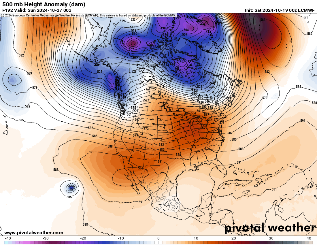
Day 7
-
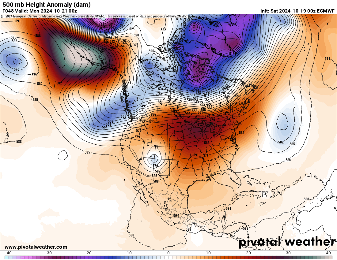
October 2024 PNW Weather Discussion
Gradient Keeper replied to TigerWoodsLibido's topic in West of the Rockies
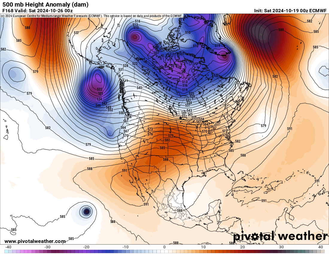
Day 6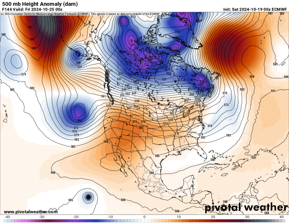
-
October 2024 PNW Weather Discussion
Gradient Keeper replied to TigerWoodsLibido's topic in West of the Rockies
Model comparison - Day 5 ECMWF, GEM, GFS.thumb.gif.f25d716bdd2bd1c393a85e7d53f5642d.gif)
-
October 2024 PNW Weather Discussion
Gradient Keeper replied to TigerWoodsLibido's topic in West of the Rockies
And a ton more rain still to come.
-
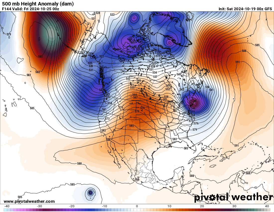
October 2024 PNW Weather Discussion
Gradient Keeper replied to TigerWoodsLibido's topic in West of the Rockies
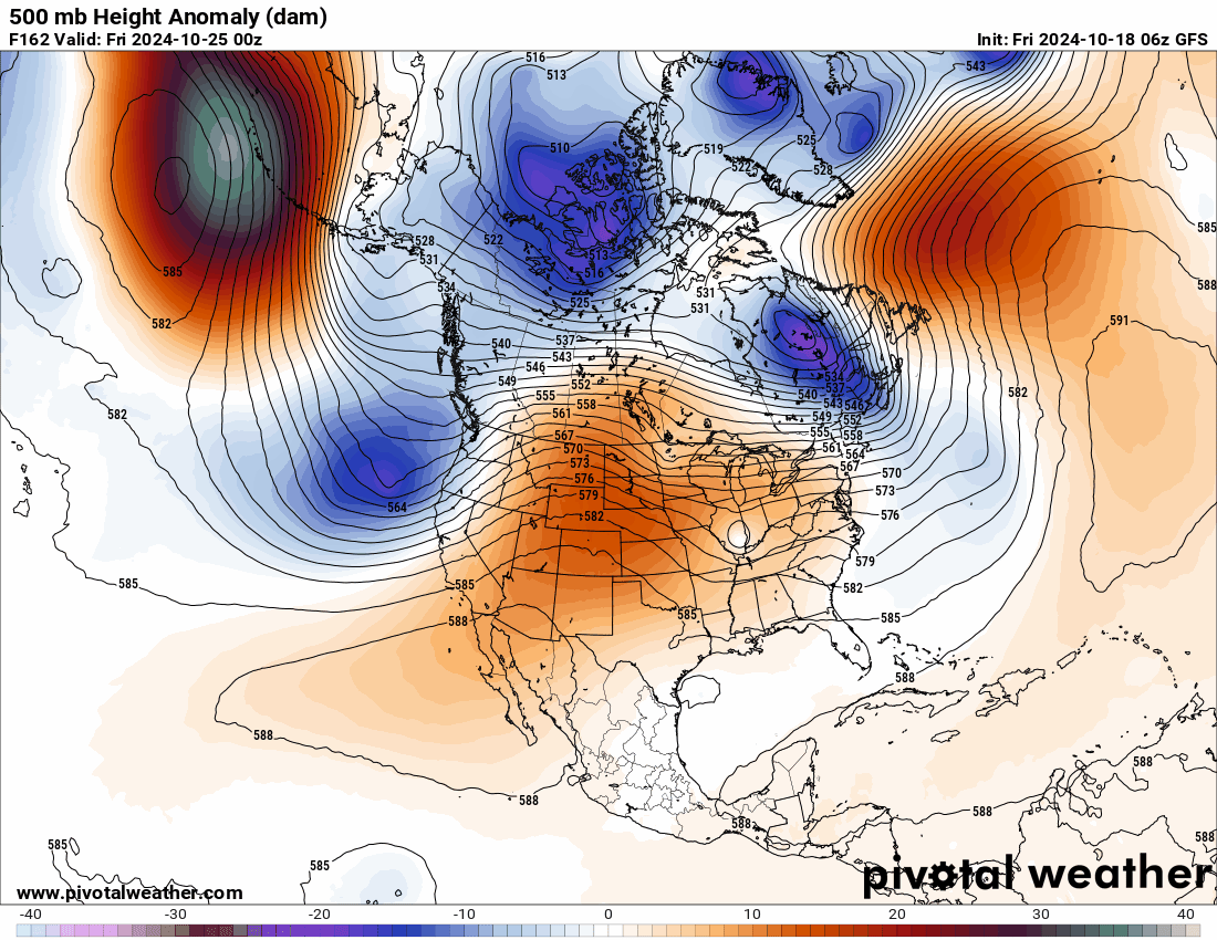
Day 5
-
October 2024 PNW Weather Discussion
Gradient Keeper replied to TigerWoodsLibido's topic in West of the Rockies
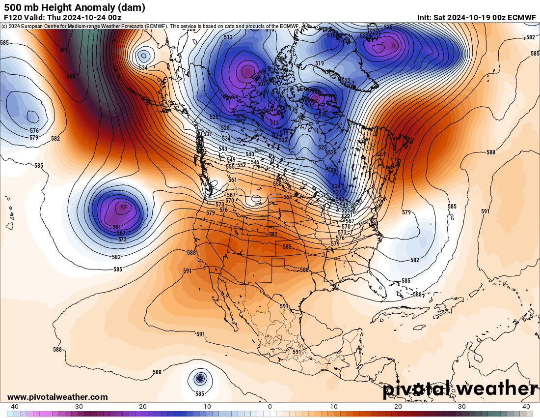
Day 4
-
October 2024 PNW Weather Discussion
Gradient Keeper replied to TigerWoodsLibido's topic in West of the Rockies
Day 3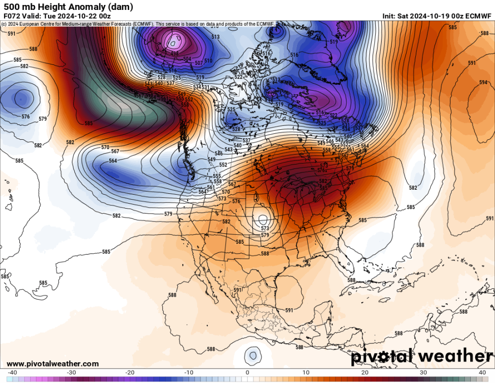
-
October 2024 PNW Weather Discussion
Gradient Keeper replied to TigerWoodsLibido's topic in West of the Rockies
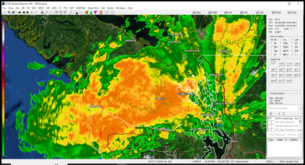
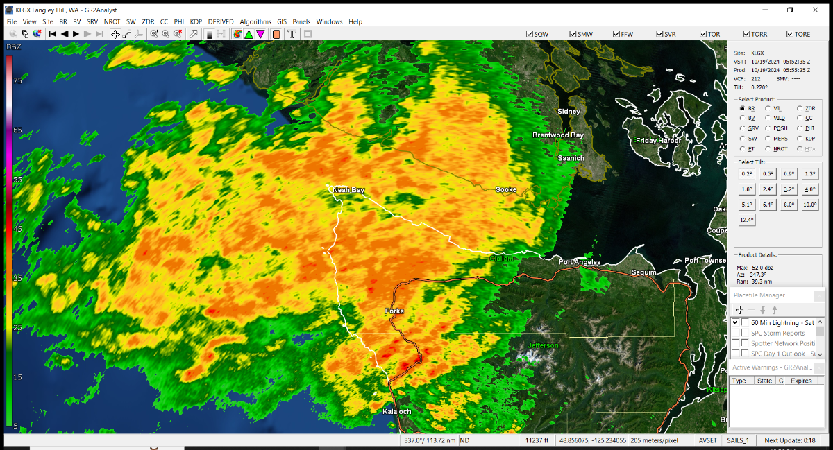
Yeah not too shabby. -
October 2024 PNW Weather Discussion
Gradient Keeper replied to TigerWoodsLibido's topic in West of the Rockies
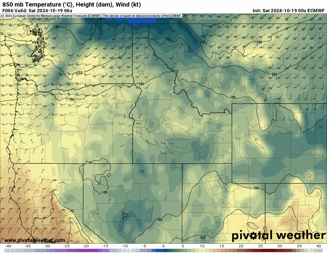
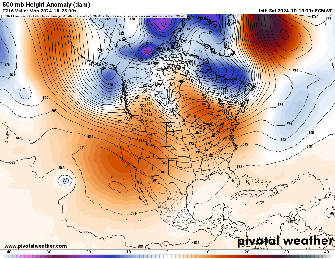
Back to the Euro. Day 2
-
October 2024 PNW Weather Discussion
Gradient Keeper replied to TigerWoodsLibido's topic in West of the Rockies
00z GEFS Day 10 (4-run trend)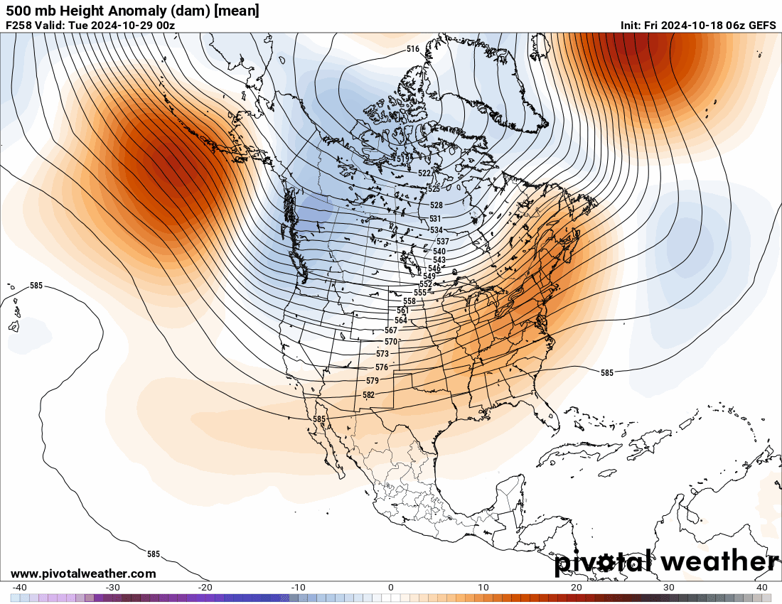
-
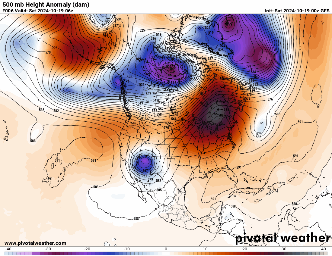
October 2024 PNW Weather Discussion
Gradient Keeper replied to TigerWoodsLibido's topic in West of the Rockies
00z ECMWF Day 1
-
October 2024 PNW Weather Discussion
Gradient Keeper replied to TigerWoodsLibido's topic in West of the Rockies
00z GFS 10 Day Rainfall, Snowfall totals

-
October 2024 PNW Weather Discussion
Gradient Keeper replied to TigerWoodsLibido's topic in West of the Rockies
00z GFS re-cap. 10 Day GIFs: 500mb Height Anomaly, 850mb Temps, 1000-500mb Thickness/MSLP/Precip
.thumb.gif.6fc93f25ae4b13d81de23c0cb125c2aa.gif)

-
Agreed.
-
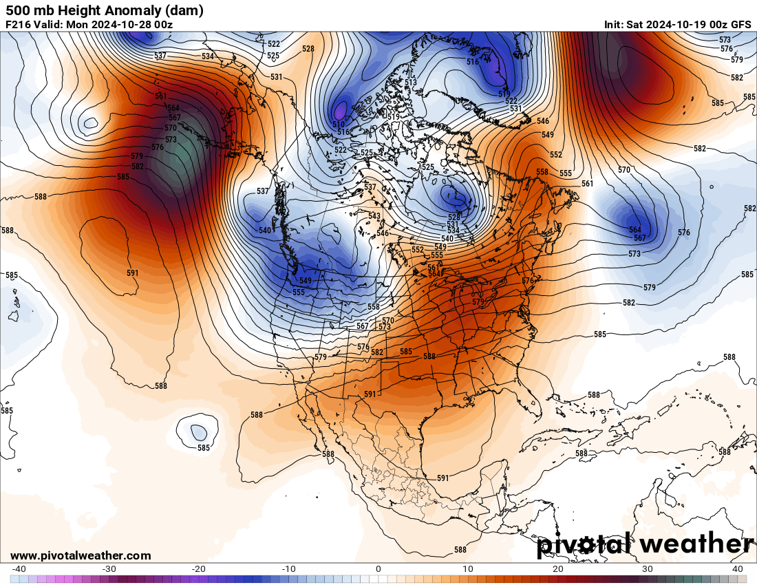
October 2024 PNW Weather Discussion
Gradient Keeper replied to TigerWoodsLibido's topic in West of the Rockies
Day 10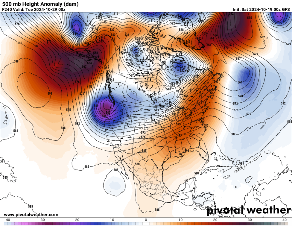
-
October 2024 PNW Weather Discussion
Gradient Keeper replied to TigerWoodsLibido's topic in West of the Rockies
Day 9'er

-
October 2024 PNW Weather Discussion
Gradient Keeper replied to TigerWoodsLibido's topic in West of the Rockies
Day 8
-
October 2024 PNW Weather Discussion
Gradient Keeper replied to TigerWoodsLibido's topic in West of the Rockies
Day 7 impressive trough digging. Wind storm pattern evolving? (4-run trend)

-
October 2024 PNW Weather Discussion
Gradient Keeper replied to TigerWoodsLibido's topic in West of the Rockies
Day 6 (4-run trend)


.gif.de99384a039986f5cf8dc33e217363b7.gif)


.gif.8d6a6ec5505a8f3689bfe4ce9ce542f3.gif)