


Cascadia_Wx
-
Posts
7170 -
Joined
-
Last visited
-
Days Won
25
Posts posted by Cascadia_Wx
-
-
1 minute ago, TigerWoodsLibido said:
Must be nice. The situation is absolute shitt here.
-
 2
2
-
-
2 minutes ago, SilverFallsAndrew said:
Pretty strong system develops a week from today on the 12z.

Nice am hoping the current strong system isn’t just a one and done and there are more in the pipeline
-
2
-
-
Ended up with a 56/43 day yesterday mostly cloudy and breezy with rain starting in the early evening
-
Only a little over .30” with the system so far here, but looks like areas to the north and south have done much better. Nice to see .80” in Roseburg on the day so far
-
1
-
-
Low of 43 here as well mostly cloudy and just a little drizzle so far
-
Starting to look like the biggest weather story in the next week could be the warmth on Thursday
-
1
-
 1
1
-
 1
1
-
 1
1
-
-
58/43 day partly to mostly sunny even though it’s been a troughy pattern the last 3-4 days there has been lots of sunshine
Clouds increasing now and 55 looking forward to a good soaking later tomorrow through Monday
-
59/37 day here yesterday picked up over .20” of rain yesterday evening and overnight a little more than expected maybe that will bode well for the upcoming systems too
Mostly cloudy this morning with a low of 43
-
2
-
-
12z Euro looking good
-
 1
1
-
-
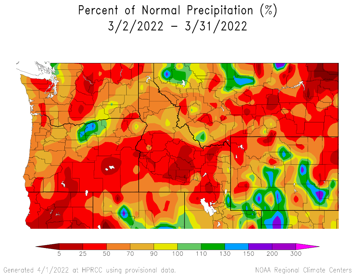
Hopefully can turn things around in April. Even a month with near average temps and precip would be a win after the last few April’s
-
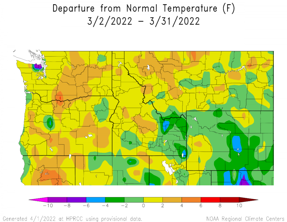
Looks like March was another warmer and drier than normal month for the region

-
1
-
1
-
 1
1
-
 1
1
-
-
Partly cloudy with a low of 37 this morning to start off the new month had a partly cloudy 55/41 day yesterday to close out March with quite a few sunbreaks and no measurable rain
-
1
-
-
An April like 2008 or 2011 isn’t happening but it would be nice to at least avoid another warm and dry month haven’t had even a slightly below average April in five years
-
1
-
-
12 hours ago, Phil said:
Yeah it is a long overdue pattern. And I’m perfectly fine with eastern ridging in April. Not much humidity at this time of year and it still cools down at night.
Last year made a weak attempt at this type of pattern, but west-Pacific influence was just a bit too much. That doesn’t look like as much of a factor this year, so far at least. The -SSTAs are centered in Niño 4, the IPWP has re-centered farther west, and there is a new upwelling OKW ongoing (we had a downwelling wave this time last year).
Last year’s attempt at this type of pattern gave PDX its latest freeze in 40 years on 4/11, but then they went on to record eight consecutive 70+ highs the 14th-21st which blew away the previous April record
-
1
-
 1
1
-
-
6 minutes ago, Phil said:
Your backyard is an anomaly, which you actively choose to reside within. The vast majority of the west has been running up ugly moisture deficits over recent years, which is concerning for both humans and the overall biosphere in those areas.
Just one summer with a more -PNA/onshore tendency and/or a suppressed 4CH could work wonders.
It’s not even an anomaly the main thing Washington has over the rest of the west is increased precip in the cold season thanks to the jet migrating further north but that still doesn’t make up for warmer and drier conditions there the rest of the year
-
12z GFS looked pretty nice would be good to see an old school La Niña style April-early June to get us in good shape for summer seems like that has been hard to get in recent years
-
2
-
-
11 minutes ago, Eujunga said:
Definitely a "1-2" punch of drought (1) and hotter summers (2) in which just the "2" punch is enough for a knockout in many situations.
And The blast of extreme heat last June almost felt like a 3 since that had more acute effect on vegetation compared to the long term stuff drought and hotter summers on average cause
-
2
-
 1
1
-
-
2 minutes ago, Phil said:
If only the rest of the West were as lucky as you.

Drove over Snoqualmie in October and there were lots of signs of drought dying hemlocks near the summit having wetter than normal conditions in the winter still doesn’t make up for the rest of the year being drier and hotter than average even up there
-
Ended up with a 57/41 day here yesterday pretty seasonable picked up about .07” in scattered showers
-
54 minutes ago, TigerWoodsLibido said:
Lot down to 33F Close to freezing. Currently 44F nd partly cloudy.
Haven’t had a any temps below 35 up this way since the 10th
-
1 hour ago, Phil said:
The D10-15 EPS goes hard core -PNA. Looks snowy in the higher elevations.
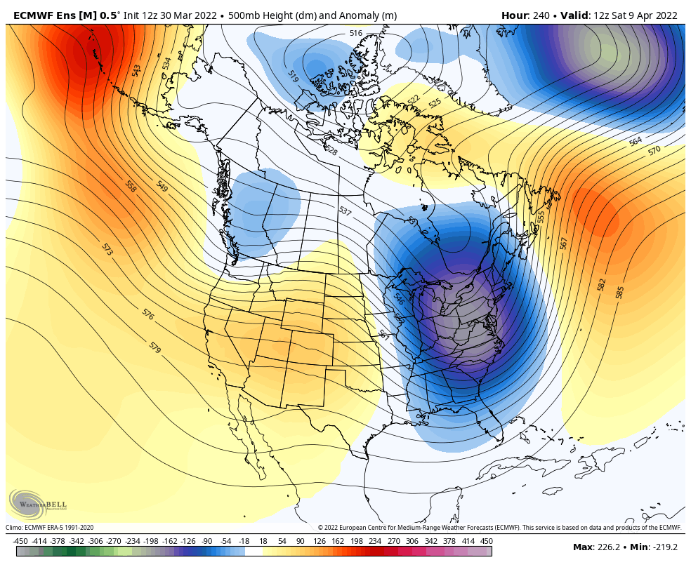
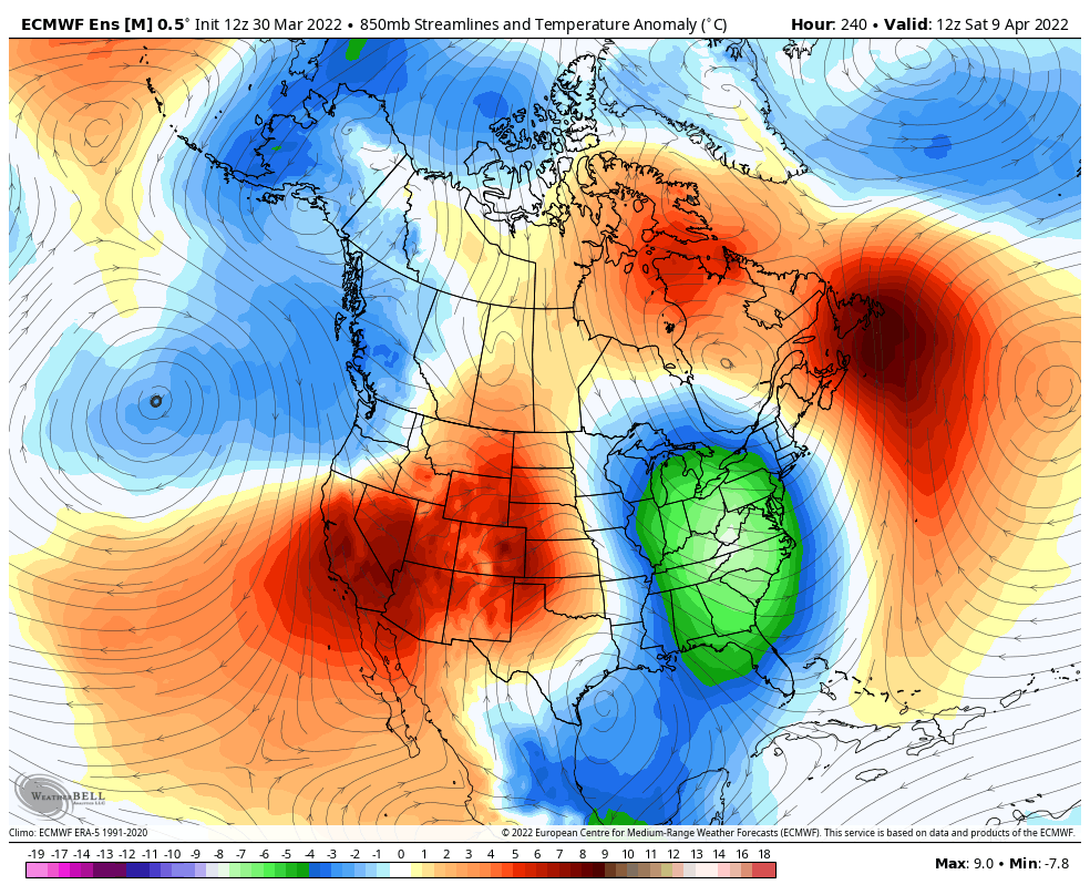
Will probably get watered down but potential is there for the best April pattern in years
-
1
-
 1
1
-
-
Looks like PDX picked up .03” with that last shower just .04” to go to get to 3” for the month (which is still almost an inch below average, but double what they got last March)
-
Nice looking 12z GFS run
-
60/44 day yesterday mostly cloudy to partly cloudy
Picked up about .02” this morning with a low of 46 pretty weak system looks like most major stations recorded 0” or a trace


April 2022 (April 2008/2011 redux)
in West of the Rockies
Posted
Temp down to 44 here with heavy rain and hail some strong wind gusts too
Was as warm as 52 with sunbreaks earlier