Jack_GradStudent
-
Posts
83 -
Joined
-
Last visited
Everything posted by Jack_GradStudent
-
That's my personal opinion. A lot of meteorologists go back and forth with the favorite model being the GFS or EURO. The nam is more of a short term model but tends to be up there as well; it has not been very good this year. The GFS has been. The CMC just is not a very good model-- they vary based off of different physical equations they use and differences in initial conditions.
-
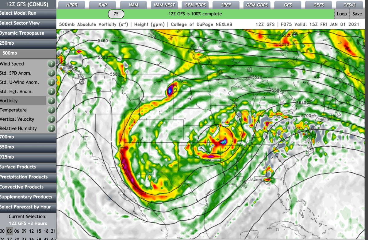
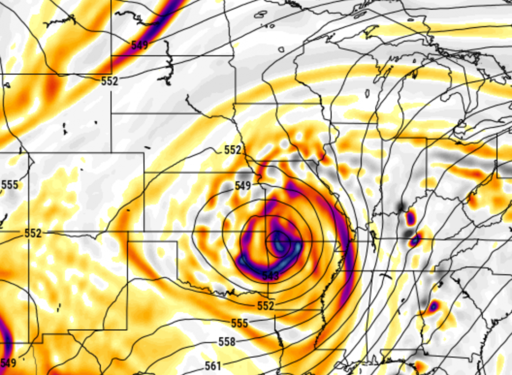
The track of this storm truly will mean everything. Most models seem to have a decent amount of freezing rain and then changing over to snow; depending on where you live determines how much of what. There are certainly things we don't know but also things we have a good feel on. Things we know: 1) A wet storm will be tracking from Mexico, northward eventually tracking somewhere through Missouri and then falling apart. 2) 1.0-1.5 QPF is likely for many areas to the west and northwest of the track of the low. 3) A freezing rain component is almost certain as the storm will bring in a lot of warm air aloft. 4) There will be a changeover to snow in areas west and northwest of the low with likely an 8-12 inches band of snow. Things we don't know 1) Exact track of the low. 2) Where the changeover to snow will occur and not occur. 3) If it will bring enough warm for precip to change over to rain.

-
The Canadian Model should be the last model we all look at... it was too cold and was the worst model for the storm that is going on right now. Best models to look at GFS, Euro, GEFS, and the NAM. The Canadian always seems to be the outlier.
-
Euro is consistently trended further west and weaker. Something to note.
-
Based off the last 8 model runs, I think we can all say there a pretty good overall trend of the low tracking further east through central MO rather than south and east of STL like it was a few days ago. Most models are trending more in the direction of a freezing rain event, followed by a few inches of snow for the KC area with most of the snow staying west and north of KC. BUT, today being Tuesday now, I don't want to start seeing the solution I really like until Wednesday into Thursday. Those who have been tracking KC snows for years know you do not want to be in the bullseye 4 days out because you know by a day out it will have shifted 50 miles. Tomorrow and Wednesday will be fascinating to track.
-
Clinton, I bet there is going to be spot that is just in the perfect spot to the northeast of where the low tracks that has the potential to see close to a foot of snow. It will be close enough to the low where it gets the brunt of the deformation zone but also far enough way that the temps will stay just below freezing at the surface and at 850 mb.
-
WOW. Latest Euro is quite impressive for Thursday-Friday. GFS and CMC are a bit further east than this. Would love to see those models hop on board within the next few runs. Also has freezing rain as a part of the solution; would make things quite interesting. Looking forward to tracking this.
-
Hey all! New to the forum. Pursuing a master's in meteorology at SLU-- looking forward to some great weather discussion! https://whatgoesonoutside.wordpress.com/2020/12/27/an-all-of-the-above-kind-of-week/ Subscribe to my blog! I blog about weather in the KC (being from there) and STL. Really looking forward to especially tracking the end of the week storm-- not going to be much in the form of snow here in KC, but Tuesday morning does look interesting with temps being just below freezing presenting chances for snow, sleet, freezing rain, then going to all rain by the afternoon. Jack