

Joshua Lake Oswego
-
Posts
1005 -
Joined
-
Last visited
-
Days Won
1
Posts posted by Joshua Lake Oswego
-
-
The 12z Euro says ''no rain for you'' through the weekend to those of us west of the Cascades. It also has PDX right around 100 for 3 straight days beginning tomorrow. This is the summer that keeps on giving.
-
1 hour ago, GobBluth said:
12z is relentless.
It sure is. Our only temps not well above average would be the middle of next week. Back to 100 by next weekend.
If it verifies, North Dakota and Minnesota are going to be setting some records in about 12 days.
-
17 minutes ago, Front Ranger said:
Some streaks could be in jeopardy!

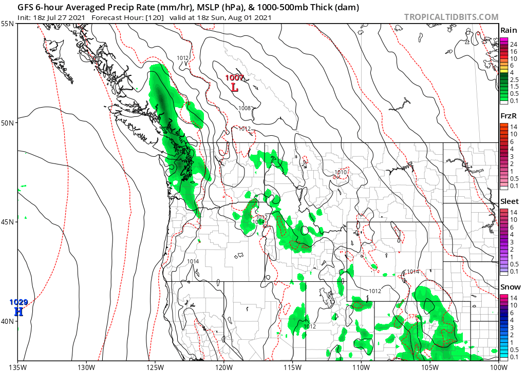
The 18z ICON looks pretty similar.
https://weather.us/model-charts/german/washington/precipitation-6h-in/20210801-1800z.html
-
 1
1
-
-
49 minutes ago, Jesse said:
Time to buckle up for the Euro. Any bets on how many hundreds of miles offshore it stalls the next trough?
Keep in mind ten days ago there were runs that showed troughing over us now. That trough is now about 500 miles NW of us and about to pump up our next heat event.
Well, looks like we're back up to the mid-90s by the middle of next week after an impressive two day break of average temperatures. That's after 5 days of 90+ including two days at or above 100.
Our summers sure are lovely here.
-
 1
1
-
-
4 minutes ago, Jesse said:
There were a couple Sundays over the spring where we fell a little short of the expected 10+ degrees above average with blazing sunshine from dawn until dusk. I’m still talking it over with my therapist.
Haha. I see.
Tim, let's see your statistics.
I would say that we have been in the Sunday-Saturday curse since February. See my statistics above.
-
 1
1
-
-
7 minutes ago, Jesse said:
You forgot about the Sunday curse

Pardon my ignorance, but what is the Sunday curse?
-
Let's put things in perspective:
We had the driest spring on record by a large margin. Our all-time high temperature was shattered last month by a large margin and was broken on 3 consecutive days. June was the warmest of all-time. 43 out of the past 56 days encompassing all of June and July have been warmer than normal. July will be one of the warmest on record. August will begin very warm. We are in the midst of one of the longest dry spells in history.
There is no other way to spin this other than it being historically warm and dry. To top it off, there is endless warmth and drought for the foreseeable future.
This is all for PDX specifically, but region-wide, the bigger picture is the same.
-
1
-
 2
2
-
1
-
-
2 minutes ago, BLI snowman said:
BLI is at 38 consecutive days without measurable rain.
Their record is 54 days, a mark which now stretches to the end of the current GFS range. There's really no rain or meaningful troughing anywhere in sight, so they have a good chance of breaking that record as it stands right now.
SEA has to get to 55 days to tie their record, and they are also on a 38 day streak. Again, a pretty decent chance they get there.
PDX has a much longer way to go to hit their record of 71 days, but something tells me they'll do it.
My idea of worst-case weather for our region keeps getting reset. Our spring dryness was worse than a worst-case scenario. Our heat wave at the end of June was worse than a worst-case scenario. The dry streak that we are on feels like it could end up worse than a worst-case scenario too.
Worst-case to me is warm and/or dry.
-
1
-
-
3 minutes ago, TT-SEA said:
Just noticed that... the Sunday curse is back!

Yea, what a curse it would be to get some rain. How horrible.
-
1
-
 1
1
-
-
Looks like an over-performing day ahead for the Portland metro area. Clouds are already dissipating or gone. Most areas should end up close to 80.
-
Another sunny morning here in the dome.
Looking at the visible satellite, almost all of western Washington is enveloped in sweet, sweet clouds while in Oregon it is limited to the coast and adjacent areas, the Columbia River basin, and eastern Portland metro area out to the Cascade foothills. This has been an ongoing theme.
-
82 at my house. One of the warmest stations I can find in the I-5 corridor from Eugene to the Canadian border. Lucky me.
-
 1
1
-
-
3 hours ago, Jesse said:
I love how a chance at brushing 90 is morphing into three straight days in the 90s for PDX. Vile trash weather.
Of course. High pressure always overperforms. Always. Both in intensity and duration.
I called temps in the 90s this week on the 20th. The Euro ensembles at that time were showing temps right around 80 with some rogue wacky members going above 100.
Basically, you have to add 10 degrees to the Euro ensemble mean in the mid-range and divide the precipitation by 4. Close to the 90th percentile for temps and 10th percentile for precipitation. Rarely fails.
-
1
-
1
-
-
It seems like the majority of this group believes that the PNW only encompasses a an area from Tacoma to Bellingham and from the coast to the cascade crest.
Objectively, it has been a warm and historically dry spring for a large portion of the PNW.
That trend will continue at least through the middle of June. A day or two of troughing here and there doesn’t change that fact.
-
4
-
 1
1
-
-
7 minutes ago, Omegaraptor said:
Spring precip totals Mar-May:
Portland 2.52" (driest on record)
Hillsboro 2.22" (driest on record)
Salem 4.54"
Eugene 3.31" (driest on record)
Roseburg 3.10" (driest on record)
Medford 1.84"
Some of those are by far the driest on record.
I already see so many dead or dying trees driving from my house to downtown Portland on I-5. Driving in neighborhoods too. Our native vegetation can only take this incessant warmth and drought for so long. It's really sad. Probably a good time to invest in tree removal company stock.
Time to pant palm trees and cacti.
-
1
-
-
7 hours ago, TT-SEA said:
Wow... there is close to the normal rain for all of June in some places.
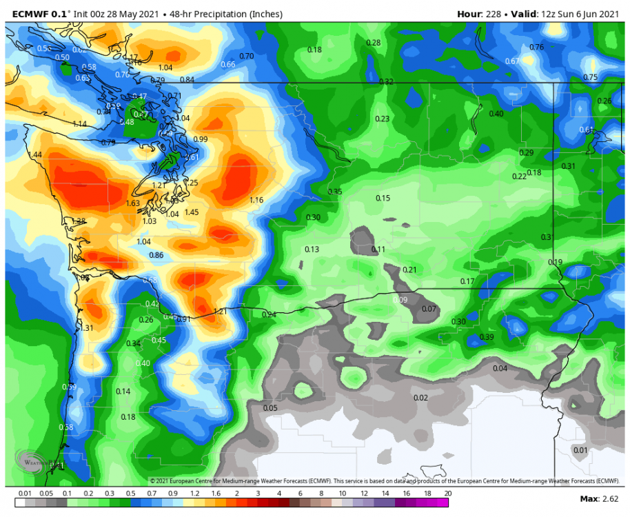
Wherever the storm track is forecasted to be at this time, add a couple of hundred miles north. BC will score. Seattle will get peanuts. Portland will get zilch.
-
1
-
-
The 00z GFS is brutal. Hotter and longer-lasting with the high pressure. No relief until day 12. If I was a betting man, I would put money on something similar to this verifying. Endless 80s with a couple of 90s sprinkled in.
-
Quote1 hour ago, TT-SEA said:
Rain and 54 here... another colder than normal day with rain. But its more enjoyable knowing a beautiful holiday weekend lies ahead. This is much better than the reverse with nice weather during the week and a washout for the long weekend.


Looks like summer starts on May 29th this year. Well, the summer pattern actually started in March down here.
-
Why is it not possible anymore to go more than a couple of weeks without crazy anomalous warmth? I know that whenever we have a short stretch of even slightly cooler than average temps, we will pay for it dearly.
And, whenever ridging is advertised on the models weeks out, it will inevitably verify but with increased strength and duration. The opposite is rarely true.
I can’t decide if we should change our name to the Desert NW or Upper California.
-
1
-
1
-
-
- Popular Post
- Popular Post
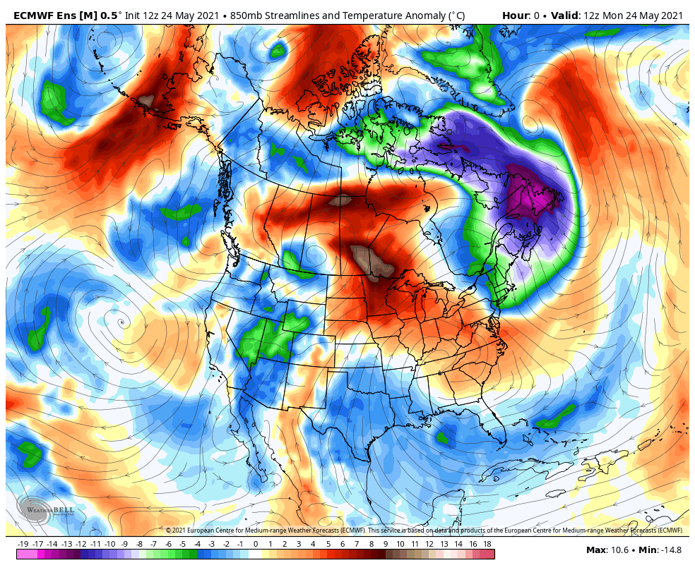
Hi, everybody.
I have been lurking here for a while and finally joined. I recognize some of you from Mark Nelsen’s weather blog. I have been active on and off there for a long time.
I love to complain about hot and dry weather. Yep, another one.
Memorial Day week is not looking fun. Next Monday and Thursday hold some promise for meaningful rainfall.
Here’s a depressing stat: PDX has not had more than .25’’ of rain in a day since Valentine’s Day. Hard to believe.-
11

July 2021 PNW Weather Discussion
in West of the Rockies
Posted
I put very little stock in these outlooks. We can all look at that models and see how much precipitation is being forecasted.
Besides, when our average is close to zero, a 30-40% chance of greater than average is not very meaningful.