SimplySmoothWX
-
Posts
101 -
Joined
-
Last visited
Everything posted by SimplySmoothWX
-
 A trace in most spots. Sidewalks have black ice on them, but the roads are fine. Hillsboro was close to a nasty morning commute.
 -
PNW January 2023 Observations and Discussion
SimplySmoothWX replied to Requiem's topic in West of the Rockies
And I thought the GFS runs in December were crazy. lol -
PNW January 2023 Observations and Discussion
SimplySmoothWX replied to Requiem's topic in West of the Rockies
A few tidbits from Mark Nelsen's latest blog post: This setup is THE SETUP you want to get cold/snow into the region. Some moisture gets picked up by the cold air heading out over the ocean. Then a little extra lifting as that surface wedge of cold air pushes into the region. Sometimes we get NOTHING snow-wise out of this pattern as cold air arrives, other times maybe up to 2″. It depends on how that upper level trough digs south too. If it just moves by quickly and slightly east of where the Euro model shows it (above), we are typically just dry and a chilly east wind begins to blow. Since we’re still 5+ days out, it’s a real guess exactly how this turns out. And then notice about 1/2 of GFS ensemble members produce noticeable snow in Portland on the chart below. That’s a decent indicator that SOMETHING is up for this weekend. But what we aren’t seeing yet? MOST of those members producing snow; this situation is very much still evolving. The two extreme possibilities I see right now: 1) We pick up 1-3″ of snow Saturday night, Portland is frozen all day Sunday and Monday, then a little more snow falls around Tuesday or Wednesday next week. 3-4 days of icy/cold stuff. 2) A chilly east wind arrives Saturday night, a few flurries fall, but doesn’t affect any of us. Temperatures only reach around 38-42 for a few days, then it’s back to milder/wetter the middle of next week and beyond. No real snow falls in Portland and it’s just a bit cold for a few days. Your life continues the same Sunday and into next week. My gut feeling is it’ll be somewhere in between. But I’ll be at work all week; no scheduled time off until the end of February! -
PNW January 2023 Observations and Discussion
SimplySmoothWX replied to Requiem's topic in West of the Rockies
Graupel switching over to snow as we speak -
PNW January 2023 Observations and Discussion
SimplySmoothWX replied to Requiem's topic in West of the Rockies
Ice pellets in Hillsboro -
PNW January 2023 Observations and Discussion
SimplySmoothWX replied to Requiem's topic in West of the Rockies
The GEM really living up to its name right now lol -
PNW January 2023 Observations and Discussion
SimplySmoothWX replied to Requiem's topic in West of the Rockies
That's funny because by February 1st the sub was active as ever with the first snow to come a few days after. -
PNW January 2023 Observations and Discussion
SimplySmoothWX replied to Requiem's topic in West of the Rockies
I noticed that too on my walk to the gym. This is definitely the windiest winter in quite some time -
PNW January 2023 Observations and Discussion
SimplySmoothWX replied to Requiem's topic in West of the Rockies
I wonder how much a snowball from 1893 would go for on here -
PNW January 2023 Observations and Discussion
SimplySmoothWX replied to Requiem's topic in West of the Rockies
To me there seems to be two likely outcomes for February, based on the Februarys in recent decades. 1) The forum favorite; Major cold snap. Dry, but still snowy. Notable years of this include 2021, 2011 and 1989. 2) A more mild, wet pattern. It's a major torch pattern for the Eastern U.S though. Notable years include 2000, 1999, and 1984. 1) Has been more prevalent in recent years However, I'm inclined to go with 2), at least for the first week. My reason is the MJO is moving through phases 1-2 right now, and by February, it will near phases 4-5, a major torching pattern for the Eastern 2/3s. After that though, it's hard to tell what happens. I wouldn't be surprised if a cold snap drops over us around Valentines day. If one does, it won't be as severe as Feb 2021. I'm not picking up on that right now. That being said, this post is intended to be left in the dirt and see how it grows. I hope into a beautiful rose! They're my favorite. -
PNW January 2023 Observations and Discussion
SimplySmoothWX replied to Requiem's topic in West of the Rockies
The 00Z GFS shows a 'Megaflood' for California. Similar to the one in 1861 For once, I wish the GFS is wrong -
05-06 was a weak Nina, -0.8 for the DJF period.
-
True. It was the golden egg in an otherwise ugly winter.
-
Since 1958, there have been 18 SSW events during El Nino winters. 15 of those impacted the Continental U.S. 8 of those impacted the PNW, them being Jan 1958, Dec 1965, Feb 1966, Nov 1968, Jan 1970, Dec 1987, Feb 2007, and Jan 2019. Statistically, that's a 44% chance a SSW affects us during an El Nino. La Ninas are at a higher margin, with 50% (8 out of 16) affecting the PNW. There are also more household names on the La Nina side. Feb 1989, Dec 1998, and Feb 2021 just to name a few. Overall, I would view SSWs during ENSO events the same way I view them on lowland snow. Sure, there is an increase for snow during La Nina but it is not guaranteed.
-
That is some serious drought-busting rain
-
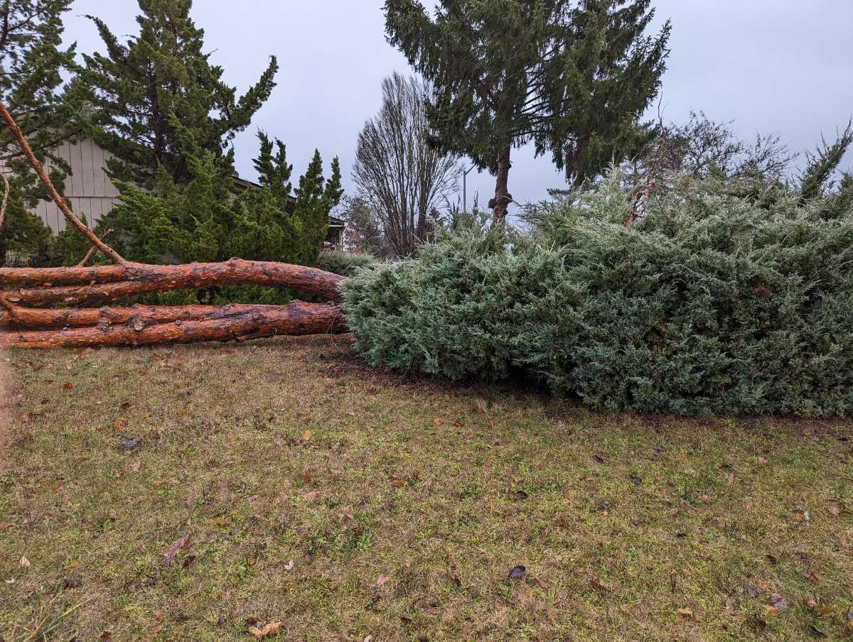
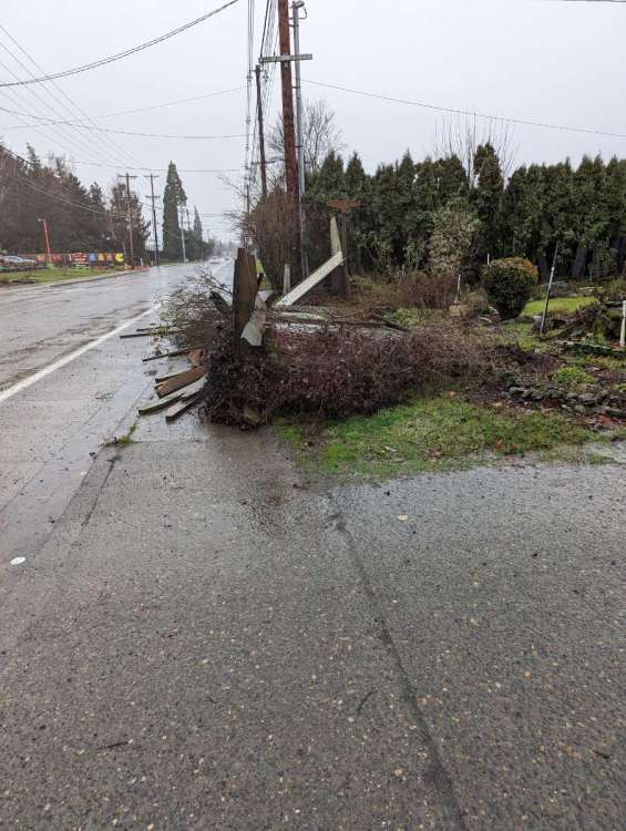
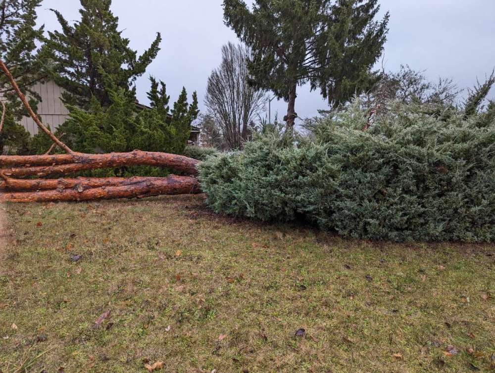
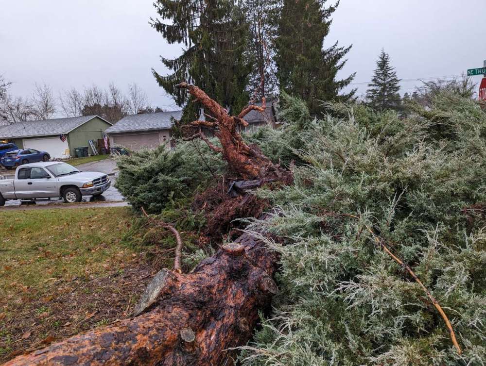
Some pics that I took on my walk to the gym
-
Woke up to a trace of snow here. Anyone else in the Willamette Valley get some?
-
Eh, I tend to not look at things that could've/should've happened. If you look at things from that perspective, you're always gonna want more, and will never be truly satisfied. I don't know if that's me being wise or my therapist talking. Anyways, we're in the midst of a historic arctic blast, with an (unfortunate) ice storm to follow it up. I think that's decent in terms of weather historically. Hopefully we get some actual snow in the coming months, but this will do for now.
-
-
I-5 is closed both ways 5 miles north of Eugene
-
Somebody save this image somewhere because this is insane
-
Looks like snow on radar just west of Salem right now. I don't think any of its reaching the surface, but I'll be checking the road cameras just in case.
-
Portland's at 24 degrees with a dp of 6 And it's not even midnight
-
The east winds have made it to Hillsboro. Albeit off and on, but when it's blowing it's stupid cold.
-
Beat me to it!