Mid Valley Duck
-
Posts
426 -
Joined
-
Last visited
Everything posted by Mid Valley Duck
-
January 2024 Weather in the PNW (Part II)
Mid Valley Duck replied to Meatyorologist's topic in West of the Rockies
My dog said hell no to going outside IMG_3534.mov -
January 2024 Weather in the PNW (Part II)
Mid Valley Duck replied to Meatyorologist's topic in West of the Rockies
No I got some snow. Currently sleet. It has switched back and forth. So don’t worry PDX friends. It took a bit for the column to saturate and cool before going to snow. -
January 2024 Weather in the PNW (Part II)
Mid Valley Duck replied to Meatyorologist's topic in West of the Rockies
More than I expected!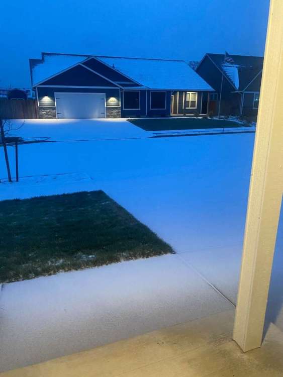
-
January 2024 Weather in the PNW (Part II)
Mid Valley Duck replied to Meatyorologist's topic in West of the Rockies
12z HRRR. If it were to verify, PDX is looking at 4-10” and the warning would need to be updated to a Blizzard Warning for a large part of the metro imo.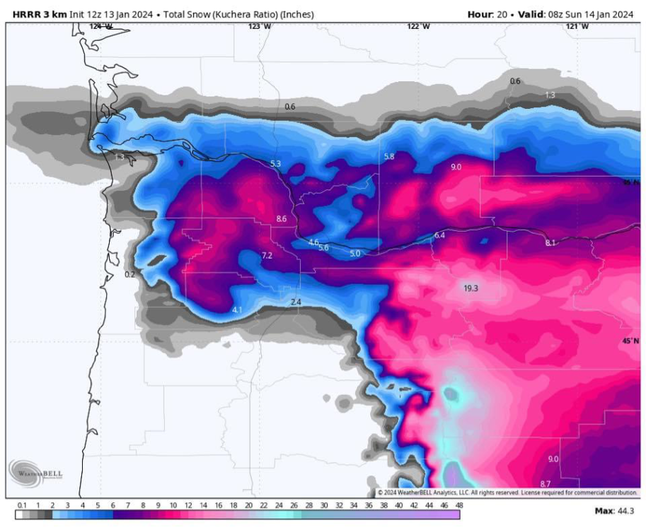

-
January 2024 Weather in the PNW (Part II)
Mid Valley Duck replied to Meatyorologist's topic in West of the Rockies
Time to quit looking at models. The low is starting to blow up on the satellite imagery. It looks very good out there -
January 2024 Weather in the PNW (Part II)
Mid Valley Duck replied to Meatyorologist's topic in West of the Rockies
Someone on Facebook today said the UKMET can’t differentiate precip types. So that might be sleet and ZR too but I hope it’s snow! -
January 2024 Weather in the PNW (Part II)
Mid Valley Duck replied to Meatyorologist's topic in West of the Rockies
31.1 at my house, with light sleet -
January 2024 Weather in the PNW (Part II)
Mid Valley Duck replied to Meatyorologist's topic in West of the Rockies
I’ll enjoy my 3” of sleet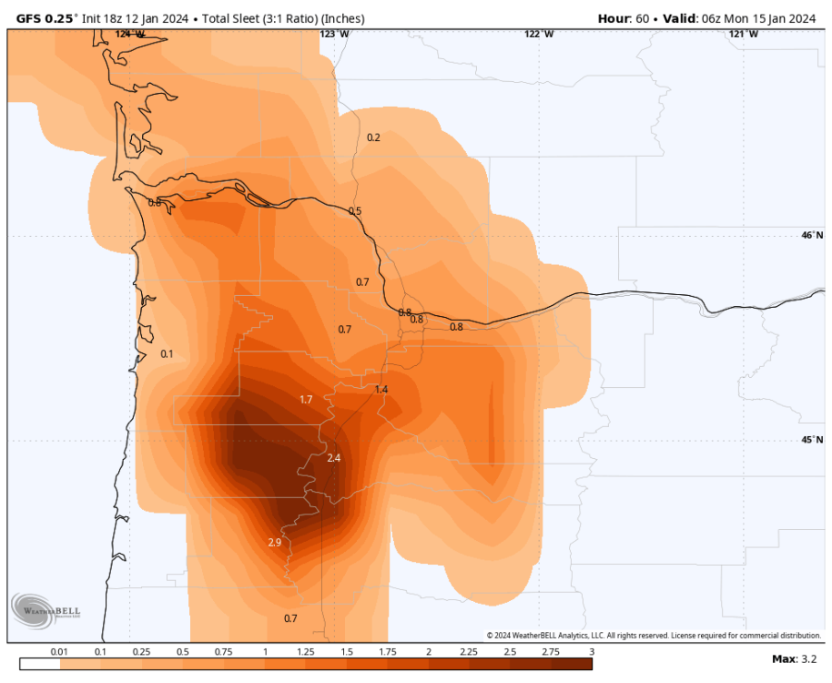
-
January 2024 Weather in the PNW (Part II)
Mid Valley Duck replied to Meatyorologist's topic in West of the Rockies
Yeah it basically is the same. -
January 2024 Weather in the PNW (Part II)
Mid Valley Duck replied to Meatyorologist's topic in West of the Rockies
It’s south of the 12z lol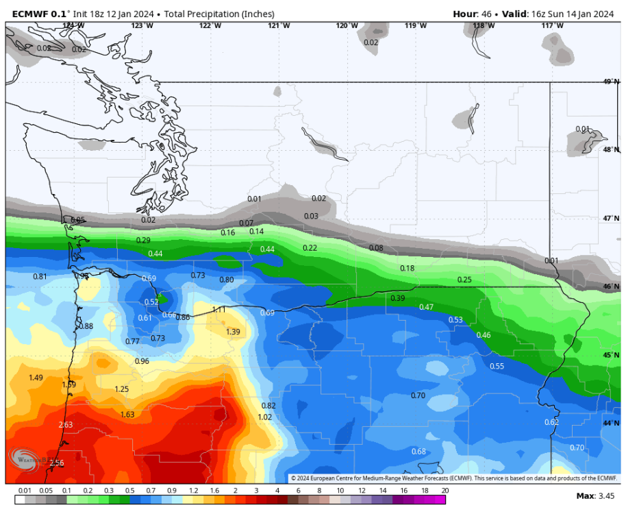

-
January 2024 Weather in the PNW (Part II)
Mid Valley Duck replied to Meatyorologist's topic in West of the Rockies
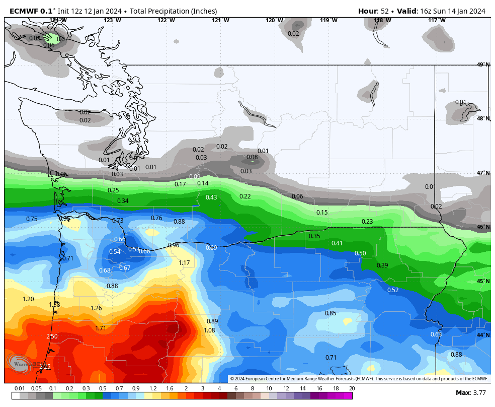
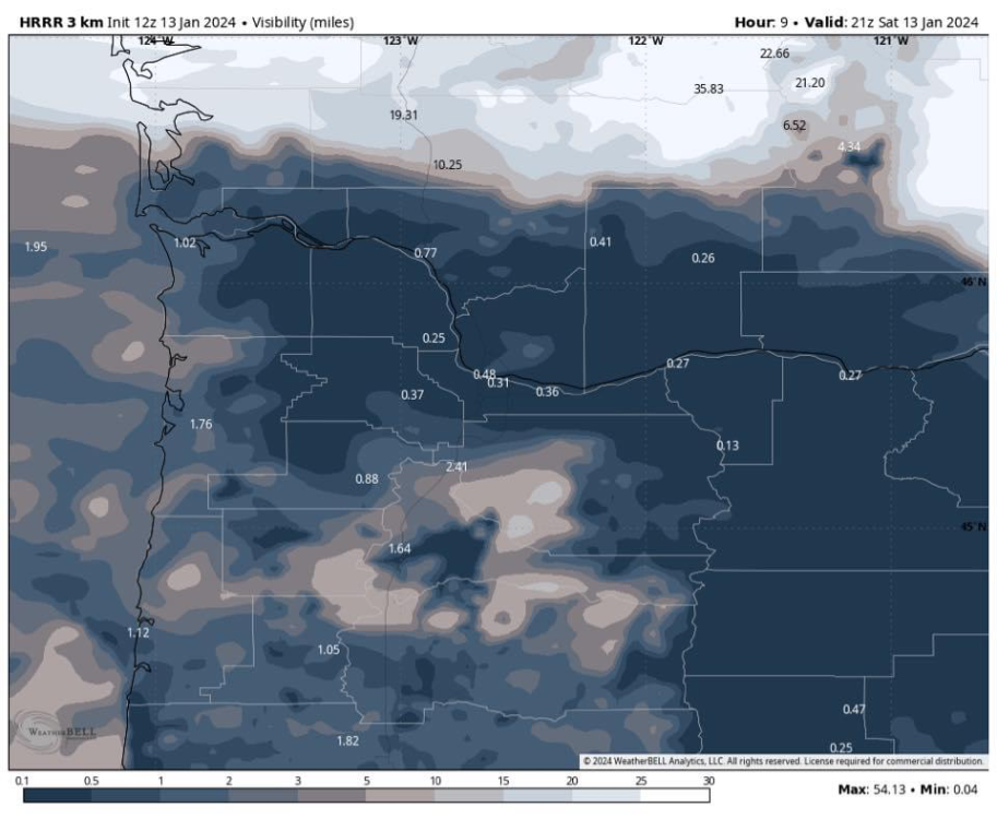
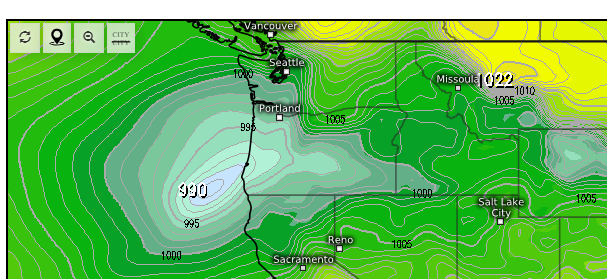
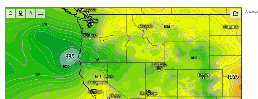
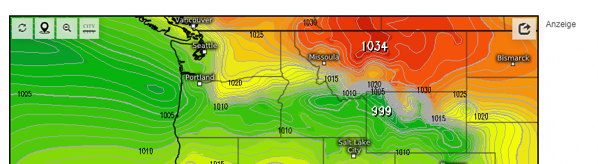
Think models might be having trouble with QPF. This system has plenty of subtropical support. -
January 2024 Weather in the PNW (Part II)
Mid Valley Duck replied to Meatyorologist's topic in West of the Rockies
That's a good point. Here are some cross sections of various models for Hillsboro. NAM clearly the most aggressive with the warm nose. But the Euro, GFS, HRRR and Canadian models look like mostly or all snow. -
January 2024 Weather in the PNW (Part II)
Mid Valley Duck replied to Meatyorologist's topic in West of the Rockies
NAM wants a lot of sleet, I dont buy it. This would be a good snowstorm imo. -
January 2024 Weather in the PNW (Part II)
Mid Valley Duck replied to Meatyorologist's topic in West of the Rockies
Things that make you go hmmm 12z GFS 1/10/17 1/1/2004 2/7/2014 1/11/1998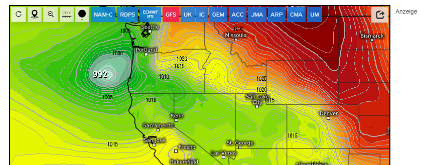

-
January 2024 Weather in the PNW (Part II)
Mid Valley Duck replied to Meatyorologist's topic in West of the Rockies
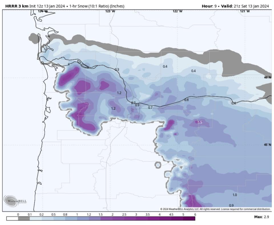
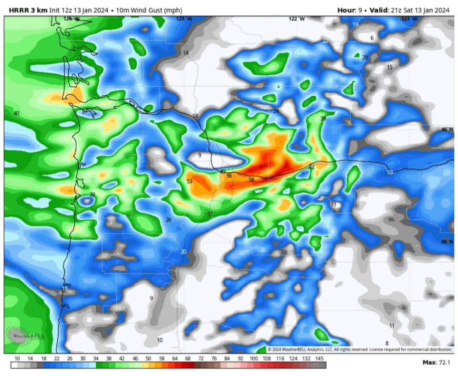
Yep, all models are showing an intense band tomorrow afternoon/evening where 2-3" an hour snowfall rates are not out of the question. It looks to last anywhere between 3-4 hours. -
January 2024 Weather in the PNW (Part II)
Mid Valley Duck replied to Meatyorologist's topic in West of the Rockies
Looking at the maps on the Euro anything above this blue line would be all snow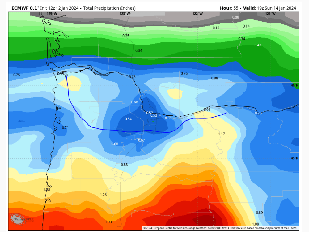
-
January 2024 Weather in the PNW (Part II)
Mid Valley Duck replied to Meatyorologist's topic in West of the Rockies
Dont understand the sleet profile on the Euro. This sounding is the warmest one for Hillsboro on the euro. -
January 2024 Weather in the PNW (Part II)
Mid Valley Duck replied to Meatyorologist's topic in West of the Rockies
Some food for thought on what the models are showing. If they are off on the northern extent of the precip shield, these totals will be low (see Feb 2014), off on the dynamics (see Jan 2017), off on the battle between WAA and the cold to the east (lots of examples). This is a high variance event. Literally nothing between 2-12" would surprise me at all for the PDX metro. The one scenario I would be surprised with is a shutout (trace to 2"), especially those in Multnomah county. -
January 2024 Weather in the PNW (Part II)
Mid Valley Duck replied to Meatyorologist's topic in West of the Rockies
I think some of the models are overdoing the sleet maps. The warm layer is pretty thin around the 850mb level and in the 33/34 degree range. The models might be overdoing the WAA associated with this anyway -
January 2024 Weather in the PNW (Part II)
Mid Valley Duck replied to Meatyorologist's topic in West of the Rockies
GEM op struggles with the Gorge. Hi Res GEM dumps on the metro -
January 2024 Weather in the PNW (Part II)
Mid Valley Duck replied to Meatyorologist's topic in West of the Rockies
The mesoscale models are coming around for Portland. NAM probably looks the worst, RGEM best -
January 2024 Weather in the PNW (Part II)
Mid Valley Duck replied to Meatyorologist's topic in West of the Rockies
With how all over the place the modeling has been on this, nothing will surprise me. I could see a reality where we all get skunked. I also could see one where PDX metro gets 1/10/17 v2. -
January 2024 Weather in the PNW (Part II)
Mid Valley Duck replied to Meatyorologist's topic in West of the Rockies
Yeah tonight’s runs have made me very nervous. Originally I was thinking major snowstorm. Now I’m think this might just be a solid one -
January 2024 Weather in the PNW (Part II)
Mid Valley Duck replied to Meatyorologist's topic in West of the Rockies
I don’t think 5” of sleet accumulation is even possible. That map is crazy