

Ken in Wood Village
-
Posts
784 -
Joined
-
Last visited
-
Days Won
8
Posts posted by Ken in Wood Village
-
-
It really looks like something is going to happen around the 11th and 12th

 🌨
🌨
-
 4
4
-
-
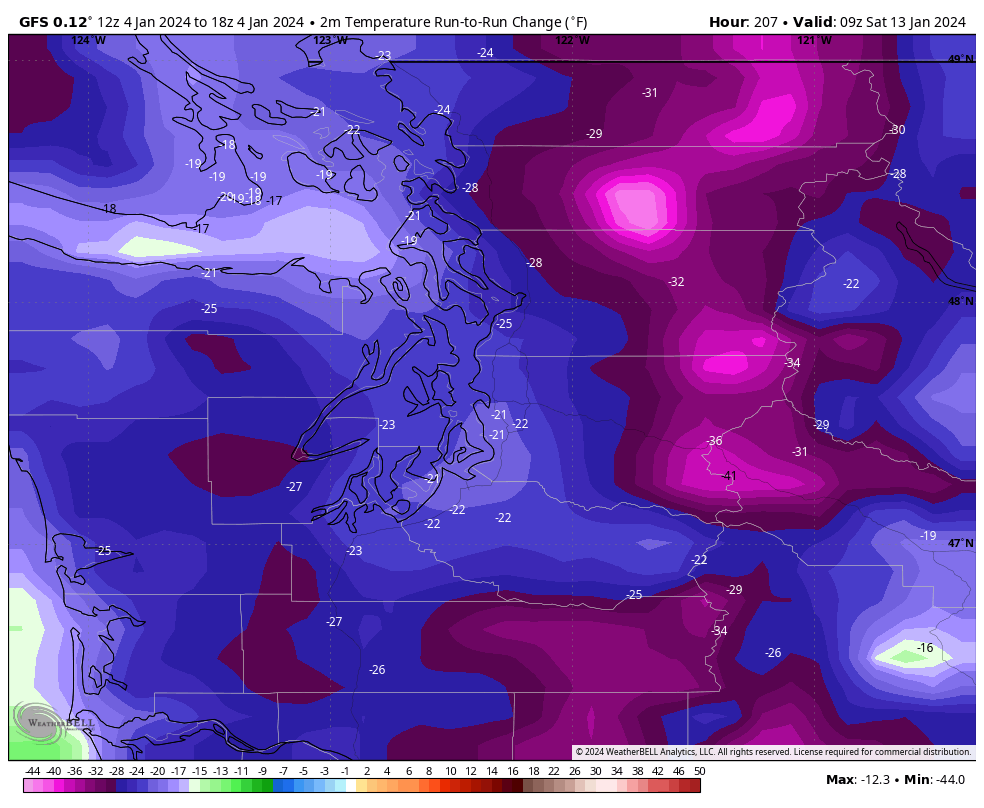
34 minutes ago, SeanNyberg said:
This is the biggest run to run change I can remember seeing for surface temps. 18z is like "shut up 12z, no one asked you!"

What about Oregon?
-
What a dramatic change from the 12Z run to the 18Z GFS run.
-
1
-
-
It's a little frustrating when this site goes down
 I was having withdrawals
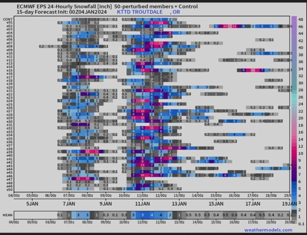
The 00Z EPS looked good. In fact, the storm on or about the 11th looks even better for snowfall in my area
🌨
What's funny is I was talking to my lead at work about the possibility of snow on that day then the colder air coming in, work decided to work this Saturday instead of next Saturday (1/13/24). I didn't think they would actually take my input about the weather conditions...lol
-
2
-
-
2 minutes ago, Gradient Keeper said:
Day 8
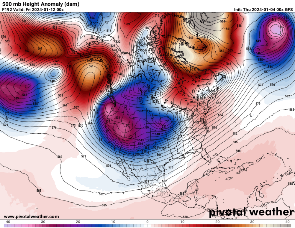
See what's coming over the high pressure from Alaska. I think that's another low which could be coming our way.
-
2
-
-
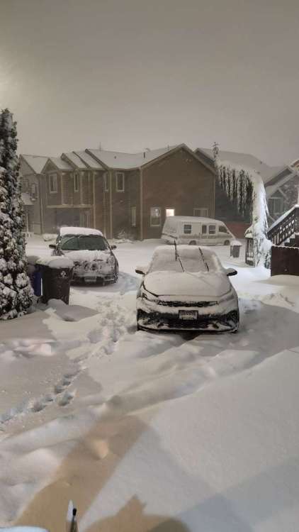
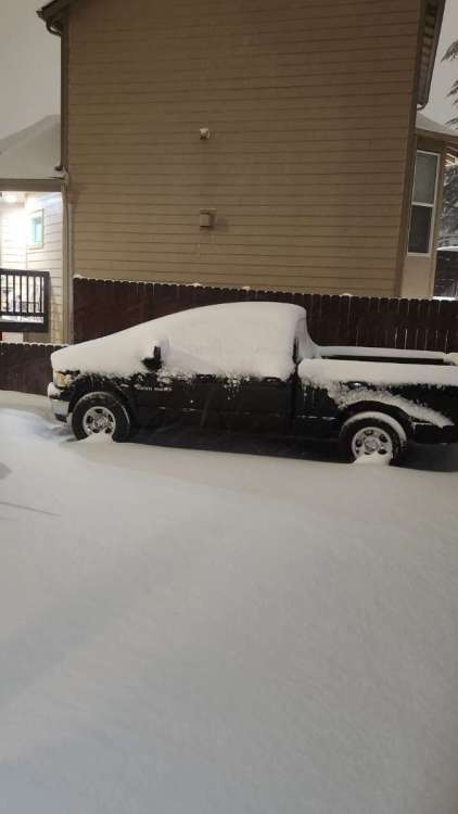
I just remembered something. IF we get a snowstorm on the 11th, it will be 7 years and one day to the date when the Portland area had that big snowstorm. We had 8" of snow by the next day.
The only reason why I remembered it was because earlier that day (1/10/2017) I needed to call an ambulance to get my mom to the hospital because she was really sick. I knew there was going to be a lot of moisture coming that night and I didn't want to try to get her to the hospital in a snowstorm.
-
2
-
-
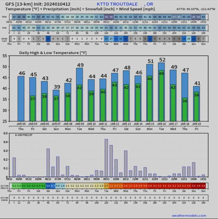
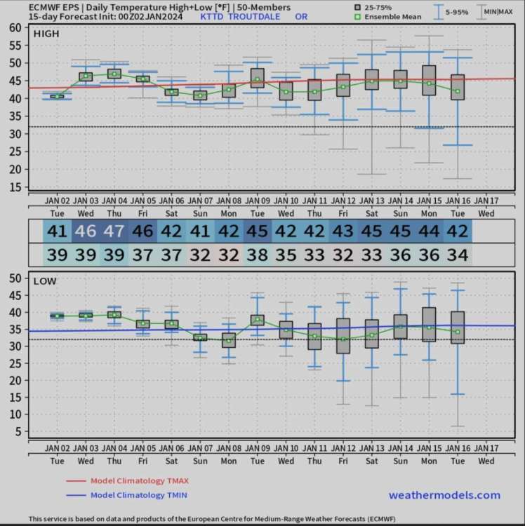
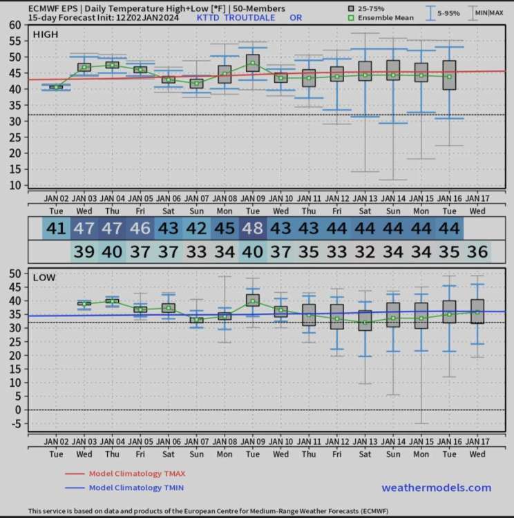
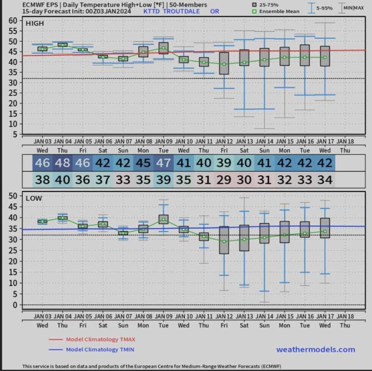
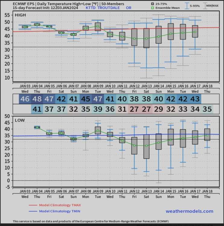
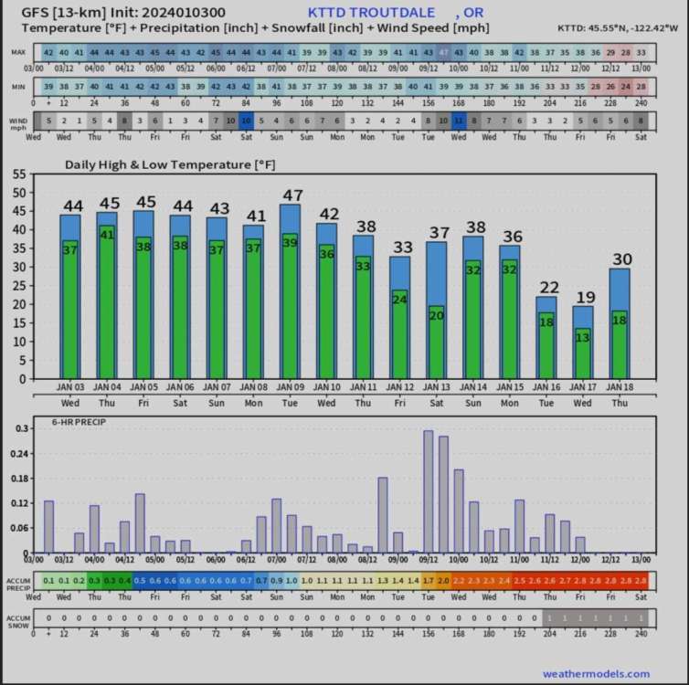
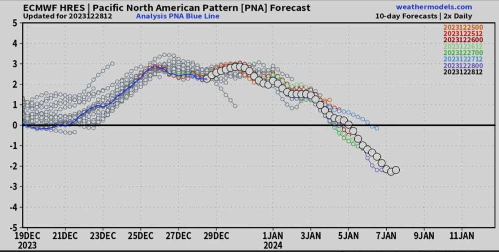
I've been keeping track on this model a lot. I'm posting the last 4 runs (2/00Z, 2/12Z, 3/00Z and 3/12Z). As you can see, temperatures keep falling. It's still a long ways off and things can change but I think something will happen, just don't know what yet. When we get closer to the event, the high resolution models will have a better understanding what we will see.
Remember, models will waver from time to time so don't lose all hope. The big pattern change will start Friday with lower snow levels. From Friday forward, I don't see the snow level getting above 4k but that will be early next week then it will fall further and hopefully be at sea level later in the week.
Let's watch and see how the models look tonight.
🌨
-
4
-
-
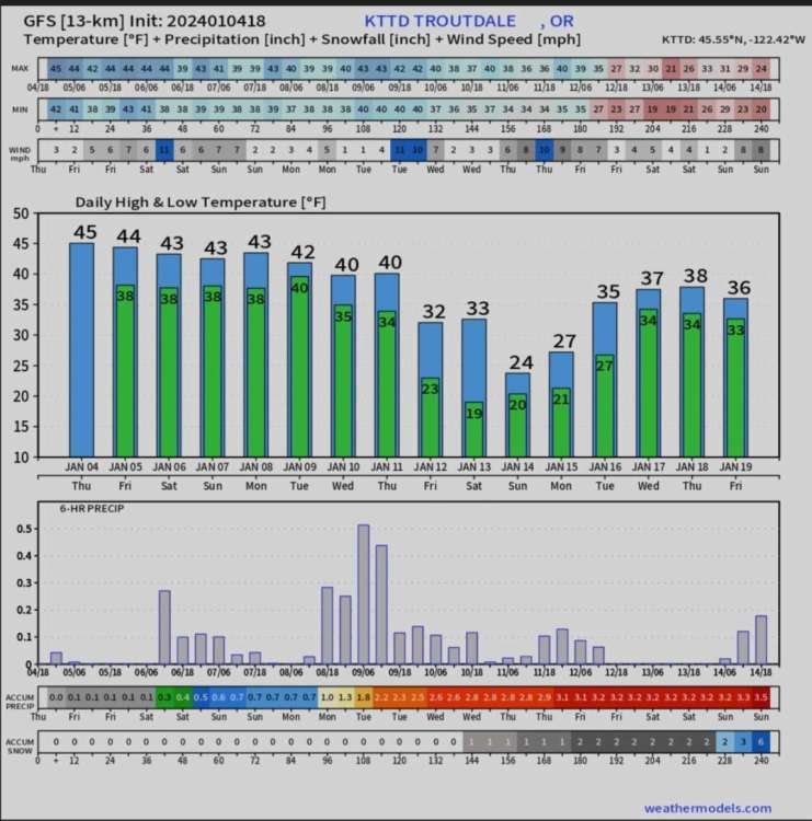
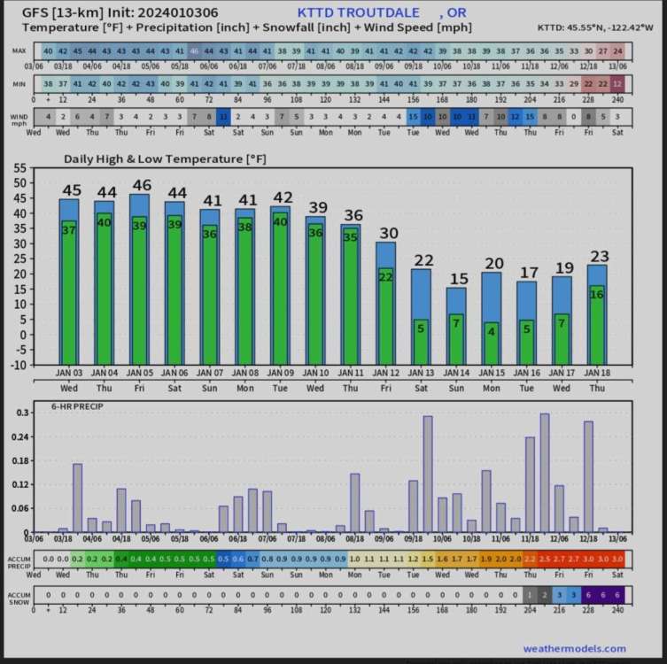
This is the 06Z GFS, this is insane if it verifies

 🌨
🌨
-
2
-
 1
1
-
 1
1
-
-
This is what the 00Z GFS shows for my area. I need to get to bed. It's way past my bed time...lol. I'll see what the 00Z Euro shows in the morning. Have fun
🌨
-
6
-
 1
1
-
-
I'm not online for a little over a hour and when I come back it says there are 176+ new comments. What the hell happened...LMFAO
I'm guessing what the 00Z GFS is showing 
-
7
-
1
-
-
Even though the front came through long time ago, I'm still having some strong winds
 it makes it feel much colder in my area
-
1
-
-
Was the website down? I had a difficult time refreshing it.
-
1
-
-
34 minutes ago, iFred said:
It’s 5:54am here in Las Cruces and I don’t see any pepto, so I’m guessing Blue Raspberry and Spokane Tim were right that this was going to fall apart.
Oh well, at least we’ll get a good Nina in a few years or so.
The event isn't supposed to happen until this coming weekend!!
-
1 hour ago, Deweydog said:
REJOICE!
THE GFS IS ACCURATE AGAIN!
I told everyone, models will flip back and forth. People need to be a little patience with these cold spells. The models pick it up but don't know what to do with it. We know there is going to be a major pattern change, what's going to happen is still up in the air.
I'll try to see what's happening with the next runs today but I'm normally really busy with work so have a little fun watching the models come in
🌨🌬
-
2
-
 1
1
-
-
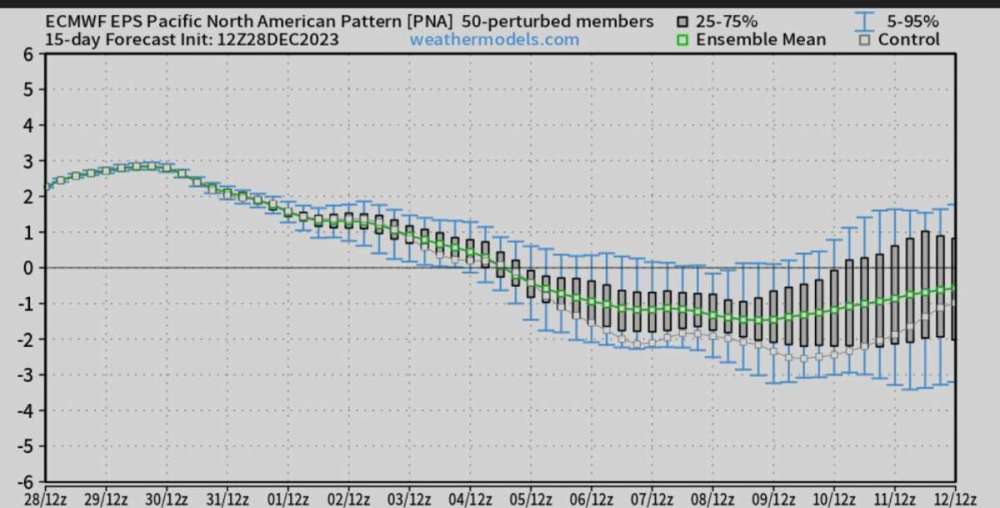
Models (GFS, ECMWF, GEM) are not an exact science when it's the long range forecast. It's more of what the atmosphere may do in the future. What I do see is a shift in the overall pattern. When we get closer to the event, models will have a better understanding what type of weather we will see.
I know everyone wants to know what is going to happen but it's more of a waiting game right now. I want to remind everyone, models will waver from time to time. I have noticed in the past that the models have a hard time with the cold air and where it's going. I think we will have a better understanding on what will happen around Thursday. All I know is the pattern change will start happening around the 5th. Say goodbye to the warm weather for awhile. Looks like this pattern will be around for awhile.
🌨🌬
-
4
-
-
20 minutes ago, Brian_in_Leavenworth said:
Here's another classic, created by Rob (Gradient Keeper).
I loved watching this game show

-
 1
1
-
-
1 minute ago, Front Ranger said:
Looks like the Sierras are finally going to score.
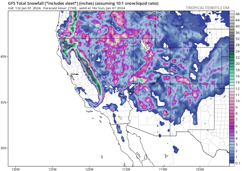
I think this is the start of a very active winter weather for the whole West Coast
🌨
-
4
-
-
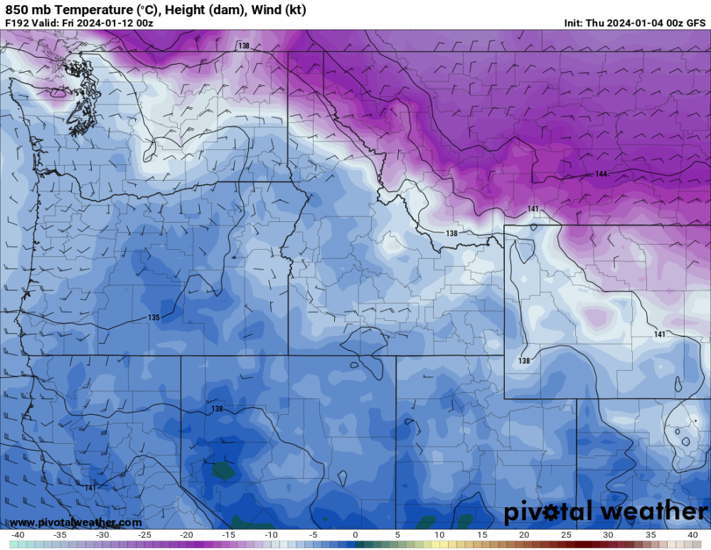
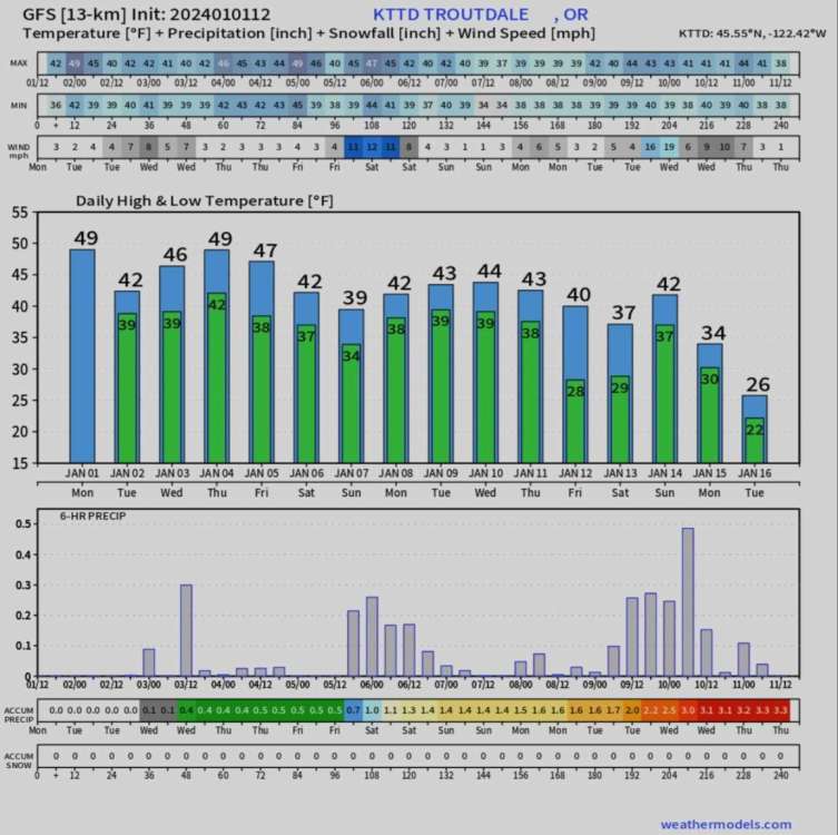
This is the control run of the 12Z GFS for my area. I'm thinking big changes will happen around the 6th. The temperatures I think around that time are being conservative, I think they maybe lower just because I don't think the model handles the East Wind factor very well. At the end of the run, looks like a possibility of a Arctic Outbreak with high temperatures in the 20’s. The start of January looks to be very interesting
🌬🌨
-
4
-
-
15 minutes ago, Rubus Leucodermis said:
I forget the details but the model guidance was just so cryingly obvious to me (and most here) that Portland was about to get hammered, yet the NWS refused to issue any watches or warnings until way too late.
P.S. I believe the NBM refusing to forecast much snow for PDX played into the official forecast's big bust.
I remember saying to myself, "why haven't they issued a Winter Storm Warning" because of how much snow was falling and accumulating on roads. I know the further South you went, the less snow fell but they could have been specific in the cities that were being hit the hardest. Hopefully they learned their lesson from that day...lol
-
6 minutes ago, SilverFallsAndrew said:
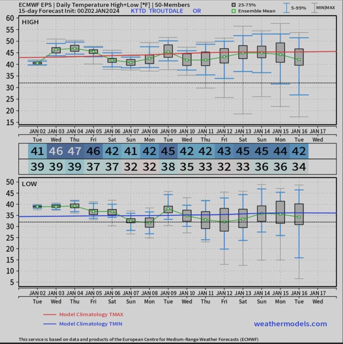
Sitting here thinking back on the year and I can't believe how little love the February 22-23rd event gets. 10.8" of snow at the NWS office. I know @Gradient Keeper got around a foot with that one, the Salem area scored 2-5". And then PDX had the high of 31 on the 23rd and the low of 18 on the 25th. Impressive all around. We had 31/27, 28/14, 32/12, 37/17 on the 22-25th here. Also a total of 11.3" event on the 22/23rd, which was pretty impressive considering we were dry slotted for a long period of time during the middle of the storm when the action was focused over PDX. Though we got a consolation wrap around band just after midnight which lasted until mid-morning.
I remember that day very well. I was at work when it started snowing around 9am or so. I told my boss that one of the models I looked at (don't remember which one) showed a deformation line hitting the area (Gresham, Fairview, Troutdale) showing up to a foot of snow so he said we could go home. I remember needing to go pick up my roommate from his work next to the airport. It was passed 11pm and traffic was really bad trying to pick him up. It was a beautiful day...lol.
-
4
-
 1
1
-
-
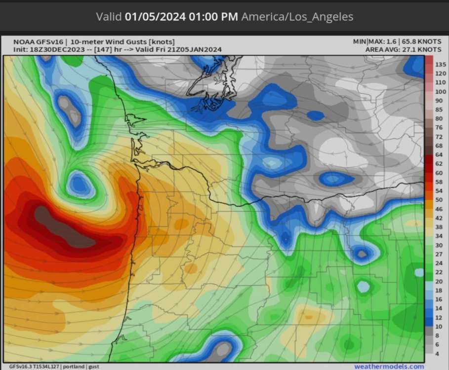
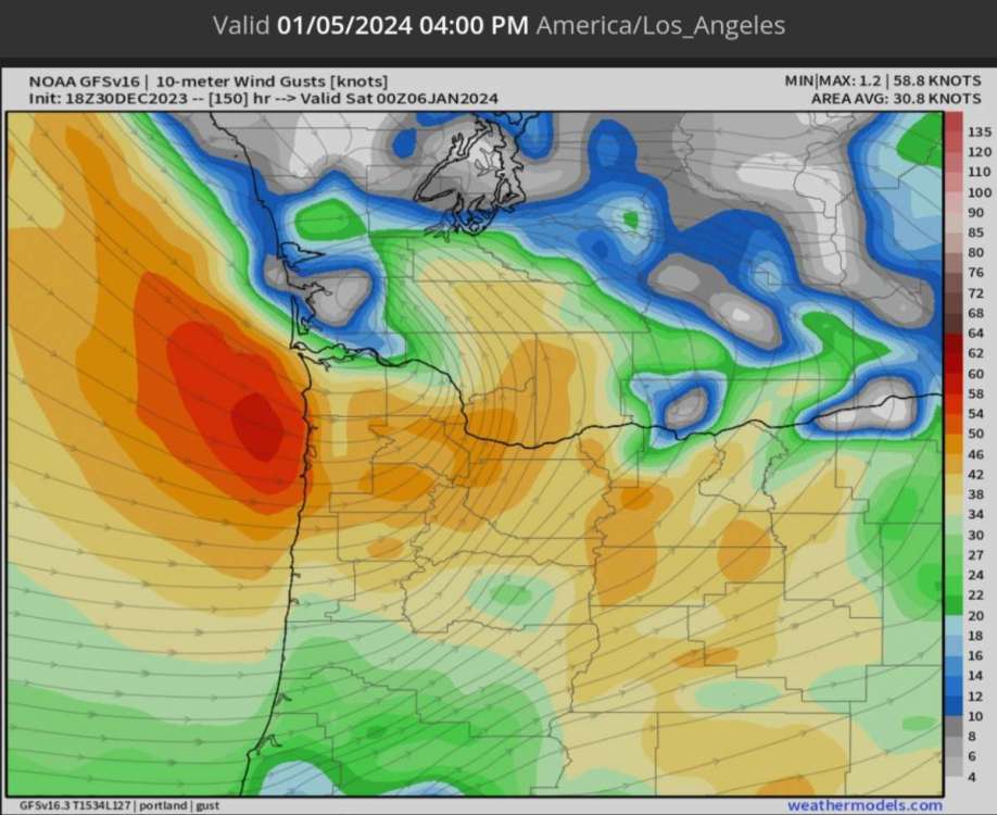
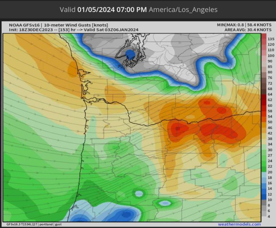
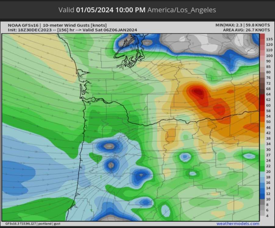
2 hours ago, FroYoBro said:
ALERT ALERT. WINDSTORM AT MY LOCATION.
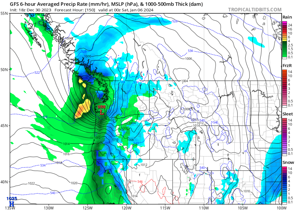
This would be the wind gusts for this storm. It doesn't look like a good windstorm for the Seattle area but good for points South of Olympia. We need to keep an eye on this storm because it's not the first time a windstorm has shown up around this time in previous runs. The winds are in knots, not mph. So 50 knots is about 60 mph.
-
5
-
-
6 hours ago, Doinko said:
Big freezing rain/snowstorm happening at the end


That actually looks like a blizzard. Because the East Winds would be blowing like crazy out of the Gorge
🌬🌨
-
2
-
-
26 minutes ago, Brian_in_Leavenworth said:
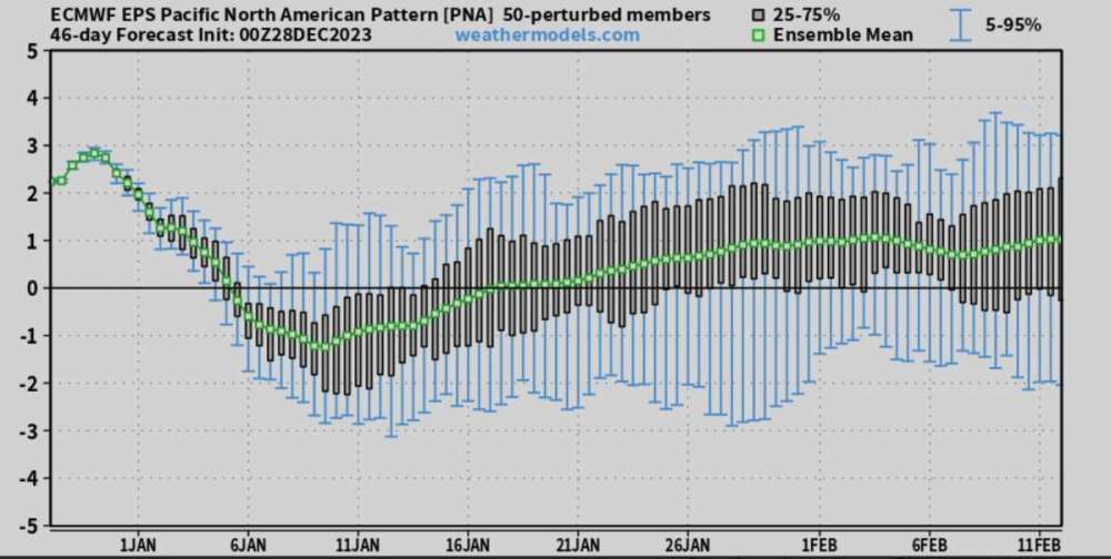
Nobody's mentioned the weeklies, so here are some maps. Notice the colder temps anomalies go all the way to the end of the 46 day period. Doesn't look arctic but maybe good for the mountains. Hopefully comes with decent precipitation. Also note that each image in this map is a running 5 day average
![14-km EPS 46-DAYS North America 5-d Avg T2M Anom [C].gif](https://theweatherforums.com/uploads/monthly_2023_12/14-kmEPS46-DAYSNorthAmerica5-dAvgT2MAnomC.gif.5ac2291af5e2d79a5549ea06f9e5eade.gif)
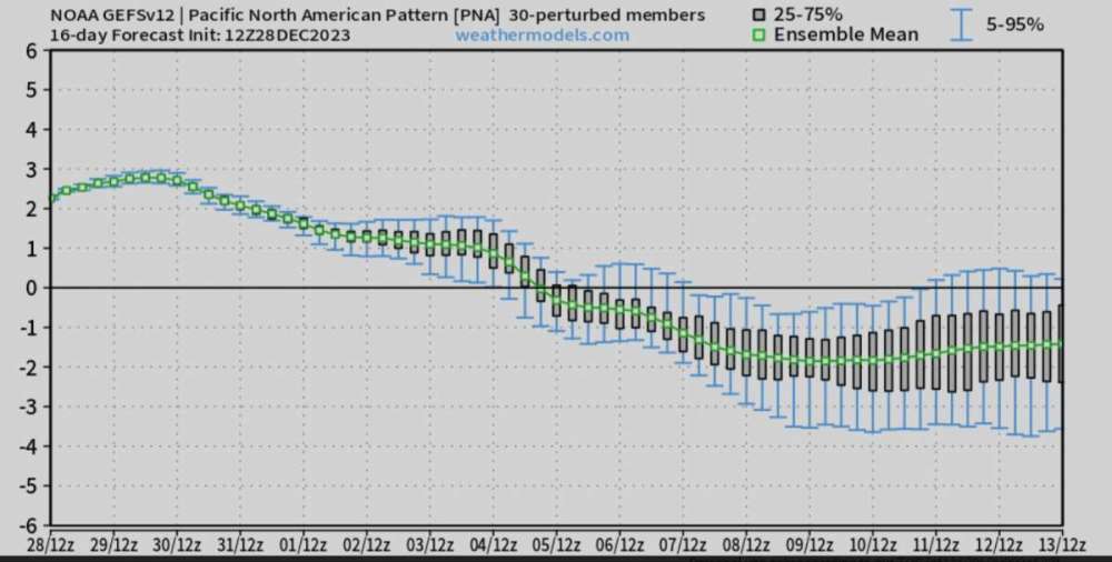
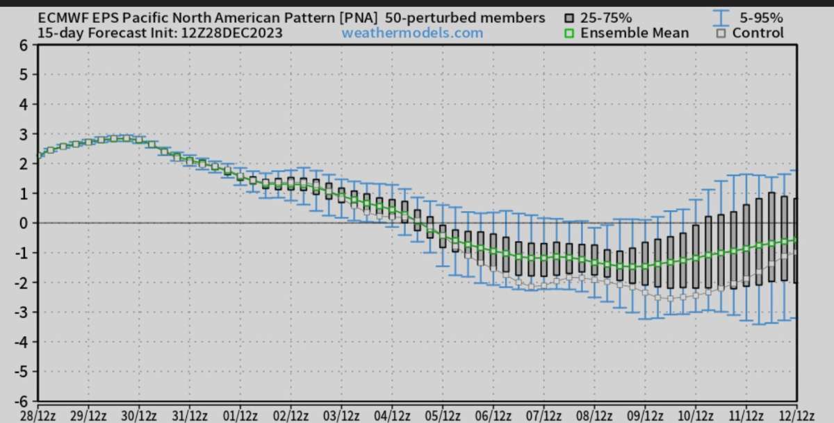
Here's the PNA
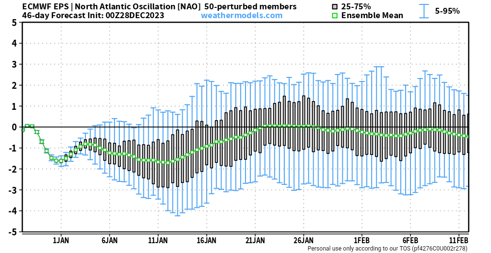
That's actually the NAO. This is the PNA you wanted to post.
-
1
-
-
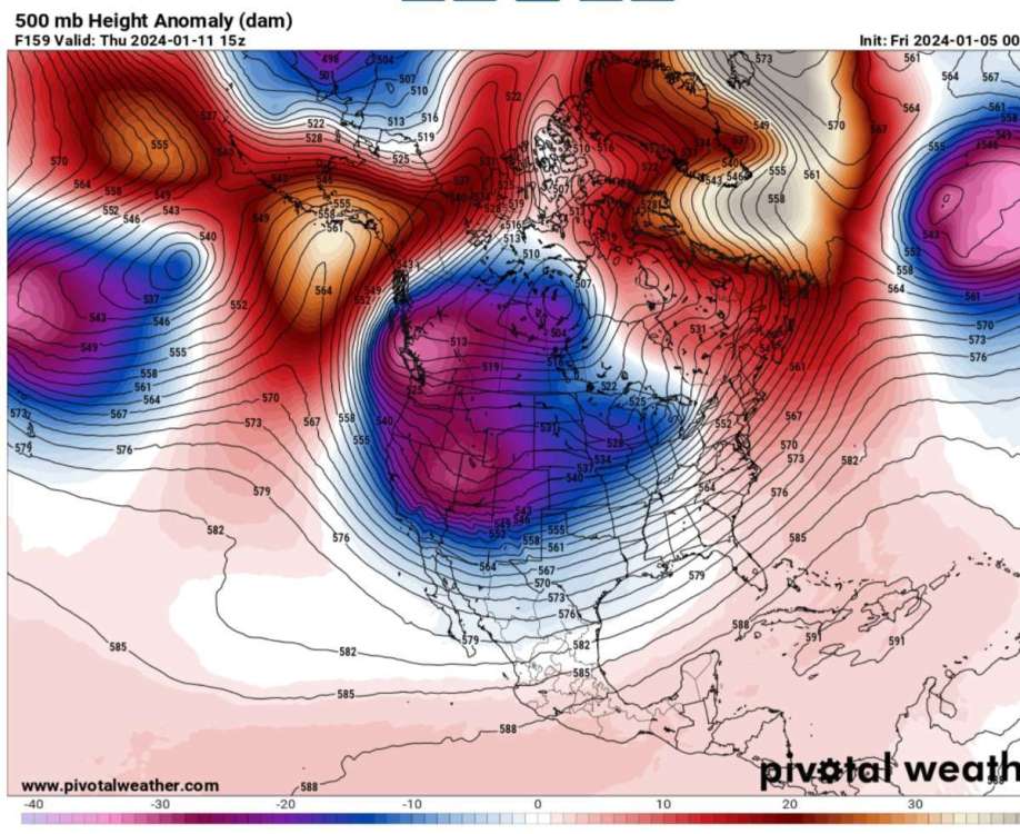
Things are getting interesting
🌨
-
8
-


January 2024 Weather in the PNW (Part I)
in West of the Rockies
Posted
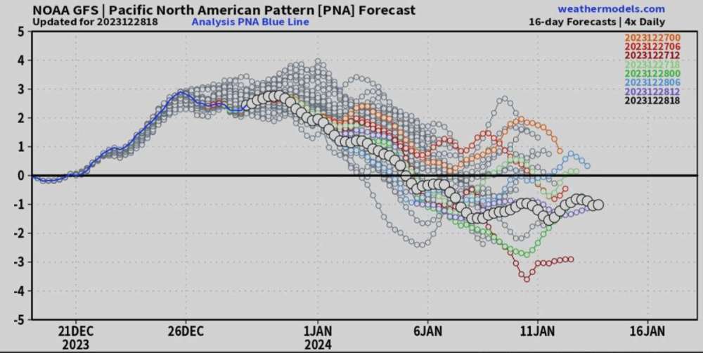
That's not the GFS?