
the_convergence_zone
-
Posts
1224 -
Joined
-
Last visited
-
Days Won
2
the_convergence_zone's Achievements






-
April 2024 Weather in the PNW
the_convergence_zone replied to Tyler Mode's topic in West of the Rockies
In the last 10 years, Seattle has seen a whopping 3 rain events totaling more than 0.25” rain in July. That’s it. In my experience, a drizzly convergence zone behind a marine push totaling 0.05” is where most of the July rain comes from. -
April 2024 Weather in the PNW
the_convergence_zone replied to Tyler Mode's topic in West of the Rockies
My hope going into this period was to get at least an inch at my location. I'm only at 0.73" for April as of today and it looks like I'm going to be shadowed all weekend. But the EPS has continued to look progressive through the week with a couple opportunities for another 0.25-0.5" event so I'm holding out hope. At least my 300 gallon rain tank is back to full so I won't have to use any tap water on plants for at least a month. -
April 2024 Weather in the PNW
the_convergence_zone replied to Tyler Mode's topic in West of the Rockies
I bet Sea-Tac was around 0.55 based on neighboring stations. I ended up with 0.40” in West Seattle. Great event for the mountains though. -
April 2024 Weather in the PNW
the_convergence_zone replied to Tyler Mode's topic in West of the Rockies
The wind knocked over my mini greenhouse with all of my vegetable and flower starts. I salvaged as many as I could but it was a pretty big disaster from my perspective. -
April 2024 Weather in the PNW
the_convergence_zone replied to Tyler Mode's topic in West of the Rockies
Cloud seeding is a form of public relations to say “at least we’re trying” to end droughts. Throwing some silver iodide in a cloud isn’t going to do anything to a storm that is large enough to produce appreciable precipitation. It might cause a few sprinkles from a cumulus cloud that otherwise wouldn’t have rained. There are also legal ramifications since it had been argued that cloud seeding is a form of theft — you are stealing the water from areas downstream of where you seeded. The ironic thing is that project Stormfury got axed in the late 60s after they seeded a hurricane and it happened to make a left turn to the Eastern seaboard shortly thereafter. It would be funny if this makes them think twice about seeding in the UAE, although it’s a bummer that they didn’t seed this storm (or at least they claim to have not seeded it LOL). -
April 2024 Weather in the PNW
the_convergence_zone replied to Tyler Mode's topic in West of the Rockies
Better than nothing, as long as these 0.2 storms don’t turn into 0.02 as they have been lately.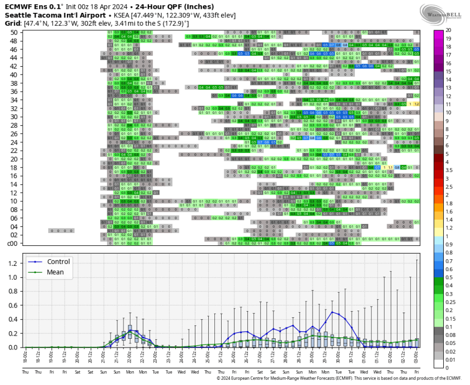
-
April 2024 Weather in the PNW
the_convergence_zone replied to Tyler Mode's topic in West of the Rockies
They are useful for communicating warming to the public. The 2 meter temp in urbanized areas is what the majority of people experience. Obviously scientists have to be careful to make the distinction of local vs. global climate change and sometimes they are not as careful as they should be. My personal weather station tracks closely with Sea-Tac airport so I think it is fine enough as a representative site for Seattle. What bothers me more is that like all surface obs these ASOS stations are prone to sensor drift and bias but they don’t seem to have good QC measures in place to catch that early and it’s often the general public alerting the NWS to an issue. -
April 2024 Weather in the PNW
the_convergence_zone replied to Tyler Mode's topic in West of the Rockies
35.6 with light frost here. Impressive for mid April. I bet the recent dry weather helped with that. September and early October are an awesome time in the mountains here with all of the high elevation terrain snow free and showing fall color. Most of my favorite days in the mountains have been around that time of year. As Cascadia says, need a decent rain to knock down the smoke most years. But even last year I had two days up around Mt Baker in mid-September that were fabulous since we were in an onshore flow regime. -
April 2024 Weather in the PNW
the_convergence_zone replied to Tyler Mode's topic in West of the Rockies
I wish my grandfather was still alive to see EVs. He had a depression era mindset and was obsessed with gas prices. When his old beater car broke he got a Prius and loved the gas mileage of that thing. I guarantee he would have a Model 3 right now and would have figured out where all of the free level 2 charging stations are located. -
April 2024 Weather in the PNW
the_convergence_zone replied to Tyler Mode's topic in West of the Rockies
0.02” of rain today bringing my to 0.32” for the month. So about as wet as the average July. Temps are like 2F above normal, but corrected for climate change that is pretty much normal now. -
April 2024 Weather in the PNW
the_convergence_zone replied to Tyler Mode's topic in West of the Rockies
I like my Model Y. I’ve had it for 4 months. I’ve never used the Tesla charging stations so can’t comment on those. They are starting to install chargers on residential streets in Seattle attached to the power poles, those are going to be on every block eventually. Would never buy that monstrosity that is a Cybertruck. It’s too bad that Tesla is headed to the toilet after so much promise. The smaller Rivian that looks like a Subaru is going to fly off the shelves when it is released. Hopefully BYD starts selling cars in North America soon as well. -
April 2024 Weather in the PNW
the_convergence_zone replied to Tyler Mode's topic in West of the Rockies
I can barely even remember the details of May-June 2022 except that it was extremely wet. I just remember how green my garden was in late June of that year. -
April 2024 Weather in the PNW
the_convergence_zone replied to Tyler Mode's topic in West of the Rockies
One decent storm cycle can cut those deficits in half or more. The problem is that the clock is ticking…if the wetter period for the end of April doesn’t verify, then we might be out of luck for a regional soaker. -
April 2024 Weather in the PNW
the_convergence_zone replied to Tyler Mode's topic in West of the Rockies
I only have EVs and recently had to fill up a gas tank on a trip. It felt so archaic. Like going to a Blockbuster or something. -
April 2024 Weather in the PNW
the_convergence_zone replied to Tyler Mode's topic in West of the Rockies
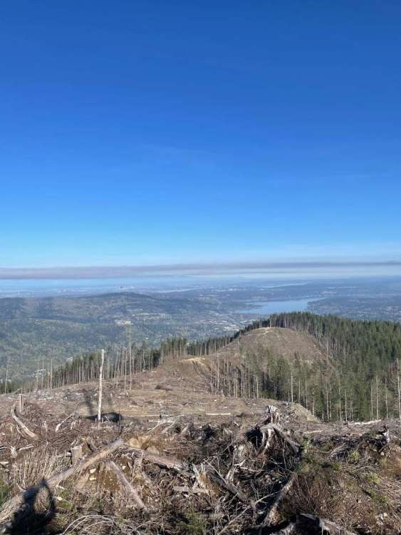
Tiger mountain this morning. There are foxgloves growing everywhere in that clear cut, it’s going to look awesome in amount a month.