


the_convergence_zone
-
Posts
1273 -
Joined
-
Last visited
-
Days Won
2
Posts posted by the_convergence_zone
-
-
2 minutes ago, RentonHill said:
Where did that chart come from? It looks low but not 6 sigma low...https://zacklabe.com/antarctic-sea-ice-extentconcentration/
-
34 minutes ago, Cascadia_Wx said:
Let’s just assume that below average rainfall is the same for water supply as average or above. I mean even when we hit average it just feels like too much rain to me, personally.
#science
It amuses me that you treat me like I'm an idiot and openly mock about half of the things I post on this forum. I make an offhand comment about something that seems straightforward to me and I get a barrage of insults from you in response. There's no point in engaging in a one-sided debate.
-
 1
1
-
 1
1
-
-
26 minutes ago, Cascadia_Wx said:
Any academic papers on that?
I'm actually curious to know if there is evidence for lower groundwater supplies in western WA/OR after a water year with 80-90% of normal precipitation vs. one with 110-120% of normal. I've always assumed that the groundwater supply fully recharges in winter.
Completely different story east of the Cascades, obviously.
-
3
-
-
2 minutes ago, SilverFallsAndrew said:
The idea that most of our rain runs off and doesn’t percolate into the ground and recharge ground water supplies is… interesting.
I didn't know it was controversial that streamflow increases when it rains.
-
1
-
-
2 minutes ago, TT-SEA said:
We have much more cushion out here. Drier than normal is still plenty wet in the rainy season.
Yep, most of the excess just runs off. Snowpack is the problem, it's around the 5th worst year in the past ~30 years in most of Washington.
-
2
-
 1
1
-
-
12 hours ago, Sunriver Snow Zone said:
I'm curious, what's the coldest high temp and low temp for everyone this year, total snowfall, and largest Snow event?
-7 low here which is maybe slightly cooler than our average coldest low, coldest high of 2 which was a midnight high, daytime high was -1 that day. 84" seasonal snow total (so far), largest 24hr event of 21" but it was probably more than that, because fluffy sub zero snow compacts VERY easily.
25/14 on January 13 was my coldest high/low.
Total snowfall was ~0.5". Largest event was ~0.5" on Jan 11. I had a trace a few other times.
That makes two consecutive winters without a single snow event of 1" or more.
-
1
-
 1
1
-
-
I can see why some folks take a break from this forum between roughly March and October.
(love you all, but it's going to be a long time until we have a snow threat again...)
-
 1
1
-
-
Got back early this morning. Amazing how much it greened up since last Thursday. And one of my artichokes came up! I thought the Jan cold snap finished them off.
-
2
-
-
76/69 on Kauai today with the trades cranking.
Looked like a nice day back home…decent storm coming through mid-week and then another pleasant weekend to close out March. I love when the storms avoid the weekends.
-
6
-
 1
1
-
 1
1
-
-
1 hour ago, Phil said:
I’d never heard that word until today. Is that what people mean when they say it “smells like rain”?
I figured that fresh, earthy scent was just water in the air. But now that I think of it, I don’t usually smell it in the winter. But it’s always present in the summer.
I think that's because the bacteria in the soil that produce the petrichor are more widespread in the summer.
The fun part is when you can smell it before the rain actually starts, presumably because of outflow winds from the incoming rain.
-
1
-
-
Nice to catch a bit of sunshine today. All of this green will look good with a soaking rain.
-
2
-
-
39 minutes ago, Chewbacca Defense said:
How neighbourly of you to be so dismissive. Folks who have family and/or property in the area of concern are probably worried, and rightly so. I think @ShawniganLake checks both of those boxes, but f*ck him, he's just a Canadian right? He's too far north to count.
The situation he is describing is still not good for the region as a whole, where we usually count on winter snow/moisture to snuff out summer wildfires. This year, that did not happen up there. What does that say about the vegetation up in that area that has not yet burned?
Unfortunately the Border Patrol failed to stop the crappy snow pack conditions at the border. It's pretty bad up here in the North Cascades of Washington too, and while I haven't look at data lately, my telltale on the snowpack conditions (parking/carpool area for the ski area is about 200 yds from my house) shows that it is an absolute dumpster fire up there, especially after this past weekend. I can count on 1 hand the number of days the parking area was absolutely packed.
Where I live, which is on the edge of the urban expansion for my little corner of Bellingham, I've never been concerned about fire. This year, I'm starting to get a little concerned especially with how dry it has been.
I don't want to rehash an earlier conversation but I agree that the dice are loaded against us right now, but there is plenty that can happen between now and July that could reduce wildfire danger or set the stage for a below average wildfire year.
If you have property in a wildfire danger area, you should probably be concerned about every single year going forward.
-
2
-
1
-
-
Too early to worry about wildfire smoke IMO. The smoke from last year's Canadian fires didn't bother us much. The sources were too far NE of us.
-
1
-
1
-
1
-
-
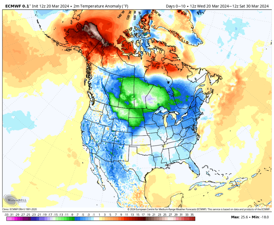
1 hour ago, TT-SEA said:
ECMWF keeps the really cold air away from us over the next 10 days.
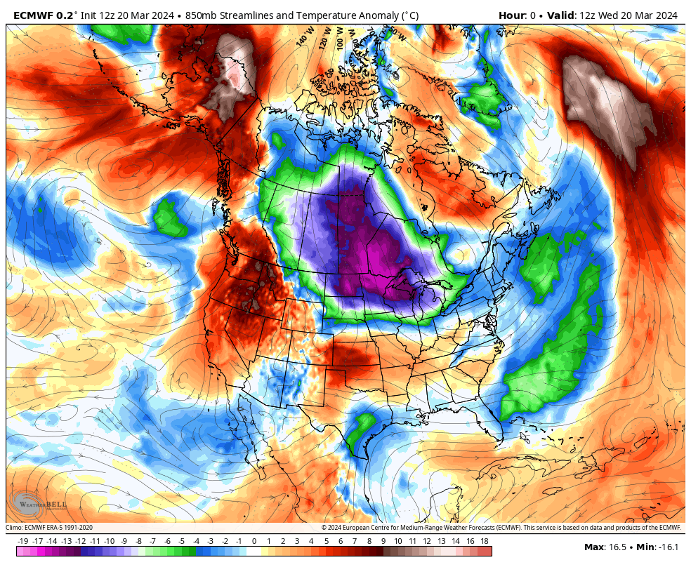
Pretty much normal around here. Some -10F anomalies in areas that have been running a +10F anomaly for 3-4+ months.
-
1
-
-
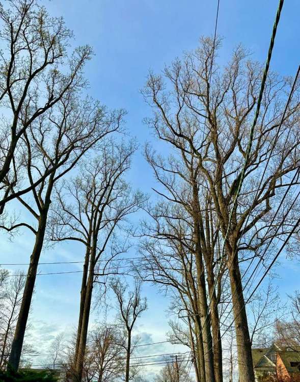
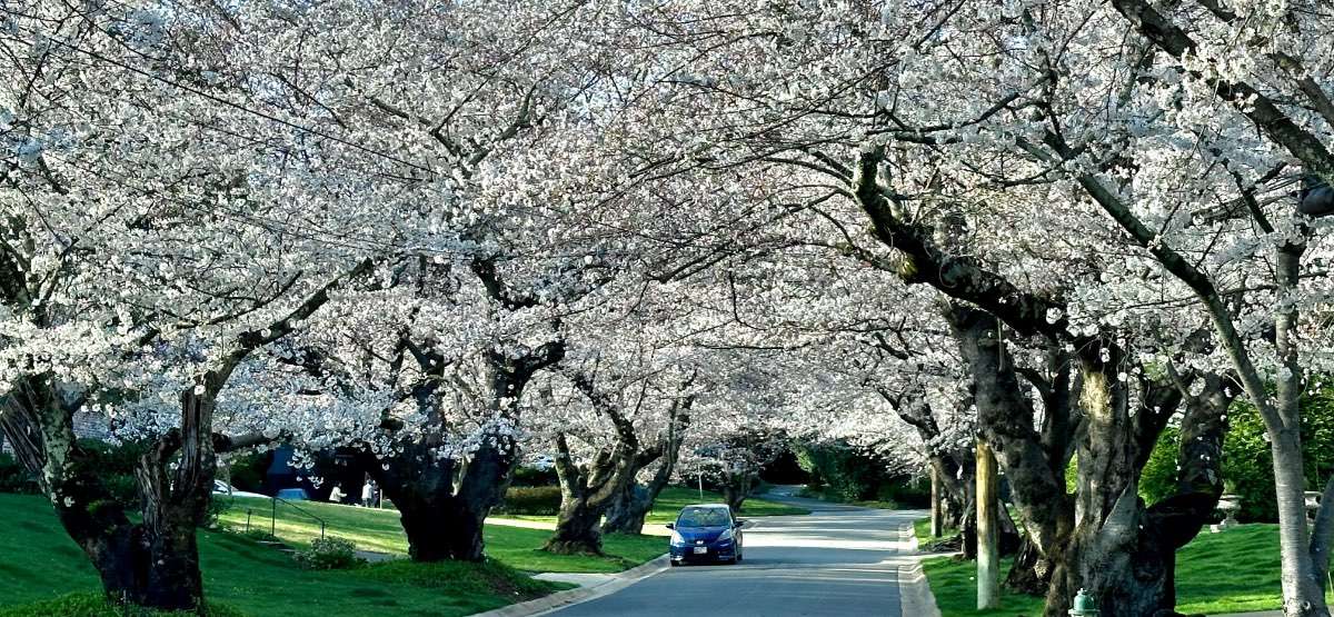
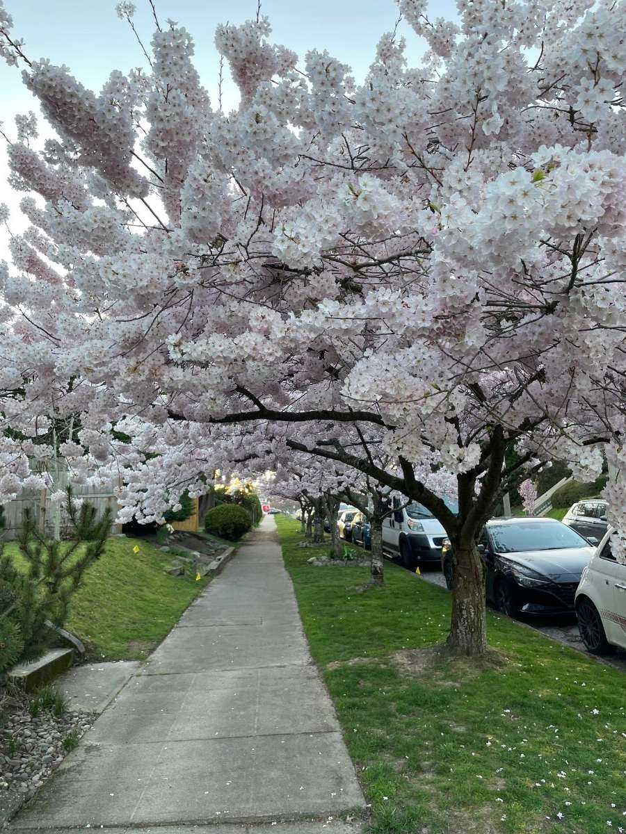
11 minutes ago, Phil said:
The bark doesn’t look yoshino. On trees that age/size, yoshino bark is smooth with slits of horizontal furrowing.
I suspect it’s a yoshino cultivar/hybrid of some sort.
I have no idea what variety they are. There is a different variety across the street that looks similar but blooms about 10 days later.
-
1
-
-
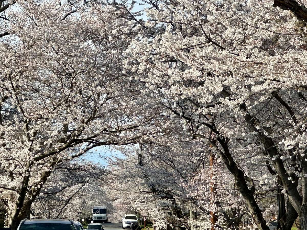
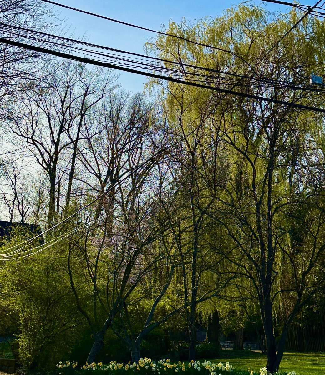
27 minutes ago, Phil said:
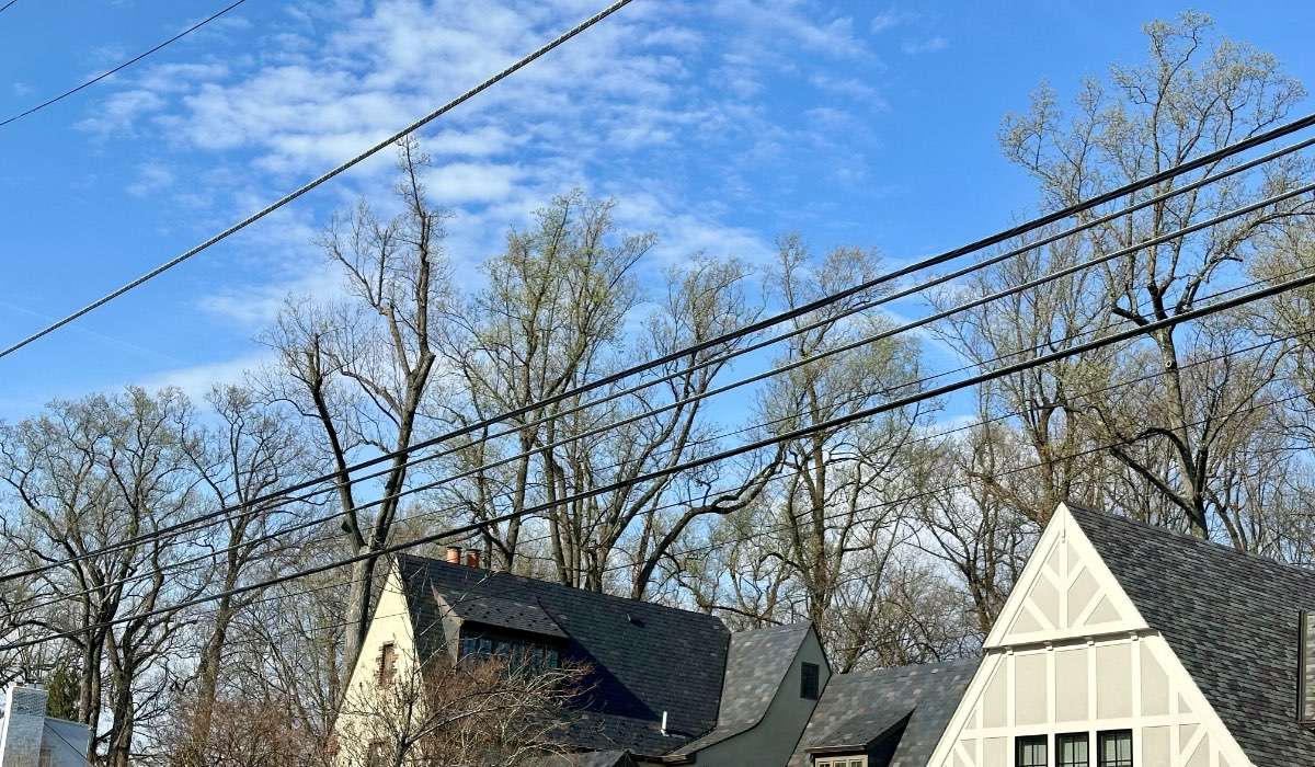
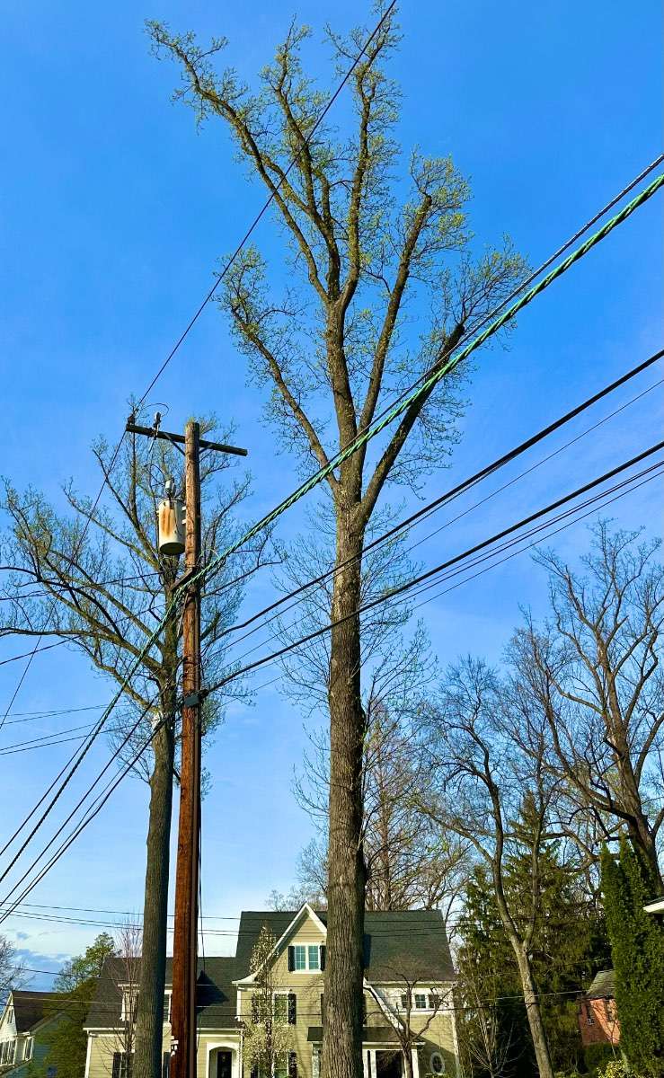
Idk how relevant this is to this particular forum but decided on a long stroll through the neighborhood today. Snapped some pics of nature coming to life.

Cherries 75% to peak. And the old trees are already either leafing out or heavy with buds. Bizarrely rapid green-up as everything was dormant 7-8 days ago.


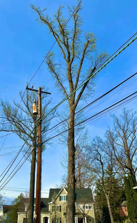


Saw these on my evening walk. A gust of wind caused so much pollen to come off a juniper hedge that it looked like smoke.

-
9
-
-
8 hours ago, Phil said:
It was lit. Wish I could relive it.
Light snow began around 2pm in association w/ WAA/isentropic upglide, gradually intensified to moderate snow by sundown as the first frontogenic bands rotated in. No wind yet at this point, just completely dead calm and silent.
Then at ~ 10pm, frontogenic forcing and moisture advection went nuclear all of a sudden. In the blink of an eye it started puking snow at ~ 2”+/hr, along with frequent thunder/lightning and the first gusts of wind from the E/NE. The entire character of the storm changed in an instant. This went on until ~ 5AM, then we temporarily lulled back to light snow ahead of the ULL/deform pivot. Still a light NE wind at that point.
Then just after lunchtime, the deformation band pivoted overhead, and the true blizzard conditions began, with the highest rates and strongest winds of the storm. As winds quickly veered to the N/NW, the temperature dropped from 29°F to 21°F and snowfall rates increased to 3”+/hr. Lots of blowing/drifting snow. No thunder/lightning this time, but the conditions on the ground were more extreme than overnight. Ripped like crazy until 6-7pm, until the deform band pivoted off to the E/NE, at which point we fell back to light snow for the next 3 hours. Finally stopped snowing ~ 10PM.
NWS employee that lived a few miles away reported 37” as the grand total. My measurements were all over the place because of drifting, but the average was a bit over 34”. Though this doesn’t account for compaction, so maybe it would’ve been a little higher if I’d followed official measurement procedures.
All in all, an amazing storm. My 3rd favorite storm of all time, in fact (behind the 2/10/10 mega-blizzard and 2/6/10 snowmageddon that had occurred just days prior).
I experienced a couple of storms like that in Wisconsin although there's not enough moisture to go much above about 20" in one storm. We had a few in the 15-20" range with frequent lightning and wicked deformation zones. The blizzard of 1999 was always the top one for me but it happened to work out that when I was in the atmospheric science program in Madison there were a couple of really epic storms during the winter where Madison broke 100" of snow in a season for the first time on record ('07-'08).
At that time, the university hadn't closed for snow since the early 1990s, so they took it as a point of pride to keep the streak going and stay open for some really nasty storms. I remember once we trudged to class in the afternoon near the end of a 14" storm (although as met students we would have been there anyway to track the storm). They made it through the entire 100 inch winter without a closure, but then there was finally a huge storm in December 2009 with 18"+ forecasts that forced their hand. And they called the closure the night before, just as the snow was beginning to fall, so it resulted in a gigantic party. Good times!
-
4
-
1
-
-
10 hours ago, Sunriver Snow Zone said:
Sunday might be cold enough. Probably too warm for Snoqualmie, but stevens pass should be good if you're willing to drive a little extra.
I'm still baffled that there's a ski resort at less than 3k feet, there's too many days that are too warm at Snoqualmies low elevation. I'm glad that here in oregon they put ski resorts at places that should actually have a ski resort
It's almost always too warm for snow there except when there is an approaching warm front with cold air available on the east side of the Cascades. Which describes at least half of our winter weather systems. So it dumps feet of snow there with the snow level sitting at 2950 ft at the ski resort and 4500 ft just about everywhere else in the Cascades.
The crazy thing is that Snoqualmie actually had better early season coverage than Crystal and Mt. Baker this year because picked up a few feet from their microclimate in early December while everyone else was seeing rain. And a high of 40 with December "sun" doesn't melt anything. I was up there around Christmas and it looked much better than I was expecting.
The projections continue to indicate that there are about 20 years of skiing left at Snoqualmie before it gets too warm, but so far the 2014-15 winter was the only one where they didn't get enough snow to have a full season.
-
1
-
1
-
-
4 minutes ago, TacomaWx said:
Yeah for some locations this warm spell was pretty top tier. Not IMBY but close. Kind of reminds me of the warm spells we had in April 2016 and 2021.
Add it to the list of things that used to have 10-15 year return intervals but is now 3-5 years.
-
1
-
-
4 minutes ago, Front Ranger said:
I'm not talking about the news media. Again - if you'd like, I'm more than happy to link the statements made by "climate experts" the years I cited, saying we had 10 years to act or we're screwed. Many names revered by the climate alarmist community.
It's a repetitious cycle. Nothing new under the sun.
It sounds like we’re in agreement that these statements were not made by mainstream climate scientists (whose views are well represented in the IPCC reports) but rather by “experts” who are known for making splashy quotes that the media eats up.
-
1
-
1
-
1
-
-
18 minutes ago, Front Ranger said:
Quillayute is one station, and they have been prone to more extremes in recent years.
But my point was that the temps seen today overall are not close to unprecedented for the the Puget Sound region in March.
Quillayute is an interesting site. That 110 record is perhaps the most extreme daily temperature record of any station anywhere in the entire world. There is something about that location that has made it more prone to downslope warming events in recent years. It’s an oddity.
-
2
-
-
3 minutes ago, Front Ranger said:
What isn't? Are the alarmist headlines of today "mainstream" or not? Makes an easy copout if Al Gore or James Hansen or whoever says something but it turns out to be nonsense.
I would hope that the collective weather and climate knowledge of this forum puts us above using news headlines to form opinions about climate change. If we did that for regular weather events we would probably lose our minds…how many terms like “bomb cyclone”, “polar vortex”, etc have been butchered by the media over the years?
-
1
-
-
Just now, Front Ranger said:
You really want me to link those predictions? Google makes it easy.
It’s not a mainstream opinion in the climate science community.
-
1
-
1
-
-
4 minutes ago, Front Ranger said:
I'm reading we have 10 years or less to alter the fate of humanity. Make drastic changes now or DIE.
Of course, they said the same thing in 2019. And 2009. And 2006. And 1989.
But maybe this time they're right.
Who is “they”?
-
1
-
 2
2
-


April 2024 Weather in the PNW
in West of the Rockies
Posted
I think we can score an 80 burger in the next heat wave at KSEA. We’ve gotten one (or more) in 5 of the last 10 Aprils.