the_convergence_zone
-
Posts
1273 -
Joined
-
Last visited
-
Days Won
2
Everything posted by the_convergence_zone
-
March 2024 Weather in the PNW
the_convergence_zone replied to TigerWoodsLibido's topic in West of the Rockies
I'm fine with a 2016 repeat if it means the warm spring is followed by a not-blazing-hot summer. -
March 2024 Weather in the PNW
the_convergence_zone replied to TigerWoodsLibido's topic in West of the Rockies
29.7 this morning. That's my coldest reading for March in 5 years of having a weather station. -
March 2024 Weather in the PNW
the_convergence_zone replied to TigerWoodsLibido's topic in West of the Rockies
Cold and sunny is awesome. Today was fantastic. -
March 2024 Weather in the PNW
the_convergence_zone replied to TigerWoodsLibido's topic in West of the Rockies
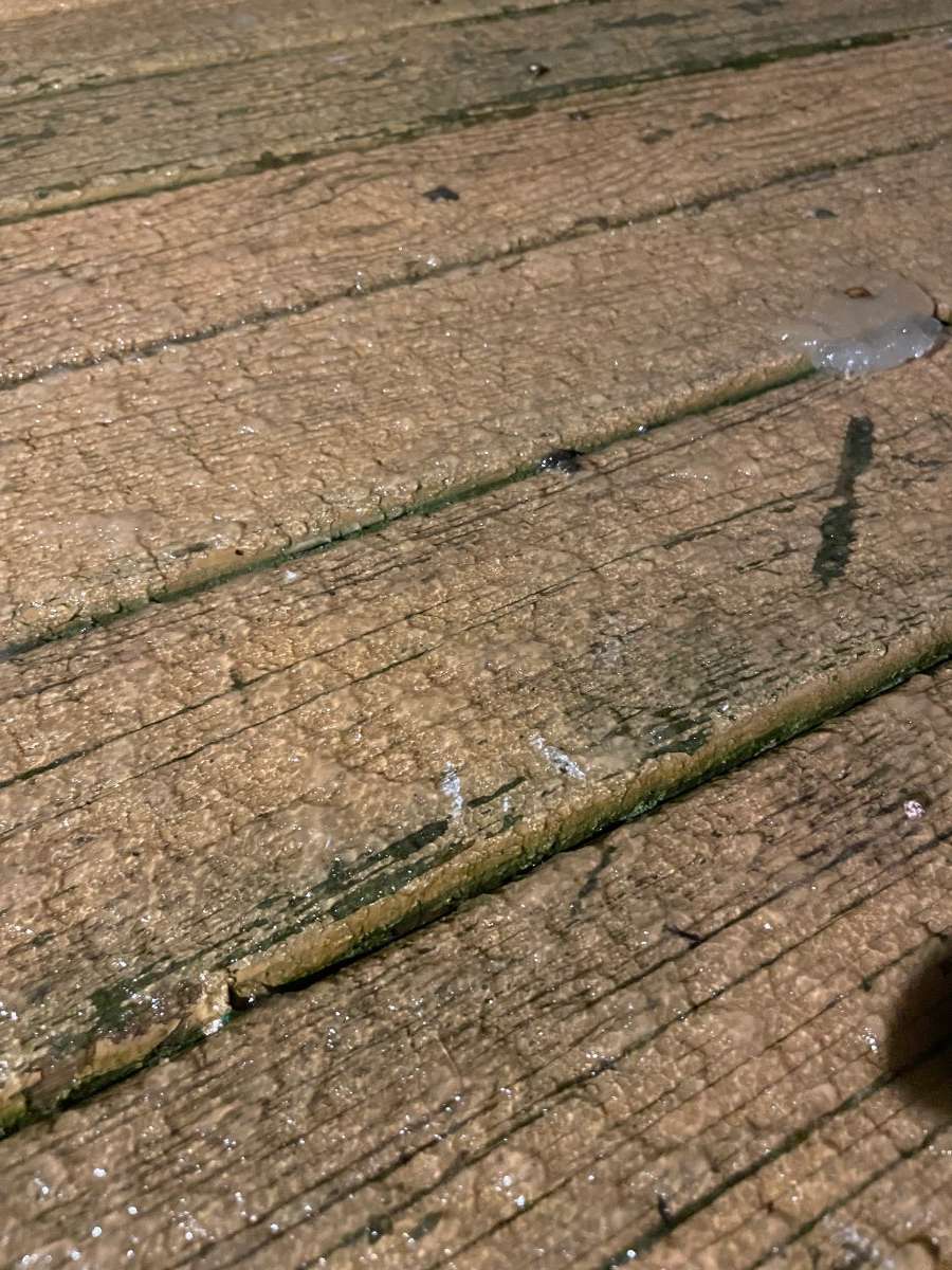
Terro liquid traps. -
March 2024 Weather in the PNW
the_convergence_zone replied to TigerWoodsLibido's topic in West of the Rockies
Looks like it is being undercut by the STJ at the end. Gotta keep the California Niño gravy train going. -
March 2024 Weather in the PNW
the_convergence_zone replied to TigerWoodsLibido's topic in West of the Rockies
The snow streak lives! That was so close to an epic surprise snowstorm last night. I ended up with 0.48" of liquid out of that band (edit -- make it 0.49, bucket tipped again as the slush keeps melting). Once it got going and the profile saturated, I sat right at 34 degrees on the nose with mostly rain mixed with slushy snow. Near the end it dropped to 33.5 and I finally had some nice aggregates. There was a bit of icy snow on the grass this morning but I'm calling it a trace. Interestingly, there wasn't any more snow on the top of the hill this morning, so it wasn't really an elevation thing, there just must have been an isothermal layer near the surface that couldn't quite cool enough. A few times I thought for sure that it was going to switch to snow and stay there, but the thermometer refused to budge. Ugh. You couldn't draw that one up any better for West Seattle winning the jackpot other than not being cold enough. -
March 2024 Weather in the PNW
the_convergence_zone replied to TigerWoodsLibido's topic in West of the Rockies
I run quite a bit on Cougar Mountain in the winter, that area gets dusted often but rarely anything significant. It does seem like 1,000 ft tends to be the snow line in this type of cold, onshore airmass. Wilderness Peak is 1,400 ft and sometimes I go there to get my snow fix if it’s raining in Seattle, but it’s usually just an inch or two. Squak Mountain at 2,000 ft doesn’t do much better unless it’s actual arctic air. As we were discussing the other day, the back side of Tiger Mountain does much better at an equivalent elevation where the cold air can stick a little longer, that’s the only spot where I worry about not being able to get through in running shoes. -
March 2024 Weather in the PNW
the_convergence_zone replied to TigerWoodsLibido's topic in West of the Rockies
The snow level is about 250 ft with this band. I’m at 150’ in West Seattle so I’ve been mostly rain with occasional snow when the precip rate picks up a bit. 0.30” in the bucket now which is crazy over-performance. -
March 2024 Weather in the PNW
the_convergence_zone replied to TigerWoodsLibido's topic in West of the Rockies
0.17” of liquid already with this band and it’s still right over me. Could have easily been a 2-3 incher if it was colder. -
March 2024 Weather in the PNW
the_convergence_zone replied to TigerWoodsLibido's topic in West of the Rockies
Back to rain here. Going to take a while to dig out from this one.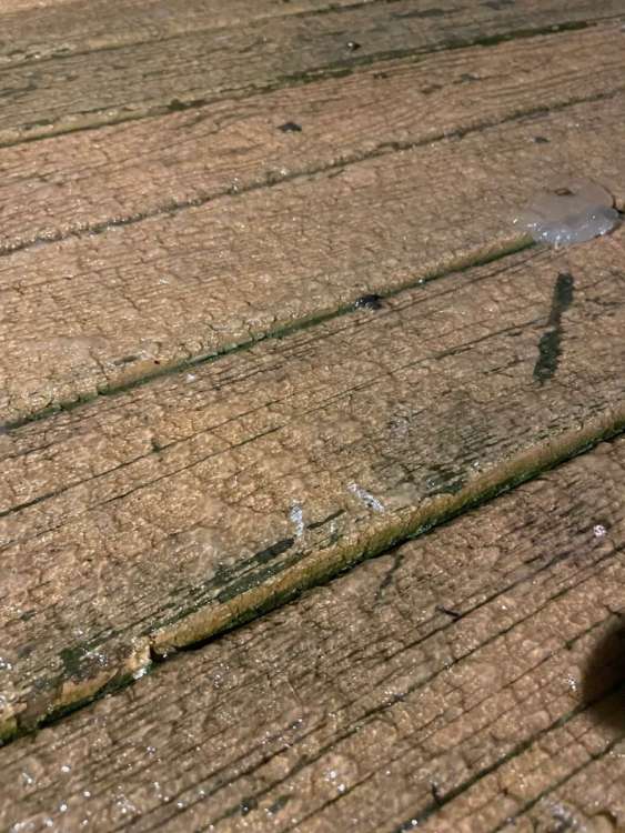
-
March 2024 Weather in the PNW
the_convergence_zone replied to TigerWoodsLibido's topic in West of the Rockies
Down to 34.3, it’s a slushy snow now. No rain drops. Flakes are coming down half melted and accumulating a bit on my deck. I’m right under one of the heavier showers. -
March 2024 Weather in the PNW
the_convergence_zone replied to TigerWoodsLibido's topic in West of the Rockies
37 with a rain snow mix here…for the 4th straight day LOL -
March 2024 Weather in the PNW
the_convergence_zone replied to TigerWoodsLibido's topic in West of the Rockies
Need this thing to hurry up, it’s cold enough but it’s gonna fizzle out in a few hours without the daytime heating. -
March 2024 Weather in the PNW
the_convergence_zone replied to TigerWoodsLibido's topic in West of the Rockies
I stand by my comment -- in 50-60 years, winters like this will be common across the Upper Midwest unless there is some drastic reduction in global greenhouse gas emissions. -
March 2024 Weather in the PNW
the_convergence_zone replied to TigerWoodsLibido's topic in West of the Rockies
I think the 30 year normals obscure how fast it has warmed in the Midwest -- it's easy to generate those departure numbers (as I did for my post), but the rate of warming there is pretty crazy. Even comparing this mega Niño to past ones. Other than the northern half of Minnesota, last winter was mild as well across much of the Midwest. -
March 2024 Weather in the PNW
the_convergence_zone replied to TigerWoodsLibido's topic in West of the Rockies
I knew you would reply with some post like this which has nothing to do with my comment. Do you disagree with the climate model projection that the climate of Wisconsin in the 2070s will resemble the climate of Arkansas in the early 21st century? -
March 2024 Weather in the PNW
the_convergence_zone replied to TigerWoodsLibido's topic in West of the Rockies
It really sucks to see what climate change is doing to the Midwest. By the 2070s, Wisconsin's climate is expected to resemble Arkansas. -
March 2024 Weather in the PNW
the_convergence_zone replied to TigerWoodsLibido's topic in West of the Rockies
Minneapolis departures from normal: - December: +12.3 F - January: +5.9 F - February: +12.7 F Snowfall: -26.6" below normal season to date (14.3" vs. normal of 40.9"). -
March 2024 Weather in the PNW
the_convergence_zone replied to TigerWoodsLibido's topic in West of the Rockies
Found the edge!
-
March 2024 Weather in the PNW
the_convergence_zone replied to TigerWoodsLibido's topic in West of the Rockies
Kitsap special incoming this evening perhaps. Too warm for snow in metro area. -
March 2024 Weather in the PNW
the_convergence_zone replied to TigerWoodsLibido's topic in West of the Rockies
Buckinghorse — the only SNOTEL on the windward side of the Olympic Mountains. Snow depth has gone up about 60 inches with 10 inches of liquid equivalent added in the past week. Still dumping snow out there.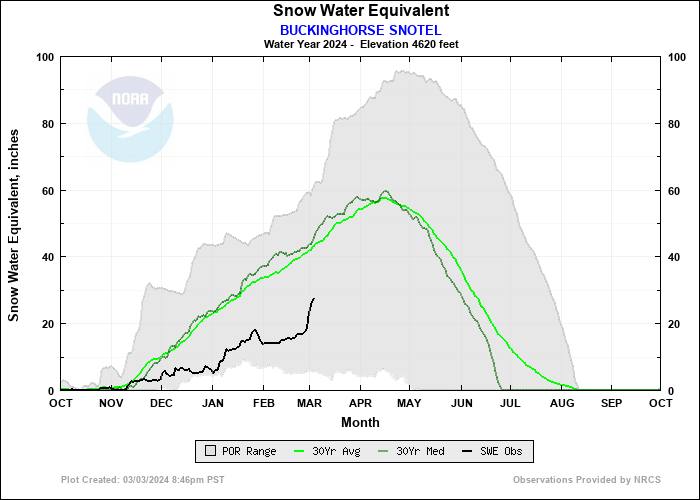
-
March 2024 Weather in the PNW
the_convergence_zone replied to TigerWoodsLibido's topic in West of the Rockies
That’s a pretty big ridge for March. Looks likely, just a matter of how warm it gets.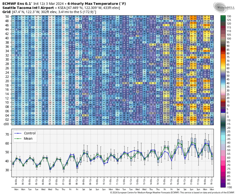
-
March 2024 Weather in the PNW
the_convergence_zone replied to TigerWoodsLibido's topic in West of the Rockies
37 here, briefly a mix in this band before changing to all rain. -
March 2024 Weather in the PNW
the_convergence_zone replied to TigerWoodsLibido's topic in West of the Rockies
Lucky!!! -
March 2024 Weather in the PNW
the_convergence_zone replied to TigerWoodsLibido's topic in West of the Rockies
Lots of precip coming into the Sound, going to be a rainy morning here and snowy on some of the higher spots.