CentralNebWeather
-
Posts
7209 -
Joined
-
Last visited
-
Days Won
34
CentralNebWeather's Achievements
")


-

July 2024 Observations and Discussion
CentralNebWeather replied to westMJim's topic in East of the Rockies
Hope everyone in the my area of the Central Plains got the rain they needed. Looks like not a drop for at least 2 weeks, maybe longer. This will stress the damaged crops for sure. Irrigation, which has been almost non existent this summer, will start to ramp up. -
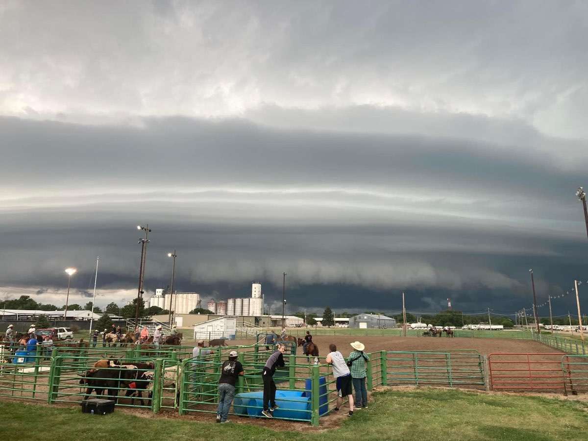
July 2024 Observations and Discussion
CentralNebWeather replied to westMJim's topic in East of the Rockies
Really cool picture taken from our county fairgrounds looking north, as the storm was moving south towards town on Tuesday evening.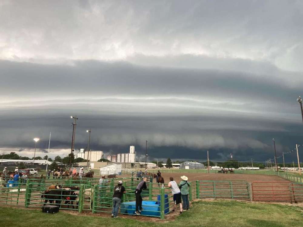
-
July 2024 Observations and Discussion
CentralNebWeather replied to westMJim's topic in East of the Rockies
0.50” in this quick moving mini hurricane. I’m hearing more crop damage to fields that hadn’t been hit this summer, and others that are struggling. Uncle. IMG_2532.mov -
July 2024 Observations and Discussion
CentralNebWeather replied to westMJim's topic in East of the Rockies
Current dew points across the state. Disgusting. I’m at 75 dew
-
July 2024 Observations and Discussion
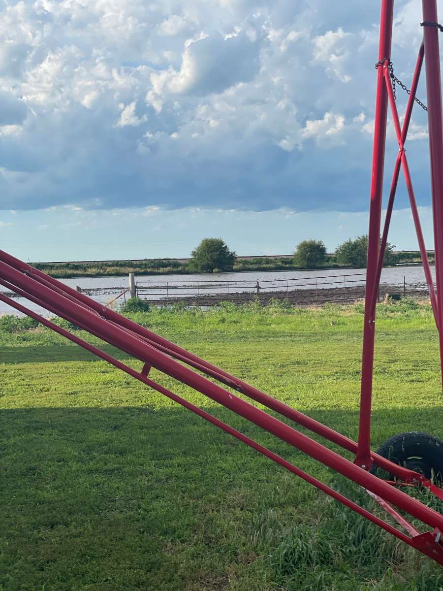
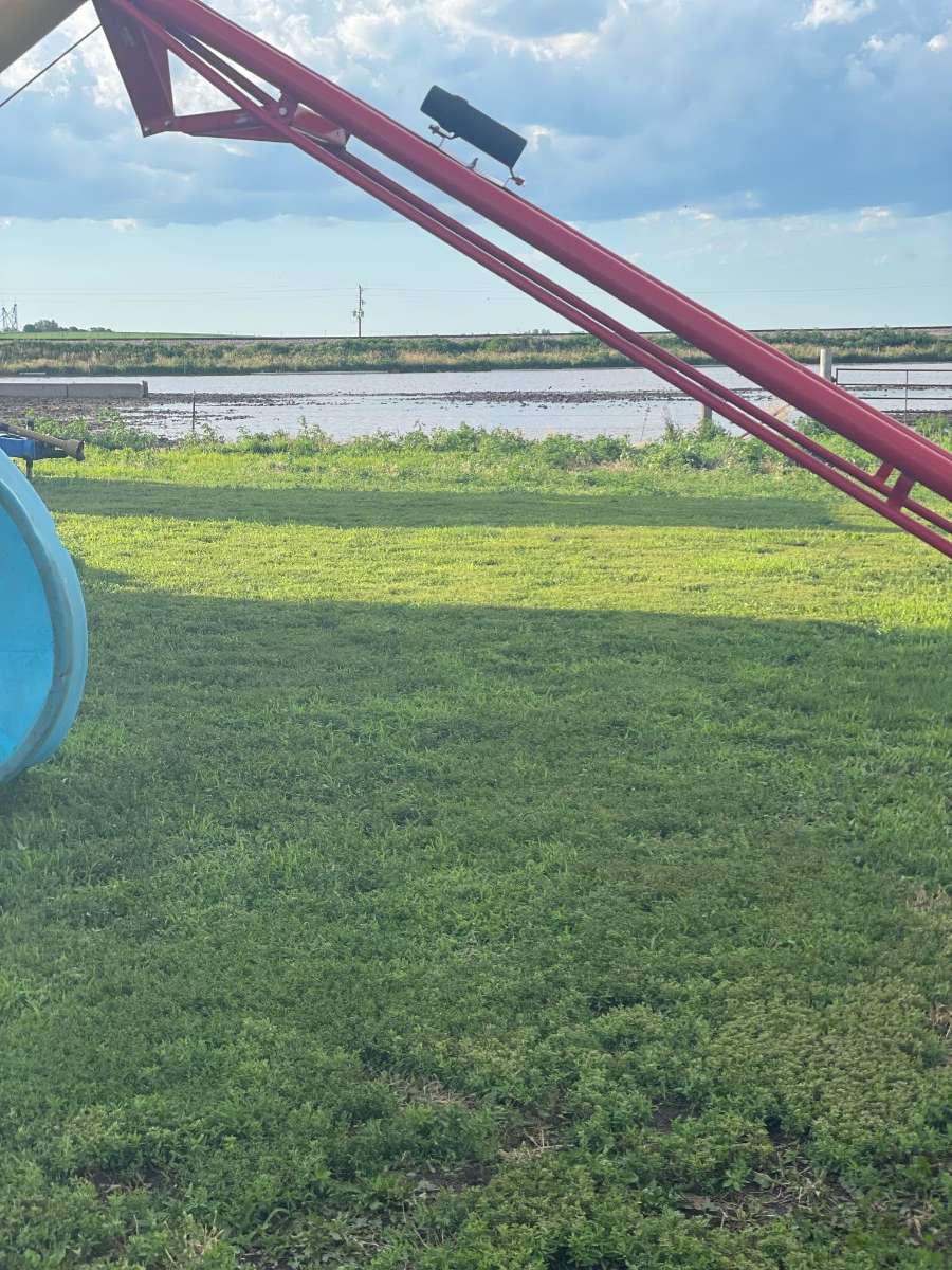
CentralNebWeather replied to westMJim's topic in East of the Rockies
My wife’s brothers farm east of town. Water where there shouldn’t be water.

-
July 2024 Observations and Discussion
CentralNebWeather replied to westMJim's topic in East of the Rockies
Looks like most of my county has had 6-8” of rain or more since July 1st. If it wasn’t for all the damage we’ve had, there would be more celebration. There are parts of the area getting close to yearly precipitation averages and it’s only July 6. Most of our area averages around 25” of precipitation in a normal year. This year isn’t normal. -
July 2024 Observations and Discussion
CentralNebWeather replied to westMJim's topic in East of the Rockies
That is the storm that went through my area. Just a very tough day for many with lots of damage. I’ve held off on getting my new roof, siding, etc. I’d love to wait until September. We go many summers and get no tornadoes or hail. Then we have this summer. -
July 2024 Observations and Discussion
CentralNebWeather replied to westMJim's topic in East of the Rockies
Unfortunately, looks like crop damage in my county might be catastrophic. This is hail from my farmer friend 8 miles north of town. Corn and soybeans leveled. Just horrible.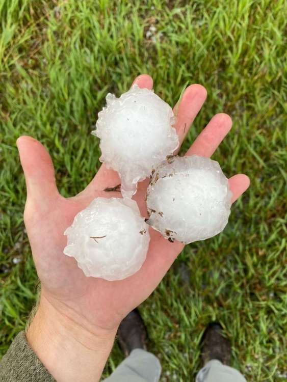
-
July 2024 Observations and Discussion
CentralNebWeather replied to westMJim's topic in East of the Rockies
Holy hail storm. Plus lots of wind and rain. No mas please. One of the stormiest stretches i can ever remember. IMG_2506.mov -
July 2024 Observations and Discussion
CentralNebWeather replied to westMJim's topic in East of the Rockies
Another tornado warning for my county. Severe storms everywhere in Central Nebraska -
July 2024 Observations and Discussion
CentralNebWeather replied to westMJim's topic in East of the Rockies
Tornado Warning for my county. That’s 6 or 7 so far this year. Insane. -
July 2024 Observations and Discussion
CentralNebWeather replied to westMJim's topic in East of the Rockies
Another day, another Severe Thunderstorm Watch. I’d hate to guess how many we’ve had this year. Possibly more hail. -
July 2024 Observations and Discussion
CentralNebWeather replied to westMJim's topic in East of the Rockies
Happy 4th everybody. Lighting off fireworks out in the country with lots of relatives. Weather is amazing. 65 degrees, dew in the 50’s. Actually feels a little cool. Temp supposed to drop to 55 tonight. Almost unheard of for the 4th of July. -
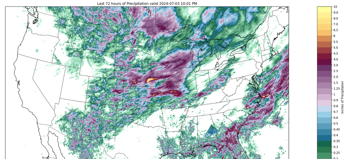
July 2024 Observations and Discussion
CentralNebWeather replied to westMJim's topic in East of the Rockies
This is from the Nutrien Ag site. (ag-wx.com). It is a 72 hour radar that updates every hour. My county is in that yellow dot in Central Nebraska pushing 5” or more.
-
July 2024 Observations and Discussion
CentralNebWeather replied to westMJim's topic in East of the Rockies
Pouring rain again. Temp has dropped to 60 degrees. Hello early October. IMG_2489.mov