CentralNebWeather
-
Posts
7132 -
Joined
-
Last visited
-
Days Won
34
Everything posted by CentralNebWeather
-
 Looks like about 2.40”. Most rain in a long time. More this weekend. Nice.
-
1.25” so far as of 10:10 pm and it is still pouring.
-
After I took this video, an heavier storm has come through. Incredible lightning, torrential rain, and some of the loudest thunder I’ve heard in a while. Looks like it should keep moving NE towards your area. My forecast just keeps it back building well into the night.
-
“Don’t think the heavy stuff is coming down for a while”. My gracious. 9 pm. IMG_2042.mov
-
Already had storms, and more are developing off to the west and southwest. Stormy night ahead.
-
Nice rain this morning moving up out of Kansas. First of many chances in the next 4 days. Things are really greening up. Trees just starting to bud out.
-
April 2024 Observations and Discussion
CentralNebWeather replied to westMJim's topic in East of the Rockies
1 mile north of me. Davis Weather App. My gauge was pretty close.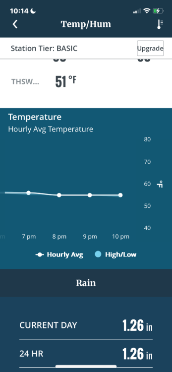
-
April 2024 Observations and Discussion
CentralNebWeather replied to westMJim's topic in East of the Rockies
Got home from school, and my guage showed almost 1.10” today. Way over performed. Now we have another cold rain coming Wednesday night into Thursday. Then rain and snow Friday night into Saturday. Nice. -
April 2024 Observations and Discussion
CentralNebWeather replied to westMJim's topic in East of the Rockies
Now just a leisurely 53 mph north wind as the low moves away. One of the windiest springs in recent memory. -
April 2024 Observations and Discussion
CentralNebWeather replied to westMJim's topic in East of the Rockies
Closing in on 1.0”. Very unexpected, and not forecasted to get this amount. We’ll take it. -
April 2024 Observations and Discussion
CentralNebWeather replied to westMJim's topic in East of the Rockies
Overnight was a bust here, only 0.10” with no severe weather. However, we have had rain with embedded thunder since around 10 am. Moderate to at times heavy rain has put down 0.60” as rain continues. We are on the wraparound side of the low as it slowly moves east. Very appreciative of this rainfall. -
April 2024 Observations and Discussion
CentralNebWeather replied to westMJim's topic in East of the Rockies
Well, here it is. Might not be much sleep tonight. -
April 2024 Observations and Discussion
CentralNebWeather replied to westMJim's topic in East of the Rockies
Oh Boy. Could get really rough around here tonight. -
April 2024 Observations and Discussion
CentralNebWeather replied to westMJim's topic in East of the Rockies
Looks like 85 was our high today. 85-90 tomorrow and Monday. Storms and rain Monday night through Tuesday. Cold rain/wet snow Wednesday night into Thursday. -
April 2024 Observations and Discussion
CentralNebWeather replied to westMJim's topic in East of the Rockies
-
April 2024 Observations and Discussion
CentralNebWeather replied to westMJim's topic in East of the Rockies
South/southeast winds gusting to 40 mph still this evening, have brought smoke up here from prescribed burns in Kansas and Oklahoma. Very hazy with a strong smoke odor in the air. -
3/24-3/27 Midwest/Plains Colorado Low(s)
CentralNebWeather replied to Minny_Weather's topic in East of the Rockies
-
3/24-3/27 Midwest/Plains Colorado Low(s)
CentralNebWeather replied to Minny_Weather's topic in East of the Rockies
-
3/24-3/27 Midwest/Plains Colorado Low(s)
CentralNebWeather replied to Minny_Weather's topic in East of the Rockies
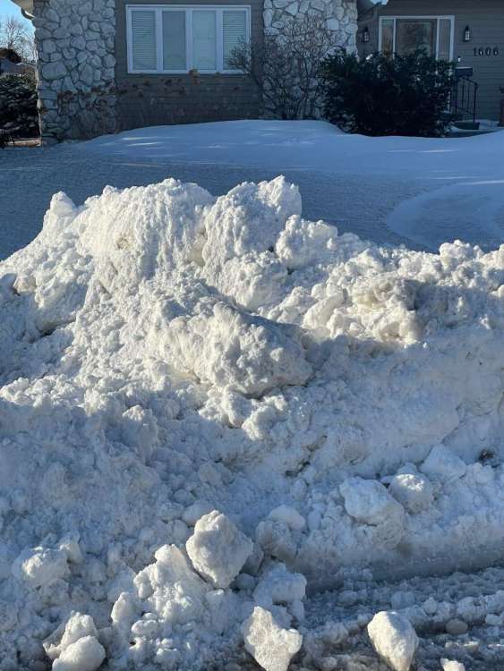
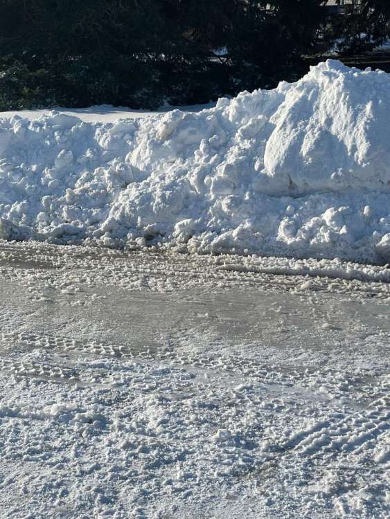
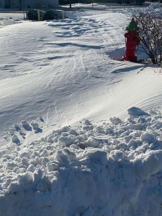
Some pics.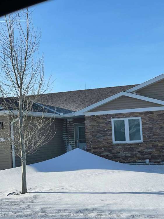
-
3/24-3/27 Midwest/Plains Colorado Low(s)
CentralNebWeather replied to Minny_Weather's topic in East of the Rockies
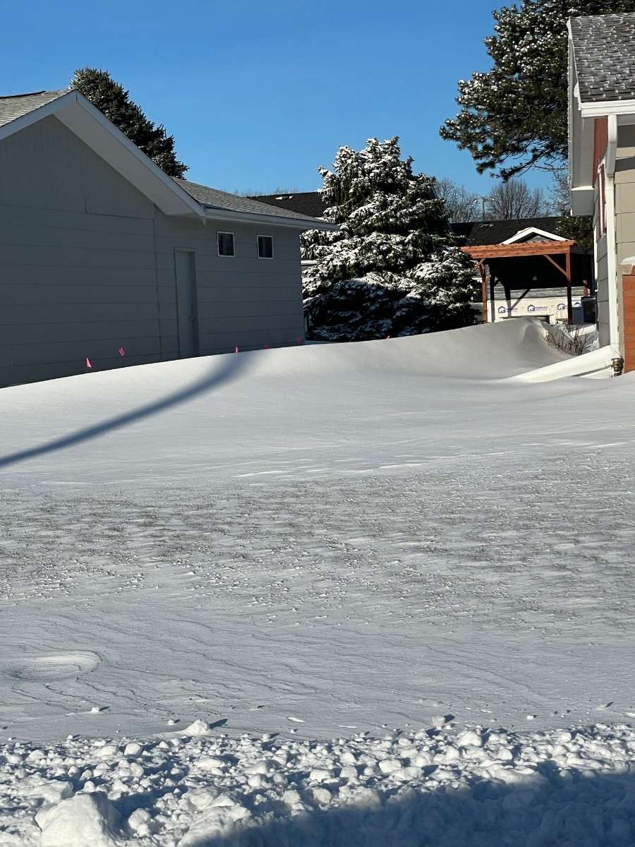
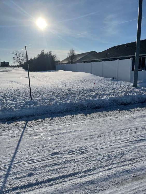
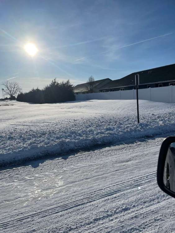
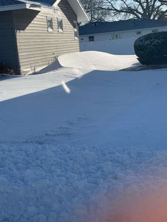
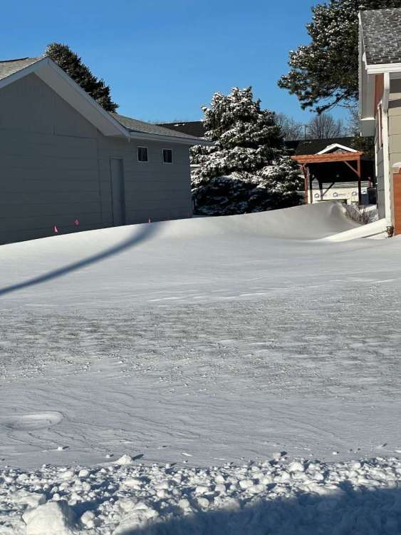
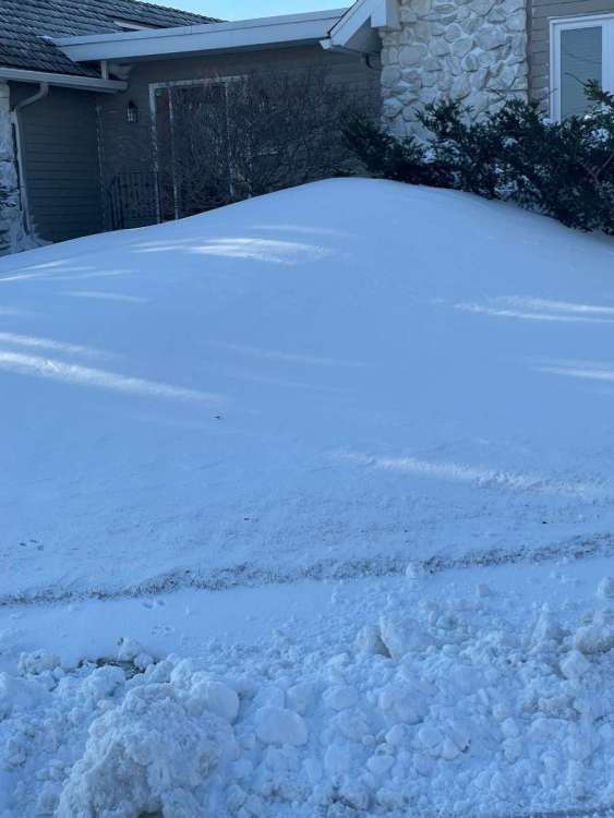
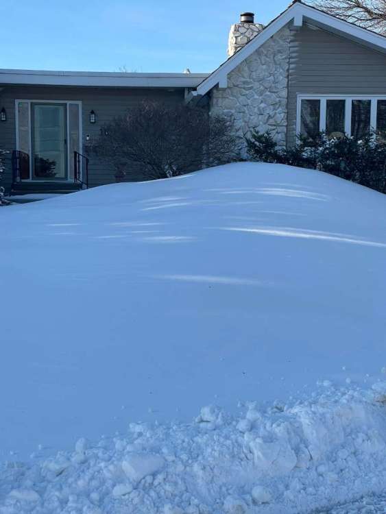
No school here. We were going to have a late start, but many county roads are impassable. Interstate 80 and Highway 30 still closed. I’d say we got 4” more last evening into overnight on top of the 6” we had, of course some compaction happened during the day yesterday. I have the largest drifts of the season in my yard and driveway. Have to say, it has been a very odd winter. I’ll give my final analysis when I’m sure all snow events are over. -
3/24-3/27 Midwest/Plains Colorado Low(s)
CentralNebWeather replied to Minny_Weather's topic in East of the Rockies
-
3/24-3/27 Midwest/Plains Colorado Low(s)
CentralNebWeather replied to Minny_Weather's topic in East of the Rockies
Not any improvement as of 6:25 pm.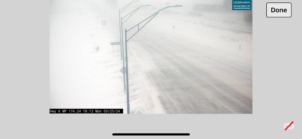
-
3/24-3/27 Midwest/Plains Colorado Low(s)
CentralNebWeather replied to Minny_Weather's topic in East of the Rockies
Probably snowing as hard the last 2 hours as anytime since this morning. This band is intense. It just hasn’t wanted to move towards your area. We have a late start tomorrow. Our superintendent and principal really want to get the Junior ACT done tomorrow or I’m wondering if we’d have another snow day. Going to have to really let up by morning if we’re going to start by 10 am. -
3/24-3/27 Midwest/Plains Colorado Low(s)
CentralNebWeather replied to Minny_Weather's topic in East of the Rockies
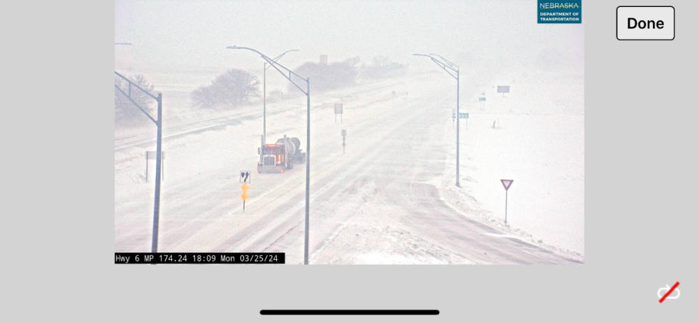
Just east of town currently at 3:58 pm.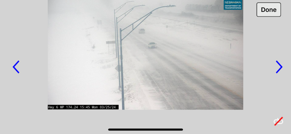
-
3/24-3/27 Midwest/Plains Colorado Low(s)
CentralNebWeather replied to Minny_Weather's topic in East of the Rockies
Blizzard Warning continues until 7 am. Next round of snow moving up from Kansas. It is picking up in intensity. Forecast says up to 4” more as the winds continue. Nice.