

Timmy Supercell
-
Posts
7775 -
Joined
-
Last visited
-
Days Won
14
Posts posted by Timmy Supercell
-
-
81 / 35 in Klamath Falls today. It actually was quite breezy the whole afternoon. It was especially nice over by Lake Ewauna with estimated 15-20 mph winds. It felt like 72-74 outside during the peak because of that.
-
Absolutely... hard to achieve 25 degrees above normal for high ever around here.
My average high in early April is 54 in K-Falls. I could potentially see 30+ above normal today.

-
Klamath Falls had a low of 35 degrees this morning. If we get 80+ today that will be an impressive diurnal change for April standards. This looks a lot like an October warm spell where K-Falls can easily come from a hard freeze/fog to 80-85 within 12 hours.
I have seen many days in April with low changes between 15-30 degrees from low-high. These few days will surely look out of place this month.
-
High of 78 in Klamath Falls. I broke my record high of 77 set in 1996. I also was a few degrees above forecast temperature. If tomorrow performs similarly, I should achieve 82-84, and that would be another record.
Who said 75 was a tragic nightmare?
45 and drizzle is your favorite weather right?

-
Here it is folks. 1st video is the highlight shot with slow motion lightning. 2nd video is the full t'storm video.
https://www.youtube.com/watch?v=0Jz1ROcYprI
https://www.youtube.com/watch?v=QjdNHyxUCv0
-
Well well.. I actually DID end up with a t'storm. One with fairly frequent lightning for an early-April type t'storm that is. I am compiling some video of this, I hope it turned out great.
If this one qualified as a warm core thunderstorm, it has to be my earliest of any year I have been here, by at least a month or so early.
-
Other than a potential rumbler near Fort Klamath (about 50 or so miles north) nothing showed up around here. I might just have to wait until early May before I get storms.
-
Cumulus clouds out and about in Klamath Falls. Seeing some dark base development to my south/SW. I hope this turns into actual convection this afternoon. NWS Medford hinted at a small chance of thunderstorms for the cascades and surrounding areas.
... time to power up my dusty old GR radars. They've been collecting layers of dust since September.

-
Probably will end up warmer than I was thinking. It'll be tough to make up for the first 10 days.
Nice to be on the good side of wrong, I suppose.
If the other 3 weeks of April turn out to be significantly cooler than normal, it could all average out to normal. Too early to say anything.
-
Some freakish warmth isn't unheard of in the spring during the collapse of a mega Nino
I think it's the fact that this is still "early Spring" that makes this a potential record breaking wave. Sure, in my years I've seen many mid-May or late May waves with temps in the 90's even approaching 100. But in my years I've never seen a 80+ degrees in the first week of April, especially not in Klamath Falls over 4000 feet high. This is still graupel/snow season for another couple weeks here. I should be having highs in the low 50's and upper 40's well until late month.
Even my neighbors who've lived in K-Falls for 30-40 years could have a surprise waiting for them on 04/07. They'll tell me "isn't it too early for this kind of weather??"
-
70 / 30 in Klamath Falls today. I love going from freezing to warm all in the same 10-12 hours.
-
Lightning or even large electric sparks can produce nitrogen dioxide which turns to nitric acid when it comes into contact with water. Sounds like that was an extreme case.
It could also be that at higher elevations, this is so much more noticeable in severe lightning events. I don't know anyone else personally who lives at 4000-5000 feet and been through a wide variety of t'storm events over a period of years.
If this were in the Willamette Valley, I'd assume I wouldn't have had such an experience.
-
Why only for California?? This would cause MORE problems than we already have. If this were for the whole west coast, go ahead I'm all for it. It'd be really weird to have a "California Time" and then have PDT/PST differ by an hour.
-
Pretty much if you want a guarantee of a severe event happening you need to be east of the cascades. For widespread text-book events like 06/04/2009 or 05/19/1993 to pan out, multiple things need to come together just perfectly in the valleys (typically only a couple ingredients are present while another huge ingredient might be missing in some events). I've noticed we can lack heavily with ample wind shear, which in high amounts can help longevity and organization of storm cells (or as we've seen in 2009; state-wide storm complexes with embedded rotation). While shear is not 100% needed for severe storms to develop (I've seen severe storms happen in a low shear environment), but it does help an overall event from looking better and lasting longer, and sometimes increases the number of storms seen in a region. Another problem the lowlands have west of the mountains, is it can take several hours to get out of a CAP.
Sometimes moisture really isn't a problem; evidently in much of summer 2014 and 2015 most of the PNW had lots of moisture to pull from Upper Level Low activity frequently occurring. Not quite comparable to anywhere east of the Rockies, but for PNW standards I had noticed large quantities of it (numerous NWS Medford AFD's mentioned PWAT's ranging from 1.25" to 1.50" in July and August in southern Oregon).
On another note, I have wondered myself why a nocturnal storm might exhibit much more erratic lightning characteristics. For example, early in the morning on 06/09/2015 in Klamath Falls, 2 storms (1 near the border of CA, and 1 just to my west) absolutely exploded with frequent lightning from 4am to sunrise. (ranging from 8-12+ flashes per minute). This was the most lightning I had personally witnessed in my life. By far, more lightning than any Severe Thunderstorms have accomplished here in the afternoon/evening hours. So much ionization happened that I began to smell a charged ozone type air, to the point where it was not as easy to breathe it and made me feel nauseous.
Though there is an exceptional severe storm that occurred on 08/05/2012 from 7pm-8pm while I was out of town, with a spotter report indicating 3-4 strikes per 10 seconds frequency. I am assuming this is extraordinary for a late afternoon-evening type setup in this area. The storm itself was a 10-15+ year type storm based on what neighbors have said (folks who have spent more than 30 years in Klamath Falls). I spent all of summer 2012 visiting my brother in Beaverton, so I missed a great event. Though for some strange reason, that was the only t'storm to occur in K-Falls while I was away.
-
It was just a poke at the spring fever the forum is currently experiencing. Nothing more.
Silly me. I was too much into my facts and figures at the moment
-
Don't you mean this spring?
Not sure what you mean by that. I was talking about 2014 and 2015. Last year I had a record average high temperature for January 2015, and 2nd warmest February the next month. March I believe was also a record as well for average high.
These last couple months look like they are a around normal overall. This month actually could end up below avg a bit because of the hard freeze this area had below 0 in the 1st week.
-
Of course spring-like conditions in the winter are totally normal in the lowlands of WA and OR. Even in the coldest years. But it still feels like spring to me.
I'm in the highlands, and I had False Springs in Klamath Falls last couple January's and February's. 55-60 degree highs, absolutely no snow to be seen over 4000 feet. I wore t-shirts many afternoons. No coats (except for in the morning). When there was moisture it was in the form of rain 90% of the time.
But of course this winter it's doing what it's supposed to in the mountains
-
67mph at LMT. Quite a strong line.
When was that? I looked at KLMT observations and didn't see anything over 33 mph. My house probably had 40-45 at most, before the t'storms arrived. Was that a local storm report you saw somewhere?
Edit: Ah, I see 67mph on Mesowest KLMT. Never mind! I didn't get anything nearly as strong as that at my place. Must have been a very localized burst of winds at the airport.
-
So apparently after this squall line went through Klamath Falls, NWS issued Severe Thunderstorm Warnings for 70mph winds in SE Klamath County and western Lake County! I thought this storm died down.
-
I just had an extraordinarily rare January Thunderstorm in Klamath Falls. What's even more surprising is that this was a squall line that originated well off the southwest Oregon and northwest California coast around 8-9am. It continued inland and over the southern Cascade mountains (with all this snow and everything??).
I had 7-8 flashes, and a few pretty close rumbles/booms. At about 12:25pm I had a flash illuminate my living room, and I'm sure that was from a 1/4 mile away from this house. The sound was almost immediately after the flash. Some small hail too.
One thing I know for sure is that winter time convection is super rare east of the cascades. I asked NWS Medford on their Facebook page how many December/January/February t'storms occurred in Klamath Falls. I really look forward to getting their answer. Looking through Wunderground history from 1970-current I only see a couple occurrences.
With a lot of snow still on the ground in town, this was certainly an interesting sight. I wish I got all of that on camera. Unfortunately my videos aren't too great when it comes to capturing t'storms.
What exactly drove this squall line to stay together this far? Even many Spring time squall lines have (time and time again) failed to pass the cascades. Including 03/13/2011; it completely fell apart and lost most characteristics before reaching the mountains to my west. All I got from that one 5 years ago was some brief 50-60mph outflow winds.
-
Can't say really. It's rather subjective.
"Chilly" could mean anything. 50 degrees to a Tampa resident is chilly. 0 to a Klamath Falls resident is a bit "cooler".
-
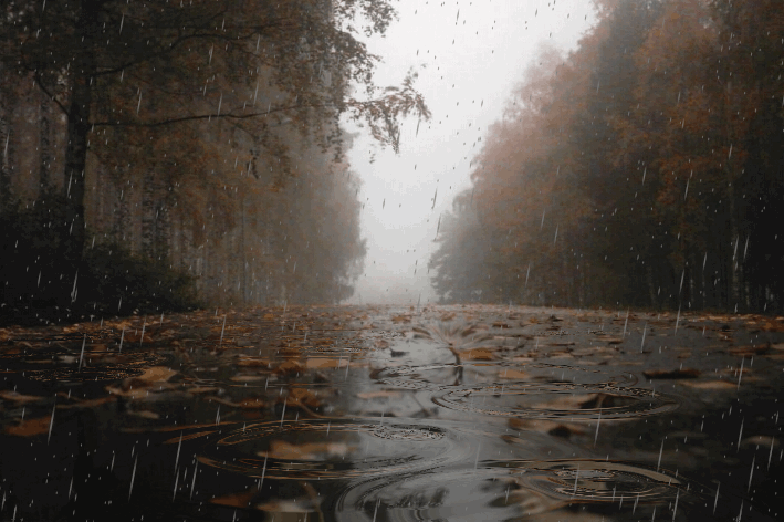
A nice rainy day in K-Falls. Much of the snow has been melting, currently spots of 8-10" in the yard now. Though huge piles still remain in nearly every parking lot in town.
KLMT logged 0.57" of rain as of 4:53pm.
-
Nice to see thunderstorms still kicking even in this time of year up in NW Oregon. That's one quality I loved about the lowlands while I lived there up until 2010. I would actually much rather replace my snow with more cold core convection in the winter season.
Yeah I just noticed those storms are warned on the radar now.
When I noticed that, at first I thought it was an error of some sort. Especially because there was a radar gap at the time (KRTX wasn't picking up the area that was warned). But it turned out to be legit!
-
I don't doubt it, but statistically speaking severe weather is more frequent and prolific elsewhere, where latent heat dynamics and EMLs can sustain more activity.
Don't get me wrong, Montana has one hell of a climate. I'm just a numbers guy.
Well of course Montana isn't the most prolific when it comes to severe setups. But they get 5x as many severe storms, and even outbreaks than we do on the west coast. Especially eastern Montana, they can get TOR watches once or twice a year. Central and Eastern Oregon will be lucky to see more than 3-4 SVR watches in a summer, plus zero TOR's (except for May 31 1997).
I still view Montana as exceptionally active for Spring/Summer time storms. The average populace may still not need to worry about tornadoes in general, but when it comes hail/wind and lightning amounts, they make the PNW look like wimps.
April 2016 Observation and Model Discussion for the Pacific Northwest
in West of the Rockies
Posted
Yesterday was interesting. Multiple t'storms cells in Klamath County in the afternoon (t'storm coverage on radar was AMAZING for early April standards). We went to go shopping around 2pm with just some distant cumulus buildups in a few directions and solid sunshine. Left the store an hour later to see dark bases covering most of the north and NE skies (slowly coming our way from the NE). I heard a couple rumbles. Eventually the storm that was supposed to hit K-Falls collapsed but there were what looked like very great thunderstorms in the SE corner of Klamath County that passed through Bonanza and Malin with potential severe sized hail. Obviously nothing reported and there likely were no spotters out that way but the sky was pretty ominous towards the east and radar indicated a strong hail core on a few frames.
Even though we got sort of screwed, the overall day looked like a day in July or August, except the only thing different was it was 73 for a high and not 85 as it would have been in these kinds of widespread convective events. Radar-wise, yesterday performed a lot better than I would have expected, considering how early it is in the year.
It was still nice seeing some cloud-ground strikes in the distance while having some pizza and red wine (oh did I mention I love having both storms and booze? They go great together. )
)