

Timmy Supercell
-
Posts
7826 -
Joined
-
Last visited
-
Days Won
14
2 Followers


Recent Profile Visitors


Timmy Supercell's Achievements
")


-

June 2024 Observations and Discussion
Timmy Supercell replied to westMJim's topic in East of the Rockies
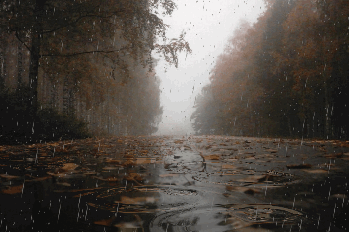
We had a surprise with yesterday's storms in the area. Around 9-10pm lightning every 1 second in frequency and had some high wind gusts that resulted in a few trees down. Our power was out until 5pm today. This was one of the last streets to get restored, otherwise I think it should have been a few hours without electricity. 2024 is a loaded year for severe wx reports out here. There was another chance of storms today but everything has been to the south of I-64 this time. -
July 2024 Observations and Discussion
Timmy Supercell replied to westMJim's topic in East of the Rockies
Coolest entrance to a July here in years? Tonight and tomorrow look quite mild. June started in a similar fashion, but will probably end warm.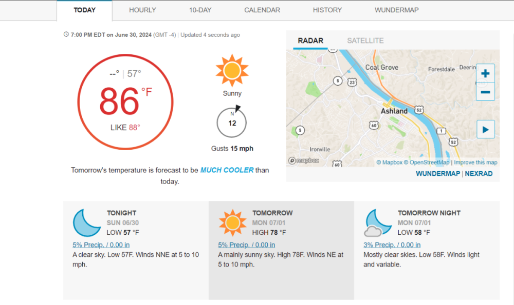
-
June 2024 Observations and Discussion
Timmy Supercell replied to westMJim's topic in East of the Rockies
We had a couple t'storms yesterday, however not like the ones in summer 2022 so far. This month might go out with below average precipitation, maybe even less than half. About 21 of the last 24 days were dry. -
June 2024 Observations and Discussion
Timmy Supercell replied to westMJim's topic in East of the Rockies
We stayed a bit warmer than forecast this morning. 75 for a low in Ashland, and some areas to my west never went below 80 degrees. I see I'm in a Slight Risk for severe t'storms today.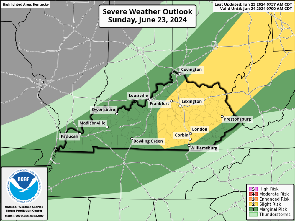
-
June 2024 Observations and Discussion
Timmy Supercell replied to westMJim's topic in East of the Rockies
It never gets that bad around this area. Even though it's very bushy and green here we have a more moderate number of cicadas. -
June 2024 Pacific Northwest Weather
Timmy Supercell replied to Anti Marine Layer's topic in West of the Rockies
One of them looked like it wasn't exactly a warm June. Anything within +/- 0.5 degrees should not be a red or blue if I made that graphic. -
June 2024 Observations and Discussion
Timmy Supercell replied to westMJim's topic in East of the Rockies
If we didn't have one day in the first week of June that produced 1.25-1.5" I'd be agreeing on the dry June out here. We've gone most of the month without a drop which is a contrast to June of 2022. I hope it trends wetter towards 4th of July, this is MCS season for us right about now. -
June 2024 Observations and Discussion
Timmy Supercell replied to westMJim's topic in East of the Rockies
96/71 yesterday. Oh did I mention I heard my first cicadas a couple evenings ago? They're so cute the first time you hear them. There was a t'storm last night with a decent amount of flashing but overall it was a non-severe storm. -
June 2024 Observations and Discussion
Timmy Supercell replied to westMJim's topic in East of the Rockies
Does that mean no more 60's and red wasps next February? -
June 2024 Observations and Discussion
Timmy Supercell replied to westMJim's topic in East of the Rockies
Today turned out to be warmer than yesterday. And no storms (though the horizon to my north did have a few flashes). 89/64. Summer really kicks the door down in a couple days. -
June 2024 Pacific Northwest Weather
Timmy Supercell replied to Anti Marine Layer's topic in West of the Rockies
Eastern KY has such fickle behavior with some of these lower end convective setups. Once again sitting between two areas of t'storm clusters to my west and NE, they're moving SE.. -
June 2024 Observations and Discussion
Timmy Supercell replied to westMJim's topic in East of the Rockies
Had 88/56 yesterday, today will be a few degrees cooler for a high but we traded off with a warmer overnight low. 64 this morning with overcast skies. Some storms today maybe. -
June 2024 Pacific Northwest Weather
Timmy Supercell replied to Anti Marine Layer's topic in West of the Rockies
Meteorologists have their own definition of summer which may not be a popular one. -
June 2024 Pacific Northwest Weather
Timmy Supercell replied to Anti Marine Layer's topic in West of the Rockies
Depending on the city, half of a year of 1 season and not a drop of rain. lol -
June 2024 Pacific Northwest Weather
Timmy Supercell replied to Anti Marine Layer's topic in West of the Rockies
Coolest start to a June out here in a few years, but will probably end on a warmer note.


