Clinton
-
Posts
6643 -
Joined
-
Last visited
-
Days Won
28


Clinton's Achievements
")


-
Hot and dry as we go through the dog days of summer. Good news training camp has started so football weather is right around the corner.

-
It looks like I'll return home to some beautiful weather with highs around 80. It's been a comfortable July with the cooler temps. WS Kansas City @NWSKansasCity Follow Temperatures for 16 of the first 20 days of July were at or below normal at Kansas City...that trend will continue through at least Tuesday
-
Looks like the weather has cooled off back home, temps are currently in the upper 60s to 70 degrees. Rain over the weekend with a disturbance slowly moving through the area. This cool part of the pattern is related to the cold we experienced the week of January 15th.
-
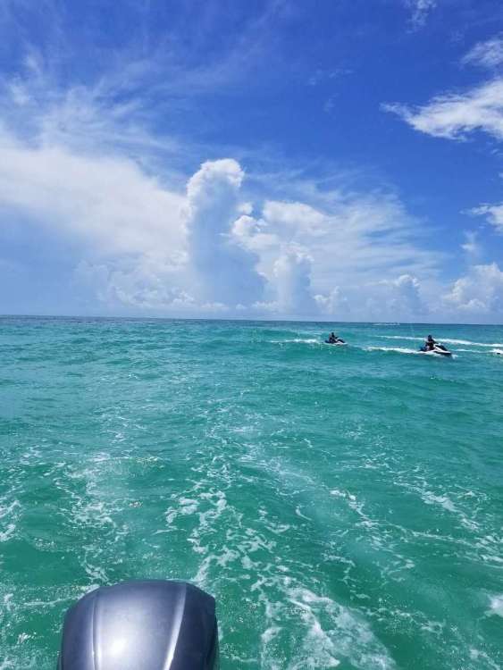
We have had wonderful weather in the panhandle with highs in the low 90s. A strong thunderstorm overnight produced over 2 inches of rain. I got some pictures of thunderstorms over the Gulf. While parasaling I could see several storms over the open water.
-
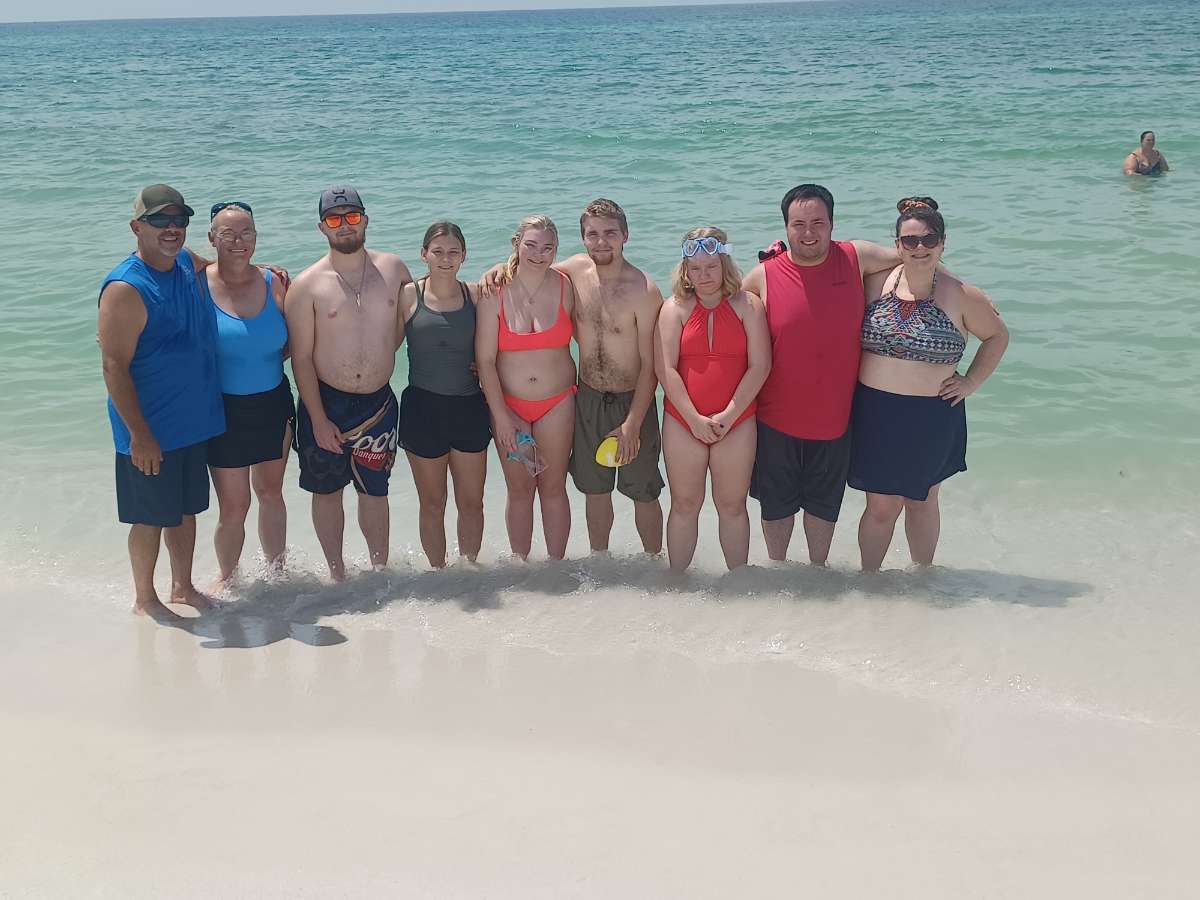
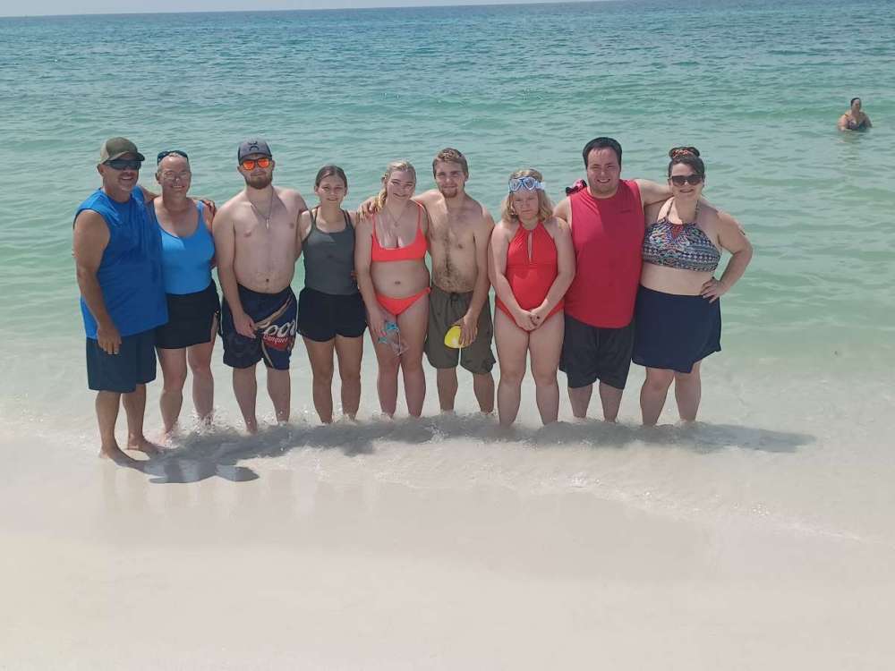
The beaches are beautiful with white sand and clear water. The weekend was crazy busy with the Blue Angels performing at an air show. Estimated crowd was 100,000+
-
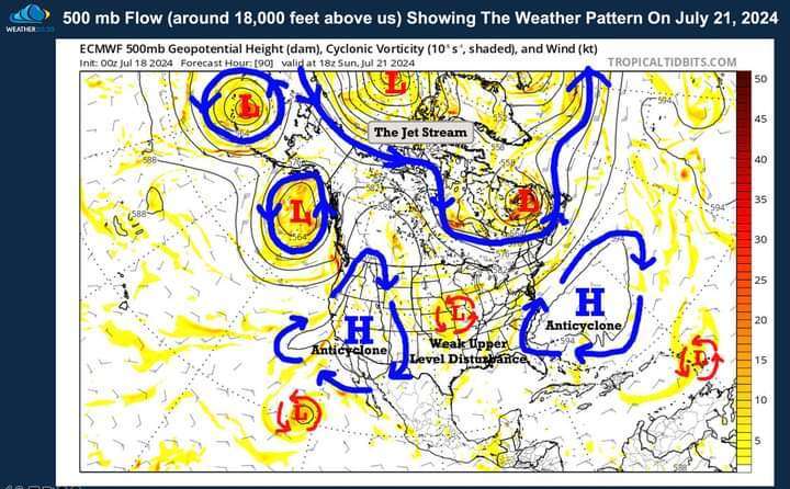
Greetings from Navarre, Florida where the weather has been perfect for being at the beach. Looks like eastern Iowa and northern Illinois are in line for some big storms tomorrow. Reed Timmer, PhD @ReedTimmerUSA A MAJOR WIND BAG and even derecho looks possible from central Iowa through northern Illinois, including into Chicago by Monday late evening, with a swath of 75+ mph winds and QLCS tornadoes likely. The initial mode could be supercells in central Iowa, but will quickly congeal into a fast-moving bow echo by the eastern Iowa through Davenport area Monday afternoon. I am considering a live stream for this textbook ridge rider summer
-
I had a thunderstorm last night that dropped .25 inches. Hot and humid weather is here for the weekend and into early next week.
-
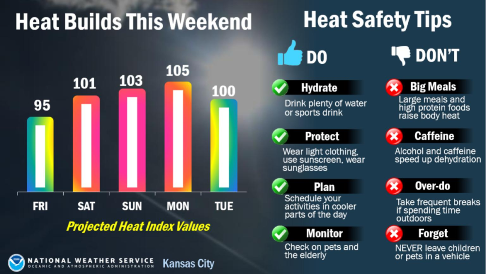
Scattered thunderstorms around here this morning and they will likely be around through tomorrow. The heat builds in here this weekend.

-
Average temps around here today with highs in the upper 80s. The heat and humidity build in here Friday and will last over the weekend. I will be headed to the Florida panhandle (Navarre) this weekend through next week where the weather nice and toasty. I may have to dodge a few raindrops on the beach.
-
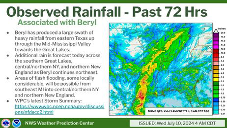
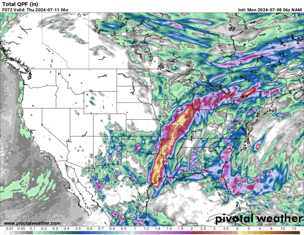
72 hour rainfall map for Beryl.
-
I received. 53 from thunderstorms yesterday evening. Beryl is wrapping in some light showers this morning.
-
I'm getting some rain from Beryl. Thunderstorms are forming and barely moving, looks like another soaker.
-
The NAM remains further west with the remnants of Beryl, all other models keep the remnants to my east.
-
Hurricane Beryl made landfall around 4 AM Central time this morning near Matagorda, TX as a category 1, with maximum sustained winds of 80 mph with a minimum central pressure of 979 MB. Hurricane conditions and storm surge are ongoing as Beryl moves inland.
-
I received 9 tenths of an inch with Thunderstorms overnight. Nice weather expected today with temps in the mid 80s.