

Minny_Weather
-
Posts
10525 -
Joined
-
Last visited
-
Days Won
19
Everything posted by Minny_Weather
-

January 2024 Observations and Discussion
Minny_Weather replied to Minny_Weather's topic in East of the Rockies
-
January 2024 Observations and Discussion
Minny_Weather replied to Minny_Weather's topic in East of the Rockies
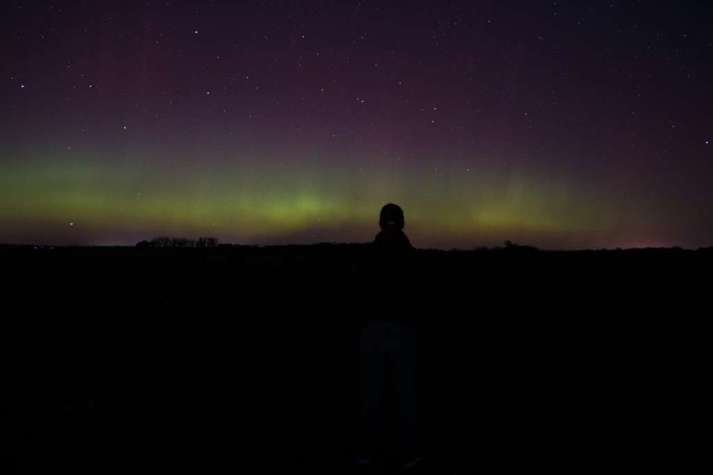
My town looks a lot better with snow than it does with brown grass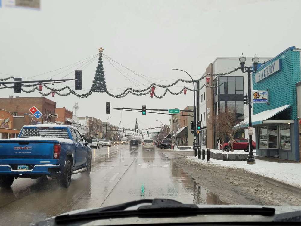
-
January 2024 Observations and Discussion
Minny_Weather replied to Minny_Weather's topic in East of the Rockies
12Z GFS is a pretty big kick in the balls for most areas of MN -
January 11-13 Major Winter Storm/Blizzard
Minny_Weather replied to Hoosier's topic in East of the Rockies
Basically the only hope I have here is that it trends North enough to give Duluth a few inches, as I'll be there on Saturday. This isn't gonna do anything for me here at home. -
January 2024 Observations and Discussion
Minny_Weather replied to Minny_Weather's topic in East of the Rockies
It's pretty amazing how different radar returns look from what the models have been spitting out. Definitely not nearly as much dry air and even S MN is seeing snowfall. -
January 2024 Observations and Discussion
Minny_Weather replied to Minny_Weather's topic in East of the Rockies
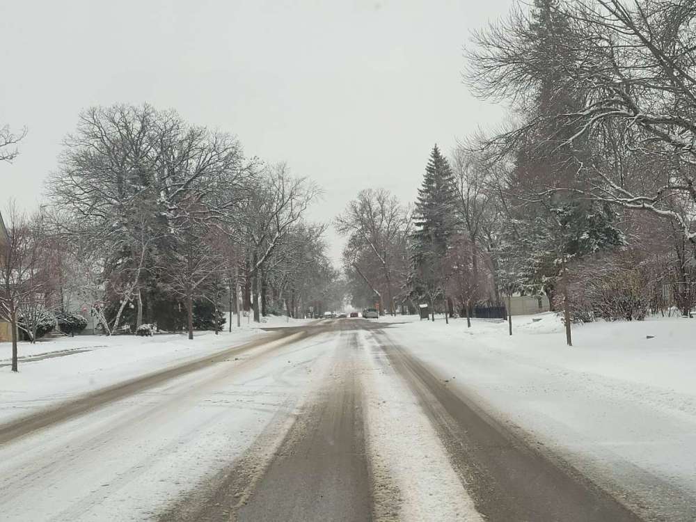
I'm 2 hours west of the cities but the snow floodgates just opened up way before they were supposed to here and it's accumulating easily. I think this could be an overachiever. -
January 2024 Observations and Discussion
Minny_Weather replied to Minny_Weather's topic in East of the Rockies
Freezing drizzle has iced everything over here. 27°F. -
January 2024 Observations and Discussion
Minny_Weather replied to Minny_Weather's topic in East of the Rockies
I believe the 18Z more because it isn't absolutely terrible for me unlike 12Z! -
January 2024 Observations and Discussion
Minny_Weather replied to Minny_Weather's topic in East of the Rockies
To my pleasant surprise, I'm actually getting some beautiful, windless light snow this morning. Won't amount to anything but it's still pretty to look at. To my not-so-pleasant surprise, models have introduced dry air to tomorrow night's snowfall. That's the type of trend that typically only gets worse, not better. 15*F. -
January 2024 Observations and Discussion
Minny_Weather replied to Minny_Weather's topic in East of the Rockies
Every GFS ensemble member gives me a multi-inch snowfall on Saturday.... except the operational. Euro looks good for me. I'm confident that I'll finally establish a nice base and this stupid brown ground will finally go away for good. -
January 2024 Observations and Discussion
Minny_Weather replied to Minny_Weather's topic in East of the Rockies
Suddenly, I'm liking my chance of a multi-inch snowfall from the weak SLP on Friday & Saturday. Another trend that models have been picking up on is a nice clipper on Thursday of next week. Both GFS and Euro put out borderline warning levels of snow. GFS bullseyes me, while Euro keeps heavier totals up in Canada. Something to watch. -
God FORBID people have their own opinions on what party better suits them!
-
January 2024 Observations and Discussion
Minny_Weather replied to Minny_Weather's topic in East of the Rockies
EPS has some rather bombastic runs re: the storm in 2 weeks, as well. And a couple of members have it as a nor'easter ... And most members have no storm at all.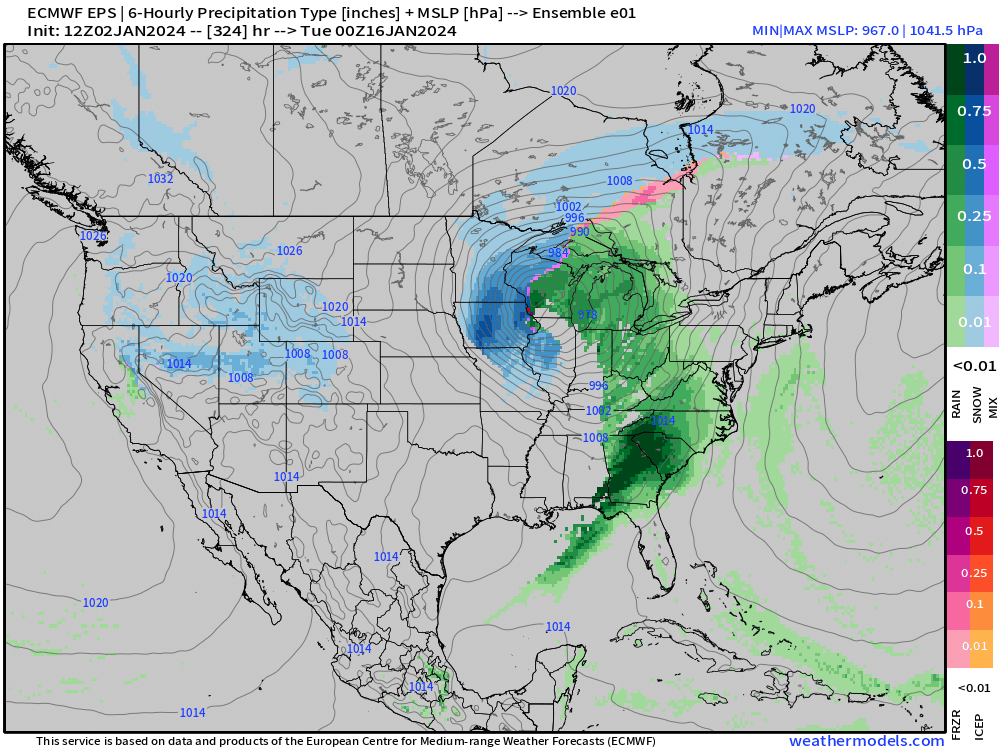
-
January 2024 Observations and Discussion
Minny_Weather replied to Minny_Weather's topic in East of the Rockies
Has the looks of a clipper, I'd expect that to trend north. Definitely worth watching, I wouldn't mind you cashing in from that. -
Even if my place is in a bad spot on there, I'm happy to see the North shore in the >90% zone. They need the snow the most.
-
January 2024 Observations and Discussion
Minny_Weather replied to Minny_Weather's topic in East of the Rockies
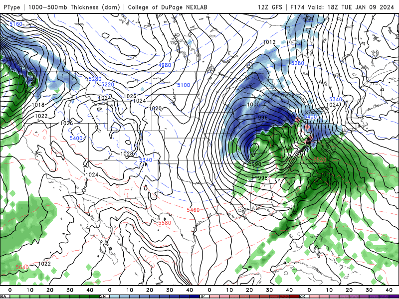
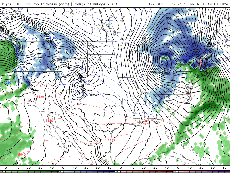
Fired up a thread for the main low ONLY, discussion of any other shortwaves or clippers around the same time will stay in here -
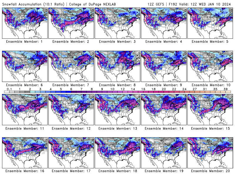
GEFS still has quite the variation, mainly as it pertains to thermals GFS storm track
-
January 2024 Observations and Discussion
Minny_Weather replied to Minny_Weather's topic in East of the Rockies
That thought crossed my head earlier. I'll start it later unless someone else wants to do the honors now. -
January 2024 Observations and Discussion
Minny_Weather replied to Minny_Weather's topic in East of the Rockies
This is the time of year in this part of the country where we basically need to rely on clippers to get snow on the ground. This is why the warm December annoyed me so much. Such a favorable storm track wasted on rain, now it looks like the Northern Plains/Northwoods has another 2020-21 on our hands. That being said, I like where I sit better than you. -
January 2024 Observations and Discussion
Minny_Weather replied to Minny_Weather's topic in East of the Rockies
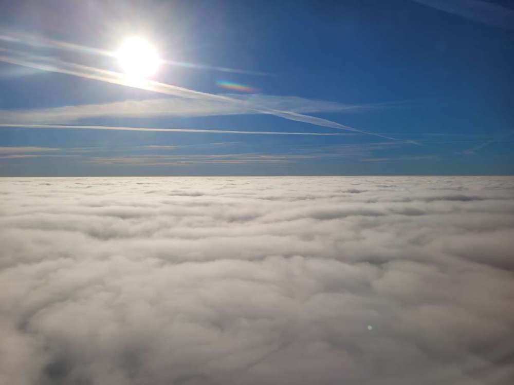
Awesome! I was on UA6128. The gear came down before we even got to the cloud tops, I was extremely surprised at how low they were. -
January 2024 Observations and Discussion
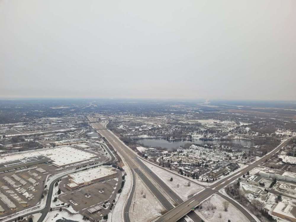
Minny_Weather replied to Minny_Weather's topic in East of the Rockies
Complaints about how horrid this winter is setting up for me aside, I had quite the approach into MSP today. Great to be home.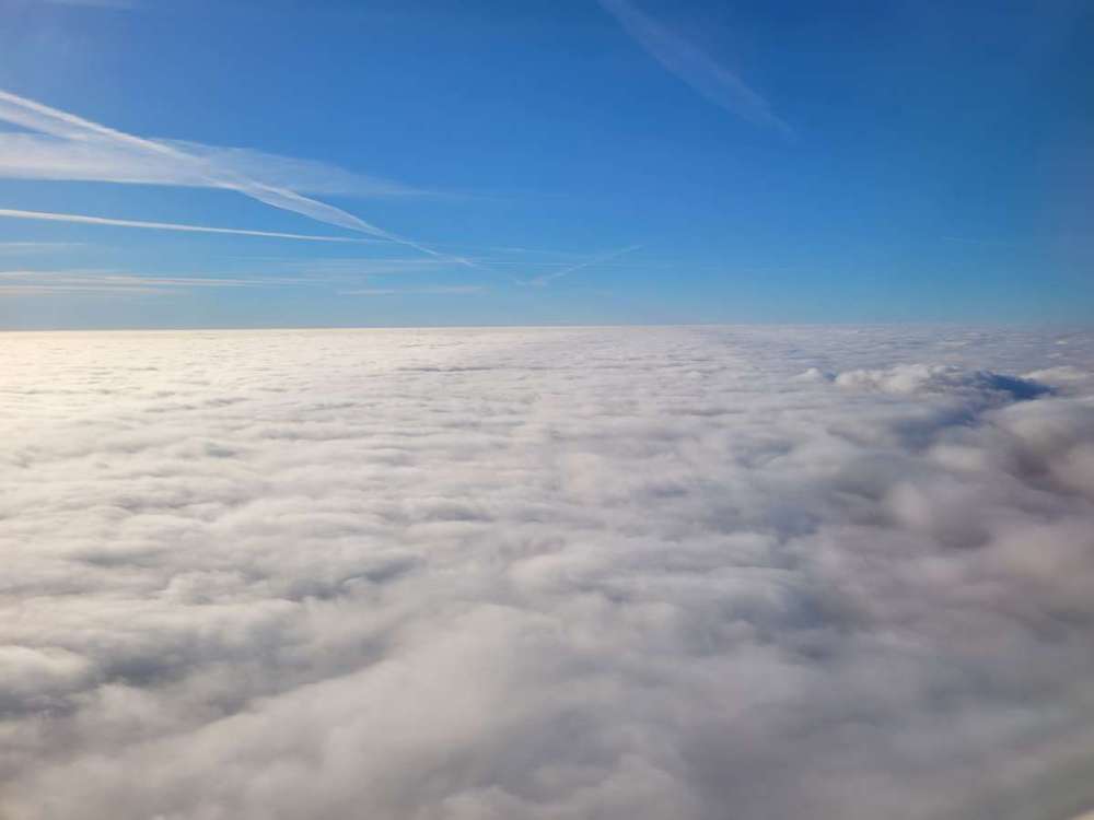
-
January 2024 Observations and Discussion
Minny_Weather replied to Minny_Weather's topic in East of the Rockies
Not a good pattern for me. I'll be very very VERY lucky if I have >3" on the ground in 2 weeks, which, yeah, is terrible for here. -
January 2024 Observations and Discussion
Minny_Weather replied to Minny_Weather's topic in East of the Rockies
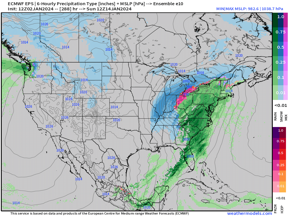
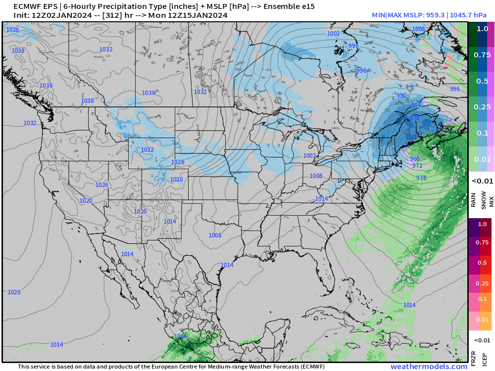
EPS overall favors the KC-Ottumwa stretch, but there are obviously solutions all over the place, including a few to the north. -
January 2024 Observations and Discussion
Minny_Weather replied to Minny_Weather's topic in East of the Rockies
Yeah I sorta knew I was hosed on this one from the start. D**n shame too, considering, y'know, there is zero snow on the ground in most of Minnesota. -
January 2024 Observations and Discussion
Minny_Weather replied to Minny_Weather's topic in East of the Rockies
Yeah... I'm realistic enough to know that I'm not receiving 15" from a low in Central Iowa lol. There is only one GEFS member that is more bullish than the operational.


