


Black Hole
-
Posts
2645 -
Joined
-
Last visited
-
Days Won
1
Posts posted by Black Hole
-
-
29 minutes ago, Iceresistance said:
GOOD LORD
.thumb.png.25ca207a7f646cf5d8282118ff16ea5f.png)
There is going to be some big time variation in the totals with this one. I assume a few areas with heavier rates really will get some good snow totals, but slightly lighter rates could mean a lot of areas get little to no accumulation. In general, I think most areas will not accumulate more than 2" for central/eastern OK and none (for me at least) would not surprise me. With that said, there is a chance if its just a little cooler and heavier we could get a good one. At least we got a shot!
-
 1
1
-
-
Ensemble guidance overall looks weaker and warmer this morning for the coming system. Probably still going to get at least a little snow but for me I am thinking a dusting to 1" is the most likely at the moment. If precip comes in heavier than expected it could still be more but given the dependency on precip rates, lack of existing cold air, and warm ground temps it'll be tough.
-
 1
1
-
-
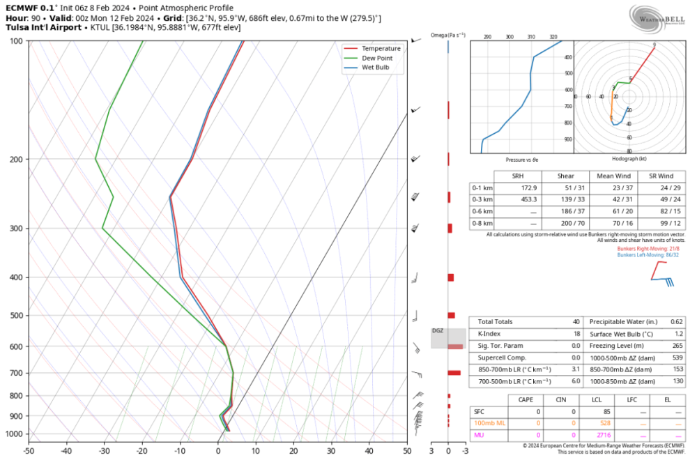
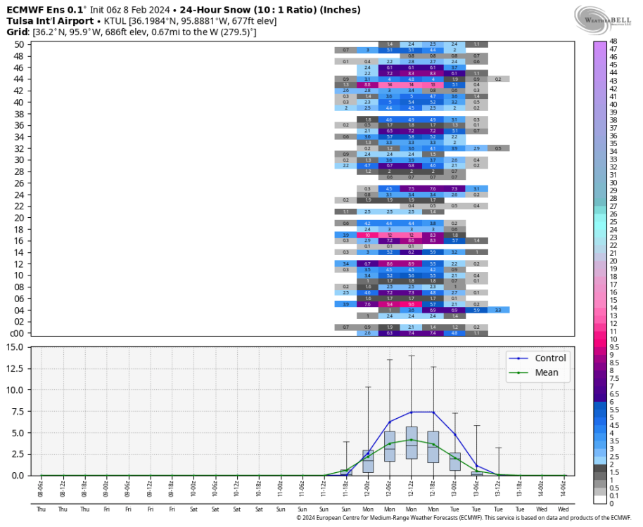
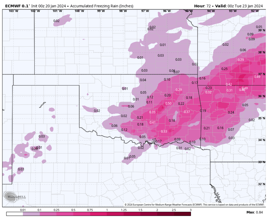
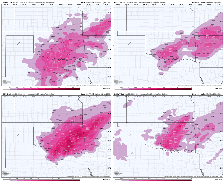
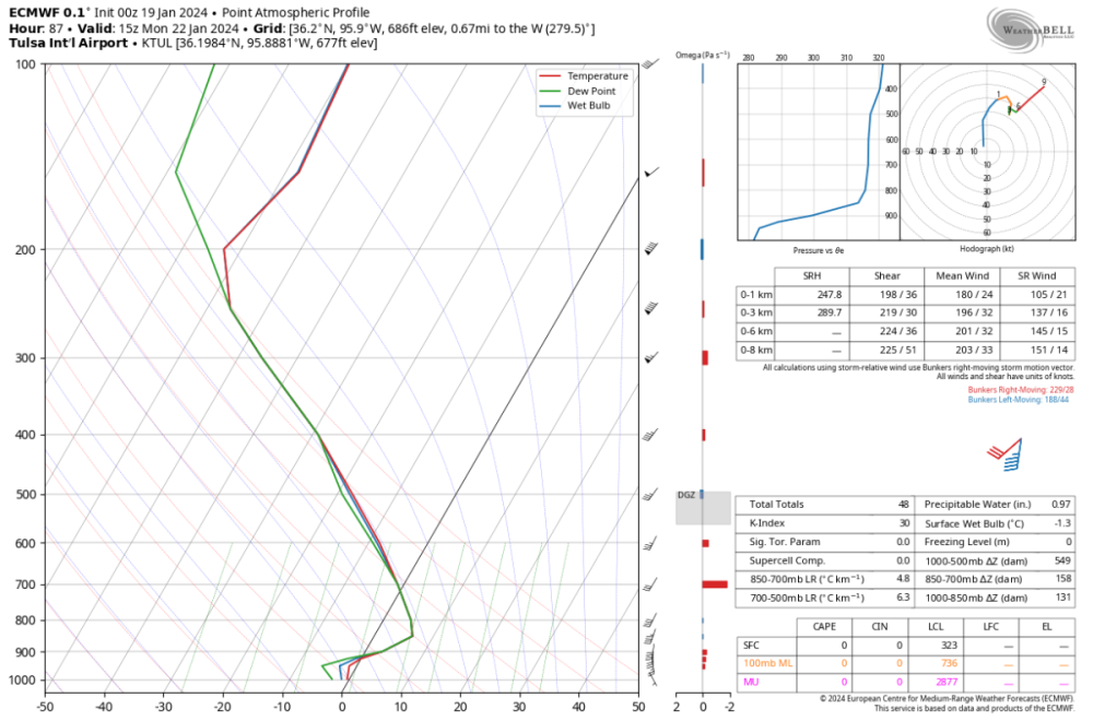
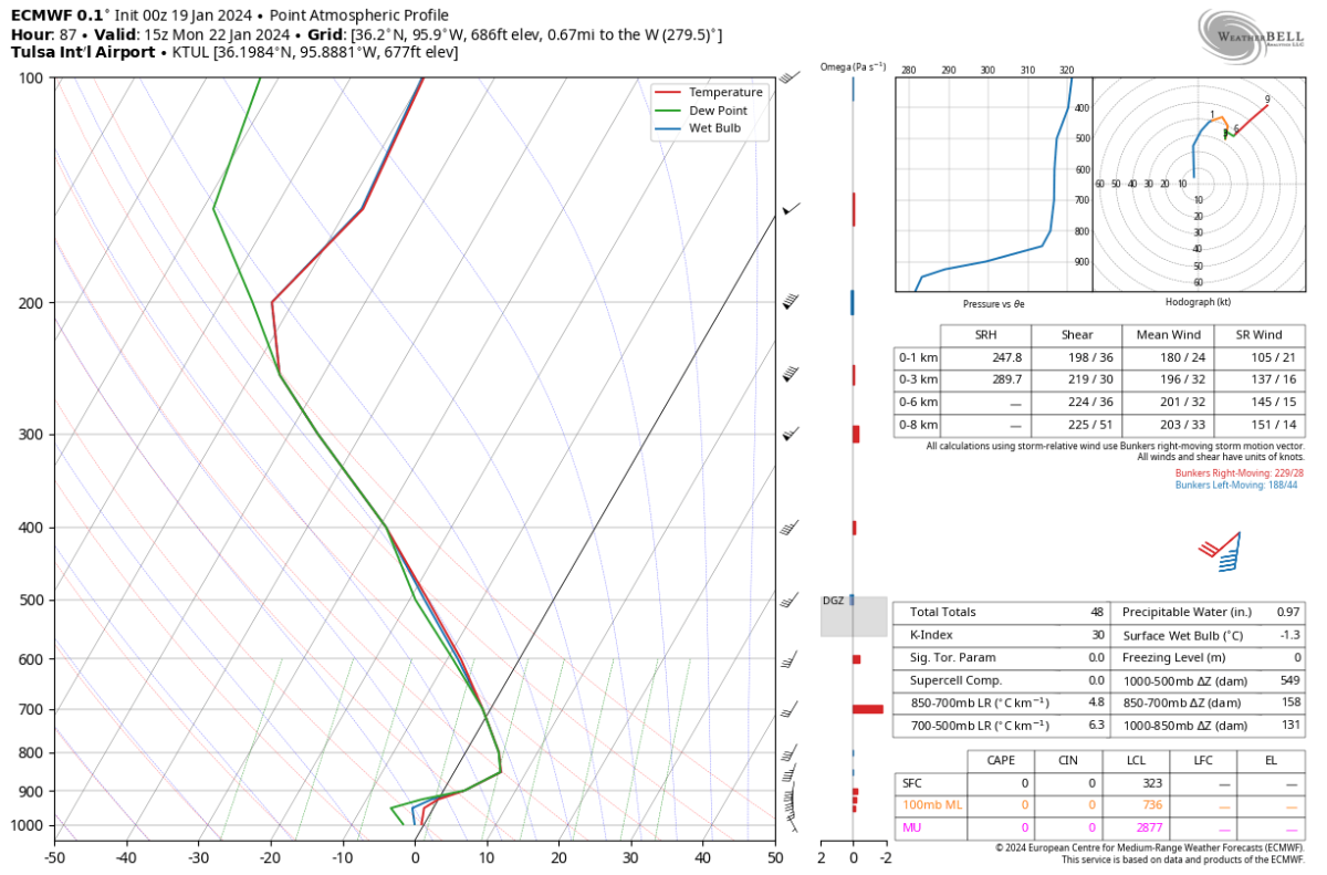
A compact but potent system will pass through OK Sunday->Monday, then tracking through MO/AR. Total liquid precipitation may exceed 1" based on the EPS mean. Current guidance has a near perfect track with the heavy wraparound passing through northeast OK. The attached ECMWF sounding shows cold enough temperatures aloft to support a change to snow in spite of marginal temperatures going into the event.
There are a number of crazy ensemble members, but I think cutting the totals in half or a third might make sense given the warm antecedent conditions. So the probable outcome for here based on current guidance would probably be 1-4", best bet of 1-2". However, the list of how we get less is long so I would not be surprised to see it turn into nothing too. At least its something to watch!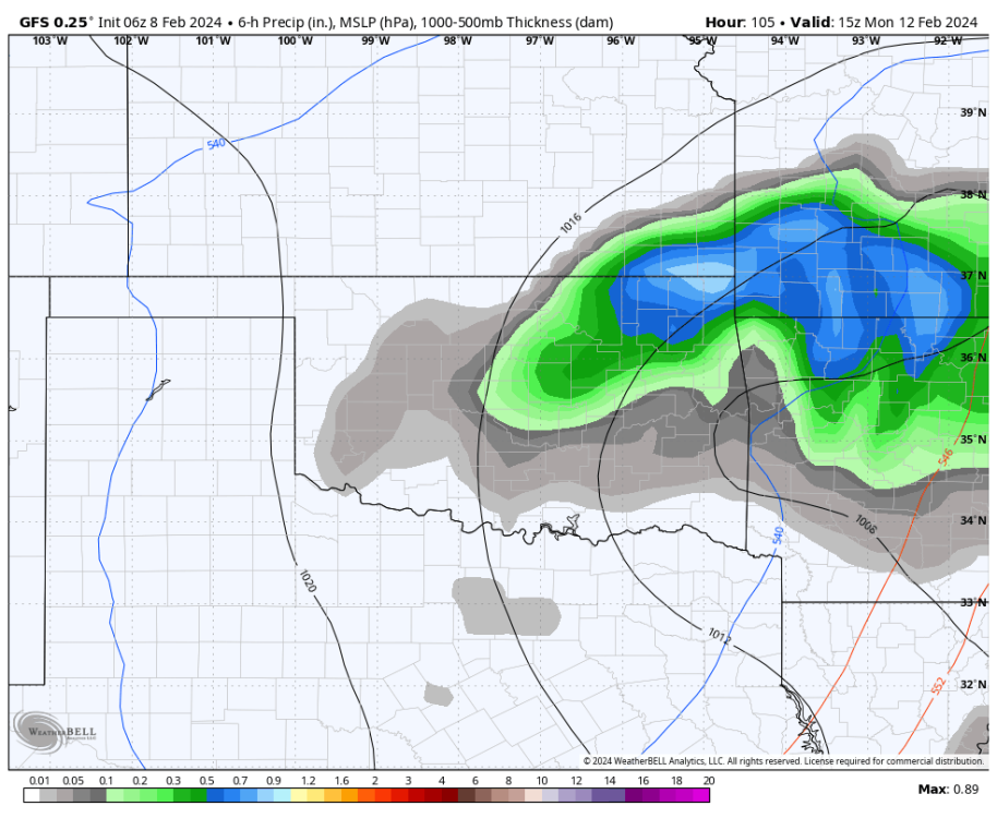
-
2
-
-
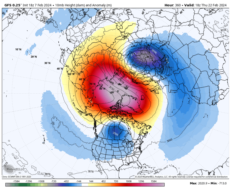
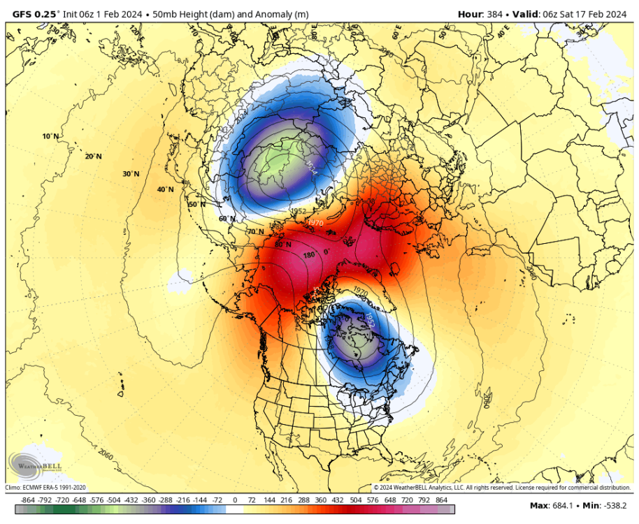
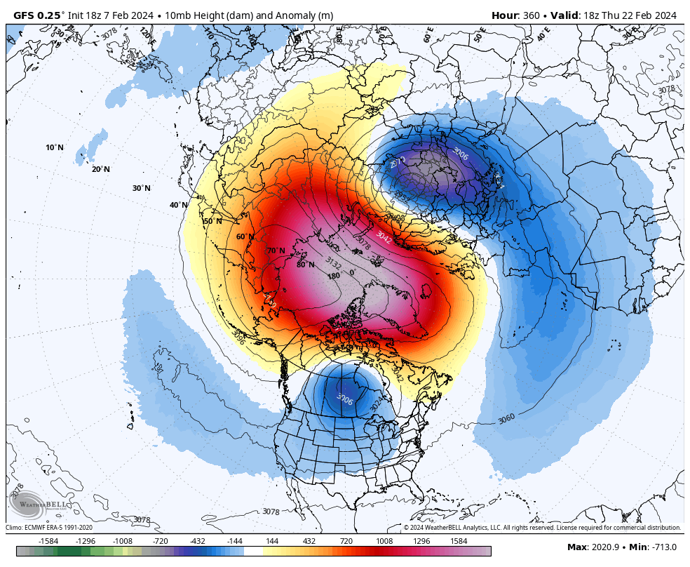
I forgot to post these yesterday when I grabbed them, but a SSW now appears likely with a complete PV split. Easterly flow may extend as far down as 100 hPa across the pole region, which supposedly hasn't happened since 2010. At any rate, this should give us some winter weather potential through mid to late March.

-
1
-
1
-
-
27 minutes ago, Tom said:
Ya, I fully anticipate a strong finish to winter for the Heartland and into the East Coast. The JMA weeklies from yesterday pretty much suggest this also.
Week 2...

Temp & Precip...
Its running a little warm bc its covering next weekend's blow torch but around the 13th or so I think it gets colder.
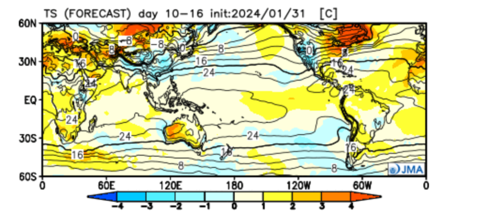

Week 3-4...

Temp & Precip...The GL"s should really fire up in this pattern...
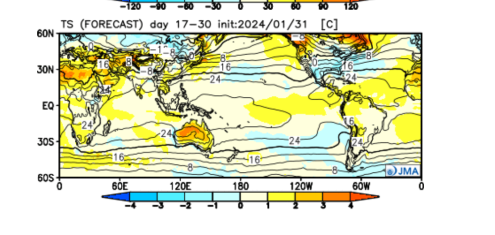

The window has been pushed back a little, but I think Gary's timing that was mentioned above is about what I would say right now. Around the 18th or so and onwards we should at least see a return to colder weather and snow for some. No reason to panic just yet!
-
1
-
1
-
-
I'm exactly at 11" for the water year so far, which is just slightly above average. We will probably get 1-1.5" here with the coming storm cycle, so moisture wise we are in good shape down here.
-
2
-
 1
1
-
-
The 6Z GFS (and other guidance) showing a PV split mid month, so this may keep snow chances alive into mid March.
-
3
-
-
7 hours ago, tStacsh said:
Going to be a fun week or two of winter we have left. Best hope is a strong storm or two later in the month. But this will be remembered as a 10 day winter. It was a great 10 days. Maybe it repeats? But the writing is on the wall obviously for any sustained winter like weather. The UP barely had one. Here is a sad example.

Given the longer range forecast, it may well be that there is significantly more lake effect than is typical for Feb or even early March given the nearly ice free lakes. It won't save winter, but it may help at least.
-
1
-
-
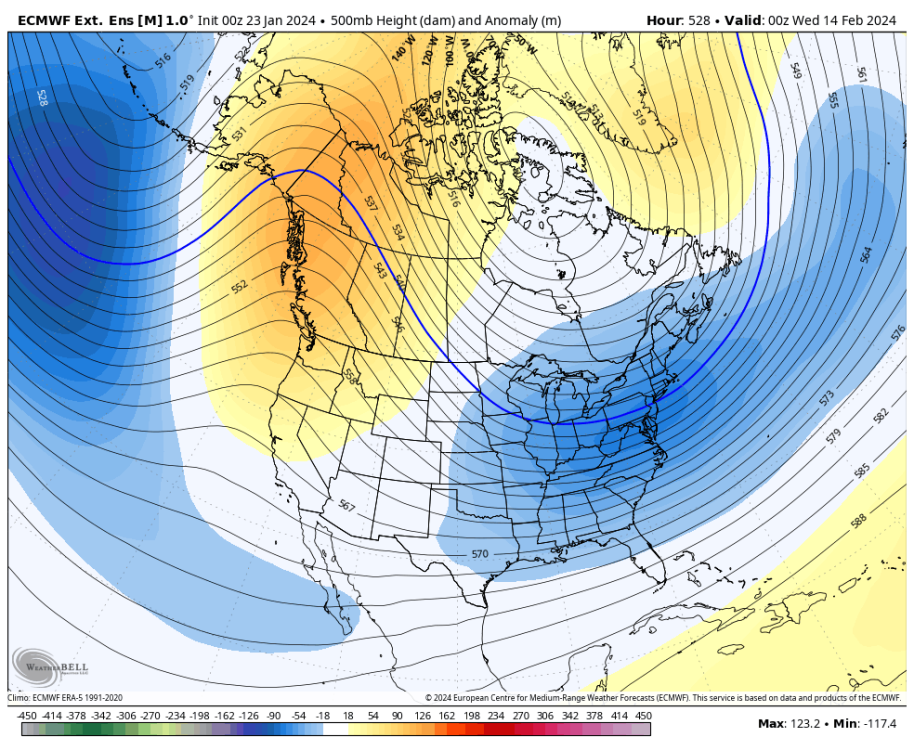
EPS has the trough expanding west towards the +PNA block in the extended. That's a cold look developing for the Plains, but also probably mostly dry if I had to guess.
But it's a big time snow pattern for the southeast and east coast.

-
3
-
-
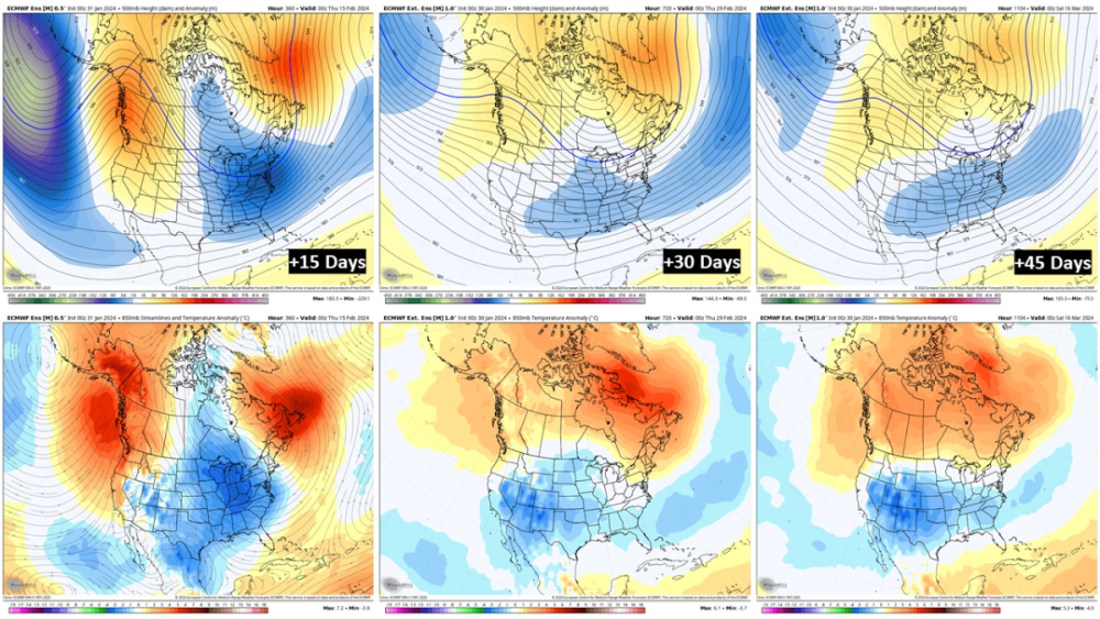
EPS snapshots of the next 45 days. Once we get through the current warm spell it should definitely average colder than normal for the east, and wetter than normal along the Gulf and east coast. I still suspect there will be snow threats for many of us, but difficult to say who at this range...other than that as you go east odds probably go up.
-
2
-
 1
1
-
1
-
-
Warmer than expected today. My thermometer might have been reading a little warm, but still topped out at 70F!
-
3
-
 1
1
-
 4
4
-
-
The first week of the month looks mostly quiet for winter potential. A lot of us should get a good rain Friday-Sunday though. I'd say the 8th-10th may open the door for some snow in the northern Plains at least.
Model guidance is finally looking better in the big picture as we enter the 10th-15th of Feb as a classical +PNA ridge sets up along the west coast, with lower heights across the Plains into southern Canada. This would be a good pattern to send the cold south. Presumable somebody would be getting some snow here:
-
2
-
-
It's been a while since I checked in. We had a lot of cool and foggy days after the ice event but are finally warming up and sunny again. For January my station recorded 3.84". In fact, it may have been slightly more than that since I didn't record hardly anything during our one snow event but either way a well above normal precip month.
Officially, 31.4 degrees for the monthly average temp so far. That will come up a bit, but it'll still be the coldest January since 1985. All in all, we majorly squandered snow potential this month but it still closes the books as cold and wet.
-
3
-
1
-
-
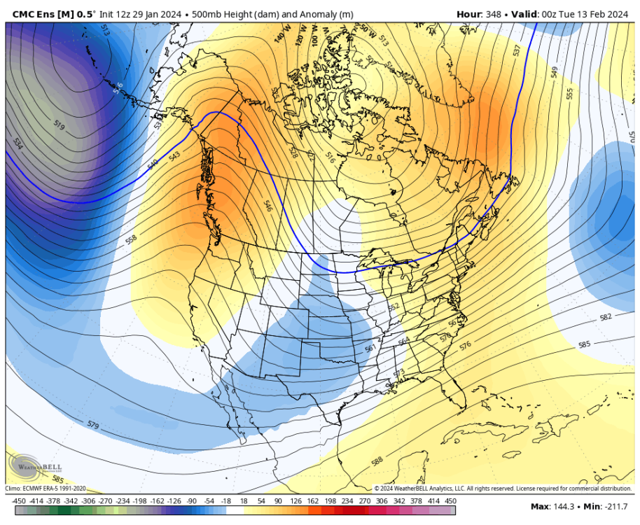
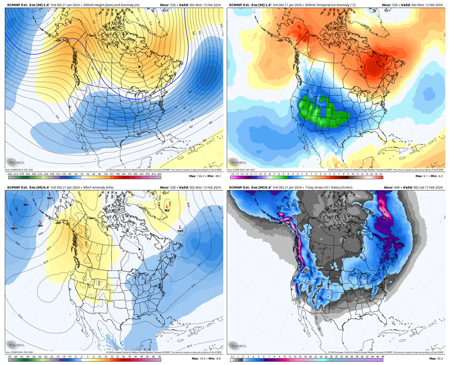
It's time for an update on what we should be expecting as we look into February. Look at this strong 7 day averaged signal for days 8-15:
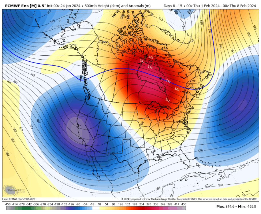
This pattern will be very warm:
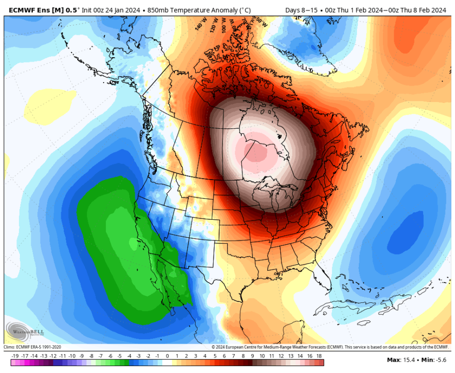
But it will also be very wet:
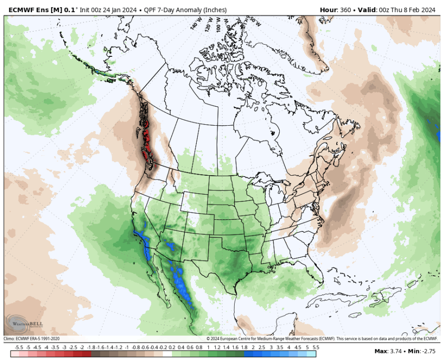
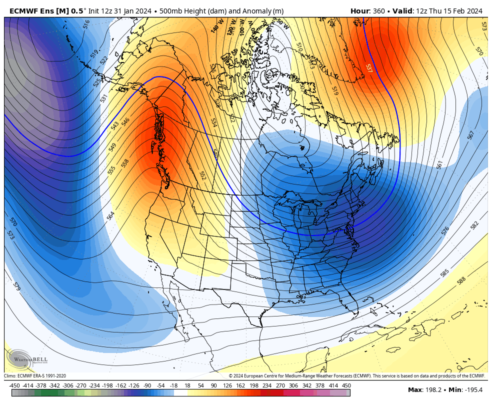
There could still be some snow for areas closer to the mountains that have some elevation. But I think the main story for this period will be mild and very wet weather. Potentially even some flooding. But then as we look ahead towards day 15 we see building heights over AK with colder air coming south:
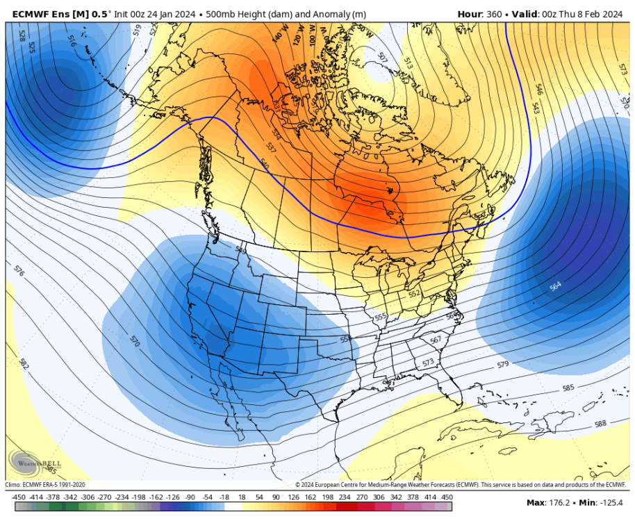
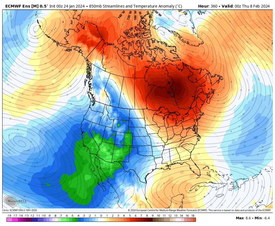
Look a few days later on the EPS extended:
I think that this will return us to very cold conditions by Feb 10-15. We should get some snow chances with this storm track as well, though it may favor areas further east. Should be fun!
-
3
-
1
-
-
The monthly average up to today for Tulsa is 28.6. Based on the current forecast I think that increases to 32.9F (or so) by the end of the month. As long as it stays below 34.1 that would be the lowest January since 1985! It would also be the coldest month in general since December 2000. That's a seriously impressive number.
-
3
-
 1
1
-
-
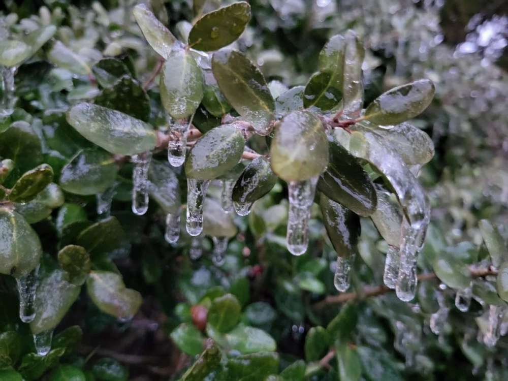
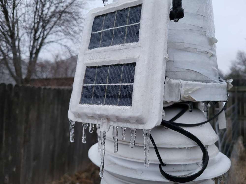
Some pictures I had taken yesterday morning as the ice was wrapping up.
-
5
-
-
Measured 0.2" of ice just now, and it seems to be winding down. It will all be melting off within a couple hours. A short but fun little event.
-
3
-
-
EPS weeklies showing an excellent pattern for that mid Feb period. This would have some serious potential for somewhere in the middle of the country.
-
1
-
1
-
-
It's been icing off and on all night. It's outrageously slippery in my parking lot at work. Took several minutes to go like 100 feet. Pretty good amount of moisture moving in the next few hours, we will see how well it can accrete. There isn't much evaporative cooling potential left at this point.
I'd estimate about 0.1" so far, probably going to get about that much more by daybreak assuming a healthy amount of run off.-
3
-
-
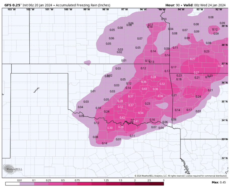
There is now a mix of Winter Weather Advisories and Winter Storm Watches for the area for tonight into Monday morning. There is still a lot of uncertainty with when we warm up tomorrow, but definitely going to get some ice this evening. It'll be an adventure coming into work tonight for my shift.
Guidance is mostly showing .15 to .30" here, so assuming some runoff maybe .1 to .2" of accretion.-
1
-
1
-
-
I saw this thread is 10 years old now. Too bad it doesn't see a lot of activity these days. My family in Utah has all been complaining about all the snow they saw the last month.
-
GFS is still trending up on its latest runs. It even has temps 28-29F Sunday evening with the first round of precip, cold enough for problems!
-
1
-
-
Models seem to still be trending up if anything for ice amounts here. GFS/ECMWF are near 0.2" here, CMC is higher and NAM is lower. UKMET is also probably lower near 0.1". I'm assuming some relatively inefficient accumulation since temps will be right near 32F. Roads will hopefully be ok given that fact.
-
Models seem to be zeroing in on the general area and timing but still with a lot of spread for how much ice.
Forecast soundings continue to show this to be a very marginal situation with only a small area near the surface that is below freezing and its primarily driven by dry air evaporating moisture given the strong WAA just above the surface. It'll be close, and we will probably get something, but I am betting against a big event.
-
1
-
.png.95be66c9306815f89c7dcc71a1354d7d.png)


February 2024 Observations and Discussion
in East of the Rockies
Posted
18z HRRR