Meichel
-
Posts
123 -
Joined
-
Last visited
Everything posted by Meichel
-
That's not very far north, meteorlogically speaking.
-
Just drove from Lake in the Hills to Deer Park and back. 90 minute round trip. Municipalities being stingy with salt thus far. Literally saw 5x as many tow trucks as salt trucks. Most of the roads are sheer ice. Quentin Road closed south of Lake Cook Road. Good times! Edit: hardest snow I saw was in Deer Park. Grass isn't close to covered IMBY
-
Radar returns showing snow over me for 30+ minutes, nary a flake, however. 27º IMBY
-
Nice big, fat, wet flakes here.
-
I still have 3 maples full. Just started turning this week. Hoping this weekend takes care of them.
-
Big surprise to the homeowner whose sliding glass door I had just taken off the back of his house as well. Luckily, it only lasted 20 minutes. Had some sun this afternoon for a bit, Round 1 with the maple leaves in the back yard. I have 6 maples. 4 of them are still solid green, 2 of them red and half bare.
-
Was kicking myself for not bringing my tackle. I know better!
-
Rock Cut State Park, Pierce Lake Saturday Sunrise 34º (put a fill flash on for the foreground to capture that frost) It was a chilly night in a tent with 40º sleeping bags. And Saturday sunset on the same lake. Turned into a beautiful day of full sun and highs in the 60ºs


-
Nice Bass!
-
September 2014 observation and discussions
Meichel replied to tim the weatherman's topic in East of the Rockies
Shhhh. Don't wake it up. I need to make hay this week. Figuratively. (I'm painting outside.) Gotta bank some $$$ to get my plow ready early this year. -
September 2014 observation and discussions
Meichel replied to tim the weatherman's topic in East of the Rockies
Bottomed out at 39º IMBY as well. -
September 2014 observation and discussions
Meichel replied to tim the weatherman's topic in East of the Rockies
I'll bet something was blue..... -
There's plenty of salt. After what happened at the end of last season, however, someone has gotten greedy. This is gouging.
-
September 2014 observation and discussions
Meichel replied to tim the weatherman's topic in East of the Rockies
Total of 1" of rain here. Storm itself was pretty meager. -
September 2014 observation and discussions
Meichel replied to tim the weatherman's topic in East of the Rockies
Those storms were a welcome relief as temps had climbed a good 10º higher than forecast today, and that air was almost too thick to breathe. Sucked that the timing/location/duration of today and yesterdays rains weren't accurately forecast though, at least for those of us who work outside. Example: AREA FORECAST DISCUSSION NATIONAL WEATHER SERVICE CHICAGO/ROMEOVILLE IL 306 PM CDT FRI SEP 5 2014 .DISCUSSION... 1142 AM CDT COLD FRONT IS MOVING THROUGH NORTHWESTERN PORTIONS OF THE CWA LATE THIS MORNING AND SHOULD CONTINUE TO MAKE STEADY PROGRESS SOUTHEAST ACROSS THE AREA THIS AFTERNOON. DEVELOPING PRESSURE FALLS OVER IOWA IN ADVANCE OF SHORTWAVE TROUGH OVER NE KS/SE NE WILL PROBABLY RESULT IN FRONT SLOWING DOWN A BIT THIS AFTERNOON. GOES EAST IS IN RAPID SCAN MODE THIS AFTERNOON AND IS NICELY SHOWING SOME ENHANCEMENT TO THE CUMULUS FIELD RIGHT ALONG THE IMMEDIATE FRONTAL BOUNDARY. IN GENERAL THE CUMULUS FIELD ON SATELLITE AND OUT THE WINDOW LOOKS VERY MUSHY AND LACKING VERTICAL GROWTH...LIKELY DUE IN LARGE PART TO THE VERY FORMIDABLE CAP EVIDENT ON DVN/ILX MORNING SOUNDINGS AND STILL PRESENT IN RECENT ACARS SOUNDINGS OUT OF ORD AND MDW. CONTINUED HEATING AND DESTABILIZATION OF THE BOUNDARY LAYER ALONG WITH FORCED ASCENT ALONG THE FRONT SHOULD EVENTUALLY CAUSE CAP TO BUST...BUT LIKELY NOT UNTIL THE FRONT IS AT LEAST TO A CHICAGO TO PERU LINE IF NOT FARTHER SOUTHEAST. WILL BE REWORKING POP GRIDS TO BETTER REFLECT THIS LINE OF THINKING...INCLUDING VERY LITTLE THREAT OF PRECIP OVER NORTHWEST CWA AND STEADILY DECREASING CHANCE FROM THE NORTHWEST SPREADING ACROSS THE AREA THIS AFTERNOON. POST FRONT RAIN STILL A DISTINCT POSSIBILITY THIS EVENING INTO TONIGHT AS AFOREMENTIONED KS/NE SHORTWAVE TRACKS NORTHEAST INTO THE REGION. Also, in yesterday (last night's?) AFD about where storms would develop, it was mentioned it would be east of I55, when in fact it was well west of I39. (Roughly 100 miles) Does that sound too picky, or would this be considered a bust? Is there something more challenging about the past week's weather that has made it more difficult to predict? -
September 2014 observation and discussions
Meichel replied to tim the weatherman's topic in East of the Rockies
What the hell happened to all the rain tomorrow? Everyone has backed off their totals dramatically! -
august 2014 observations and discussions
Meichel replied to tim the weatherman's topic in East of the Rockies
Was just looking at that myself. Earlier I was fortunate enough to get one while baking on a deck I was working on, and then received only a few drops of rain. Interesting weather day, considering how muggy and warm it started, and also what has pretty much blown right by/over me or dried up right before it got to me. -
Snow!!! 3/4" diameter flakes here. What an awesome May morning....
-
Nature/Weather/Earth Pics
Meichel replied to westiztehbest's topic in Climate, World Weather, and Earth Sciences
Washington, IL Tornado Just saw this for the first time the other day. A former softball teammate who I also coached (our daughters) with is the driver for this chase team. Pretty nicely broken down. Had no idea he was a weather geek until he started posting some stuff on FB last summer! Enjoy. -
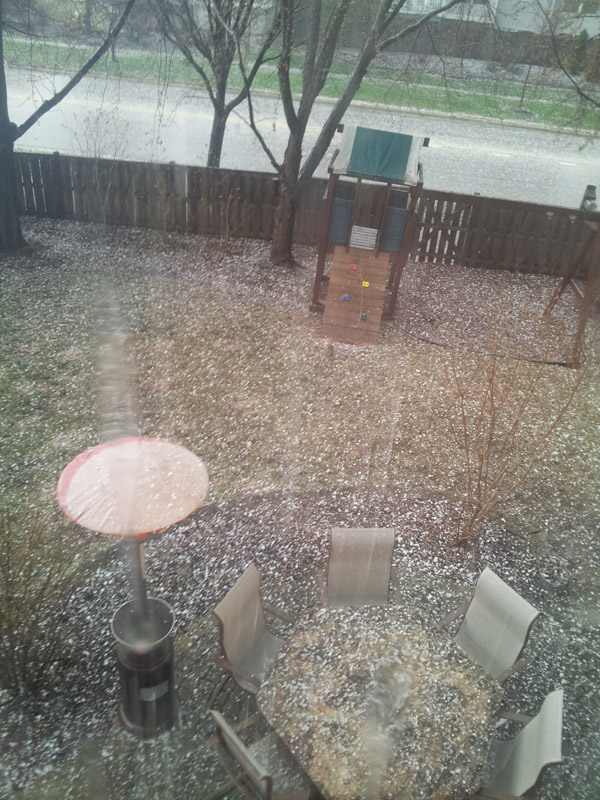
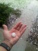
That 2" piece was mushroom shaped (as about 1/3 of all the pieces were) and looked to be 3 or 4 pieces fused together. Biggest piece that was smooth/round was 1.5" Dents on vehicles for sure, haven't checked the roof or aluminum siding. The storm chaser contractors will be out in full force here next week.
-
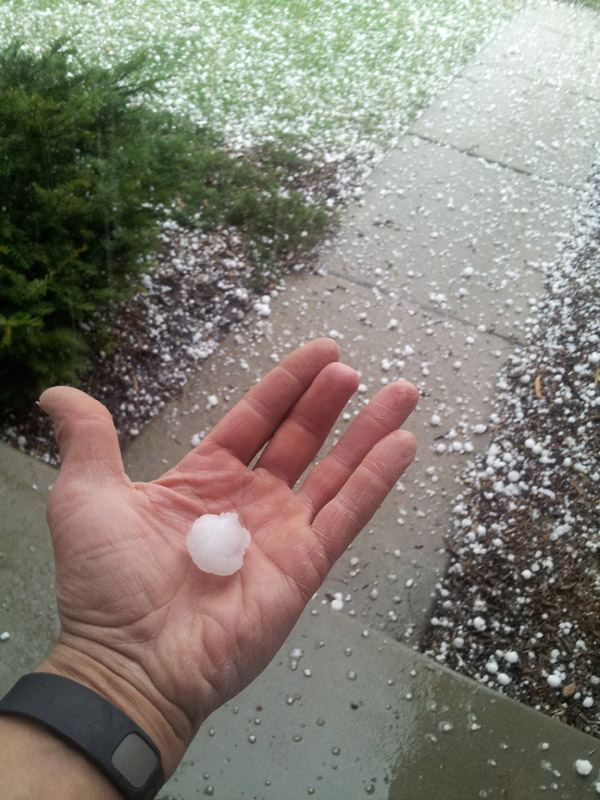
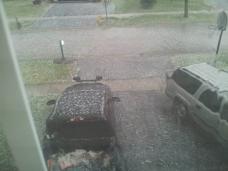
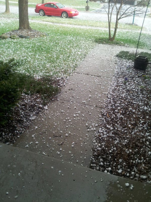
Had very little in the way of wind here when it passed through. 15mph gust max. Not much rain either. It's weakened considerably since heading east. Found a coupla pieces of hail closer to 2", and a majority of the pieces were around 1".
-
1.25" was the biggest.

-
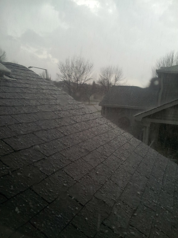
That first one will miss me to the north, second (larger) one headed toward me. We'll see how much energy it has left once it gets here. 1.5" hail reported near Cherry Valley/Rockford. Either my eyes are playing tricks on me, or the radar seems to indicate rotation.
-
35º overnight here as well. Up to 52º already under full sun, light SE breeze.
-
Hey Geos, I noticed with the new boards that the Flash version of the Weather Underground stickers are allowed. Link to my PWS weather page on mouse-over as well. Good stuff!