

.jpeg.3a024d4b702f7a1d37ccc50cc74d07e5.jpeg)
MR.SNOWMIZER
-
Posts
14194 -
Joined
-
Last visited
-
Days Won
92
Posts posted by MR.SNOWMIZER
-
-
18 minutes ago, SilverFallsAndrew said:
Heading towards the sweet spot!

Heck yah bring it on
-
 2
2
-
-
4 minutes ago, TacomaWx said:
Yeah right when I got there it was about 4”. Mostly melted by the time I left I’m back in Tacoma now. Totally epic the amount of snow they had up there was awesome!
I still have 3 inches on the ground but I'm higher than that spot. In Feb 19 there was 5 feet up there at the top
-
21 minutes ago, TacomaWx said:
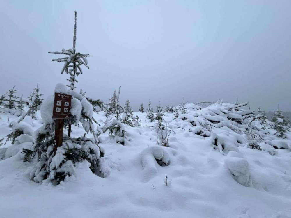
Green mountain on the kitsap peninsula.
I live 2 miles as crow flies from the trail head. Was there about 4 inches there? They usually get a little more than me?
-
1 minute ago, Cascadia_Wx said:
Yeah, I thought we would see a bit more sticking snow the last few nights. I was happy with the 1/4” we got yesterday morning, but I was sort of thinking last night would be similar or even better. Instead there was a light rain snow mix much of the night and it never got below 35.
More precip has moved in today though, and it’s sitting at a very chilly high of just 39 so far. Hopefully something organized can move in during the peak time tonight or early tomorrow morning. Might be the last shot for the lowlands of NW OR and SW WA with this pattern.
We have been incredibly lucky to get this pattern, mountain are in decent shape now. If we hadn't had this last week we would of been much worse off
-
2
-
-
Some storm totals from ski resorts in the Sierra are around 80 inches storm total and still snowing. Incredible
-
4
-
-
13 minutes ago, TacomaWx said:
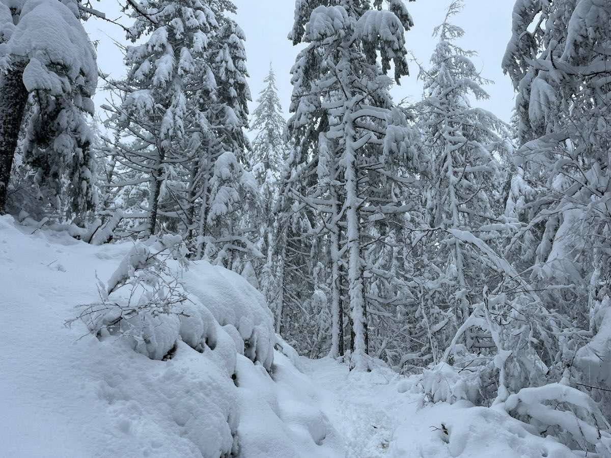
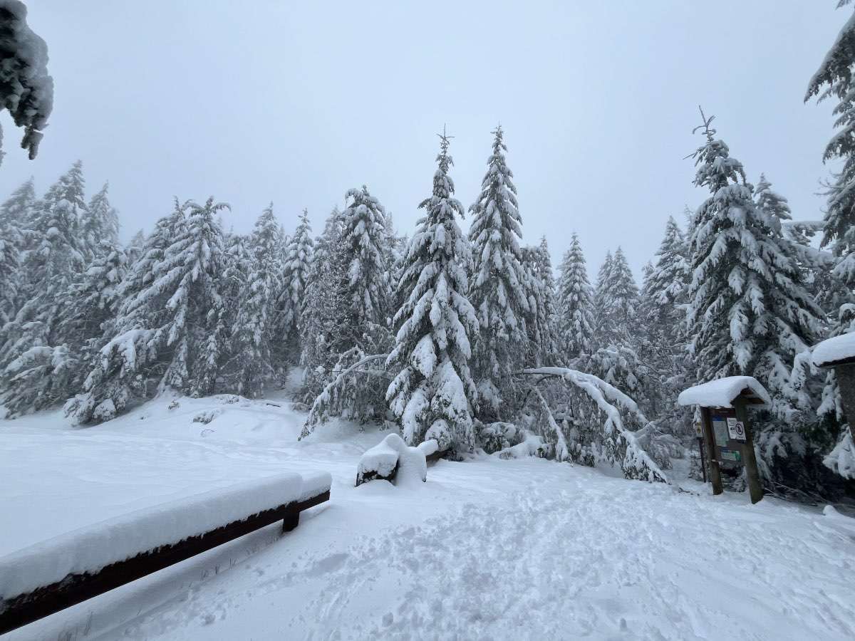
@MR.SNOWMIZER about 20” or so at the top. Tons of trees leaning over. Most snow I’ve seen here personally.
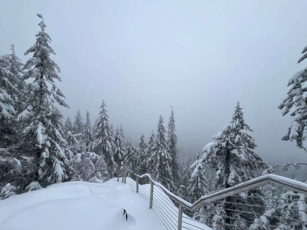

For the elevation they get crazy snow.
That is about how much models tried to give me, they had the precipitation amount pretty close just about 2 degrees to warm.
-
1 minute ago, SilverFallsAndrew said:
I understand, you have been completely hosed in this pattern. I wouldn't mind it either, it would be nice to get some work done outside. But you can clearly see the pattern retrograding toward the end, that would dovetail nicely with the idea of late month troughing.
I'd like to keep this going as long as possible and then get nicer in April. We need maximum snow in mountains and then we can have a nice green spring
-
5
-
 1
1
-
-
12 minutes ago, TacomaWx said:
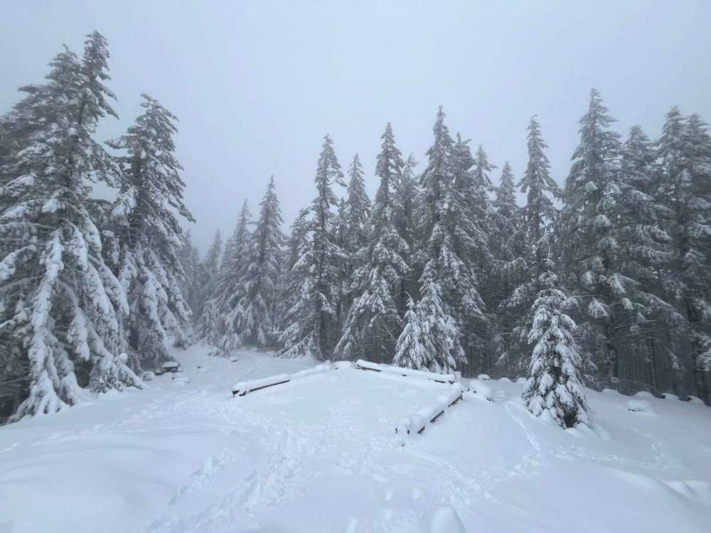
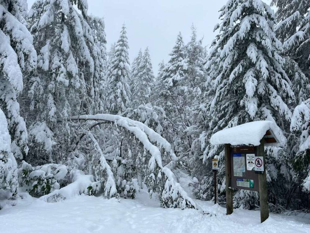
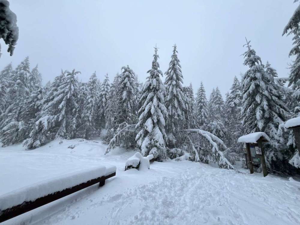
A holy sh*t snow dump at 1400’ not even to the top yet and there’s about 16-18” of snow. About 4” at the bottom trailhead.
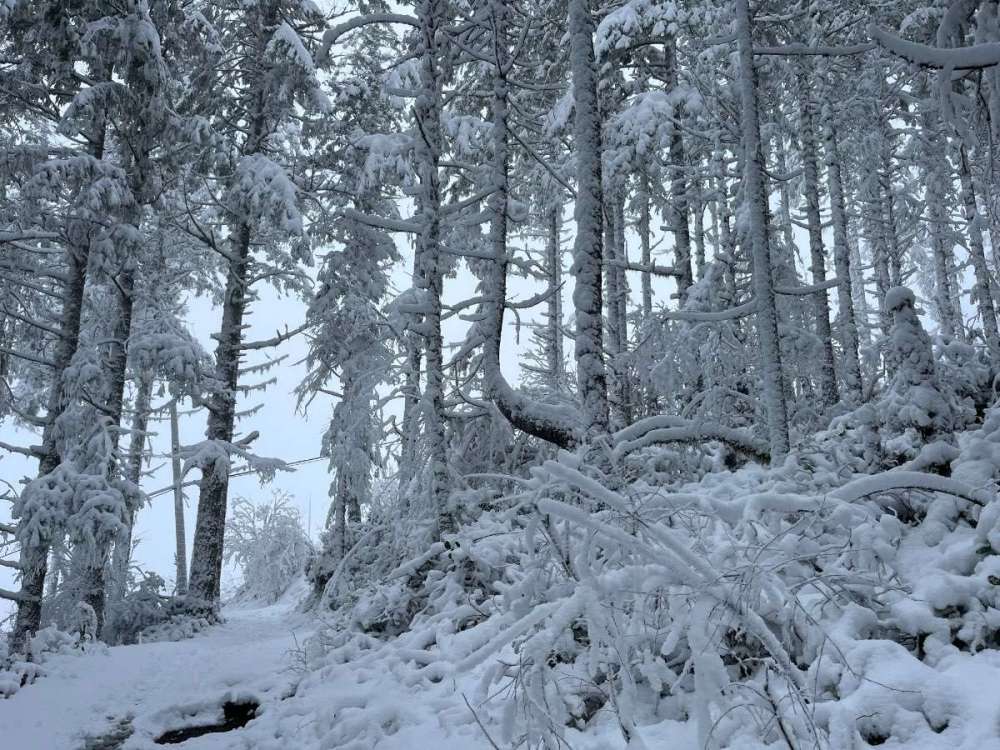
Told ya there would be over 1 foot
-
31 minutes ago, TT-SEA said:
Pretty sure we had 40 inches on the ground here at the peak in February 2019.
You did, I had 30 0r 32 and you had around 40 I remember. Was that the deepest depth you've seen there?
-
12 minutes ago, SilverFallsAndrew said:
We'll see. My one fear for next winter is that we have screaming zonal flow and that cold air is bottled up to the north. Will still feel like winter though either way! We could be looking at an unprecedented -ENSO event. Nothing in the post 1950 era really compares to what some of the models are showing.
What is the deepest depth you have ever had there?
-
10 minutes ago, SilverFallsAndrew said:
We'll see. My one fear for next winter is that we have screaming zonal flow and that cold air is bottled up to the north. Will still feel like winter though either way! We could be looking at an unprecedented -ENSO event. Nothing in the post 1950 era really compares to what some of the models are showing.
That is the excitement for me is the new territory or unexpected possibilities.
-
Man I'm not sure what to expect this evening, I see a nice batch of showers building out there that look to rotate right under the Olympics again later. Looks like a good cell headed this way soon that will probably drop another inch maybe. Temp steady at 33
-
2 minutes ago, SilverFallsAndrew said:
We've been absolutely blasted with S winds this entire event. At times gusting 30-40mph. Winds are fairly light today so far, though I see SLE has been gusting around 30mph.
I'm really getting excited for next winter, word is out, even my girlfriend said next winter is supposed to be crazy haha.
-
1
-
-
2 minutes ago, TT-SEA said:
Not expecting anything here during the day except some non-accumulating light snow. ECMWF shows the south wind really ramping up by early afternoon... but you might be protected from that.
Nope I've had strong south winds with all this snow, didn't matter today. Must just be colder air.
-
2 minutes ago, TT-SEA said:
12Z ECMWF is another notch north with the deformation band on the north side of the low moving inland tomorrow night. Clips King County on this run.
Crazy, the shower activity looks to be building on the coast again, not finishing with snow today here
-
3
-
-
Next time a huge storm is forecast to hit lake tahoe I'm going, not that bad of a drive and I'd lobe to see a blizzard for 2 days
-
4
-
-
Com on AL give us a blizzard update and pics!
-
Some crazy vids coming out of the Sierra Nevada. Massive drifts. Talk about an awesome climate up there, sometimes the wait for snow can be agonizing but when it hits it hits in a big way
-
1
-
-
That band that moved through here was a 5 inch per hr rate cell. Since this cold on shore flow started I've had a total of 7 inches.
-
3 minutes ago, Port Angeles Foothiller said:
I have been in the shadow for days now. Cold, but sunny. Moisture stops in the mountains.
You should score tonight as that low moves in
-
3 minutes ago, SilverFallsAndrew said:
Can't wait to get a report from AL.
He had 28 yesterday and was expecting 12 more but it looks like the area got another 20-25 since then.
-
1
-
-
Snow is still coming down hard at Tahoe, its been relentless since yesterday
-
1
-
-
Cabin had a high of 29 yesterday and a low of 9 last night. Man that area can pull off some crazy lows.
-
2
-
-
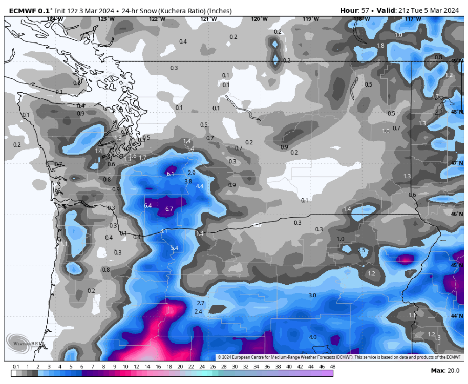
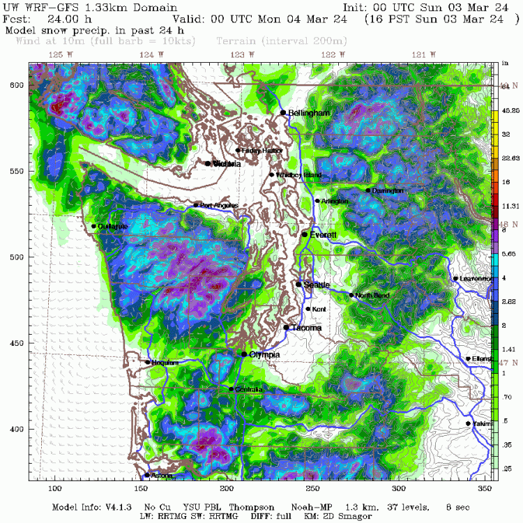
5 minutes ago, ShawniganLake said:
When you say mm5 are you talking about the WRF GFS. This is what it showed through 10am from the 0z yesterday
This one but this goes a little longer. I didn't figure anything would stick much today.


March 2024 Weather in the PNW
in West of the Rockies
Posted
Hood canal area had 3-5