Brian_in_Leavenworth
-
Posts
3545 -
Joined
-
Last visited
-
Days Won
7
Everything posted by Brian_in_Leavenworth
-
PSA: The NWS always appreciates observations, especially detailed observations that everyone on here is capable of giving. That can be done thru Twitter, as they often set up a feed for that, or the mPing app. That can include final snowfall amounts, when the snow starts/stops, precip type, dew point, etc This helps them with short term forecasts as well as future forecasts as they can learn from them. A few years ago they had a freezing rain advisory for Leavenworth, but I notified them that the rain was not freezing, temps were above freezing and the roads were fine. They thanked me and told me that they were able to cancel the zr advisory thanks to my observations. So yes it helps. We all want better forecasts. Yes, more $ to build better models helps, but the more data they have, the better. And it can also help to inform the public about conditions. This will be even more helpful during the possible freezing rain event later this week. Instead of just complaining about forecasts not verifying, let's be a part of the solution.
-
Some of the frames are missing from the run on the site that I use, but it looks like mid to late January has potential.
-
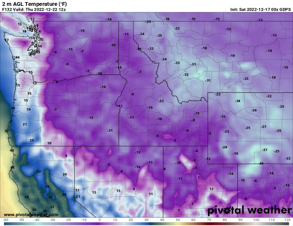
Snyder said the high resolution models have been horrible. They were horrible in November with the first cold snap. Snowfall predictions were even worse.
-
Snyder streaming now
-
I've wondered how exactly they calculate that. And its for the 500's. A model could get that right and still get temps wrong and precip wrong.
-
I can see that over there, especially with models often getting the temp wrong. And I'm not sure Pivotalweather.com's formula is the same one the NWS uses.
-
-
Not true at all where I live. We often have snow ratios in excess of 15:1 and the traditional 10:1 is useless. NWS Spokane uses it
-
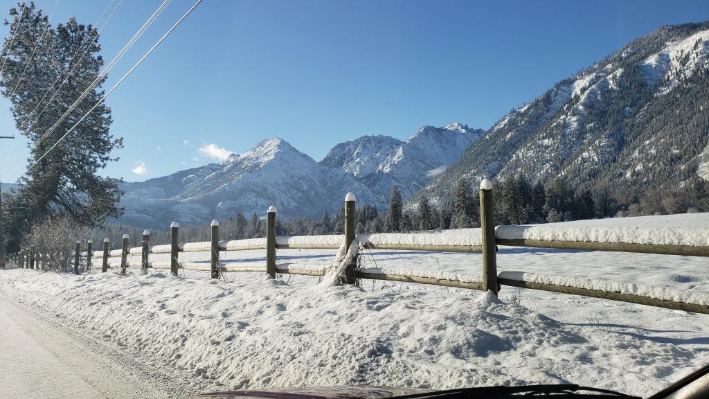
So there was police action Friday night. Someone called in a threat to a local business, so they had a shelter in place order for awhile. Turns out to be a false alarm. 3rd time something like this had happened in the last couple of years. Police don't know I'd they are related. They shut down the live cameras so people can't watch it. Not sure why, maybe to discourage people who do this because they might get a thrill, or maybe if it was a real threat they don't want a criminal to have an advantage because they can watch the cops. They should have turned it back on by now. I'll try to tweet at them to remind them to turn it back on. Currently 20, temp hasn't budged all morning. Very light snow, like a flake here and there. Not expecting much today, more later this week. Probably close to 24 inches on the ground.
-
Snyder with a new video. Of course he mainly focuses on Washington. youtu.be/9RJe6w1cnqY
-
Like Randy said, a quarter inch or more. Branches start to break, you get power outages, etc. One thing though is if the precip starts as accumulating snow, the freezing rain on top of snow on the road is a lot better than freezing rain falling on bare pavement. So driving in that situation is not as bad. But freezing rain falling on tree branches full of snow makes that situation worse.
-
Does the inevitable warmup keep on getting pushed back?
-
I lived in the condos right behind the store, and that is where the bus stop is, so I always took the bus back and forth downtown to work during snow. But with the steep hills there, especially the gate just before the store, so many people would park at the bottom of the hill.
-
I used to live in Sudden Valley. It was beautiful there when it snowed. (Pretty nice in the Summer too).
-
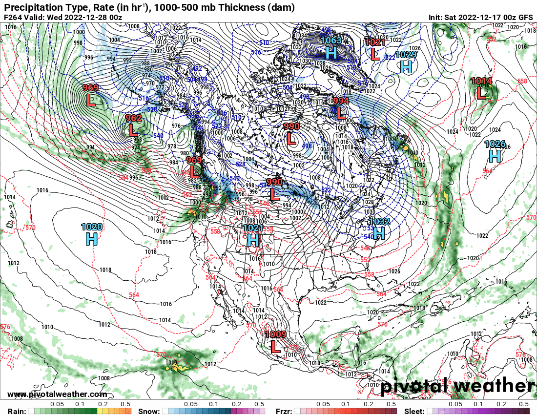
Would seek hard to imagine the atmospheric layer would be 30 degrees warmer than the surface. Obviously a lot of uncertainty, NWS is really broad brushing now, but for now only mentioning snow for CDA, more likely Thursday night and highs Friday in the low 20s.
-
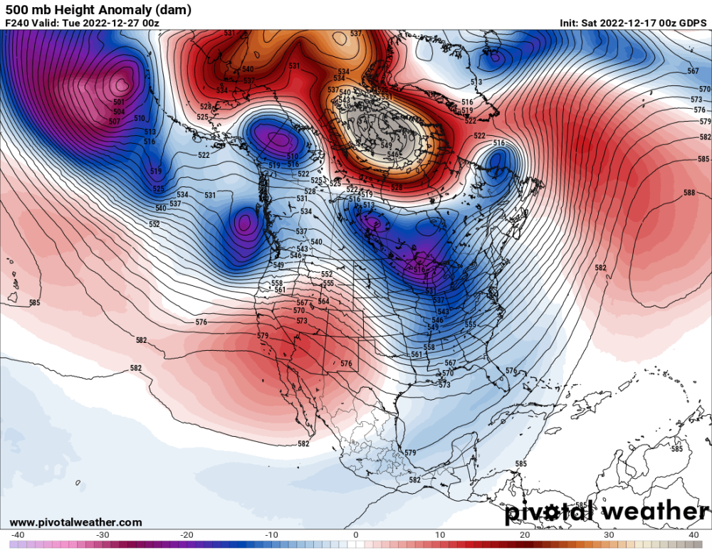
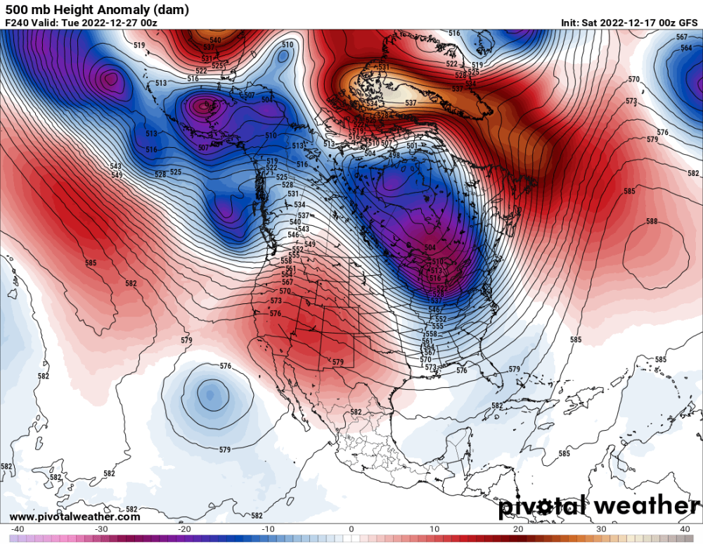
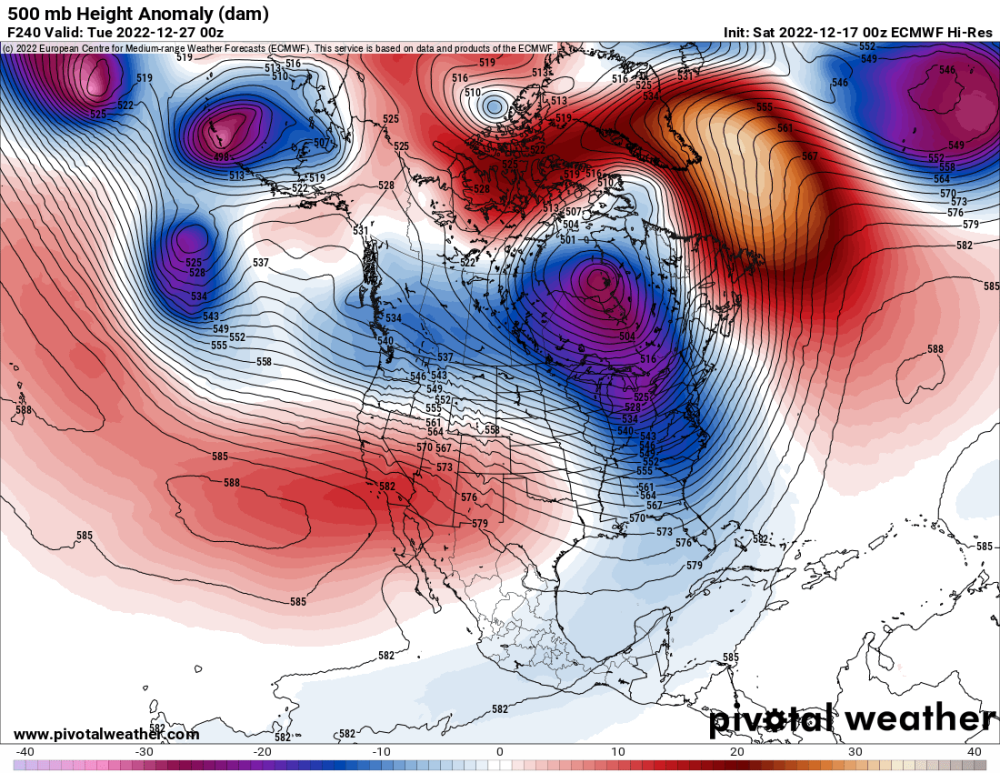
And now add the Euro to this also day 10
-
-
What was interesting to me is 1) It's a big change from previous runs, and 2) good agreement with each other. A recent ECMWF run had a very warm pineapple express. This looks more seasonal temp wise.
-
Looking out further than I should, I find this interesting. Day 10 on GFS and GEM
-
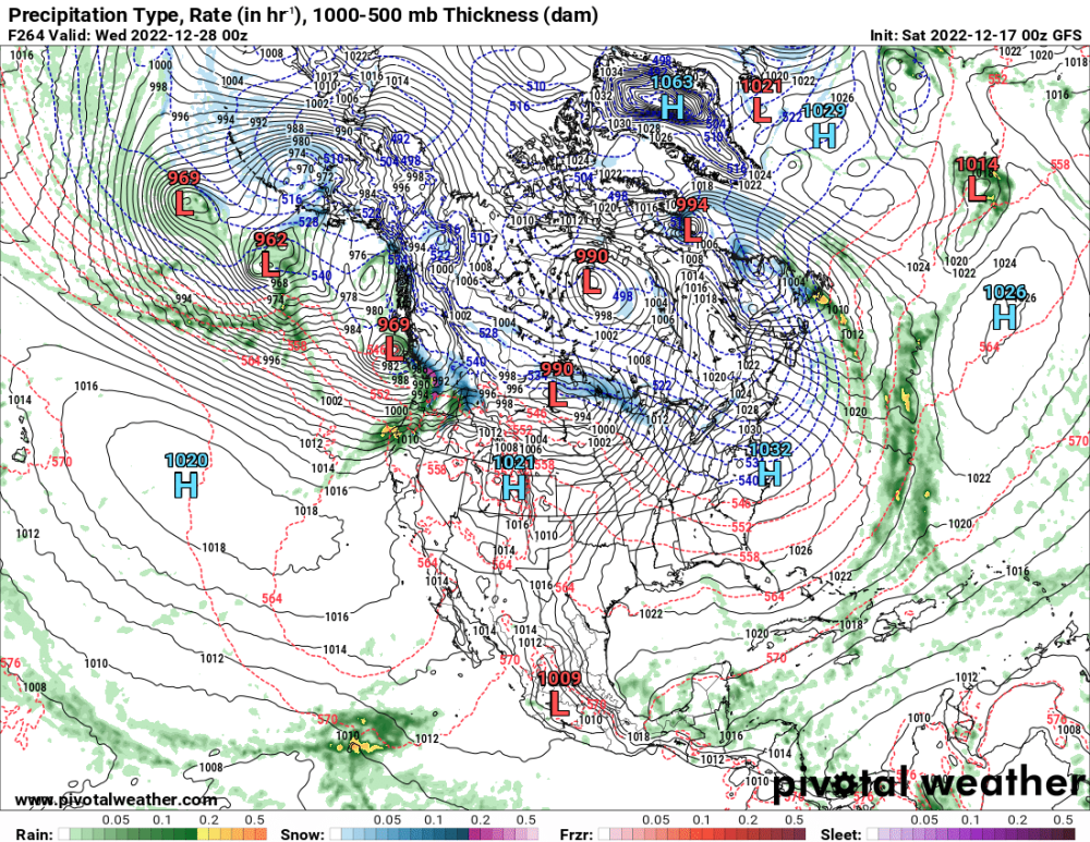
Don't know if this means anything or not. On the operational, there is a low pressure system developing off the BC coast. What Jay Albrecht was talking about. You see it on the 18Z GEFS but NOT so much on the 0Z GEFS. 18 GEFS 00Z GEFS

-
-
-
Yes, the GEM doesn't develop that low pressure by Haida Gwaii.
-
People in Washington don't give a sh*,t about what Mark says either. Of course he is a Washington homer, it's where he lives and forecasts. And he has talked about snow possibilities for Portland Western Oregon
-
Sorry for the blue highlights, I don't know how to change that. DISCUSSION... Tonight through Sunday Night: Weather changes are in store as a blocking upper ridges amplifies off the coast allowing a cold upper trough to carve out over western Canada. Not much change in the weather through Saturday morning with continued stratus and areas of freezing fog. The stratus will again limit temperature drops tonight with lows mainly in the teens to low 20s. Saturday afternoon into Saturday night as the upper trough drops south with an advancing arctic front, broad isentropic ascent develops below 700mb as winds back to the southwest. Several models are generating light snow across Eastern WA, northern mountains, and the ID Panhandle and thus have gone above NBM POP's especially Saturday night into Sunday. Yet with the air mass is dry above 700mb, and thus the shallow nature of the precipitation should yield light snow amounts. The exception is along the Cascade crest and Central Panhandle Mountains where upslope flow will enhance snow totals. A mid level wave passing through Sunday afternoon into Sunday night along with an arctic front beginning to make inroads into the area will likely give another boost to the snow. For now have issued a Winter Weather Advisory for the Central Panhandle Mountains where confidence is highest of moderate snow amounts of 4-7". For the remainder of the ID Panhandle, Palouse, and Spokane area 1-2" is possible by Monday morning with local amounts of 2-4" under heavier snow bands not out of the question. Another area of higher snow amounts will be along the Cascade crest with 5-10" possible. But with the westerly flow amounts away from the crest should be much lighter in the 1-3" range. JW Monday through Friday: A weakening ridge along the coast will give way to a series of quick moving troughs through the period. With a decent moisture plume, widespread snow showers are expected across the Inland Northwest. Temperatures will continue to be cold with overnight lows in the low teens and single digits. The wave from Sunday will continue to exit the region on Monday. It will primarily impact Southeast WA and lower ID Panhandle as it exits the region. It is indicating good chance of 1 inch of snow for most of the low lying areas. The higher terrain can expect amounts near 3 inches through Monday. The next wave will be late Tuesday and Wednesday morning. Confidence of snow amount with this wave a decreased as models have pulled back on the moisture support. It continues to have decent west to east zonal flow. The Central Basin has less than a 20% percent chance of an inch. The Cascades and ID Panhandle mountains have a greater than 30% chance of 6 inches or more through Wednesday morning. Wednesday morning is expected to be coldest morning with widespread single digit temperatures across the Basin. The wave on Thursday and Friday will bring warmer temperatures and more moisture with it. It is the warmer temperatures that is limiting the confidence of potential widespread snow for the low lying areas. While it will start as snow, it is expected to transition through the day to a wintry mix and freezing precip across the Basin. It will be another round of snow for the mountains though but potential amounts are not expected to be significant.