


gabel23
-
Posts
2306 -
Joined
-
Last visited
-
Days Won
5
Posts posted by gabel23
-
-
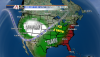
Honestly I can't recall a tougher forecast for our area in a long while. The mini blizzard of April a couple years ago comes to mind with this forecast, biggest difference is what falls?! You can see anything from .25" of ice or 3-4" of snow......
-
00z NAM:
http://i.imgur.com/DTDAr6m.pnghttp://i.imgur.com/ea32cdF.png
I like to see that, 18z nam had most of the precip freezing rain, I would gladly take that.....granted temp profiles will be the biggest player.
-
Very interesting, I'm not gonna lie I was pretty much expecting nothing major but things now look horrid for turkey day. Gonna be a very close call between freezing rain, sleet or snow. I'm hoping we see mostly sleet and snow more than freezing rain. I have to travel back and forth from David city and Shelby. Add the fact I have my big team scrimmage Friday morning and that has me very worried; nothing worse than high school kids trying to get to practice in freezing rain! We all hate sleet but.....give us that rather than freezing rain!!
-
Ha, that's funny. We don't stand a chance at much of anything with the AO/NAO being positive. Systems are just too darn progressive....
-
What's crazy is looking at all of the GRID's in Iowa, already they have rain likely next week around thanksgiving. This coming after the fact that a lot of the state north of I-80 received 10+ inches of snow.....flooding next week?!
-
Congrats to all with the snow, enjoy!! It's hard to say I'm not jealous, hopefully our luck will finally change this year. It has been a very rough couple years for us but things have to change eventually. One thing is certain, the Iowa and Purdue game tomorrow morning at Iowa City will be brutal, I hope Iowa holds serve so the huskers can ruin their run at the CFP next week on Black Friday!! GBR
-
 1
1
-
-
What a storm, if this was all snow I would have seen 2 feet plus! I ended up with 1.8" of rain and some heavy snow with huge flakes this morning. I wasn't in town all morning as I teach over in rising city but the roads were slushy and ground was covered white. Has been a very wet couple weeks and hopefully next time around this storm produces all snow!! Below is Hastings summary of the storm, including just the second ever recorded tornado in November for the CWA!!
-
That would not be a boring winter is the least for either of us.
I think there will be large swings in temperatures all winter long. Kind of like 2007-2008, but maybe not quite that wet.
For sure, he mentions kc will see a wild swing with weather. If that jet stream is the dominant feature, all of us will be in for a hell of a winter and severe weather season.
-
Here is a teaser put out by Gary Lezak tonight, once piece of the LRC this year. He mentions this will be one pattern we will see repeat this winter. The one caveat to the winter......near to above average temps nation wide.
-
12z Euro pretty much agrees with the high rez models on the shift eastward...
Correct me if I'm wrong, the comma head is currently undergoing formation?? Another deformation zone is setting up right over central/western nebraska? This is crazy, but I would think for sure this storm system would have rung itself out by now! Looking at the national radar, its impressive seeing the stream of precip out in front of the low, and another area of precipitation forming over nebraska.
-
1
-
-
4km NAM in your favor CNW!
Gabel might get snow accumulation now.
Cold air is pressing more south and east.
Holy cow that baby is knocking on my door!! Quiet the surprise considering I thought there was no way i was going to have a chance at snow.
-
That is crazy! North Platte now included in the Blizzard warning, they are looking for 10-14" of snow. I picked up .90" of rain over night, hoping to see more and maybe a little snow to end it.
-
Has a ways to go before I see any of the white stuff....I just want a heavy dose of rain and for this storm to cycle back and affect me in the heart of winter!! I'll gladly take the rain, I recently tilled up part of my lawn and put a big load of chicken crap on it. Come this spring time hopefully a lot of precipitation has fallen and allows that soil to mellow out.
-
might be time to start a thread for Friday's system. Here is the latest Euro at 15:1 ratios, that's just what I clicked on, so know this is a tad high in all likelihood.
http://i.imgur.com/UhnRdGE.png
Can you repost, the map isn't showing up?! Thanks!
-
It can be found at this link. I haven't read it myself but I hear its a good introduction but its math based. Anyway if you are thinking about getting into weather give it a read and ask questions if you have any. Or it could be useful if you have a single topic you want to learn about.
I have always loved weather and was good at math. In fact I was originally a meteorologist major but the fact I couldn't get thru the higher levels of math did me in. Interesting book though to say the least, thanks for sharing!!
-
I think I might also take advantage of today's weather and put up at least my Christmas Lights on the gutters/bushes. Thinking about heading to AZ this coming week for Thanksgiving and the last thing I'd want to have happen is there to be snow on the ground when I come back and no decorations. I made that mistake in 2010 (I think) and never again! The way the pattern is evolving on the Euro Ensembles, you guys out there only prob have a few more nice days remaining before it turns cold/wintry.
Got to take advantage of the nice weather!! I start basketball practice tomorrow so my time will be limited. I don't mind putting my timers up in cold weather, the lights not so much. I'm hoping we can get a decent snowpack going around or after thanksgiving.....nothing makes the lights look better than a deep snowpack!!
-
1
-
-
GRI (Grand Island, NE) 39.4"
FSD (Sioux Falls, SD) 48.7"
OMA (Omaha, NE) 37.3"
AAO (Wichita, KS) 25.1
TUL (Tulsa, OK) 13.6"
MCI (Kansas City, MO) 21.2"
STL (St. Louis, MO) 12.5"
DSM (Des Moines, IA) 45.5"
MLI (Moline/Quad Cities, IL/IA) 42.5"
LSE (La Crosse, WI) 52.4"
MSP (Minneapolis-St. Paul, MN) 56.6"
AUW (Wausau, WI) 60.6"
MKE (Milwaukee, WI) 41.2"
ORD (Chicago, IL) 43.1"
IND (Indianapolis, IN) 20.1"
GRR (Grand Rapids, MI) 83.3"
DTW (Detroit, MI) 40.7"
CLE (Cleveland, OH) 70.2"
All average snowfall are the 30 year average between 1981-2010.
Three tiebreakers, just in case...
#1: Greatest snowfall; in one storm, for Omaha, NE. 11.1"
#2: January snowfall total for Chicago, IL. 11.1"
#3: Greatest lake effect snowfall total for Grand Rapids, MI in January. (Will have to pay close attention to this one... events can last for a few days) 11.1"
-
What a gorgeous day, I was able to put up quite a few of my x mas lights. I hope to finish tomorrow, things look wet next week. I'm very excited to see lezaks winter forecast.....I'm a little worried about the lack of arctic air so far this fall. Will be interesting to see how much that plays into the LRC.....
-
1
-
-
Winds rapidly increasing in the middle of IL. this evening. More storm firing out ahead of the cold front.
http://climate.cod.edu/data/nexrad/LOT/N0Q/LOT.N0Q.20151112.0102.gif
My bet is that these new storms will mix down some higher wind gusts.
Hell of a line of storms coming for you guys, enjoy! I was impressed with the severe weather today, will be interested in the official tornado count in Iowa.
-
Ended with .80" of rain and a trace of snow. Overall nws did a good job for my area with this forecast; I can wait to see this storm next time around with the LRC.
-
It's getting real in Iowa, confirmed tornadoes!!
THE NATIONAL WEATHER SERVICE IN DES MOINES HAS ISSUED A
* TORNADO WARNING FOR...
NORTHEASTERN MADISON COUNTY IN SOUTH CENTRAL IOWA...
NORTHWESTERN WARREN COUNTY IN SOUTH CENTRAL IOWA...
* UNTIL 330 PM CST
* AT 304 PM CST...A CONFIRMED TORNADO WAS LOCATED 5 MILES EAST OF
WINTERSET...MOVING NORTHEAST AT 40 MPH. -
Heavy snow falling here. Ground is almost completely covered!
Still waiting for my change over.......hoping for a little thunder and lightning too!!
-
I'm now included in the WWA!! Should be an interesting commute home tonight after school.....
STROMSBURG...OSCEOLA...SHELBY...POLK...
YORK...SUTTON...HARVARD...CLAY CENTER...EDGAR...FAIRFIELD...
GENEVA...EXETER...FAIRMONT...FRANKLIN...HILDRETH
122 PM CST WED NOV 11 2015
...WINTER WEATHER ADVISORY IN EFFECT UNTIL 8 PM CST THIS
EVENING...
THE NATIONAL WEATHER SERVICE IN HASTINGS HAS ISSUED A WINTER
WEATHER ADVISORY...WHICH IS IN EFFECT UNTIL 8 PM CST THIS
EVENING.
* IMPACT...A PERIOD OF SNOW COMBINED WITH INTENSE WINDS WILL
RESULT IN REDUCED VISIBILITY THAT AT TIMES COULD FALL BELOW ONE
QUARTER MILE...MAKING TRAVEL DIFFICULT.
* SNOW ACCUMULATION...1 TO 2 INCHES OF SNOW POSSIBLE...WITH SOME
BANDS OF HIGHER AMOUNTS POSSIBLE. EXPECT SOME VARIABILITY IN
SNOW AMOUNTS.
* TIMING...RAIN WILL MIX WITH AND CHANGE OVER TO SNOW FROM WEST-
TO-EAST...PRIMARILY THIS AFTERNOON. THE BACK EDGE OF THE MAIN
SNOW BAND SHOULD CLEAR THE EASTERN EDGES OF THE ADVISORY AREA
BETWEEN 6 AND 8 PM.
* UNCERTAINTY...TEMPERATURES WILL BE BORDERLINE BETWEEN RAIN AND
SNOW. IF TEMPERATURES ARE SLIGHTLY WARMER...THE PRECIPITATION
WILL FALL MORE AS RAIN INSTEAD OF SNOW. IF COLDER TEMPERATURES
OF 32 DEGREES OR COLDER ARE REALIZED...SNOWFALL AMOUNTS MAY
SLIGHTLY EXCEED THE CURRENT FORECAST.
* WINDS...NORTHWEST WINDS WILL REMAIN STRONG ALL DAY WITH SPEEDS
OF GENERALLY 35 TO 40 MPH...AND SOME GUSTS TO OVER 50 MPH.-
1
-
-
Tornado warning....
A TORNADO WARNING REMAINS IN EFFECT UNTIL 1245 PM CST FOR
NORTHWESTERN OTOE COUNTY...
AT 1219 PM CST...A SEVERE THUNDERSTORM CAPABLE OF PRODUCING A TORNADO
WAS LOCATED OVER UNADILLA...OR 25 MILES EAST OF LINCOLN...MOVING
NORTHEAST AT 35 MPH.
HAZARD...TORNADO.
SOURCE...RADAR INDICATED ROTATION.
IMPACT...FLYING DEBRIS WILL BE DANGEROUS TO THOSE CAUGHT WITHOUT
SHELTER. MOBILE HOMES WILL BE DAMAGED OR DESTROYED. DAMAGE
TO ROOFS...WINDOWS AND VEHICLES WILL OCCUR. TREE DAMAGE IS
LIKELY.


Thanksgiving Day - Black Friday Storm System
in East of the Rockies
Posted
Oax calls for 2-4" of sleet/snow for Columbus, which is 20 miles to my north, while Hastings nws calls for .10" of ice and a half of an inch of snow/sleet for me. In my opinion that's a forecast that says I have no idea what is coming.