


Front Ranger
-
Posts
31439 -
Joined
-
Last visited
-
Days Won
61
Posts posted by Front Ranger
-
-
1 hour ago, TacomaWx said:
One thing that this may (so far) has lacked is the convective activity we had in 2023. Had some nice storms on 5/3/23 and 5/15/23.
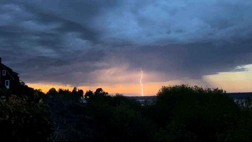
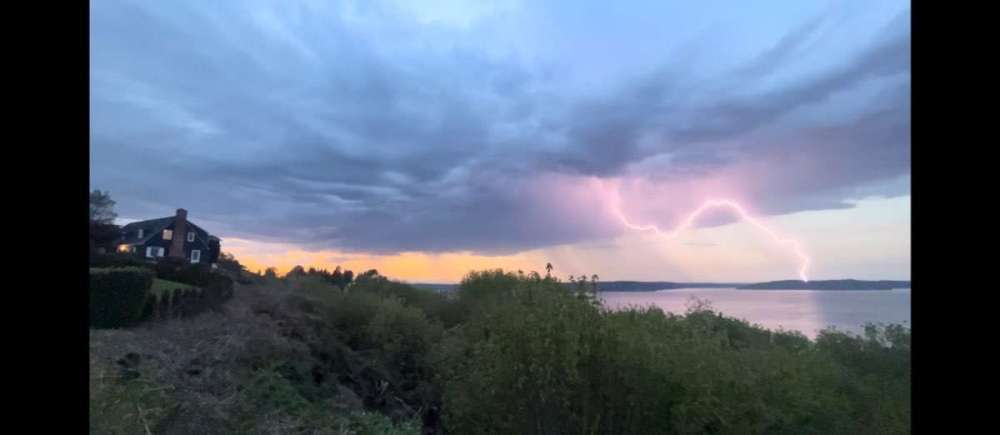
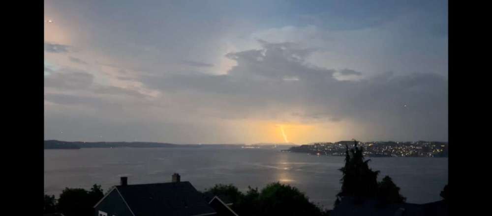

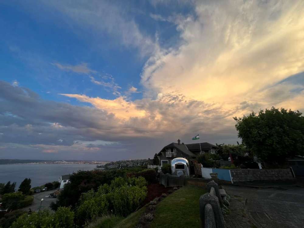
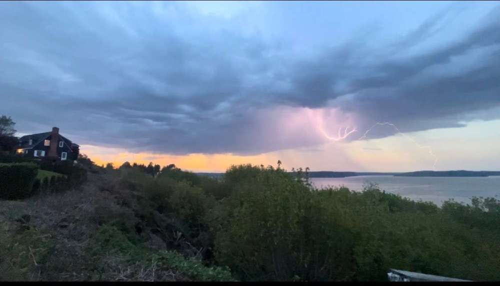
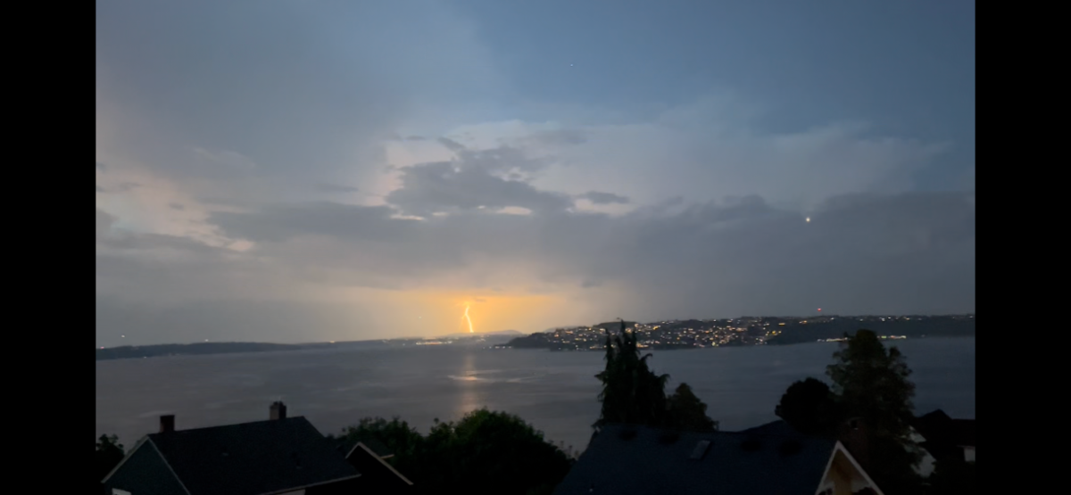
Lightning over water is my favorite.
-
10 minutes ago, SilverFallsAndrew said:
12z isn’t bad.
GFS and CMC are both onboard with no second round of ridging and a nice clipper days 9-10.
Last night's Euro still didn't budge...
-
 1
1
-
-
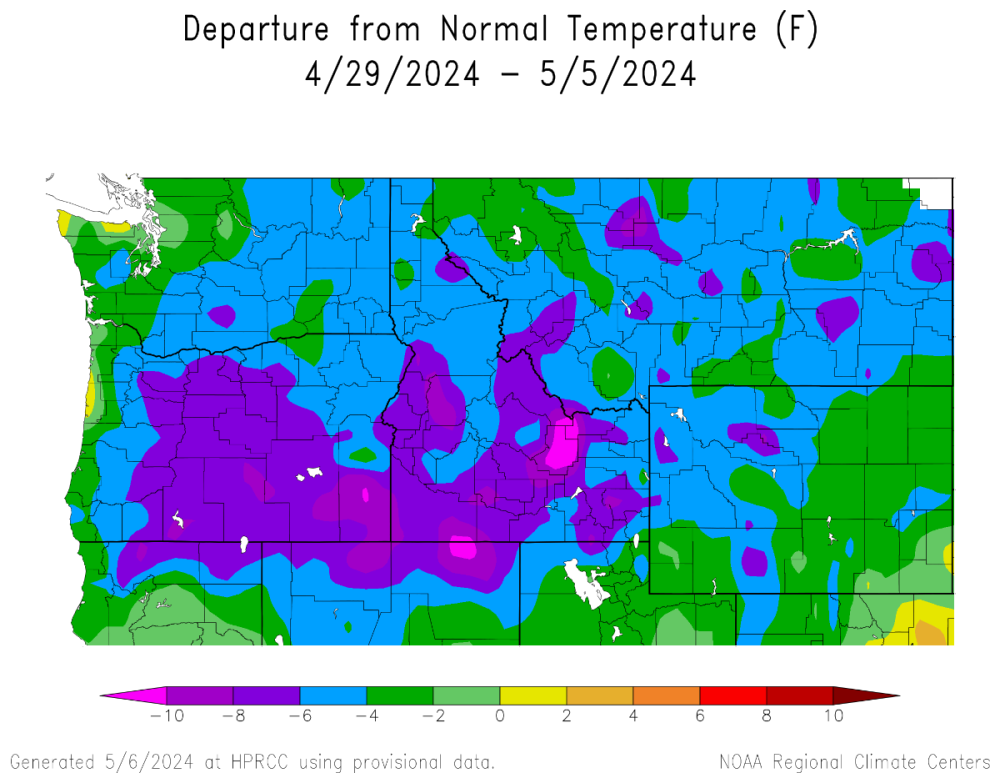
This will end up being the coldest first week of May in quite awhile for parts of the Willamette Valley. 2022 and 2012 were also both quite cold, but it looks like 2024 may top them at some locations.
-
 1
1
-
 1
1
-
-
CMC is notably cooler days 8-10. Let's see if Euro moves that direction.
-
 2
2
-
 1
1
-
-
19 minutes ago, Phishy Wx said:
no, 10 would be though, thats how norms are factored and revised
Tell that to the NWS. They use 30 year periods for climo norms.
-
1 minute ago, SilverFallsAndrew said:
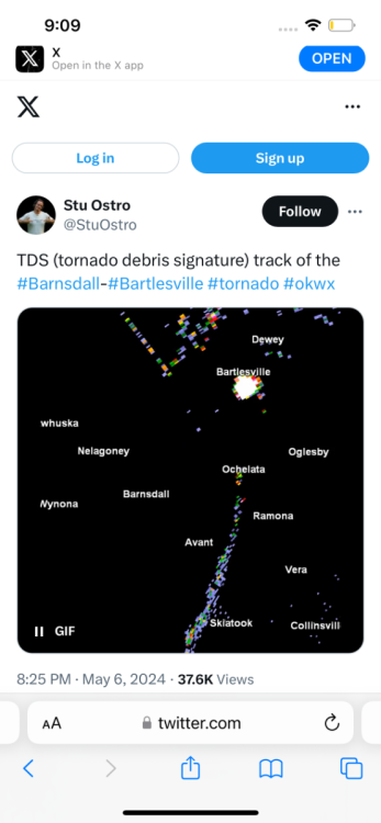
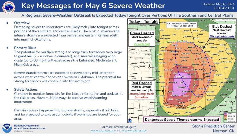
Yikes. Am I reading that right as a direct hit on Bartlesville based on the big ball of debris around there?
-
 1
1
-
-
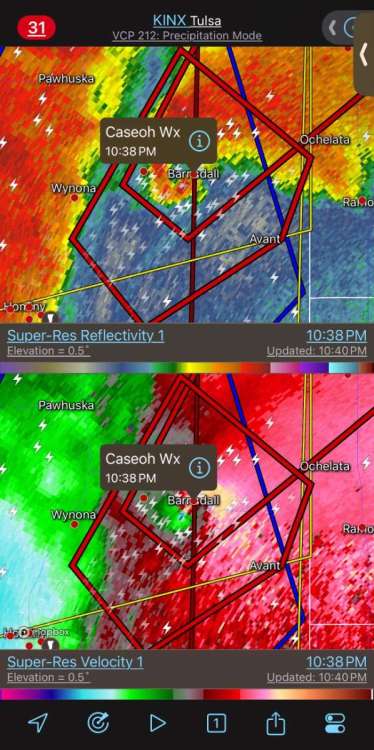
1 hour ago, Phil said:
This chaser is going to wind up dead. You never want to get that close to a nocturnal wedge.
-
1
-
-
7 hours ago, Phishy Wx said:
that's approaching a trend, Climatological change may be around the corner if that keeps up
You really think 3 years is anywhere close to climatological significance...
-
1 hour ago, TT-SEA said:
@Front Ranger caught the beginning of the Nuggets game on TNT and they had some aerial shots of Denver... trees are still surprisingly bare there going into second week of May.
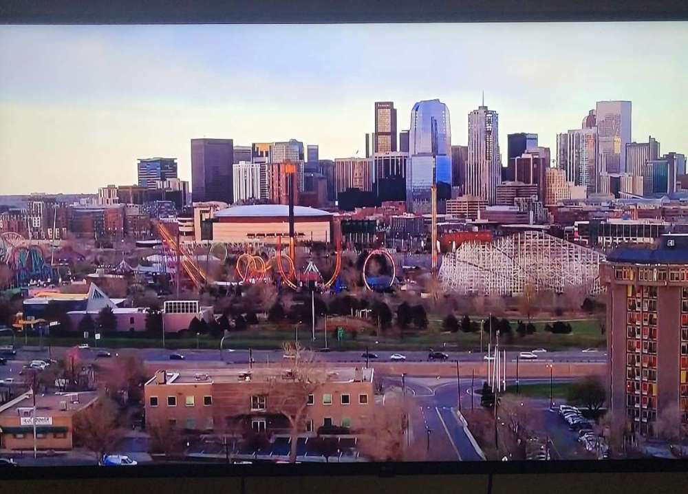
Depends on the species. Flowering trees are in full bloom right now.
-
3
-
-
26 minutes ago, Phishy Wx said:
Couple weeks? that's a 6 day period
Look at the sentence above. Separate statements...the one above the map says the past week.
-
 1
1
-
1
-
-
2 hours ago, Phil said:
OK/KS is gonna be wild today, wish I were chasing.
Extremely windy here last night. Definitely some powerful jet dynamics in play.
-
 1
1
-
-
12 hours ago, TT-SEA said:
Yes... overall its been decent. The last couple weeks have been crappy though. Par for the course. There are probably 1 or 2 more periods like this coming up before we get to our annual warm/dry period.
Past couple weeks have seen the most sustained cold anomalies of the year. Though late February/early March was close, the period starting 4/24 should end up cooler for longer (with a couple more cool days today and tomorrow).
The past week has been impressively cold for this time of year, especially in OR.
-
1
-
-
2 hours ago, Cascadia_Wx said:
What a beautiful morning out. Moderate rain with a temp of 47, after a low of 46. The green is so intense out there it’s hard to put into words.
Up to .15 on the day already with showers backfilling from the east again. 1.6” since Friday afternoon, with over an inch falling yesterday alone. Ended up with a 52/47 spread yesterday.
Looks like SLE set a daily rain record yesterday with .99", as did downtown Portland with .96".
Looking like 48 hour storm totals will be right up there with some of the May biggies for the Willamette Valley. The 1.31" EUG saw om Friday was their biggest one day total in May since 1972.
-
1
-
 1
1
-
 1
1
-
-
4 minutes ago, TT-SEA said:
12Z ECMWF 850mb temps are white hot over western OR all the way out at day 10.
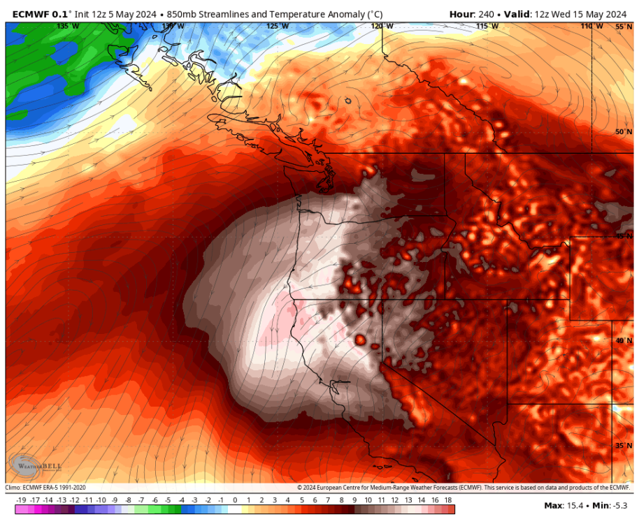
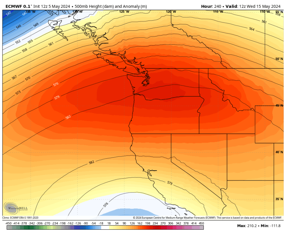
GFS way cooler. And GEM has the middle ground.
-
22 minutes ago, SilverFallsAndrew said:
I've been agreeing with @Front Ranger a LOT lately. Better check my temp.
This should be of grave concern for both of us.
-
1
-
 1
1
-
-
2 minutes ago, TT-SEA said:
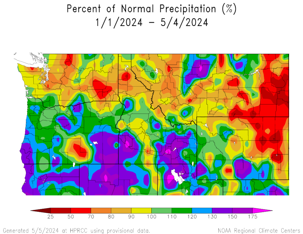
HQM looks drier than normal there... but actual data shows +3.69 inches for the year.
I don't believe anything for King County. SEA WFO and Snoqualmie Falls/North Bend are right around normal for the year with no missing data.
I really think the WRCC maps always lean drier than reality because it incorporates too many stations with data issues. And missing data for rainfall always skews things drier than reality.
Yep. But the overall theme is clear. OR has been MUCH wetter than WA so far this year.
And there should not be any real drought concerns for the vast majority of the PNW after Tuesday.
-
1
-
-
1 hour ago, SilverFallsAndrew said:
Looks like another 1.5" or so here. We are already over 3" on the month. May here is still a fairly MOIST month with average rainfall of around 4.5".
SLE has already blown by their monthly average precip for May.
I also see they are running -5.0 for the month. Meanwhile, PDX running -2.8

-
1
-
-
Striking. Though as Tim has pointed out in many different ways, there are some issues with some of the Seattle area numbers.
-
1
-
-
1 minute ago, SilverFallsAndrew said:
That's cool, Tim. I don't live in Portland.
I don't live in Salem either, but it is the closest major station and much more representative of the conditions we experience here... Once you see this you will square my previous statements a little better...
Maximum 4-Month Total Precipitation
for SALEM AP (MCNARY FIELD), OR

Rank, Value, EndingDate, MissingDays
1, 30.92, 2017-04-30, 0
2, 30.07, 1996-04-30, 0
3, 28.49, 2012-04-30, 0
4, 28.05, 1894-04-30, 0
5, 27.85, 1983-04-30, 0
6, 27.42, 1999-04-30, 0
7, 27.40, 1937-04-30, 0
8, 26.99, 1961-04-30, 0
9, 26.80, 1953-04-30, 0
10, 25.88, 1974-04-30, 0

Period of record: 1892-12-01 to 2024-05-04
My brother got married in Salem in April 2017. It rained at the wedding! But also sunned.
-
5 hours ago, SilverFallsAndrew said:
Things were better then.
Thanks, Nixon!
-
1
-
-
14 hours ago, TT-SEA said:
UHI hot spot of SEA:
March 0.0
April -1.0
May so far. -1.7 and dropping!
Scorching spring.
Once the 30 year average caught up to the UHI increases, the hotspot anomalies changed.
-
1
-
-
18 minutes ago, TT-SEA said:
Yes... because Nina summers have been so cold lately
Hottest summer ever in Seattle was in 2022... a year with wall-to-wall Nina.
I know your point is that that summer was very warm, and obviously it was, but the "hottest ever in Seattle" stat is a joke. 2015 or 1958 hold that distinction at almost every other somewhat reliable long term station in western WA besides SEA. Including the Seattle city office station.
It was definitely the hottest July/August on record for the region.
-
1
-
1
-
-
Not light rain in Salem!
-
9 minutes ago, TT-SEA said:
Bellingham might get totally skunked.
6z Euro continued to be more generous for the Seattle area at least, compared to GFS. But the GEM also moved drier with the 12z run, so good chance the Euro does as well.


May 2024 Pacific Northwest Weather
in West of the Rockies
Posted
Buy, buy, buy!
Seems like the Euro has been folding more lately.