mlgamer
-
Posts
802 -
Joined
-
Last visited
Everything posted by mlgamer
-
Just got my Winter Weather Advisory for 2-4". Yay..............
-
There was a general consensus of KS and MO being within the target zone for many days though there were questions about the thermals which I believe most folks were aware of. It has now trended mostly into NE and IA more or less since yesterday. I think that's how most KS and MO folks will look at it. Even local NWS offices issued watches that may not be needed.
-
I think the disappointment for some is the storm taking a decisive turn north late in the game.
-
Waiting to see what the 00z suite of models have to say...I'm not sold on the more northern solutions just yet.
-
If this turns into a Dakotas special, then I've seen everything. lol
-
Hey @Clinton, I see you're in a watch now! Enjoy!
-
January 2024 Observations and Discussion
mlgamer replied to Minny_Weather's topic in East of the Rockies
And after having a +7.0(F) temp anomaly in December this is getting to be a large turn around here and for a large part of the sub as well. -
January 2024 Observations and Discussion
mlgamer replied to Minny_Weather's topic in East of the Rockies
Very picturesque out there today as we wait for Monday's storm!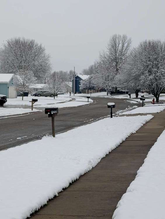
-
January 2024 Observations and Discussion
mlgamer replied to Minny_Weather's topic in East of the Rockies
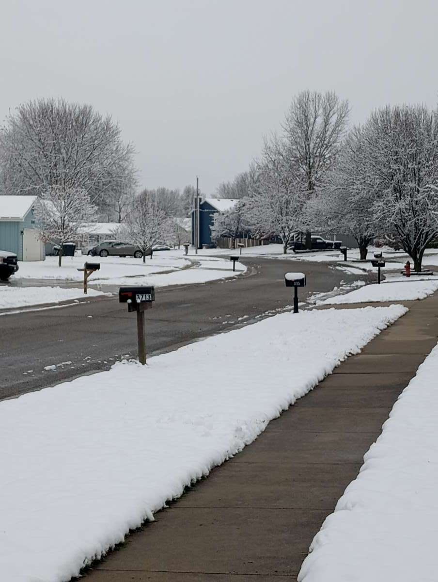
I measured 3" on the ground here a bit ago from yesterday's snowfall. That was more than forecasted and I bet another 1-2" melted with the temp above freezing at times. Nice way to get things started for the upcoming week of winter weather! -
00z GFS...If I had to complain about anything, it would be the SLP doesn't really deepen until it has passed me by to the east. Pretty whiny I know...lol
-
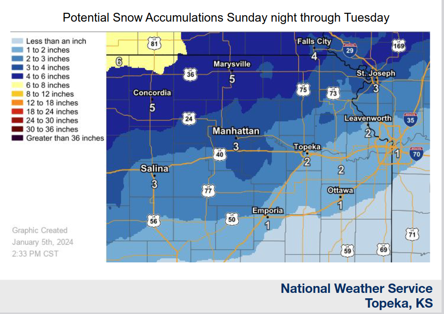
Wow...Topeka NWS is not the least bit impressed with this system. I'm guessing they're thinking warm thermals but who knows. Here is their initial snow forecast map...
-
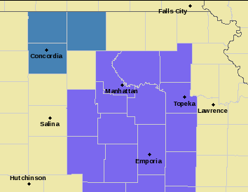
NWS Topeka has initially issued a three county watch for this system for up to 6" of snow towards north central KS including Concordia. Not sure what their thinking is yet or if a wider area is coming later. (Edit: I see @gabel23 mentioned this in his post above.)
-
January 2024 Observations and Discussion
mlgamer replied to Minny_Weather's topic in East of the Rockies
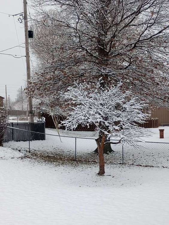
Yeah, me too! I just measured a solid 1.5" on the ground from this first system to set the table. Even got added to the WWA to boot...lol!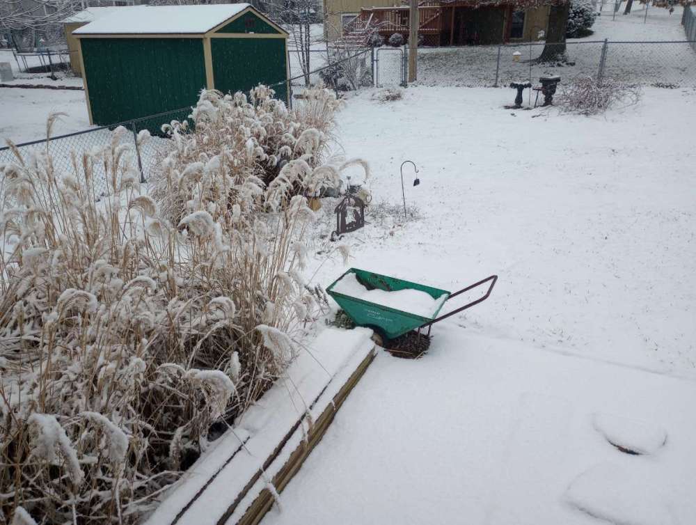
-
Funny thing...I've always thought that exact same thing living where I do. lol
-
January 2024 Observations and Discussion
mlgamer replied to Minny_Weather's topic in East of the Rockies
Amen. It has been a long time coming...so hopefully it does get here! lol -
January 2024 Observations and Discussion
mlgamer replied to Minny_Weather's topic in East of the Rockies
Here's a look at today's snow moving in. A preview of things to come? VID_20240105_100909455.mp4 -
Yeah, that 18z GFS looks a lot better as others have noted and I thought it might come around again. Of course, it does put me in a snow hole but nothing to be concerned about for now.
-
Pretty much all of that in southern KS is from the 1st system. System #2 is a no show...darn it. lol
-
In regards to the LRC, I think the CMC solution is the best match from the 12z runs this morning. Thus, I am somewhat optimistic the GFS and Euro could trend a little more favorably for MBY in future runs.
-
January 2024 Observations and Discussion
mlgamer replied to Minny_Weather's topic in East of the Rockies
I think you can add Topeka to KC area to this list. What looked promising earlier now looks very marginal at best with either strength, track or cold air problems. The ensemble means have looked better, but still things not looking all that good at the moment. -
January 2024 Observations and Discussion
mlgamer replied to Minny_Weather's topic in East of the Rockies
Indeed. CMC stays north and GFS too warm for storm #2. Trends have not been good. -
January 2024 Observations and Discussion
mlgamer replied to Minny_Weather's topic in East of the Rockies
Interesting snippet from Wichita, KS afternoon (12/31) AFD: "A look ahead into late next weekend and early next week (7-9 days out)...Deterministic and ensemble consensus supports an anomalously deep/strong western CONUS trough ejecting onto Mid- America. Based on model trends the past few days, this could possibly materialize into a strong storm system somewhere across the region, along with much colder temperatures surging south. This is still a long ways out from a forecasting standpoint, so uncertainty still remains high. Stay tuned, as forecast details are refined the next several days." -
January 2024 Observations and Discussion
mlgamer replied to Minny_Weather's topic in East of the Rockies
Yeah, the I-70 corridor hasn't seen anything like that in decades so not expecting that to verify. Yet showing on the Euro under 10 days is something to watch. However, the KS/MO folks should all break out the cigars if that somehow happened...lol -
January 2024 Observations and Discussion
mlgamer replied to Minny_Weather's topic in East of the Rockies
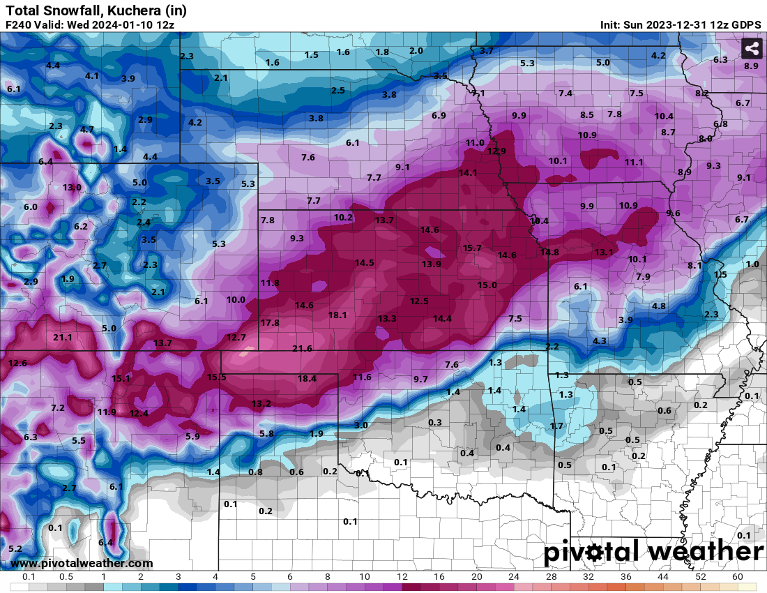
12z GEFS mean snowfall (10:1) south of the operational 12z GFS at 240 hrs. Canadian (kuchera) looks similar...

-
January 2024 Observations and Discussion
mlgamer replied to Minny_Weather's topic in East of the Rockies
Today's model runs were noticeably less favorable for me over the next 10 days (240 hrs). I expect a lot of model and run-to-run variations in the days to come so we'll see how things shake out over time.