


Meatyorologist
-
Posts
8937 -
Joined
-
Last visited
-
Days Won
13
Everything posted by Meatyorologist
-
 It's been a theme this fall and winter to overdo jet extension and underamplify ridges in the medium-long range. Before late October this bias worked against us, ever since it has kept us consistently cold. I think as time passes the 14th-20th period will grow increasingly favorable on ensemble means. Could be wrong but I'm hoping!
 -
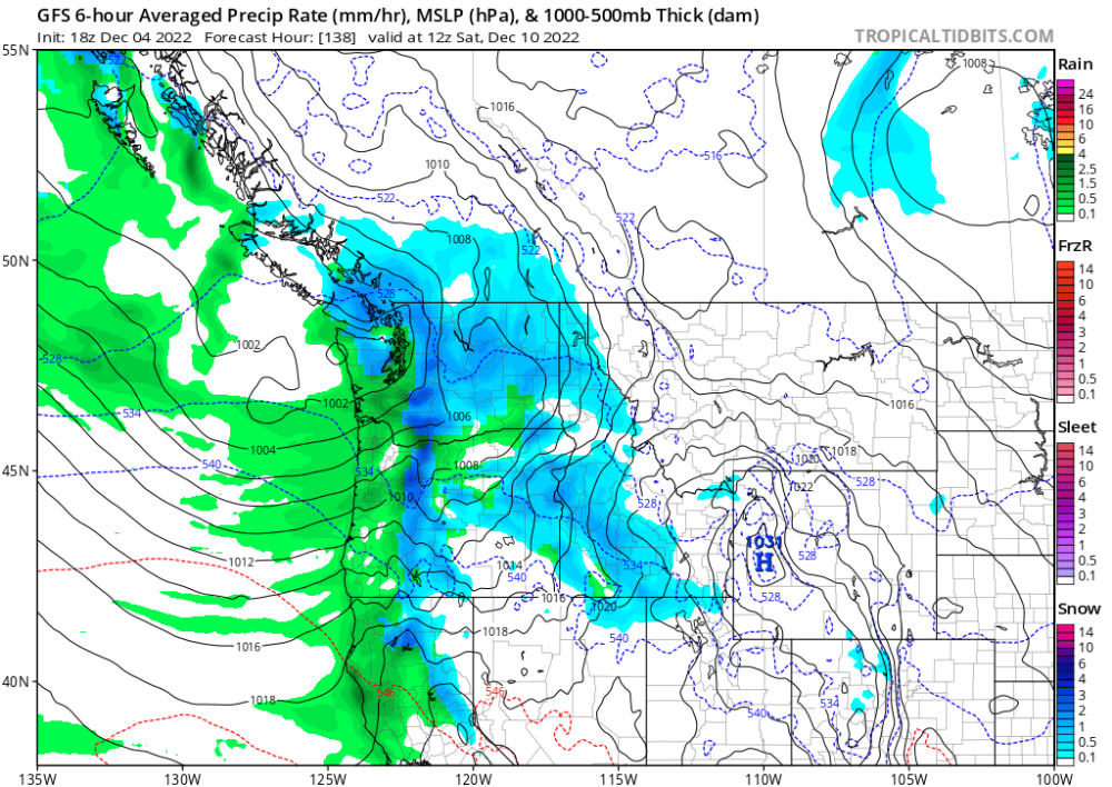
Looks like plenty of potential for wet snow in the north interior/lower mainland this coming week. Multiple situations where fronts landing onshore benefit enough from isentropic lift to overcome downsloping off Vancouver Island, allowing for heavy precipitation that lowers snow levels while sfc gradients remain weakly offshore due to the incoming lows. Classic setups. Usually occurs a few times a winter, but it could happen multiple times this *week*.
-
More upstream amplification
-
...Right as satellite trends show major weakening.
-
Michael Snyder is posting some epic pics in the Twitter GC. They're of his own home/neighborhood so I'm inclined to not post them here until he publically does so, but the inportant message is that it is snowing and accumulating as far north as KSEA and west Seattle.
-
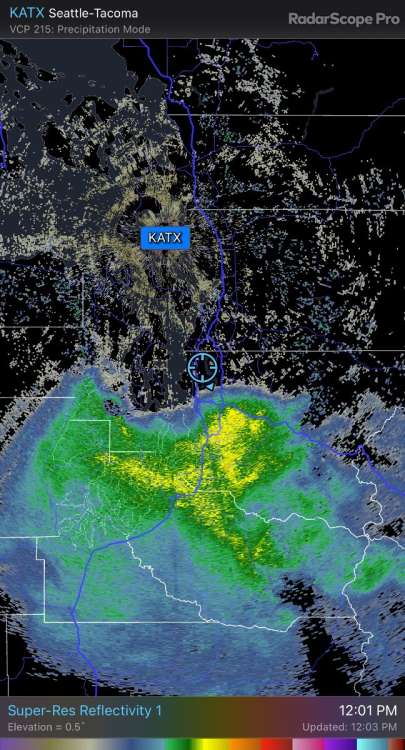
When I saw that convective banding was going to be involved on the northern flank, I seriously began to wonder if this would become an overperformer for the south Sound. Clearly it has, and as this thing continues to advance north, I'm speculating now that I might be clipped by an inch or so of the stuff.
-
KSEA down to 33/31 with light snow. definitely going to pile up significantly there.
-
as you've said multiple times, when there's cold air in play, surpises happen. could be far more moisture in the Chehalis-Tacoma corridor than previously expected
-
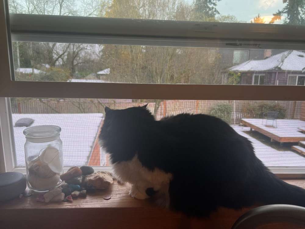
Someone's enjoying this!
-
Light snow here now! Nicely sized dendrites.
-
What an enjoyable and expensive problem to have. Too much snow to drive! hoping things get worked out soon!
-
Right, but the snow totals going north will follow a pretty linear curve with a sharp gradient. I have little doubt flurries will make it as far as snohomish county, but the real accumulations appear held to south of the city. Who knows though, maybe this thing jogs north in the next hour or so and parks itself over my place. I've seen it happen before, and some CAMs last night were hinting at it. But like I said, not holding my breath. I've been blessed in this location in the last few years. Sharing the love, even if it is so, so painfully close, is still very much a positive thing to me.
-
Okay wow! Had twelve dang pages to catch up on! Unfortunately I am juuust too north. As is life, this stuff happens sometimes. Maybe we can get some northward expansion but the clock is ticking and time is running out on the best dynamics. Not holding my breath. Really happy for you all to the south! Keep posting pictures and video! I am living vicariously through you all right now.
-
This means blocking in the sweet spot more likely than not for the indefinite future. This wintertime -ENSO atmospheric response is the strongest since 2016-17.
-
midlevel instability!

-
28F
-
Some heavier showers entering the Portland area. Should be in the form of snow, but a lot of it will fall as virga. Dewpoint depressions on the order of 15F+ with a stiff easterly breeze.
-
Big difference in the city though where the concrete surroundings absorb and emit thermal radiation more effectively. Also near sea level in elevation. I've seen colder airmasses struggle to cool to the wet bulb efficiently with similar southerly deformation extents. Not saying precip won't be in the form of snow (it will), but whether it sticks or not is a different story. If precip is heavy enough though, there should be no problem.
-
Going by the timing being during the day tomorrow, I doubt it accumulates that greatly tomorrow. But if even an inch falls, there'll be some real chilly weather this upcoming week.
-
Really it's all quite cold. It feels like this Spring where we can only do good. Cold air keeps being reinforced while there are no real warm mixing patterns to scour it out. Highs struggling to find 40F may be the norm and not the exception this month.
-
Canadian goes insane with blocking, but gets messy with cutoffs. A cleaner pattern would probably be quite cold as the main ridge axis establishes itself right in the sweet spot.
-
Yeah, just potential at this point. But it's a great place to start. Better runs ahead!
-
Wouldn't it be ironic if after this last half decade of February-dominated winters, we get a NDJ centered winter?
-
Watching the Dec 12-14 timeframe for something good. Deep cold builds in Northern Territories and eastern AK around Dec 8-10, then -PNA/-NAO ridge bridge threatens to send it into the area. Small tweaks could mean a quick, sharp Arctic event.


