Meatyorologist
-
Posts
9077 -
Joined
-
Last visited
-
Days Won
13
Everything posted by Meatyorologist
-
 Not saying it will happen, just noting that it's approaching that time of year again.
 -
First GFS heatwave of the year.
-
That is the stuff I live for.
-
Just need to have persistent westerlies, troughing, and we need to not flash fry the hydrosphere. Things we've avoided every summer dating back to 2012.
-
Why stop the fun there? Let's spend most of July and August cloudy and below 65F!
-
I'm sorry for that awful situation man, I really am, but how on Earth could he have possibly known that? You're throwing this out like a "gotcha" when in reality it really did look like you came up here for snow. Honestly this is an extremely toxic and unfair thing to say. But I'm sure you're in a lot of pain and didn't mean to cause any harm, I get it. You reached your breaking point... It happens. Jesse we've been over this a million times, I'm not a dunce who can't read subtlety
-
I had no idea that was you
-
I'm going to legally drink away the memory of this post
-
I too love to spread misinformation over the internet.
-
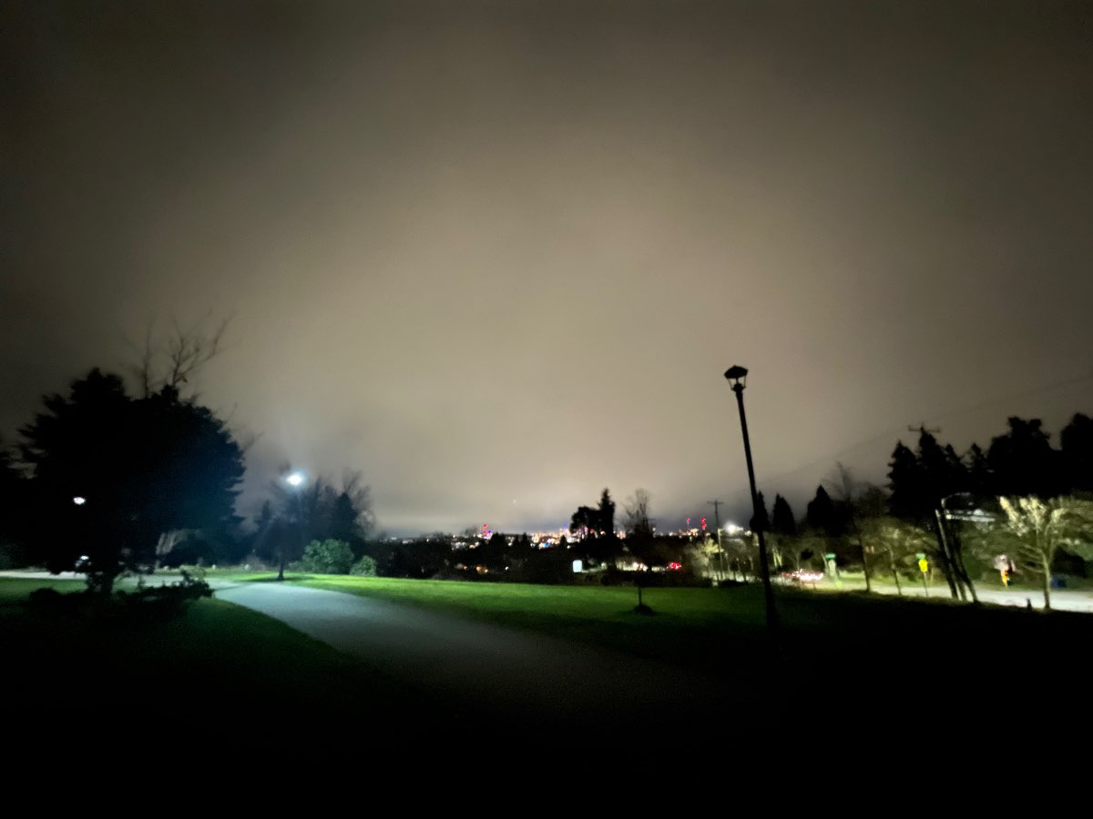
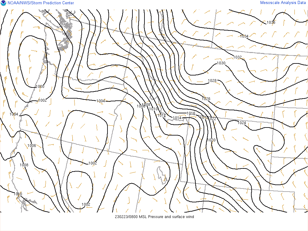
I didn't see any flakes last night due to the dry air, but I did get a good vantage point to view the virga shield overhead. That last minute jog north the low made, along with a stronger than expected high in eastern WA, caused a stronger E-W pressure gradient than expected, and as a result stronger east winds and drying in the low levels.

-
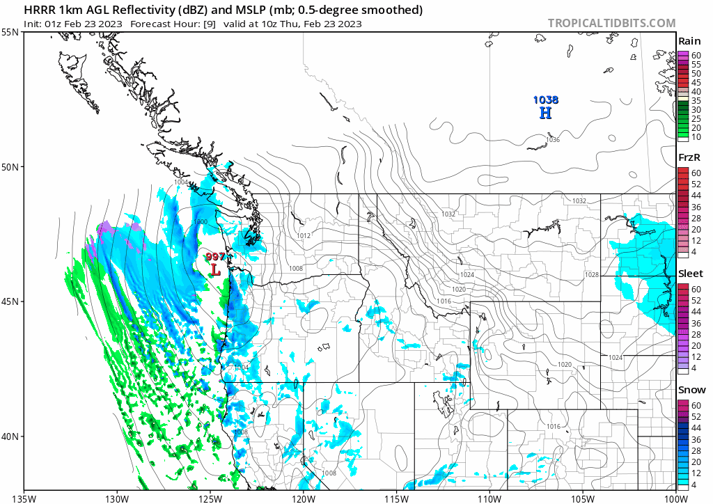
Models are continuing to verify too strong and too far south with this low, as well as too dry. The error corrections on the HRRR over the last 8 hours illustrate this move north/weaker. Precip depiction is completely lost in its own world. This is going to continue for another 6+ hours, potentially much longer.

-
I'm so glad it could verify for you! And it's just getting started man. After the BS you'd dealt with this last year, go out there and embrace it. Life doesn't get better than this for "our kind"...
-
F!@#!&* absurd. HRDPS for the win..?!
-
One of the better snowstorms in Portland's history.
-
When I saw the pieces coming together like that on the meso models and the Euro, I could hardly believe my eyes. I knew immediately that someone between Salem and Vancouver WA was going to get crushed. Everything was nearly ideal. I absolutely had to get the word out. I used the kind of language I did for a reason!
-
This is, by far, the most reacted post on this forum. Deserves it.
-
This next band is going to be insane for Portland.
-
It did in Feb 2014!
-
33/28 t/dt spread here on the north end of the city with mostly overcast skies and an ongoing flurry. To add to the wintry conditions, there is a northerly breeze sending these tiny little snowflakes on a direct sideways collision course with my face at the bus stop. #KoldAidanCheeks aside, today has been a very impressive winter weather day for this late in the season, and a welcome respite from the overal blandness of the better part of the last two months. Since dear old mother nature is sparing none of her slushy tricks she has stashed up her sleeves, it looks like Seattle will once again get in on some accumulating snowfall overnight, as a broad frontal shield is currently expanding far north of this morning's projections. The Euro and the GFS have both in tandem hopped on the white Thursday train, depicting light to moderate snow increasing over western WA into the overnight hours, and peaking shortly before sunrise. This is giving me some 2/7-2/8/2014 vibes for the central Sound, where an empty forecast suddenly seems destined to bring about a light but significant snowfall based entirely on a last minute jog north with the deformation band. It's a pretty common type of snowfall error in these parts, and on the east coast.
-
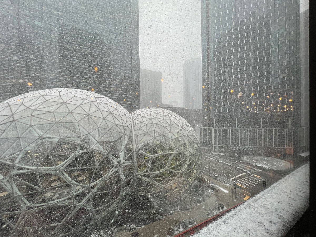
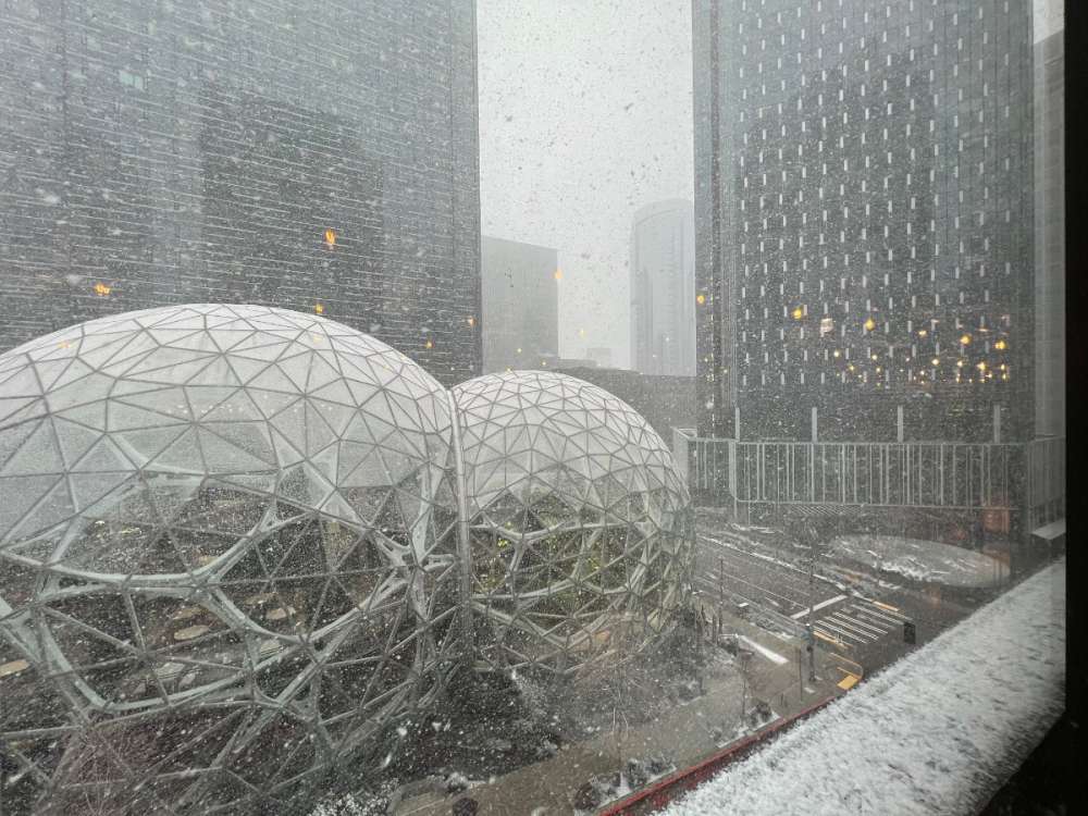
Back at the house there's just a trace. Got about an inch here at work in Westlake. Looks like this evens the seasonal snowfall gap in the immediate metro area that was created by December's transitional event that favored the north end of the city, as well as the marginal overrunning events of Nov/Dec which dotted my house but barely brought a mix to the city.
-
Surprises happen!
-
6th/Lenora
-
Not only a similar vibe, but a very similar physical configuration of the atmosphere.
-
Literal garbage doodoo trash