Wxmidatlantic
-
Posts
773 -
Joined
-
Last visited
-
Days Won
1
Everything posted by Wxmidatlantic
-
Lord we get the Georgia rain.. https://youtu.be/cAA_LUCb0QE
-
ICON has a major amplification bias outside 60hrs....
-
Should I have been banded, probably. When I get board, I listen to music.... Love this pattern. Pivot point looks south of lake Erie. Is this the final sullusion. No.
-
Sorry, got a like. Shadow banding exist. It's a Twitter thing. Looking forward to the 12Z runs...
-
Someone let me know if you can see my post.
-
Famous last words..,
-
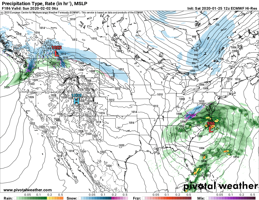
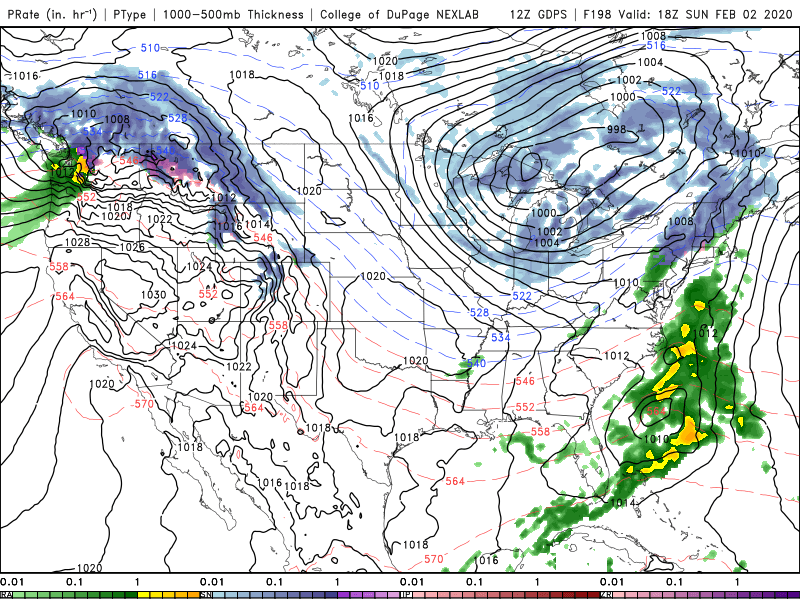
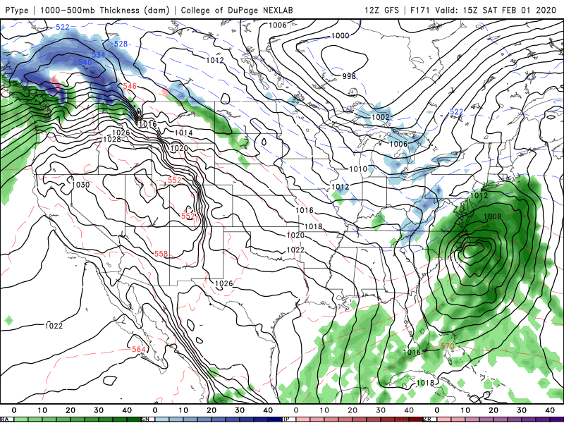
Looks like someone will get a good snowfall. How far south does the cold air sink? What will be the axis of the 500mb trof? Will the main energy come out all at once or in two pieces? Eating our heart out in the Mid-Atlantic.....
-
I would like to introduce a precip type that most of us have observed, but has not been categorized. I call it "sain." It is hard to see unless you are driving. When sain hits the windshield it splats like a slushy rain or snowflake. It exist in a narrow transition zone, but can last for hours. The Friday night early Saturday event looks like a rain/sain mix. If the Hatteras Low jogs NW, wetsnow may mix in with higher precip rates. How pathetic is that? Long range still has cold air lurking North of the metro. Individual wave amplification and confluence will eb and flow. We are still entering, "primetime."
-
Nothing coming. A few short waves. 10 day outlook trying to build a bramuda high. You can't make it up....
-
The king brings a gulf low up the coast..
-
Andie is still hear nevertheless.,
-
Loving startrek Picard...
-
https://youtu.be/h3pZZQbFWj8
-
https://youtu.be/h3pZZQbFWj8
-
https://youtu.be/h3pZZQbFWj8
-
https://youtu.be/ILbLGNDqUxA
-
https://youtu.be/ILbLGNDqUxA
-
https://youtu.be/cAA_LUCb0QEo
-
https://youtu.be/h3pZZQbFWj8
-
I am still here., I thinks itis because the babe Andie...
-
Will the king beat the old man? We will see.... https://youtu.be/aKMA-_wu2Xk
-
CMC kicks it out early with NW flow...
-
CMC kicks it out early with NW flow...
-
February is primetime in Maryland. Next chance shows gulf low coming up the coast early February. Models can agree on one thing. There will be a storm. Track and intensity uncertain. 150- 170 hrs out is plausible. It has been blinking for 72 hrs...
-
 Simp toly red. Holding back the years