


Cascadia_Wx
-
Posts
7054 -
Joined
-
Last visited
-
Days Won
25
Everything posted by Cascadia_Wx
-

October 2023 Weather in the PNW
Cascadia_Wx replied to TigerWoodsLibido's topic in West of the Rockies
First real chilly day of the season yesterday. Hit a high of 50 in the late morning before the rain started, fell to 44 by midnight. Moderate rain most of the afternoon, with some heavy downpours in the evening. Over 3/4” for the day overall, approaching 3” for the month. Scattered showers around this morning and cool, 46 currently after a low of 43 for the day so far. -
October 2023 Weather in the PNW
Cascadia_Wx replied to TigerWoodsLibido's topic in West of the Rockies
The setup this week would have been a little more fun if the lobe of cold air Friday was progged to dig farther west, as originally advertised. Could have scored some hard freezes and maybe some highs in the 40s. But as it stands, this pattern will still help many spots avoid a top or all-time record warm month, and that in and of itself is a feat these days. -
October 2023 Weather in the PNW
Cascadia_Wx replied to TigerWoodsLibido's topic in West of the Rockies
How does this rank with their latest? Also interesting, they made over to four months with no sub-60 highs (June 18th-October 24th) after coming off an historically long period with no 60+ highs last winter (November 4th-March 16th) -
October 2023 Weather in the PNW
Cascadia_Wx replied to TigerWoodsLibido's topic in West of the Rockies
Pretty remarkable how watered down this “event” has become. We’re back to high heights and ridging in about four days. -
October 2023 Weather in the PNW
Cascadia_Wx replied to TigerWoodsLibido's topic in West of the Rockies
Even taking ENSO out of the equation there are dozens of years that disprove this. Let’s not forget October 1949 was the coldest on record. Of course October cold isn’t a slam dunk but it definitely isn’t always a bad sign either. Even for +ENSO years there are plenty of examples debunking the “October kiss of death” mythos that seems to be really popular here. From what I can tell, it’s sort of a wash no matter how you look at it. Personally, cold anomalies of any significance are rare enough around here that I’ll take them any time. Probably our rarest type of weather event these days.- 3318 replies
-
- 12
-

-
October 2023 Weather in the PNW
Cascadia_Wx replied to TigerWoodsLibido's topic in West of the Rockies
Yeah, sort of the worst of both worlds this month so far with lots of warmth and mildness and clouds but not a lot of rain to show for it. -
October 2023 Weather in the PNW
Cascadia_Wx replied to TigerWoodsLibido's topic in West of the Rockies
PDX hasn’t had a sub-65 high since the 2nd. Could be three weeks assuming they don’t do it today or tomorrow. That’s pretty impressive even for early to mid-October. -
October 2023 Weather in the PNW
Cascadia_Wx replied to TigerWoodsLibido's topic in West of the Rockies
12z GEFS is surprisingly bullish on a cold end to the month. Most of the “warm camp” members gone on this run. Will be interesting to see what the 12z Euro shows. The 06z Euro doesn’t go out very far but it looked like a step toward the GFS.
-
October 2023 Weather in the PNW
Cascadia_Wx replied to TigerWoodsLibido's topic in West of the Rockies
Definitely. -
October 2023 Weather in the PNW
Cascadia_Wx replied to TigerWoodsLibido's topic in West of the Rockies
Every time I log in here I regret it.- 3318 replies
-
- 10
-
-

-

-

-

-

-

-
October 2023 Weather in the PNW
Cascadia_Wx replied to TigerWoodsLibido's topic in West of the Rockies
Average high of 71.2 at PDX so far is considerably warmer than average. -
October 2023 Weather in the PNW
Cascadia_Wx replied to TigerWoodsLibido's topic in West of the Rockies
Low clouds and drizzly, with a low of 52 this morning. Fall colors have been a major disappointment so far this year, with all the warm nights and real lack of chill in the air overall. Had a sort of blah and mild mostly cloudy 68/51 spread yesterday. -
October 2023 Weather in the PNW
Cascadia_Wx replied to TigerWoodsLibido's topic in West of the Rockies
Monday sure turned into a fun weather day. Extremely heavy rainfall at points that afternoon, and the minor tornado in central Vancouver. Ended up with a 66/51 spread that day. Evening low. Picked up close to an inch of rainfall with the morning stratiform rain and the afternoon downpours. Tuesday was partly to mostly cloudy with some spots of morning fog. Weak warm front lifted north across the area late in the afternoon with some sprinkles. 64/47. Wednesday started chilly and foggy, but was warm and sunny by afternoon. 71/42 spread. Yesterday started out cool and foggy as well, but rose to the low 70s in the afternoon with a light east wind. 72/44 spread. Mild morning today with more low clouds than ground fog. Low of 52 but that was early last night before the clouds formed. 55 currently. Would be nice to have a chilly last 1/3 of the month but the models still haven’t made up their minds. -
October 2023 Weather in the PNW
Cascadia_Wx replied to TigerWoodsLibido's topic in West of the Rockies
Looks like the Euro laid a massive turd last night. At least the GFS still looks good, although I’d rather have it be the other way around. Lots of ensemble spread. -
October 2023 Weather in the PNW
Cascadia_Wx replied to TigerWoodsLibido's topic in West of the Rockies
59 with rain currently. Had a low of 54 early in the night before the wind picked up ahead of the rain, and the temp shot into the low 60s. Had a very decent 65/53 day yesterday. Dry and partly to mostly cloudy with some scenic high clouds. Temps were progged to be in the low 70s so it was nice to see things underachieve for once. -
October 2023 Weather in the PNW
Cascadia_Wx replied to TigerWoodsLibido's topic in West of the Rockies
Similar anomalies up and down the I-5 corridor. Also an average high of 72 so far which is a significant departure in its own right. -
October 2023 Weather in the PNW
Cascadia_Wx replied to TigerWoodsLibido's topic in West of the Rockies
Looks like PDX should surpass an inch of rain for the month this morning. Better than last year at least. About the same as last year warmth wise though. Currently running a +4.5 departure on the month. -
October 2023 Weather in the PNW
Cascadia_Wx replied to TigerWoodsLibido's topic in West of the Rockies
12z Euro was actually pretty decent. Most likely an outlier. -
October 2023 Weather in the PNW
Cascadia_Wx replied to TigerWoodsLibido's topic in West of the Rockies
Had a 63/52 day Wednesday, some scattered heavy showers but most of the really heavy stuff was up toward Mount St Helens. 70/48 day yesterday, mild with east winds developing in the afternoon. East winds intensified overnight with a mild low of just 58 so far. Looks like PDX didn’t even get below 60. Starting to look like this month is shaping up to be one of our warmer Octobers on record. All time record warmest was set just last year. -
October 2023 Weather in the PNW
Cascadia_Wx replied to TigerWoodsLibido's topic in West of the Rockies
Mild 52 with breezy SW winds this morning. Ended up with a 63/52 spread yesterday, 62/55 spread Monday. Had a pretty good downpour yesterday afternoon. Besides that not a crazy amount of rain. Biggest story this month so far is probably the well above average temps, which look to continue for the foreseeable future. -
October 2023 Weather in the PNW
Cascadia_Wx replied to TigerWoodsLibido's topic in West of the Rockies
Not full time, but I’m on their back up crew in the summer and fall. Third year in a row. -
October 2023 Weather in the PNW
Cascadia_Wx replied to TigerWoodsLibido's topic in West of the Rockies
October 1968 and 1972 were both much cooler than average. -
October 2023 Weather in the PNW
Cascadia_Wx replied to TigerWoodsLibido's topic in West of the Rockies
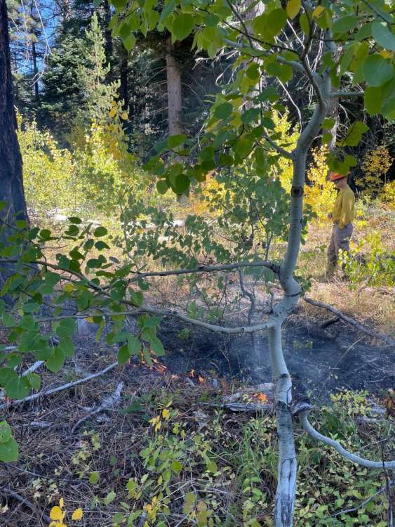
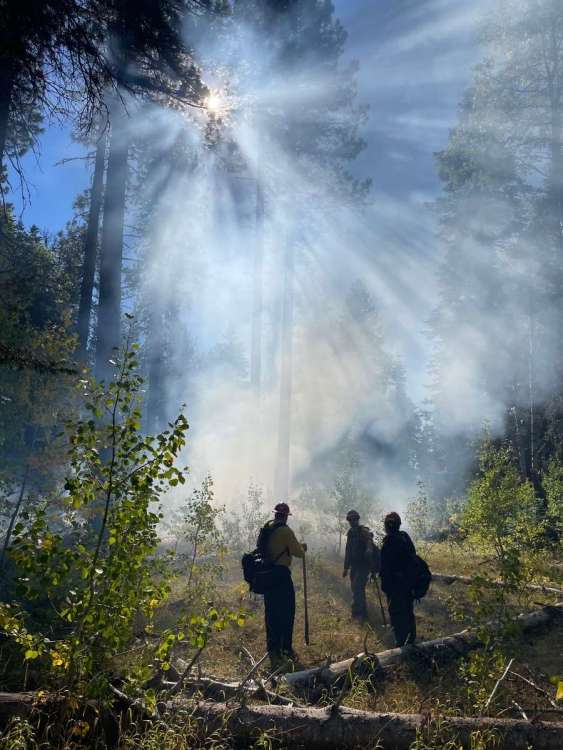
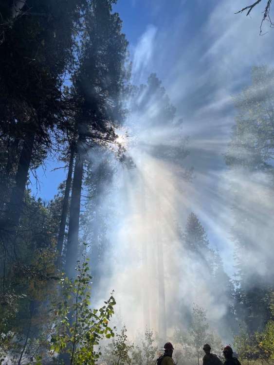
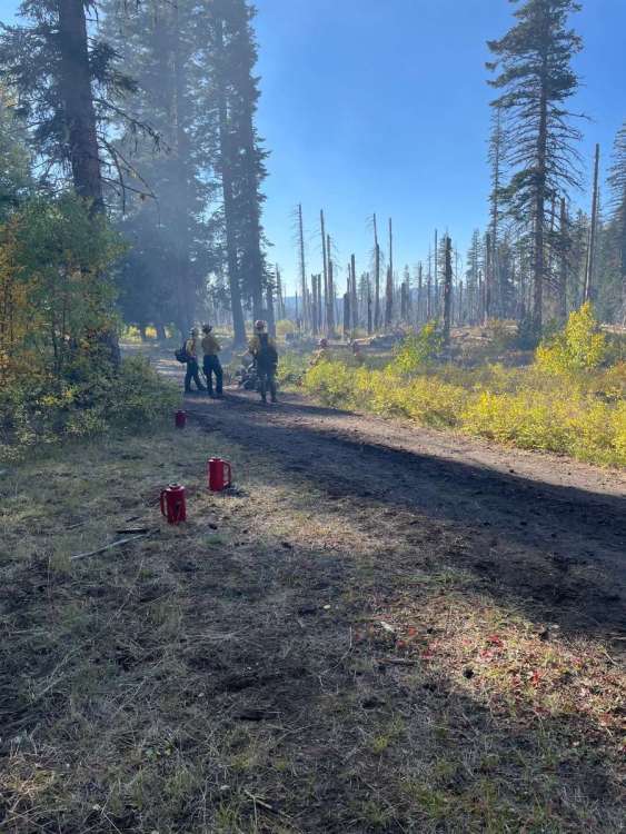
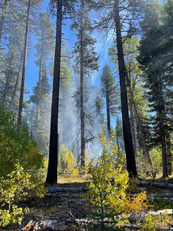
Up on a controlled burn on the south slope of Adams near Trout Lake on Saturday. Conditions were actually too wet to get things going to the extent that was desired. Just creeping ground fire at best. There was an inversion over the area at the time, east winds weren’t punching through as forecast, and temps hung in the low 60s all afternoon with the RH staying high.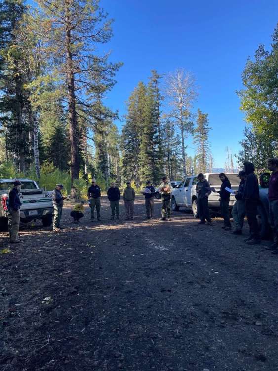
- 3318 replies
-
- 10
-
-
-
October 2023 Weather in the PNW
Cascadia_Wx replied to TigerWoodsLibido's topic in West of the Rockies
Today has been nicer so far. Very mild low of just 58, but temps have warmed very little or stayed steady most the day with light rainfall moving in late morning. High of 62 so far, picked up about 0.06” rain. Mostly cloudy and 61 currently with some drizzle around. Looking forward to some wetter systems in the future, although temps look to stay on the mild side of average overall the next 7-10 days. -
October 2023 Weather in the PNW
Cascadia_Wx replied to TigerWoodsLibido's topic in West of the Rockies
Pretty blah last four days with a typical overachieving high end warm event, temps at least 2-3 degrees above most guidance each day. 79/49 on Thursday, morning fog then severe clear. 84/56 on Friday, severe clear and east winds. 83/54 on Saturday, severe clear and east winds. 78/51 yesterday, morning fog, lighter east winds, then clearing, staying warm and sunny with high clouds moving in toward sunset.


