
SilverFallsAndrew
-
Posts
56440 -
Joined
-
Last visited
-
Days Won
402
Everything posted by SilverFallsAndrew
-

March Weather in the Pacific Northwest
SilverFallsAndrew replied to stuffradio's topic in West of the Rockies
Eugene now running a -3.5 departure on the month. They also officially recorded "T" snowfall yesterday. -
March Weather in the Pacific Northwest
SilverFallsAndrew replied to stuffradio's topic in West of the Rockies
Sun is out here and the temp has bumped up to the mid/upper 30s...Looking at radar though, the sun probably won't last for long. -
March Weather in the Pacific Northwest
SilverFallsAndrew replied to stuffradio's topic in West of the Rockies
Would be pretty cool if tonight could have worked out to being clear with a dry airmass...Could have worked out to some impressive lows in snow covered areas. -
March Weather in the Pacific Northwest
SilverFallsAndrew replied to stuffradio's topic in West of the Rockies
BTW Did Jesse or BLI Snowman pick up any snow last night in Clark Co? I went to bed at some point there so if you said I missed it. -
March Weather in the Pacific Northwest
SilverFallsAndrew replied to stuffradio's topic in West of the Rockies
For realz! You were ahead of me in seasonal snow until this most recent event. -
March Weather in the Pacific Northwest
SilverFallsAndrew replied to stuffradio's topic in West of the Rockies
Even Stayton on the eastern edge of the valley had sticking snow last night... Spots around Dallas and Falls City have done well the past couple of days. -
March Weather in the Pacific Northwest
SilverFallsAndrew replied to stuffradio's topic in West of the Rockies
April looks as if it could be active. -
March Weather in the Pacific Northwest
SilverFallsAndrew replied to stuffradio's topic in West of the Rockies
GFS says no reason to wait until next winter for arctic air. -
March Weather in the Pacific Northwest
SilverFallsAndrew replied to stuffradio's topic in West of the Rockies
Sun is trying to come out now! But Friday/Saturday look nice here at least. With a cooling airmass, could see another freeze late week. -
March Weather in the Pacific Northwest
SilverFallsAndrew replied to stuffradio's topic in West of the Rockies
I mean this is sort of nuts... -
March Weather in the Pacific Northwest
SilverFallsAndrew replied to stuffradio's topic in West of the Rockies
What the GFS is showing is kind of hard to believe... -
March Weather in the Pacific Northwest
SilverFallsAndrew replied to stuffradio's topic in West of the Rockies
Not to sound like Tim, but the GFS shows warm front drizzle here Monday-Wednesday. That will be a sad, slushy, slow melt. -
March Weather in the Pacific Northwest
SilverFallsAndrew replied to stuffradio's topic in West of the Rockies
Some moisture sliding up the valley, mostly to the west of me, just some intermittent flurries at the moment. 33 after a low of 30. The GFS is interesting. Thickness rises to about 530 here this afternoon (maybe some light rain) and then drops as the trough axis swings through. Very weak deformation basically right over me, would be 1-2" tonight at face value. -
March Weather in the Pacific Northwest
SilverFallsAndrew replied to stuffradio's topic in West of the Rockies
Was a nice sunrise this morning. -
March Weather in the Pacific Northwest
SilverFallsAndrew replied to stuffradio's topic in West of the Rockies
Will be interesting to see. We are probably "due" for a regional arctic airmass. PDX has recorded snow 3 seasons in a row now...Would be pretty amazing if they could make it 4 straight. -
March Weather in the Pacific Northwest
SilverFallsAndrew replied to stuffradio's topic in West of the Rockies
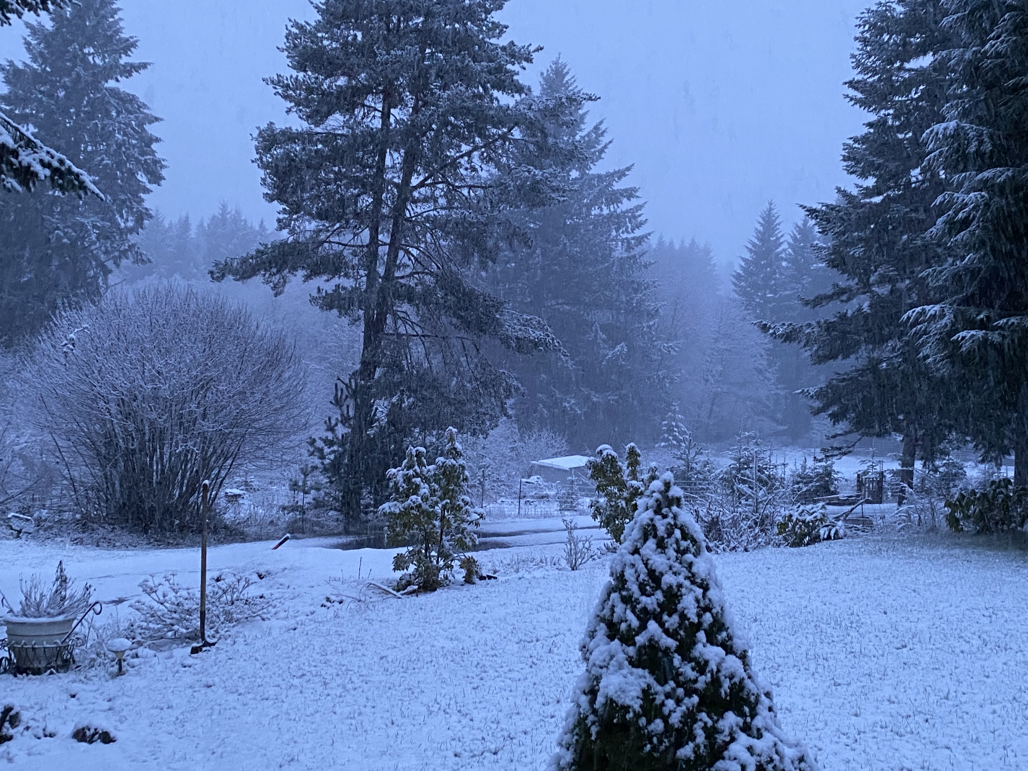
A snowy early spring scene...- 4317 replies
-
- 10
-

-
March Weather in the Pacific Northwest
SilverFallsAndrew replied to stuffradio's topic in West of the Rockies
WWA extended through 5a here. This event has definitely lived up to its potential. Nws has done a good job on it too. -
March Weather in the Pacific Northwest
SilverFallsAndrew replied to stuffradio's topic in West of the Rockies
Looks like really good upsloping starting to show up in Clark Co with the WSW flow. I think you guys have a couple hours of decent precip rates on the way. -
March Weather in the Pacific Northwest
SilverFallsAndrew replied to stuffradio's topic in West of the Rockies
Another 1.2" since midnight. Solid late March event. -
March Weather in the Pacific Northwest
SilverFallsAndrew replied to stuffradio's topic in West of the Rockies
Sticking snow in Stayton about 15 miles SW of here at 400'. -
March Weather in the Pacific Northwest
SilverFallsAndrew replied to stuffradio's topic in West of the Rockies
Picked up another inch of snow in the past hour. Ended March 23rd with 5.5", a storm total so far of 7.5". Narrowly edged out 2/18/18 for my snowiest calendar day of the season. -
March Weather in the Pacific Northwest
SilverFallsAndrew replied to stuffradio's topic in West of the Rockies
Echoes are exploding east of I-5, but there does look to be some decent development off to your west too. -
March Weather in the Pacific Northwest
SilverFallsAndrew replied to stuffradio's topic in West of the Rockies
Is that another deformation band setting up across the Central Valley? Radar is exploding down this way. -
March Weather in the Pacific Northwest
SilverFallsAndrew replied to stuffradio's topic in West of the Rockies
What an impressive event that was. Grants Pass does have a bit of elevation so it appears they get a bit more snow than places like Roseburg. -
March Weather in the Pacific Northwest
SilverFallsAndrew replied to stuffradio's topic in West of the Rockies
Grants Pass in SW Oregon now down to 32 with snow. Wonder when the last time they had snow this late was.