Nov1985
-
Posts
614 -
Joined
-
Last visited
Everything posted by Nov1985
-
January 2024 Weather in the PNW (Part I)
Nov1985 replied to Sunriver Snow Zone's topic in West of the Rockies
ICON is a follow model, not a lead model. You can see it is slowly following the better models with progress.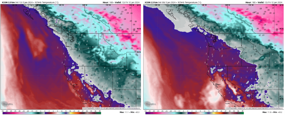
-
January 2024 Weather in the PNW (Part I)
Nov1985 replied to Sunriver Snow Zone's topic in West of the Rockies
NWS Seattle will only warn for snow after several inches have been measured by a trusted spotter or DOT camera. NWS Portland will issue warnings whenever the air smells funny! -
January 2024 Weather in the PNW (Part I)
Nov1985 replied to Sunriver Snow Zone's topic in West of the Rockies
But that doesn't speak to statistical performance and reliability when compared to other models. -
January 2024 Weather in the PNW (Part I)
Nov1985 replied to Sunriver Snow Zone's topic in West of the Rockies
I don't think GFS has been statistically proven to "lead" in anything, ever. -
January 2024 Weather in the PNW (Part I)
Nov1985 replied to Sunriver Snow Zone's topic in West of the Rockies
Ya, I mean the ECMWF ensembles 06Z mean 850T was even colder than the 00Z was. The 00Z was colder than the 12Z was. ECMWF ensembles are still trending colder. -
January 2024 Weather in the PNW (Part I)
Nov1985 replied to Sunriver Snow Zone's topic in West of the Rockies
Dual solo? That's a contradiction. -
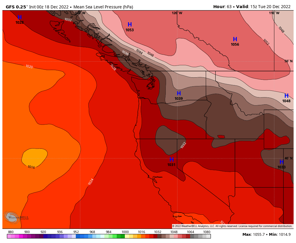
Just a 13° difference between GFS and ECMWF for tonight's low temps. The ECMWF winter warm bias and GFS winter cold bias was never more evident than the past week.
.thumb.gif.ee500b74d769be580617288cb7db24e4.gif)
-
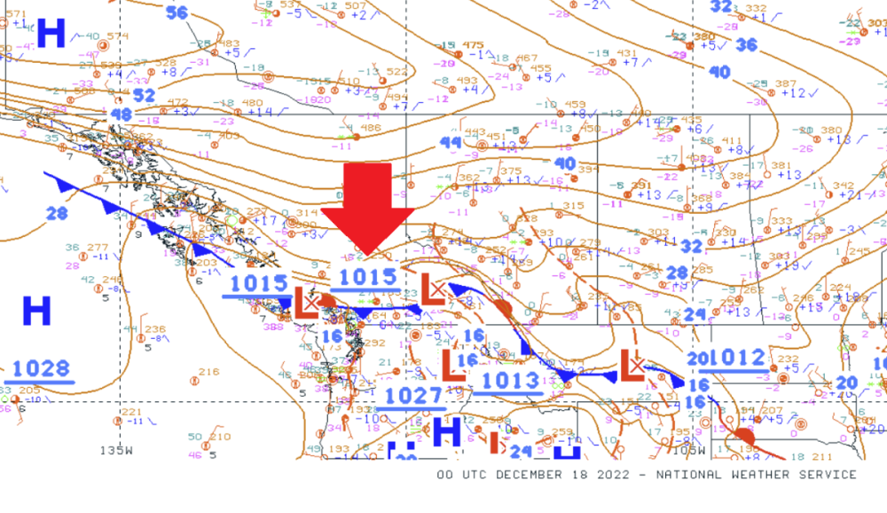
All the models are still tweaking depth and location of the low. 00z NAM even switched back from Wed to a Tue low! It's model indecision.
-
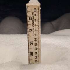
This week's systems have overperformance written all over them!
-
Looks like you are in line for more snow from around 2 to 5 pm. If you are nice, I will send more.
-
Small chances around near year's
-
If it has to come, 1am to 4am ain't a bad time. The power might go out some places, but few clueless folks on the road. Light accumulation most spots except Olympia area and the usual suspects in/near Oregon.
-
ECMWF keeps moderating slightly as a given day gets closer, especially 70 to 80 hrs out. Tuesday temps up slightly with this run. Tomorrow night we'll probably see moderation of those Wed temps. And then again Mon night for Thu temps. Still going to be cold, but probably not THAT cold IMO.
-
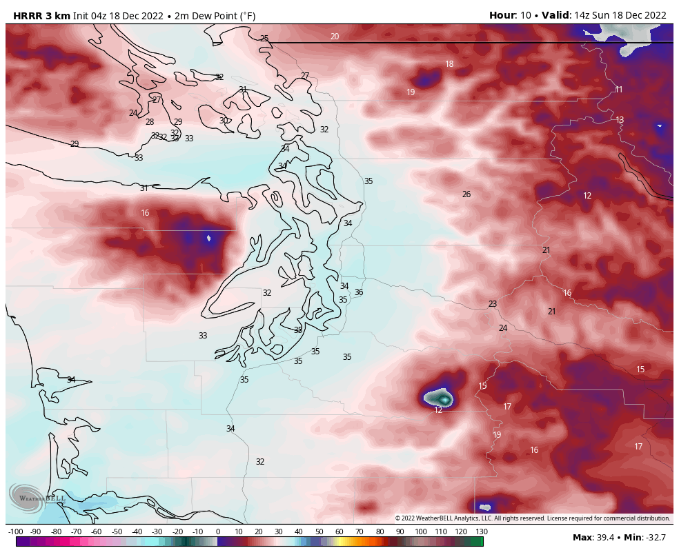
Tomorrow's front in some hourly resolution models. Mid-day for Seattle area now.


-
The low comes further north this run. Not great for Oregon, but still cold north before and after the low passes.
-
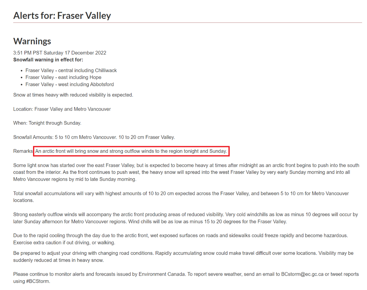
You better tell that to the Canadian weather service because they've been throwing up alerts all night.

-
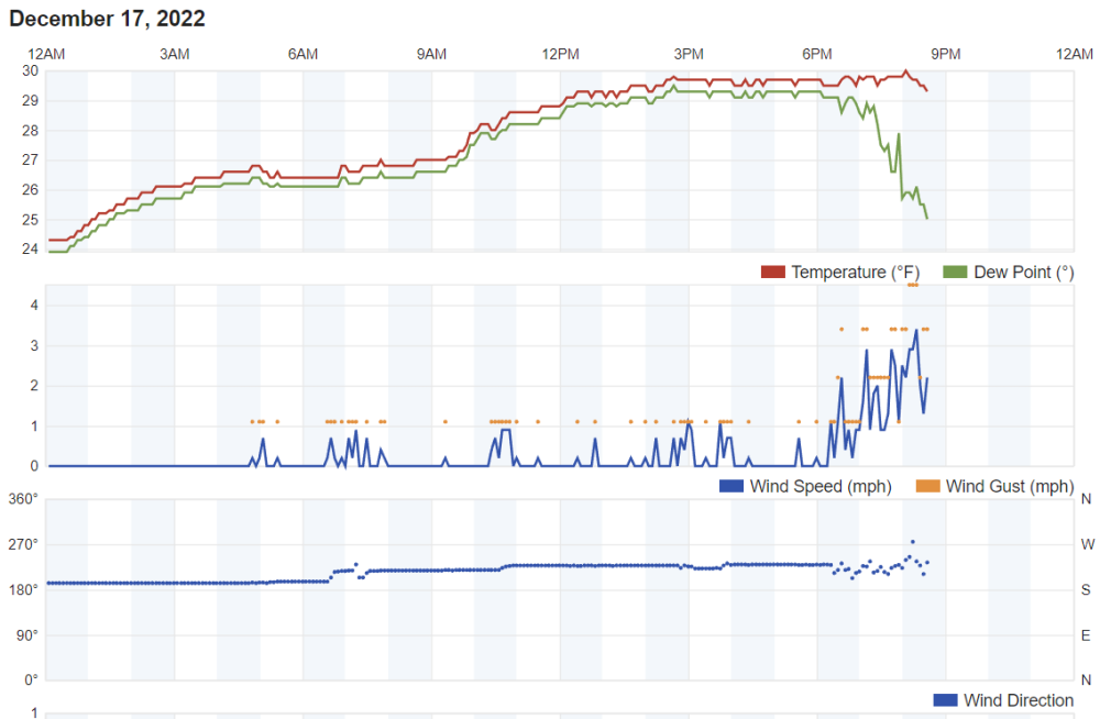
Perhaps the arctic front reaching Hope, CA now! This station's anemometer is probably sheltered like mine. Don't believe the wind direction or speed. https://www.wunderground.com/dashboard/pws/IHOPE10
-
If the only models that showed prolonged cold were GFS and GEM I would be more worried. ECMWF, ICON, UKMET, NAM LGTM for a cold spell lasting longer than what I expected yesterday.
-
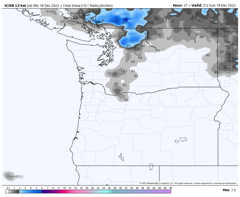
Ice or Kuchera or any other toys not available for ICON on WB.

-
ICON's latest rough draft
-
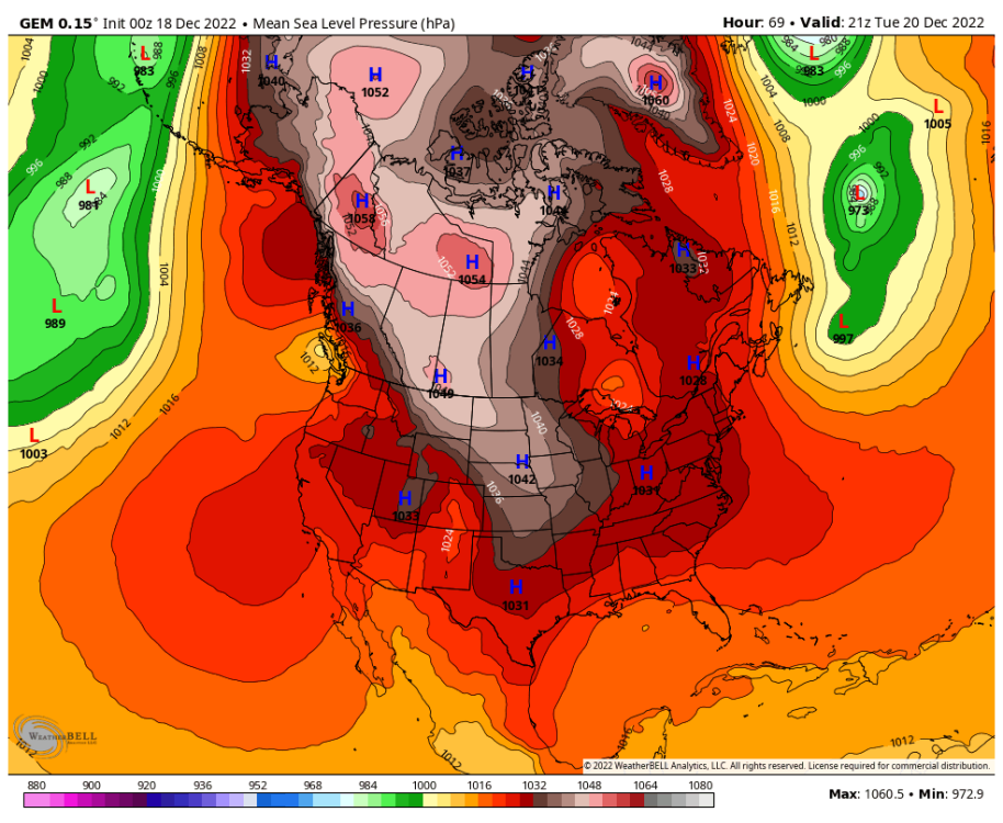
The low may indeed go into Vancouver Island like GEM shows this run, but we have enough other models to believe it might not. Either way, even in this run GEM brings some cold back south again.

-
Like the other models, it's more of just a little wave of moisture now.
-
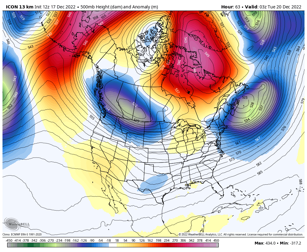
The trend towards alignment across models today is impressive after what we've been through. This 00z ICON trend also follows today's plot of extending the cold spell. I still believe nothing past Tuesday AM though.


.gif.12d7836dff096dc8eb73b6d3636eaf03.gif)