the_convergence_zone
-
Posts
1241 -
Joined
-
Last visited
-
Days Won
2
Everything posted by the_convergence_zone
-
PNW April 2023 Weather Discussion
the_convergence_zone replied to Cascadia_Wx's topic in West of the Rockies
Sure looked like that aurora was amazing, maybe this will be a good solar cycle and we won't have to wait until 2035 to hope that the next Kp=8 event happens on a clear night. -
PNW April 2023 Weather Discussion
the_convergence_zone replied to Cascadia_Wx's topic in West of the Rockies
It’s juicy out there. 53.6 / 53.2 Rain is starting to pile up as well. -
PNW April 2023 Weather Discussion
the_convergence_zone replied to Cascadia_Wx's topic in West of the Rockies
I ran the data at Sea-Tac when I was in grad school. I basically compared 2010-2019 with 1945-2009 at Sea-Tac. March-April-May-June and Sept-Oct were wetter, July-Aug were drier. Both a higher frequency of rainy days and of big events. I highly doubt it passes any statistical significance test, but if you eyeball the data, it's clear that it's been quite wet in the Seattle area particularly in springtime over the past 15 years. Edit -- found the plot! Also worth keeping in mind that it might be getting drier in late spring despite the added rainfall due to increased evaporation from warming. Tough to say...
-
PNW April 2023 Weather Discussion
the_convergence_zone replied to Cascadia_Wx's topic in West of the Rockies
That storm cycle prevented wildfires from getting out of hand following the warmest winter on record. I was up in Manning Park BC in mid-August (around the 14th) when the first storm hit -- there were a number of large wildfires at the time that were pretty much knocked down to nothing. Snow fell on the higher peaks. Then there was the memorable windstorm at the end of August. The Queets rainforest fire also got wiped out by that storm cycle. The other big mid-summer storm that I remember was July 23, 2014 which was an all-day soaking rain, 0.76" at Sea-Tac. Every year is different, but in general the August/September period seems to have a ton of variance in terms of when the first major storm cycle hits. The median date is probably around September 20 but as we've seen recently it can be up to +/- one month from that date. Fortunately the shoulder seasons have been trending wetter in recent decades, and I expect that October 2022 will remain an outlier for a while. -
PNW April 2023 Weather Discussion
the_convergence_zone replied to Cascadia_Wx's topic in West of the Rockies
I'm a little surprised the Euro is only showing low-to-mid 70s next Friday with those double-digit T850 anomalies and flow straight out of the east. Sea-Tac can hit 75 from that setup in mid-March. Could get an 80 out of this one after all. (Edit: I appear to be remembering the pair of 79s in March 2019) -
PNW April 2023 Weather Discussion
the_convergence_zone replied to Cascadia_Wx's topic in West of the Rockies
Kind of crazy/terrifying that a map like that from only 75 years ago is from a different climate and will never be repeated in our lifetimes. The best we could hope for now is one of those shades of blue, and if that did happen there would probably have been so much persistent blocking that we would be surrounded by red on both sides. -
PNW April 2023 Weather Discussion
the_convergence_zone replied to Cascadia_Wx's topic in West of the Rockies
All things considered, the upcoming period looks like a modest warm spell, typical of most springs around here. It doesn't look like any record highs are going to be threatened, maybe a couple days in the low 70s at KSEA if we get lucky. -
PNW April 2023 Weather Discussion
the_convergence_zone replied to Cascadia_Wx's topic in West of the Rockies
38.8 F this morning. One of these days is going to be my last sub-40 degree morning before fall. Possibly tomorrow, otherwise early next week before the warm spell will be the last one. Definitely done with frost now. -
PNW April 2023 Weather Discussion
the_convergence_zone replied to Cascadia_Wx's topic in West of the Rockies
The only time I look at the GEFS is if there is disagreement in the Euro ensembles and even then it's so under-dispersed that it doesn't provide much more than a random guess at which set of Euro members are on the right track. I haven't looked at the GFS deterministic run in months. It serves no useful purpose that I can think of. -
PNW April 2023 Weather Discussion
the_convergence_zone replied to Cascadia_Wx's topic in West of the Rockies
We'll be smack dab in the middle of the warm sector, so upper air temps will support 60s. Lots of uncertainty on the strength and timing of that weak cold front. The coldest is the Euro ensemble at 54 which looks wetter than the GEFS. GEFS mean is 59, NBM is 59, NDFD is 62. One of those days where it will only take 30 minutes of midday sun to hit 60. -
PNW April 2023 Weather Discussion
the_convergence_zone replied to Cascadia_Wx's topic in West of the Rockies
The PDO rules spring in these parts and it’s still waaaay negative. -
PNW April 2023 Weather Discussion
the_convergence_zone replied to Cascadia_Wx's topic in West of the Rockies
It will be interesting to see if we get warm sectored next weekend or if that system ends up being a wet one. Oregon has better odds of escaping the weekend rain curse that we’ve been under this spring. -
PNW April 2023 Weather Discussion
the_convergence_zone replied to Cascadia_Wx's topic in West of the Rockies
Deforestation does have a 100% success rate at preventing forest fires! Can’t have a forest fire without a forest! -
PNW April 2023 Weather Discussion
the_convergence_zone replied to Cascadia_Wx's topic in West of the Rockies
FINALLY some warmth in the horizon.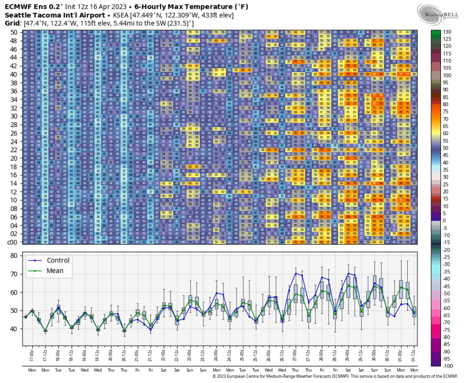
-
PNW April 2023 Weather Discussion
the_convergence_zone replied to Cascadia_Wx's topic in West of the Rockies
I can't remember the specific weather events from those years but pretty much all of the fires up there are lighting initiated so avoiding an untimely thunderstorm outbreak in mid-summer is half of the battle. The other half is hoping that some weather systems clip BC in July/August...it takes a miracle for WA/OR to get a good soaking in the middle of dry season but it's a little more common up there. -
PNW April 2023 Weather Discussion
the_convergence_zone replied to Cascadia_Wx's topic in West of the Rockies
I know Cliff Mass has done some WRF model runs looking at this, I think the conclusion was that it has the strongest influence on nighttime minimum temperatures in the lowlands west of the Cascades. Not sure about the seasonality but presumably if we are in our typical summertime pattern those cooler temperatures will push inland at night. I would think it has zero influence on the large-scale pattern, except for the fact that we're usually in a -PDO pattern when we have cold water offshore. -
PNW April 2023 Weather Discussion
the_convergence_zone replied to Cascadia_Wx's topic in West of the Rockies
Our best hope for a cool-ish summer is the large area of negative SST anomalies immediately offshore. I wouldn't be surprised to see those linger into the fall, which could mute some of the warmth from the inevitable Niño. As long as we stay out of offshore flow regimes it will be on the cool side west of the Cascades into summer for sure. I just hope the summer switch doesn't flip the last week of June as it has been in recent years. -
PNW April 2023 Weather Discussion
the_convergence_zone replied to Cascadia_Wx's topic in West of the Rockies
Sea-Tac has yet to go above 65 F this year. The warmest was 65 on the nose on March 18. Assuming there isn't a miracle warm day in the next week, it's going to be the latest >65 F since at least 2006 (April 23). The latest one in the last few decades was 2002 (April 30). The years with the first >65 F in May are 1970 (May 3) 1967 (May 6) 1961 (May 15) 1953 (May 3) I assume one of these mini-ridges will eventually materialize, but so far the warmth has been perpetually 7-10 days out. It's always crazy to look at weather data from back in the 50s and 60s to get some perspective on how much colder the climate was in that period compared with current times. -
PNW April 2023 Weather Discussion
the_convergence_zone replied to Cascadia_Wx's topic in West of the Rockies
52 and sunshine has my bees flying, but they seem to be a little hesitant to come out given the wind and relatively cool temperatures. If the weather was a bit better they would be far more enthusiastic to come out after being stuck inside for three days. -
PNW April 2023 Weather Discussion
the_convergence_zone replied to Cascadia_Wx's topic in West of the Rockies
Seattle is going to be living on the edge tomorrow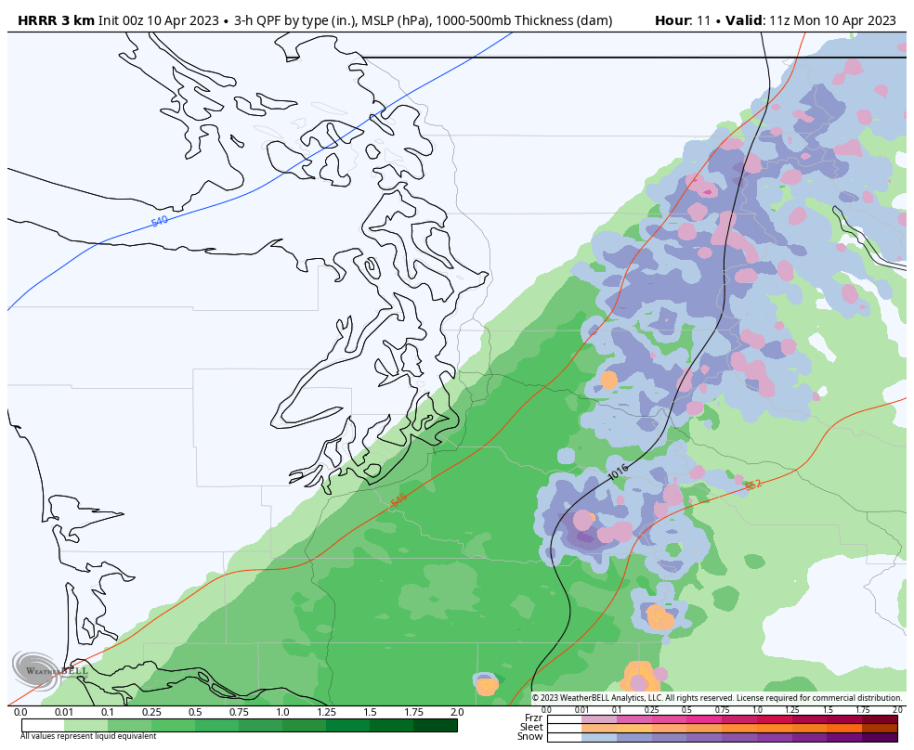
-
PNW April 2023 Weather Discussion
the_convergence_zone replied to Cascadia_Wx's topic in West of the Rockies
Just hit 0.25" thanks to the precip rates picking up in the central Sound over the last hour or two. -
PNW April 2023 Weather Discussion
the_convergence_zone replied to Cascadia_Wx's topic in West of the Rockies
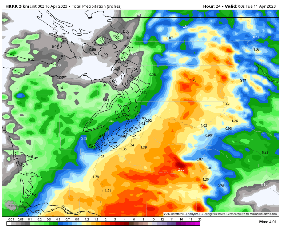
Same...but I'll take the half-inch any day. Especially when we're going to put another inch on top of that at the end of the weekend. -
PNW April 2023 Weather Discussion
the_convergence_zone replied to Cascadia_Wx's topic in West of the Rockies
It feels and smells like spring rain out there today. It's been a while since we had a steady rain and a temperature of 53 degrees. -
PNW April 2023 Weather Discussion
the_convergence_zone replied to Cascadia_Wx's topic in West of the Rockies
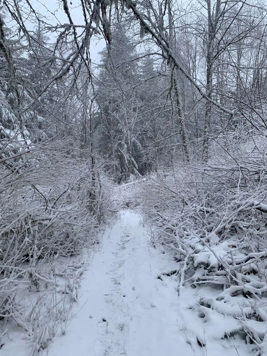
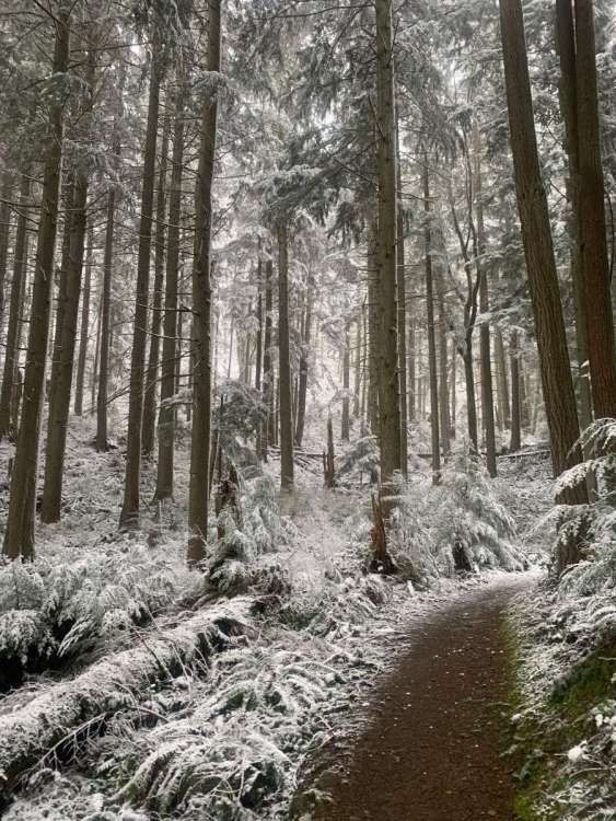
I saw snowflakes down to 600’ this morning while running in Issaquah. Accumulating above 1200’. Impressive for April.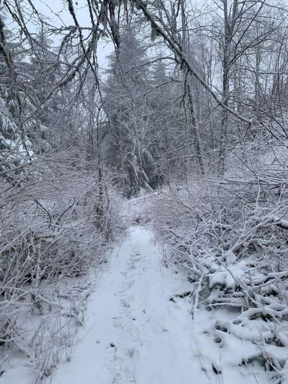
-
PNW March 2023 Weather Discussion (2012 Redux)
the_convergence_zone replied to Requiem's topic in West of the Rockies
Assuming the ensembles fully buy into the ridge (and they are getting close), Sea-Tac will get its first 70 of the year on Monday the 10th.