CentralNebWeather
-
Posts
7144 -
Joined
-
Last visited
-
Days Won
34
Everything posted by CentralNebWeather
-
-
NWS Hastings afternoon disco: The NWS in Hastings encourages everyone with travel plains in south central Nebraska and north central Kansas too look hard at their plans and adjust accordingly for maximum safety. That should include altering the timing of your trip away from most of the day Monday and Tuesday.
-
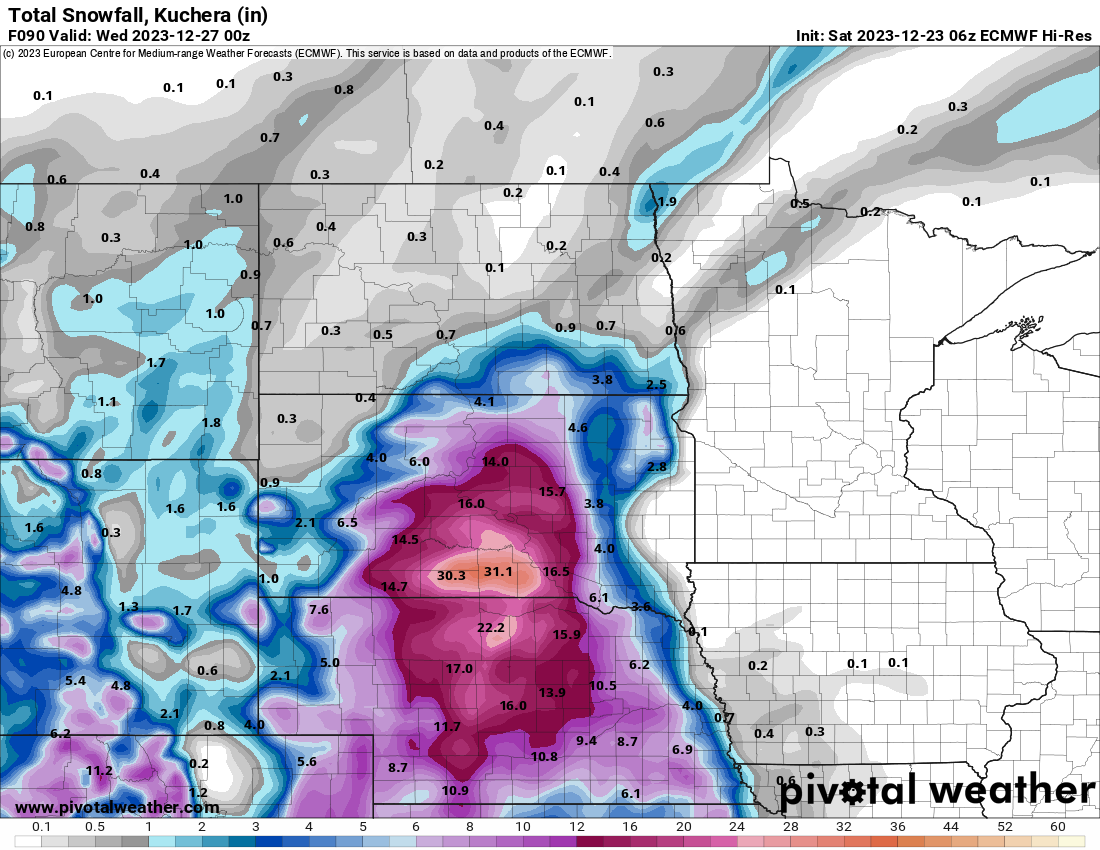
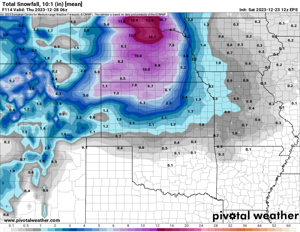
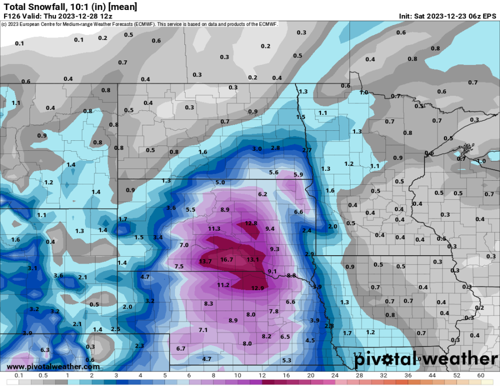
12z EPS
-
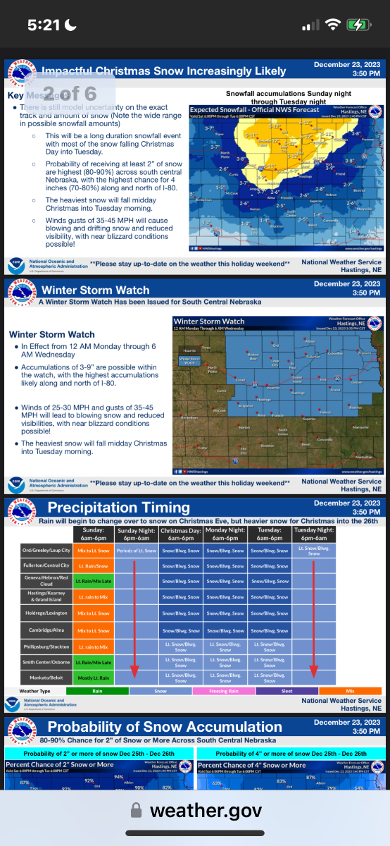
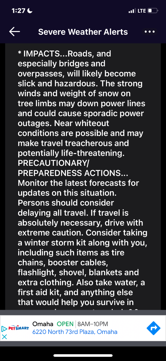
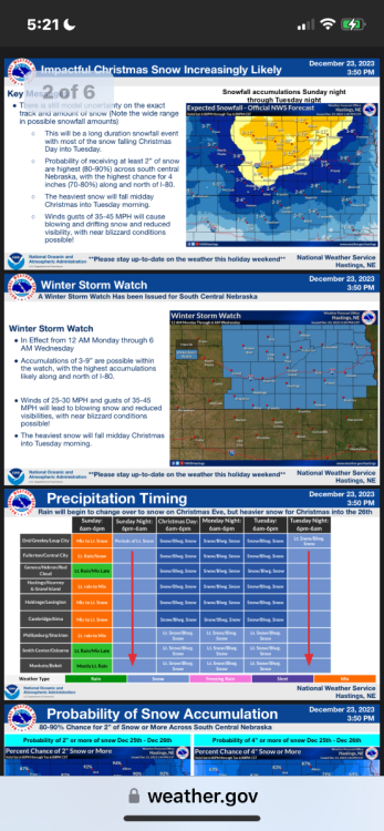
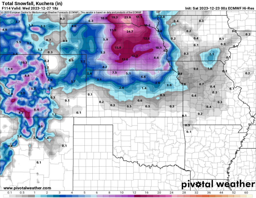
URGENT - WINTER WEATHER MESSAGE National Weather Service Hastings NE 124 PM CST Sat Dec 23 2023 ...MAJOR WINTER STORM POTENTIAL ON CHRISTMAS DAY... .The potential for major winter storm to impact south central Nebraska on Christmas Day and Tuesday appears to be increasing. Snowfall will ramp up in earnest on Christmas Day and continue into the day Tuesday. North winds gusting over 40 mph will cause blowing and drifting snow with near blizzard conditions possible. While there is still some uncertainty, do not take this storm lightly and plan accordingly the next few days.
-
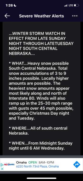
Winter Storm Watch. Whoa.

-
Been at another Christmas, so I haven’t been able to check. My gosh.
-
Getting some surprise rain this morning as of 10:30. Blustery and 41 degrees. Should be an interesting next 4 days. Good news, no traveling for us. My brother and his family from KC are here this weekend for Christmas. They are heading back late morning tomorrow before any frozen precipitation is expected.
-
As Jim Flowers always talks about, he calls dry air the wicked witch of the East. @gabel23has also mentioned it. Models might be seeing that. Still much can change in the next few days.
-
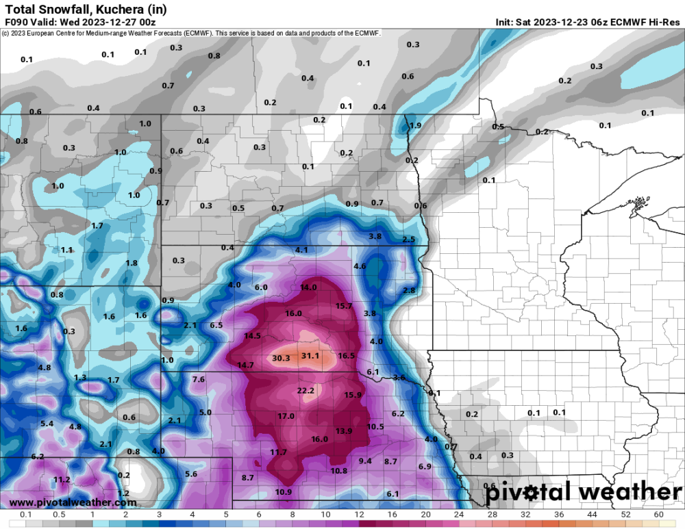
Very similar to the Euro.
-
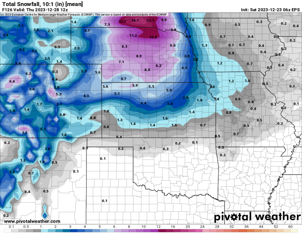
06 EPS
-
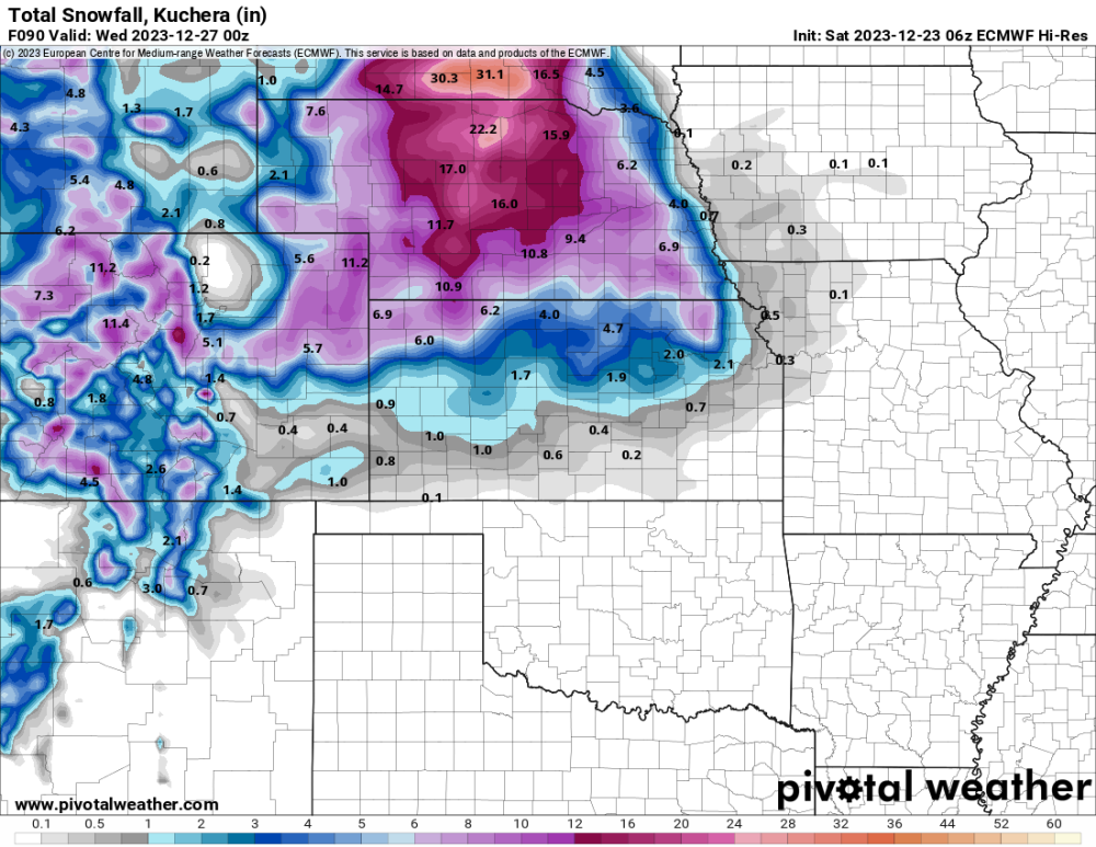
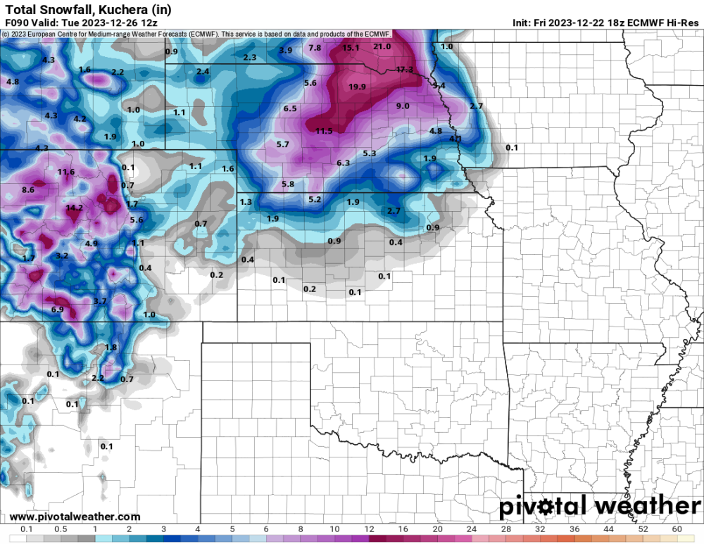
You really see it on this morning’s 06 Euro run. It really dropped snow totals for Omaha.
-
06 Euro. Nice.
-

DECEMBER 2023 Observations and Discussion
CentralNebWeather replied to Grizzcoat's topic in East of the Rockies
What a difference a year makes in Central Nebraska on December 22, 2022, to today.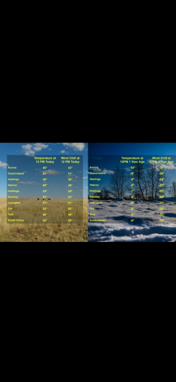
-
0z Euro. Yes please. This would also have wind in Nebraska. Trying to stay calm and not get hopes up.
-
Been at the first of many Christmas gatherings this evening over the next 4 days. Could get exciting around here Sunday afternoon then again Monday night to Wednesday for part 2. Should be good moisture and snow. The big question is how much, and then the chances of increasing winds.
-
Jim Flowers video. https://fb.watch/p5Zm9ZBIqZ/?mibextid=cr9u03
-
You beat me to it by 5 seconds. Thanks for sharing.
-
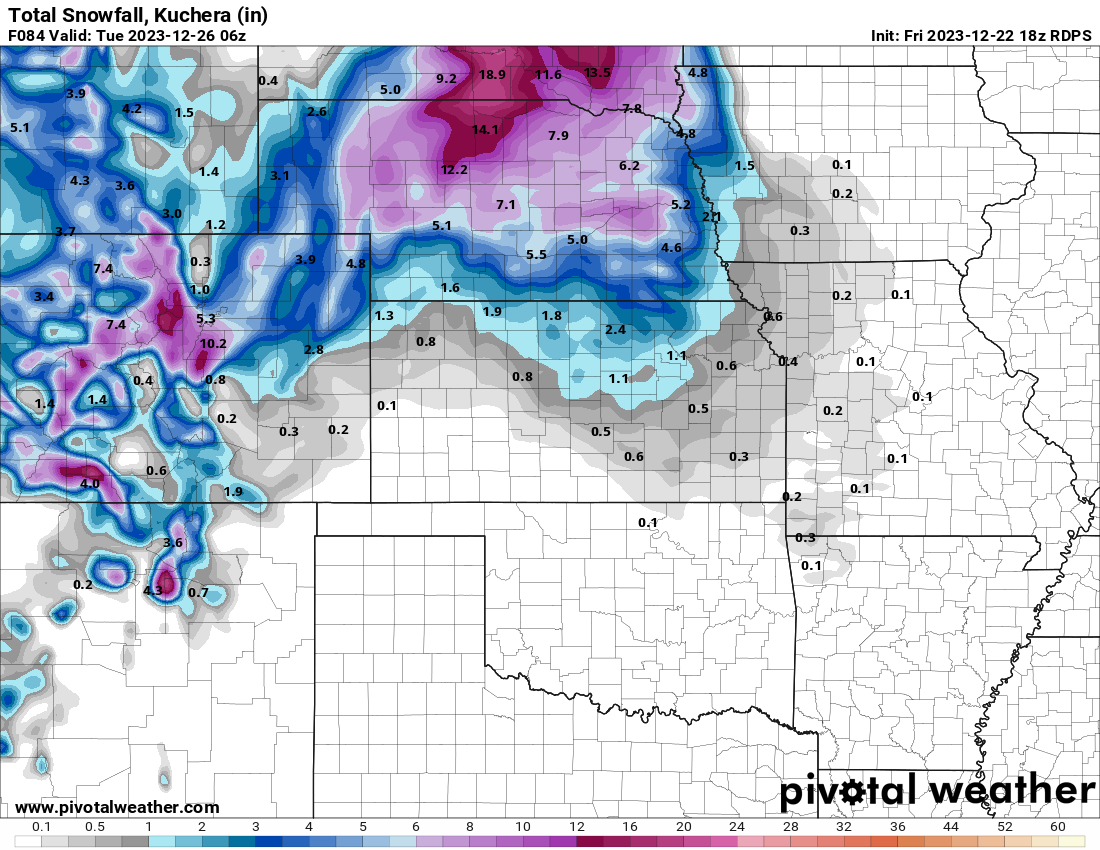
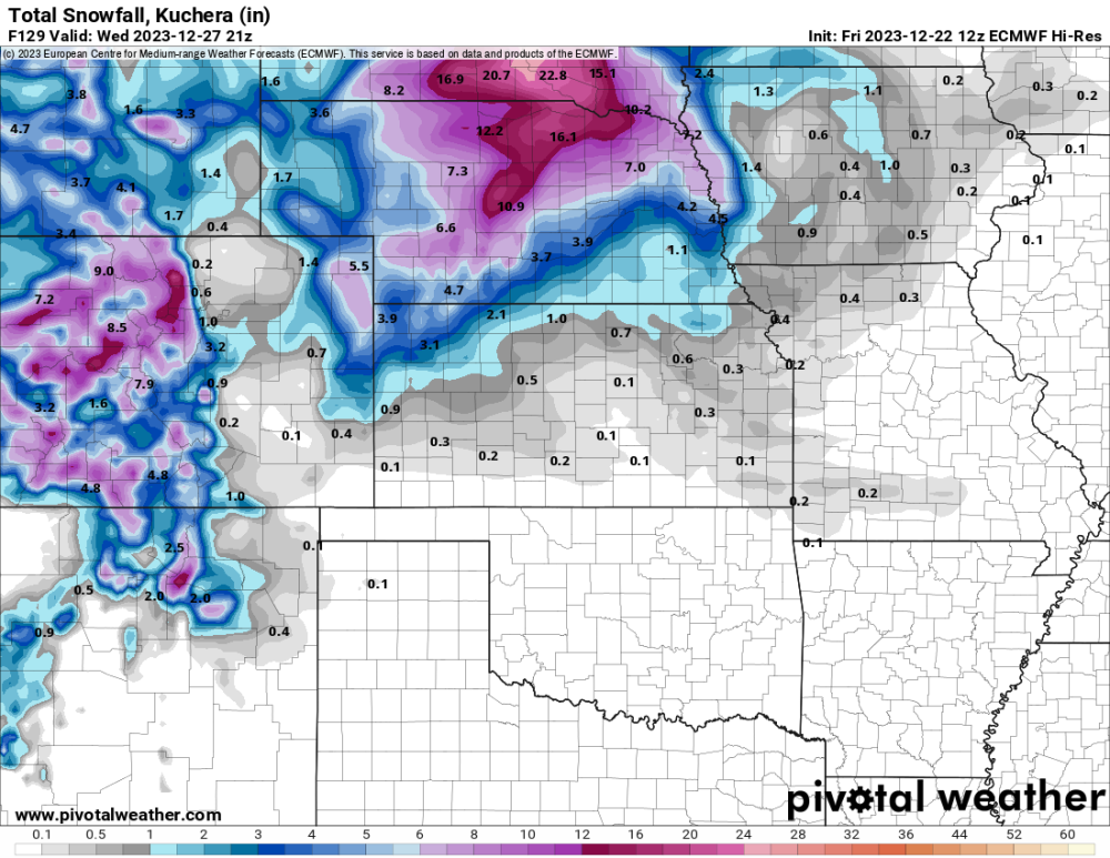
18z Euro. Snow is still falling at 90 hours. I’d take this and run with it.
-
NWS Hastings afternoon disco: A cold front sweeps through the area Sunday morning, and as cold air arrives, this rain will gradually transition to snow from west to east Sunday into Sunday night. There is some uncertainty on timing of this changeover, with some guidance showing a more rapid transition occurring mostly during the day on Sunday. Fortunately, regardless of model solution, the probability for significant winter impacts on Sunday (Christmas Eve) is relatively low. The latest NBM shows only a 10 to 20% chance for even 1" of snow accumulation through Sunday night. The forecast for Monday (Christmas Day) and Tuesday is still rather uncertain. The upper low is expected to stall as it moves over the central Plains, but the specific timing and location varies widely from model run to model run. Unfortunately, this significantly reduces our confidence in expected snowfall. Some runs have several inches of snow on the backside of the low, while others keep it progressive and largely skip our area entirely. Looking at ensembles, the highest probabilities for 3" or more of snow is focused over northern Nebraska. Both the 12Z EPS and GEFS trended upwards slightly from the 00Z runs. The latest NBM has a 20 to 50 percent chance for 4" or more snowfall through Tuesday for much of our Nebraska counties, with decreasing probabilities as you move further south into Kansas. The other thing to mention with this system are the winds. While not overly strong, we could see gusts over 35 MPH Sunday into Monday, potentially leading to some blowing and drifting snow. Depending on model solution, some snow could linger into Wednesday.
-
18z RGEM. Still wraparound snowing in Nebraska at 84 hours.

-
I was half joking about this ending up in North Dakota. My gosh. Hope this isn’t the trend.
-
Western Nebraska, Eastern Colorado and Wyoming were supposed to get hammered. They will seemingly be left with little or nothing if trends continue.
-
You and I would be about the same on this Euro run.
-
At one point, maps had heavy snow in KC. Now Nebraska and South Dakota. Who knows, might be in North Dakota in later runs if this continues.
-
We will have to see what the 12z Euro does. It’s 06 run that ends at 90 hours, looked similar to the 12z GFS.