CentralNebWeather
-
Posts
7133 -
Joined
-
Last visited
-
Days Won
34
Everything posted by CentralNebWeather
-

January 11-13 Major Winter Storm/Blizzard
CentralNebWeather replied to Hoosier's topic in East of the Rockies
12z ICON for 24 hours. More snow after that southeast.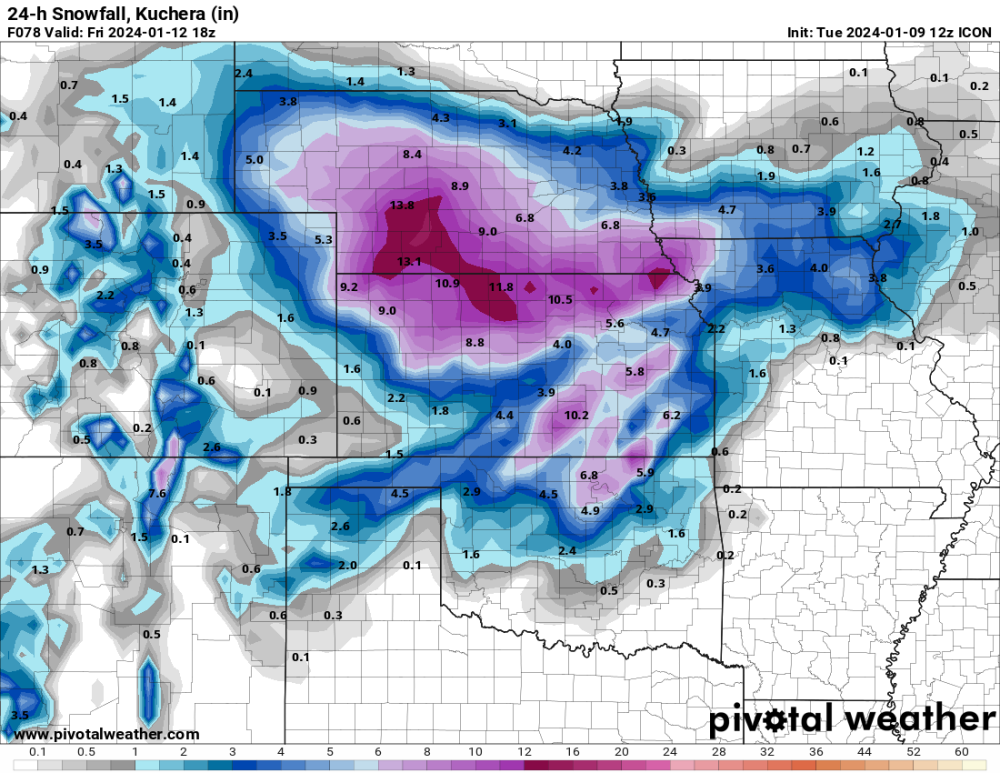
-
January 11-13 Major Winter Storm/Blizzard
CentralNebWeather replied to Hoosier's topic in East of the Rockies
12z ICON going to be a pretty good hit for my backyard. Much farther southwest than other models. -
January 11-13 Major Winter Storm/Blizzard
CentralNebWeather replied to Hoosier's topic in East of the Rockies
Canadian 24 hour snowfall for the next storm. What a pattern is shaping up.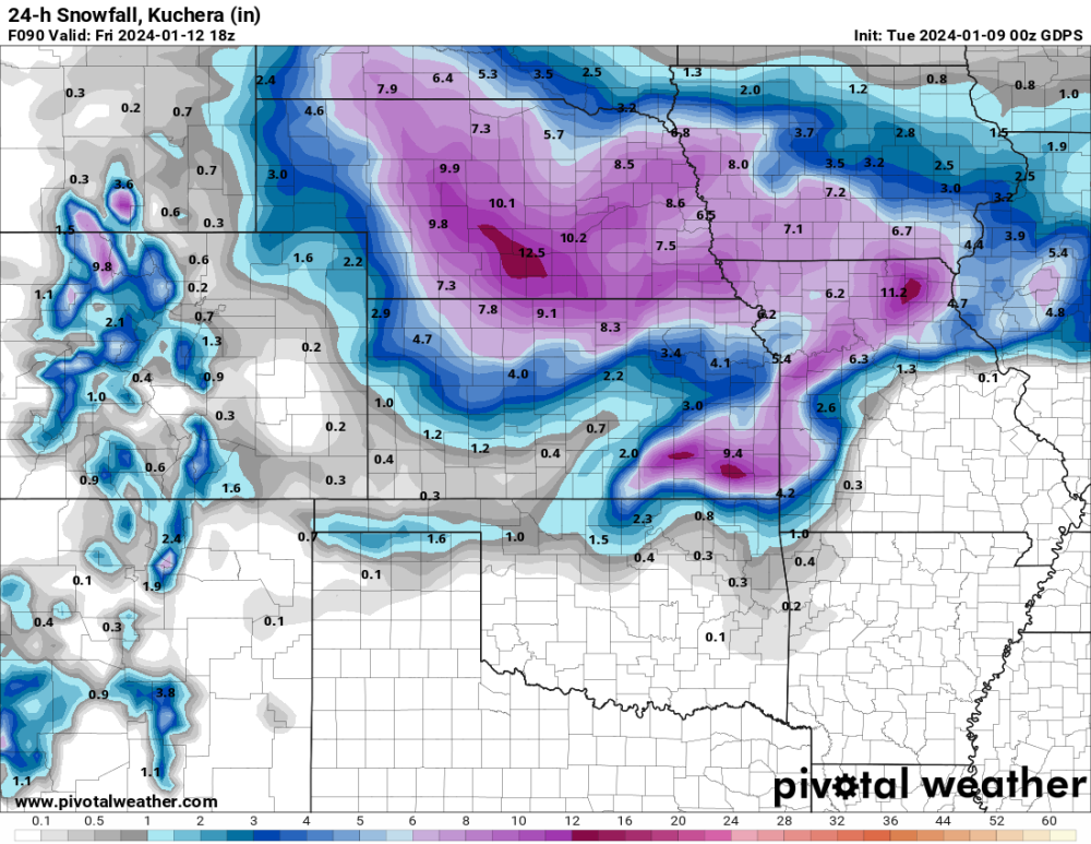
-
IMG_1858.mov 9:20 pm. Another band has developed. Parked my truck and my son’s truck in the driveway to help stop drifts that typically cover our driveway.
-
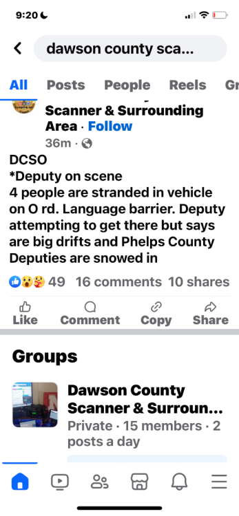
People stranded on a gravel road 4 miles north of Holdrege. A deputy got close, but also is stuck. Other Deputies can’t get to them. I guess they are trying to get a farmer with a large tractor to rescue them. Post is from Facebook.
-
Just east of town at 8:30 pm.
-
January 11-13 Major Winter Storm/Blizzard
CentralNebWeather replied to Hoosier's topic in East of the Rockies
Forecast for Thursday. Interesting.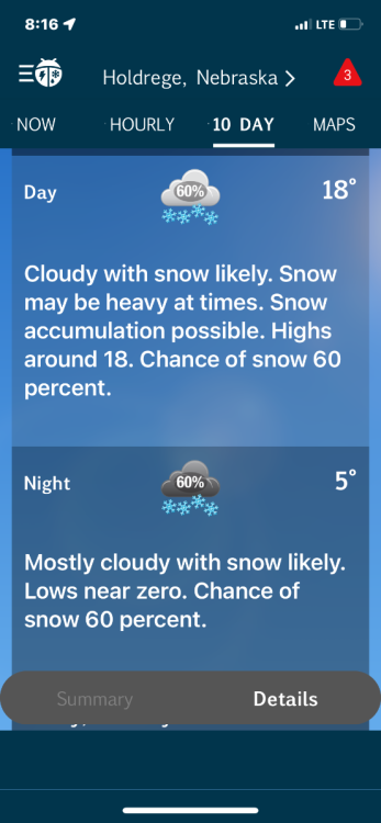
-
January 11-13 Major Winter Storm/Blizzard
CentralNebWeather replied to Hoosier's topic in East of the Rockies
Local met. saying if we add another 3-7” with the next storm on top of what we have right now, lows may be -20’s with wind chills much lower. He even said there might be a day this weekend we stay below 0 for a high. Depends on how much we get later this week. Been a pretty good winter so far. 2 blizzards in the last two weeks. Hope you can score some of the drier snow this weekend. It is fun to watch it blow around. -
January 11-13 Major Winter Storm/Blizzard
CentralNebWeather replied to Hoosier's topic in East of the Rockies
Forecast has me with snow likely Thursday morning through Friday morning. We should have a nice glacier if it verifies on top of what we got today. -
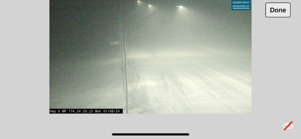
I’m thinking we are going to have some nice drifts. No one from the county will be clearing roads until sometime tomorrow. No travel advised. I’ve had a hard time seeing across the street the last 5 hours.
-
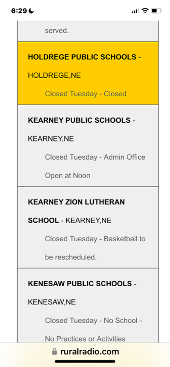
No school again tomorrow.
-
Heavy band is still sitting over me with 50 mph winds. Amounts increased again for tonight.
-
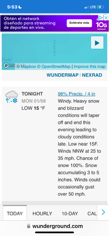
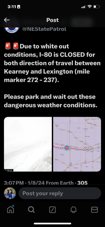
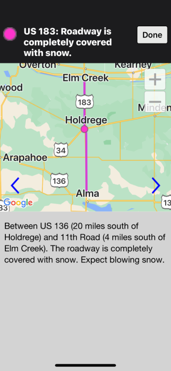
Heavy band over my area with winds gusting over 50 mph. Whiteout at times in town. I guess it is not good in the country. I80 now closed Grand Island to Lexington, 75 miles. Highway 30 closed Lexington to Kearney. Sounds like more east west roads may be shut down tonight. Wind is supposed to increase, if that is possible.
-
-
Probably around 4”. Snowing as hard now as ever, with bands coming up from the south and moving east to west. Looks like they will merge into a nice heavy band. Wind is really increasing. My wife went to the grocery store and had the truck in 4x4. She said visibility decreased from when she left until now
-
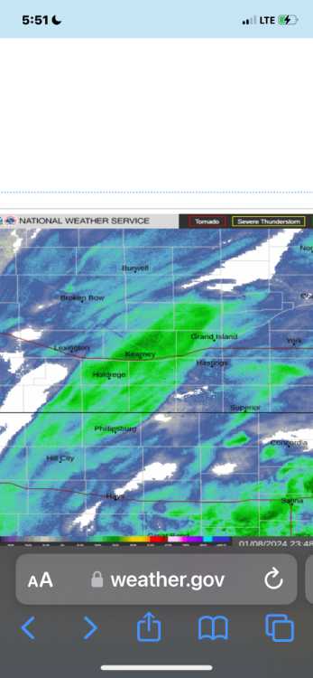
Big ole dry slot in South Central Kansas. Where does it go? Will have big ramifications on the haves and have nots.
-
-
Heavy snow falling. 1.0-1.5” approximately so far. Has some graupel in it. We still have snow in most yards and some small drifts and piles from post Christmas storm. We will transition to drier snow as the temperature drops this afternoon. That’s when the 50 mph winds and blizzard conditions ramp up. Enjoy.
-
-
Well hello Mr. Blizzard
-
January 11-13 Major Winter Storm/Blizzard
CentralNebWeather replied to Hoosier's topic in East of the Rockies
Whoa. That’s a nice run. -
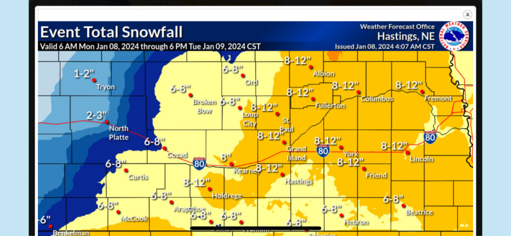
03 RAP. I think we are about to now cast and short term models
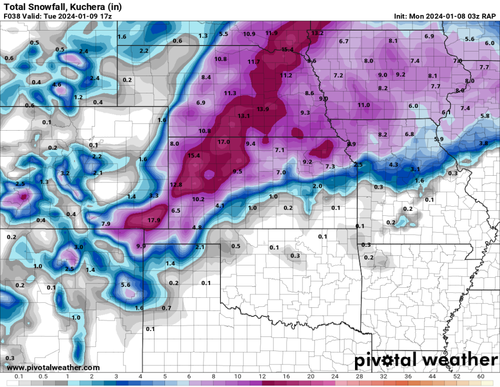
-
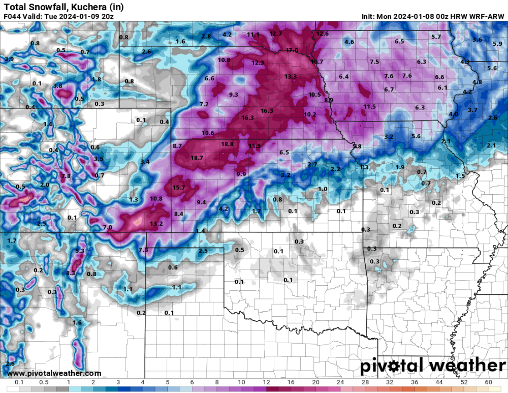
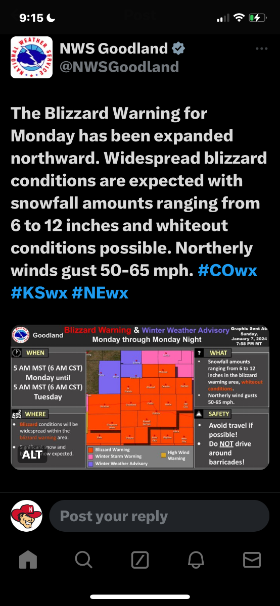
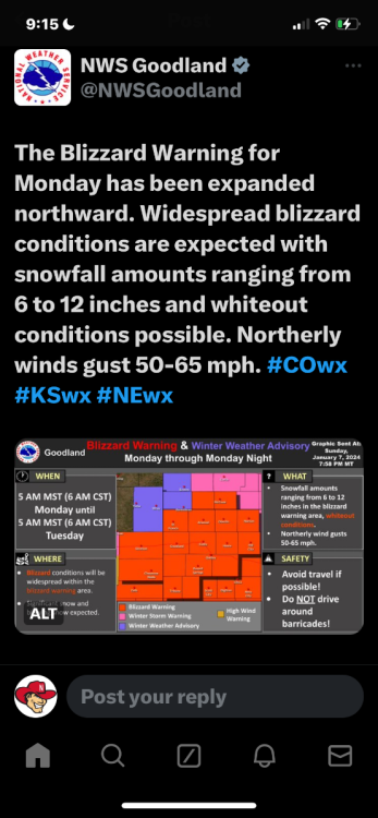
Just saw this posted by NWS Goodland Kansas. You might be on to something with your prediction.
-
I really think this is probably pretty realistic of what we will see. Unless you get under an intense band with convection. NWS is saying 1-2” an hour rates are possible. If that occurs, it could be amazing.
-
0z HRW. Gracious.