CentralNebWeather
-
Posts
7145 -
Joined
-
Last visited
-
Days Won
34
Everything posted by CentralNebWeather
-
We haven’t had any snow days or late starts yet, so we have plenty of time built up.
-
Already had several teachers text me, “any chance of a snow day”? We can hope.
-
That destroys our area if it verifies. We wait and see.
-
Stayed very steady
-

January 11-13 Major Winter Storm/Blizzard
CentralNebWeather replied to Hoosier's topic in East of the Rockies
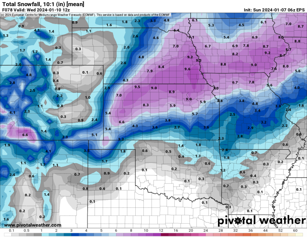
Pretty good increase around here. -
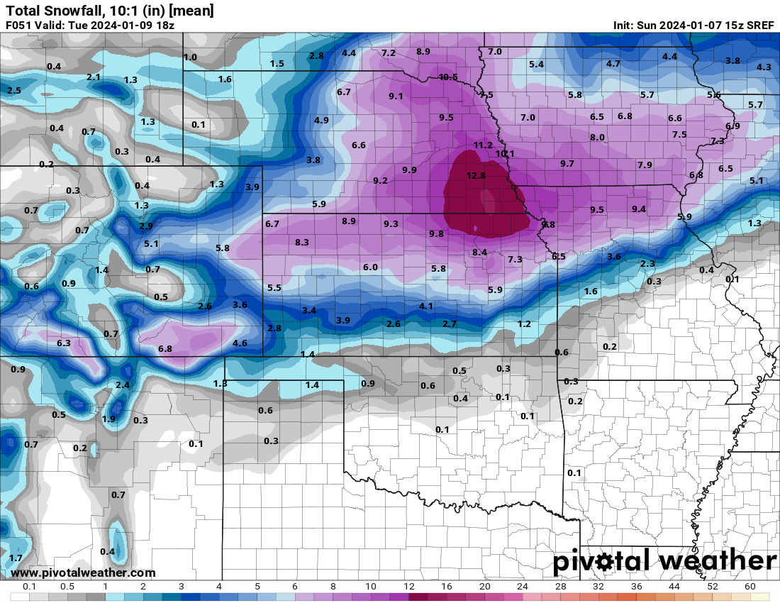
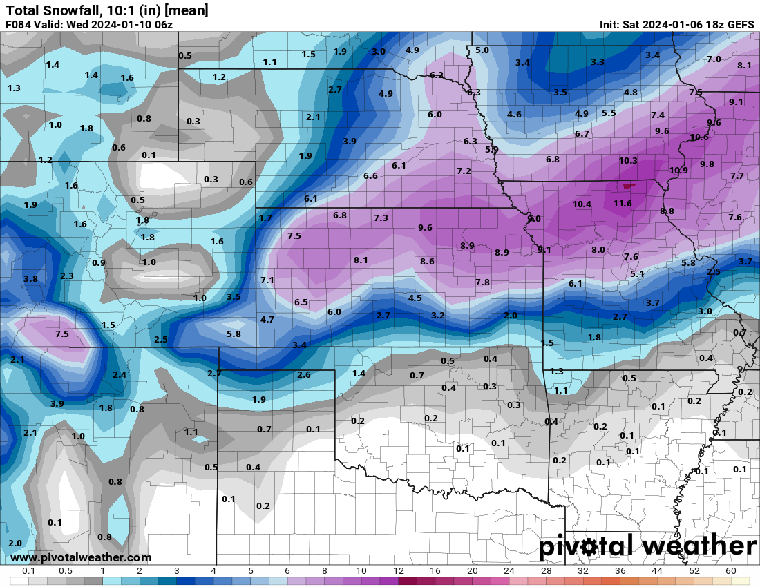
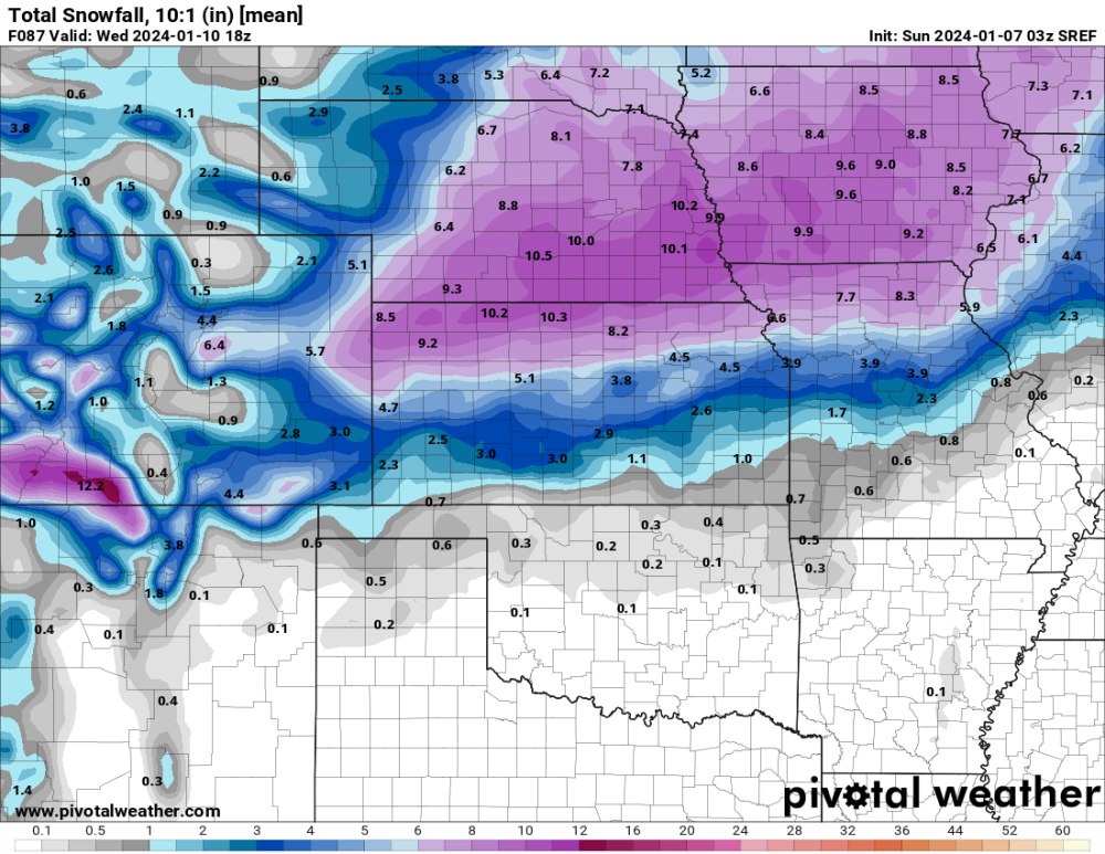
15z SREF 10:1 ratio

-
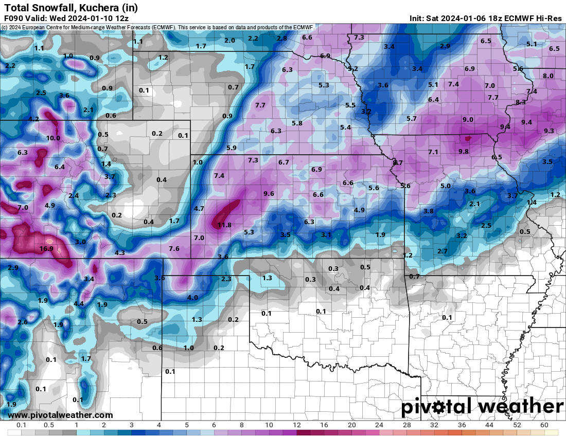
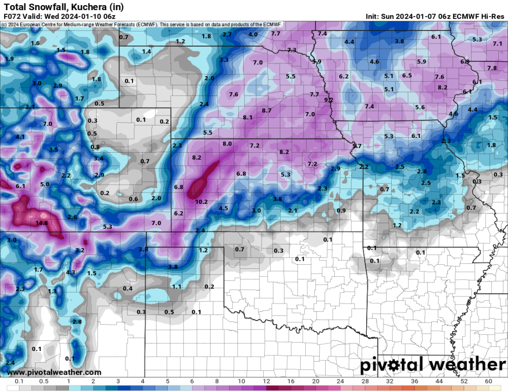
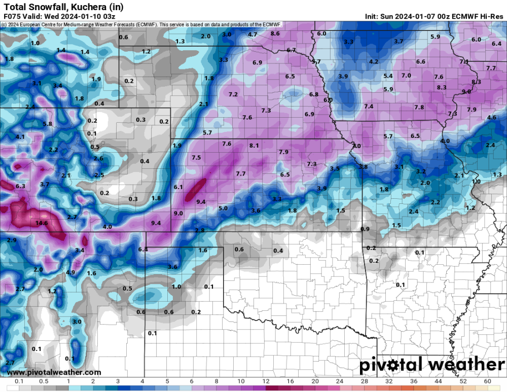
12 Euro Kuchera
-
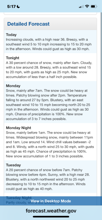
NWS Hastings mentioned in its forecast zone, that the southern counties will be tricky with thermal issues and where does the dry air punch into. I’m sure that will be the issue on the southern side of the storm as a whole. Good luck.
-
06z EPS
-
06z Euro
-
NWS Hastings morning disco Models have had a western shift with the primary deformation snow band, which could be nearly stationary for a time on Monday and combine with other factors to produce brief bouts of heavy snow rates. - Slight uptick in wind gust potential Monday night. Still think most areas will gust in the 30-40 MPH range, but especially W/SW of the Tri-Cities could gust up to 45 MPH. Nrly gusts 35-45 MPH) from W to E, as early as mid-late aftn W of Hwy 283, then elsewhere Mon evening. This will coincide with falling temperatures and increasingly "dry" nature to snow. This will really ramp up the blowing and drifting factor and possibly lead to near- blizzard conditions, especially in open areas, Mon night. Travel on W-E roads, including I-80, could be particularly difficult. Falling snow will end by dawn Tue AM, but winds will be slow to decr...so difficult travel will likely persist into/through the Tue AM commute.
-
-
03z SEEF 10:1 ratio
-
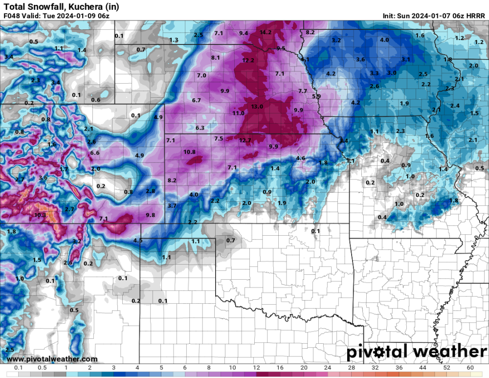
06 HRRR only through 48 hours
-
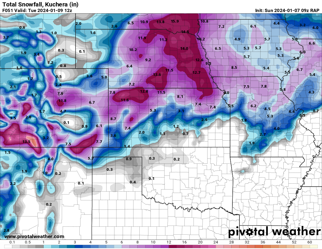
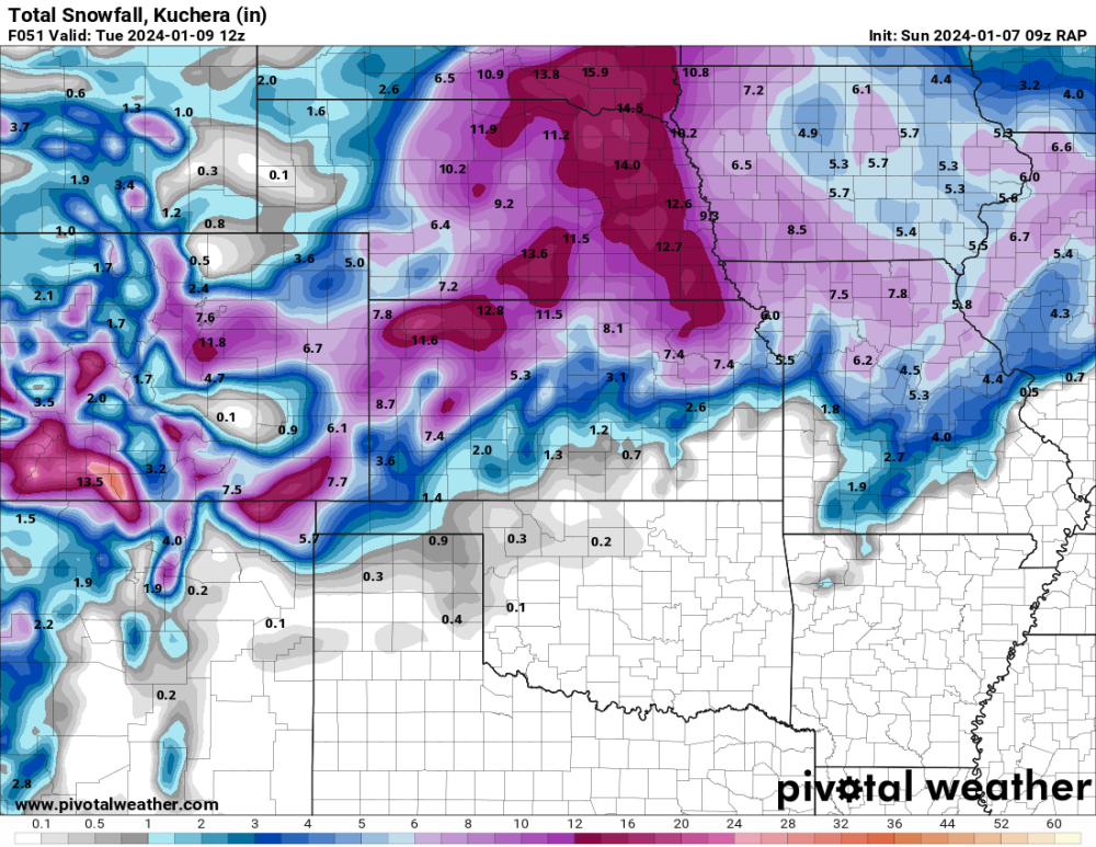
09z RAP to 51 hours
-
That hasn’t changed much in several days of runs.
-
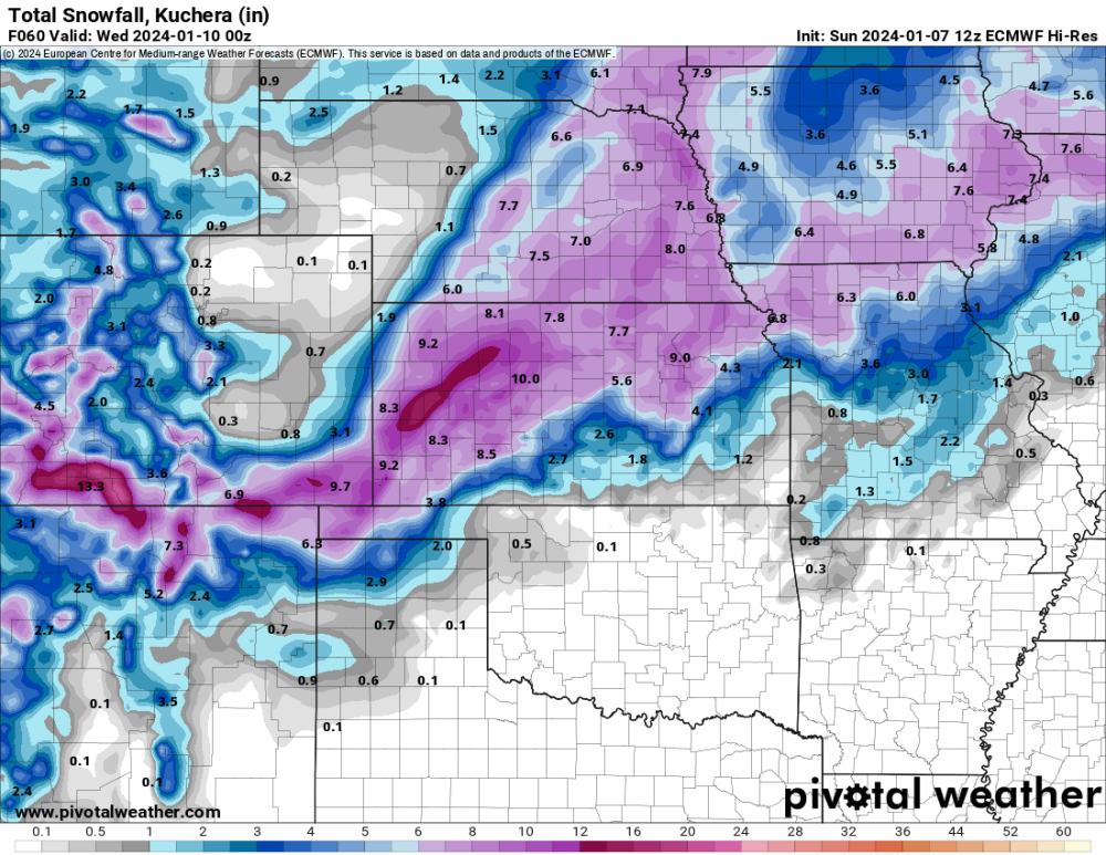
0z Euro. Yes please.
-
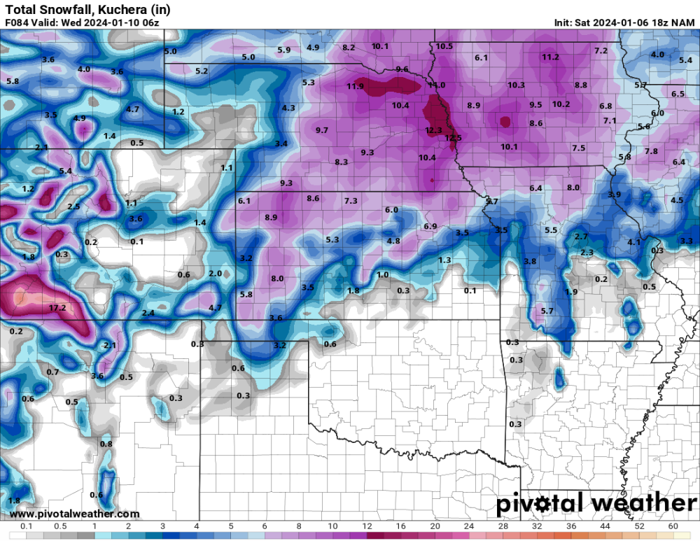
NAM looks amazing for most of Nebraska
-
21z
-
18z Euro.

-
18z GEFS

-
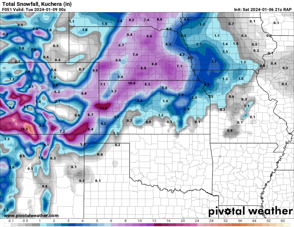
21z RAP to 51 hours.
-
January 2024 Observations and Discussion
CentralNebWeather replied to Minny_Weather's topic in East of the Rockies
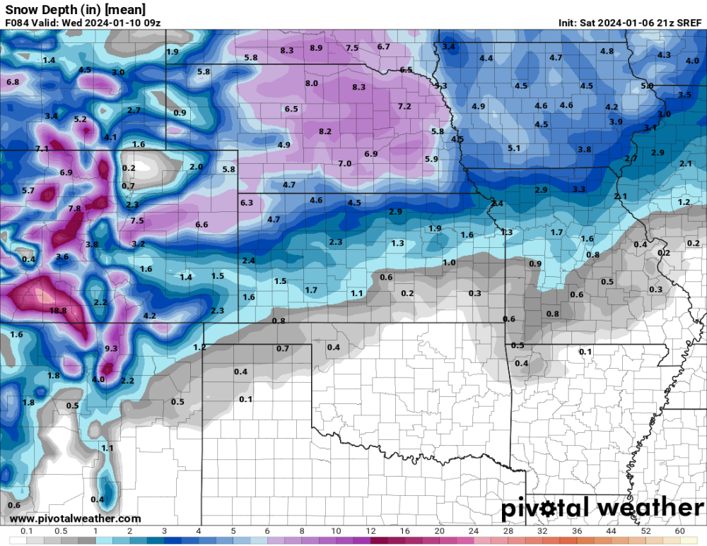
In Ainsworth Nebraska for a varsity basketball. Northern part of the state. Different world here. Snow piles and drifts. Looks like at least a 6” base. -
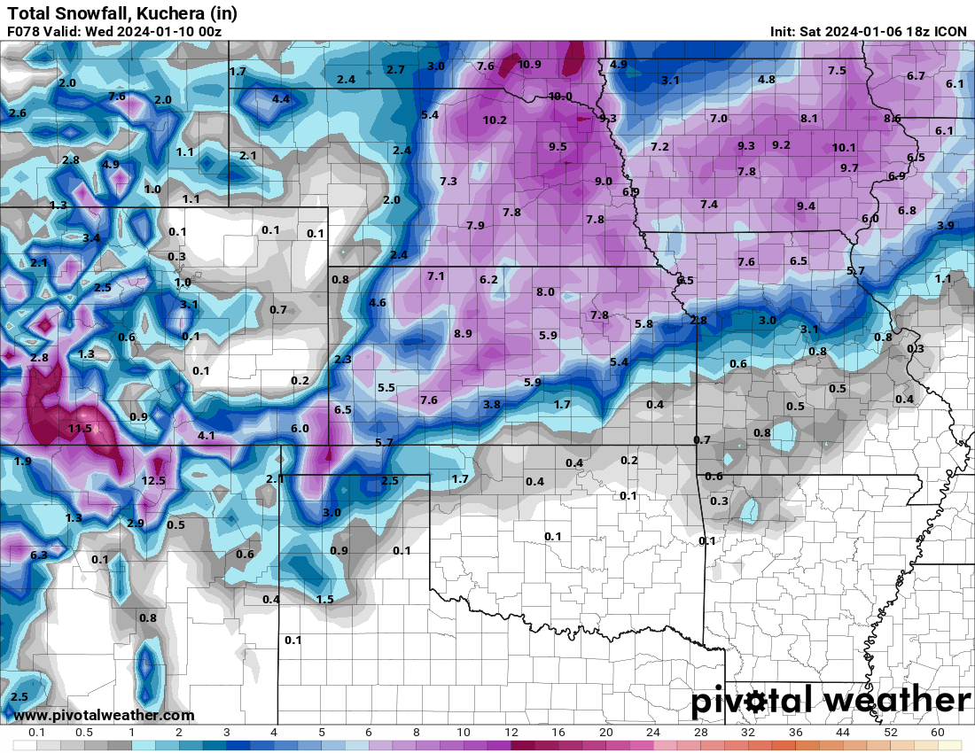
18z ICON. Ok then.

-