tbone8
-
Posts
175 -
Joined
-
Last visited
-
Days Won
1
Everything posted by tbone8
-
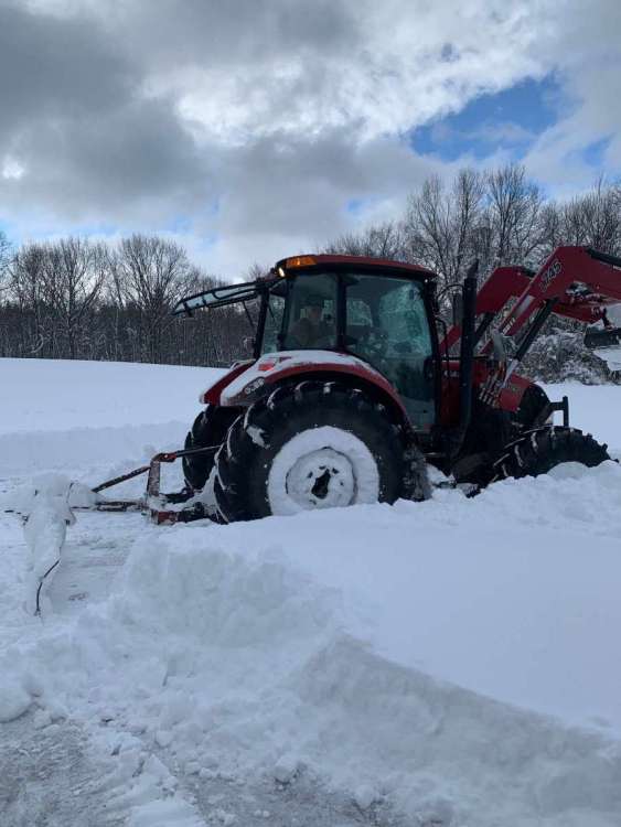
Plowed out!

-
WTH??? They extended the WSW to 9PM! ...WINTER STORM WARNING NOW IN EFFECT UNTIL 10 PM EST /9 PM CST/ THIS EVENING... * WHAT...Heavy lake effect snow. Additional snow accumulations of 1 to 3 inches. * WHERE...Portions of northern Indiana and southwest Michigan. * WHEN...Until 10 PM EST /9 PM CST/ this evening. * IMPACTS...Plan on slippery road conditions. Patchy blowing snow could significantly reduce visibility.
-
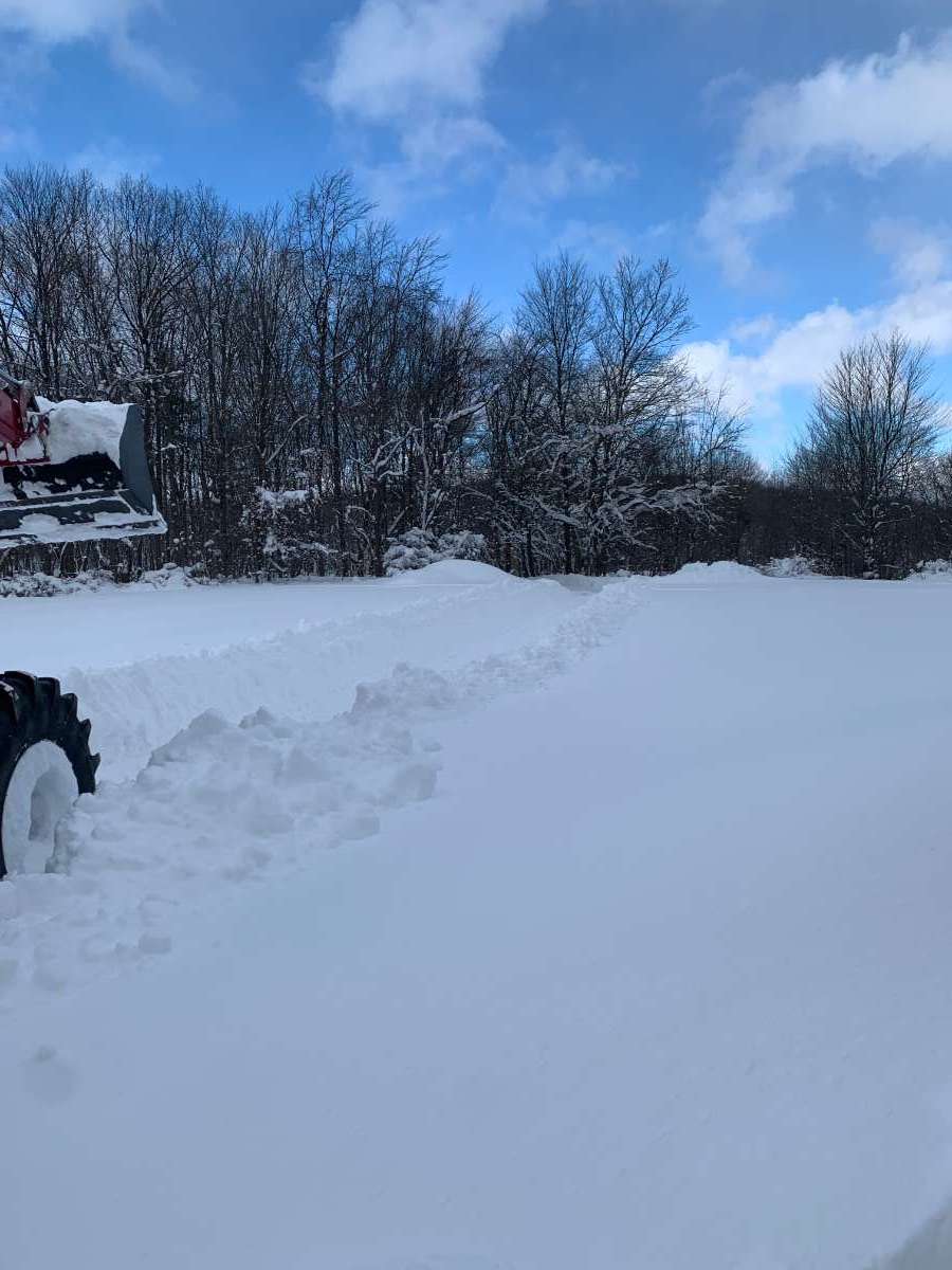
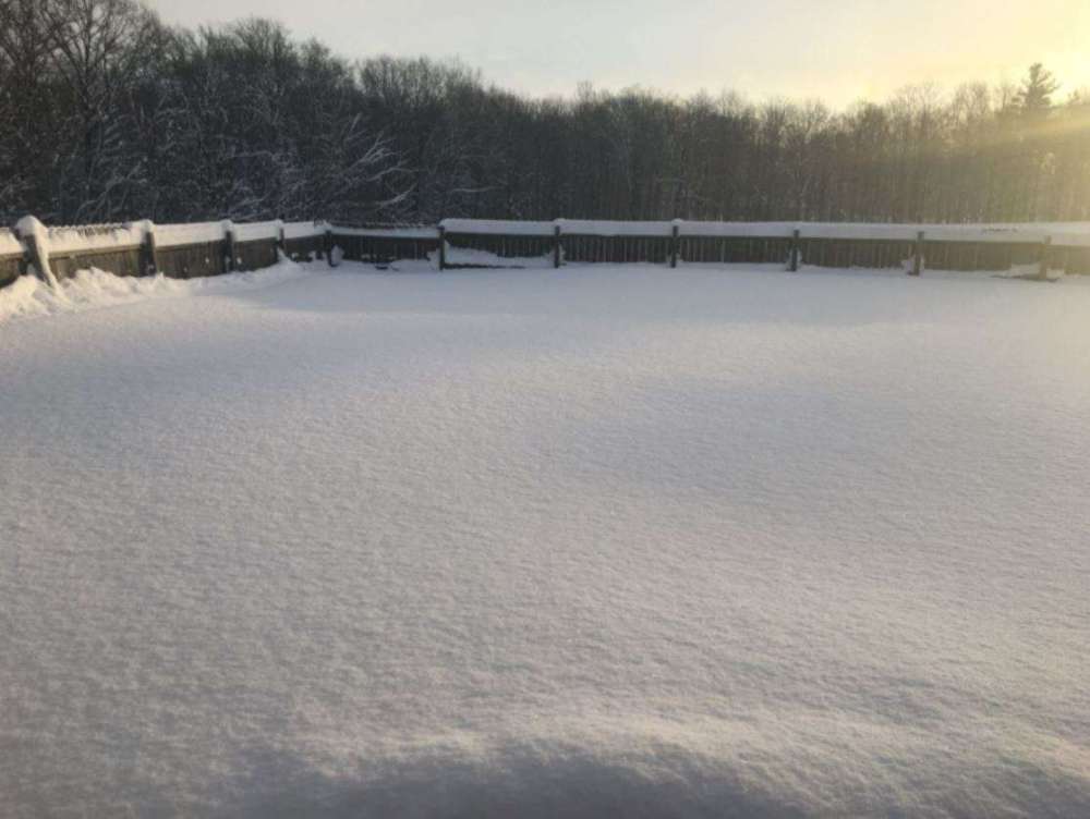
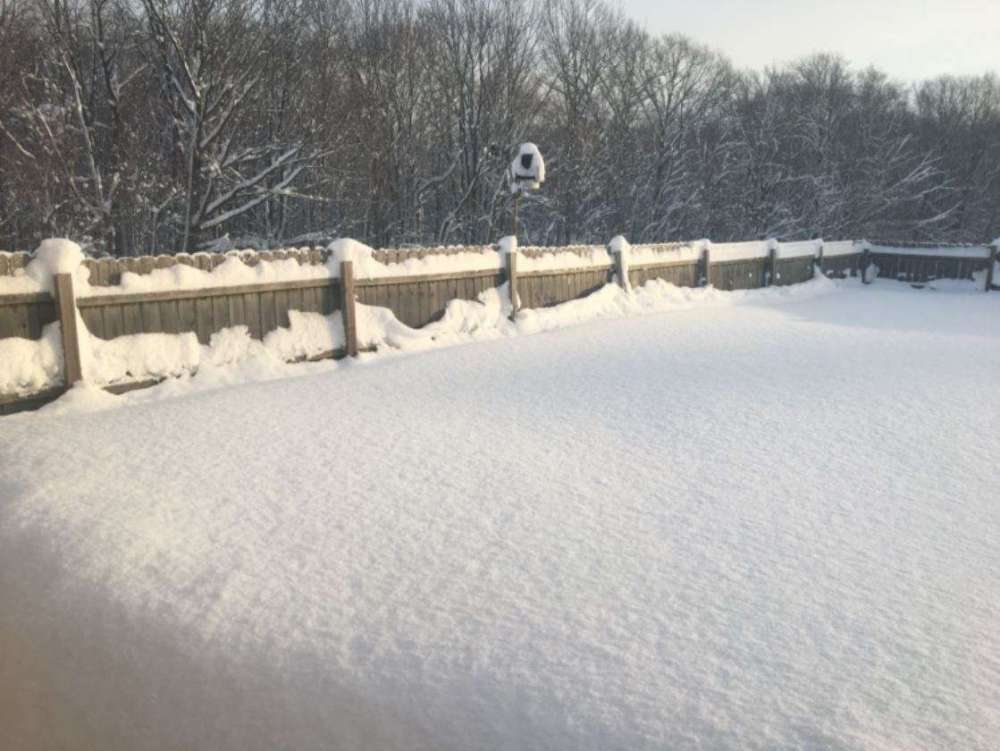
Cripes, we got another 6ish inches over nite! Snow is now halfway up a 6 foot fence, 36" I would guess for the storm total and the plume is coming back for one last pass looks like within the hour. Will take some more pics when my buddy gets here and plows me out so I can walk around.
-
We shall see IJ. Luckily it will warm up next week and hopefully melt it away...
-
Ya, got my buddy coming tomorrow with a big tractor to plow me out...
-
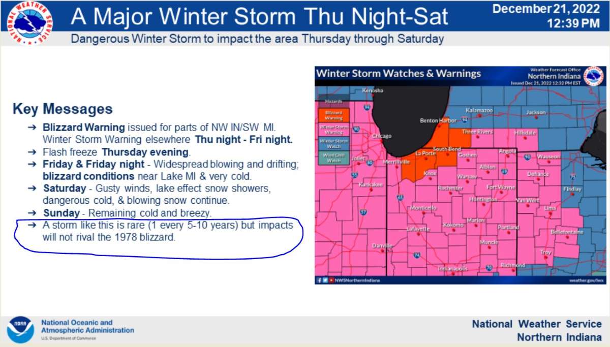
I believe this is it. We have had some doozys before but don't recall ever over 2 feet and counting. Blizzard of 1978 was the most snow, about 36" but if that fetch comes back west, it may eclipse 78. This snow is very light and fluffy, 78 snow was very dense grains which made it so much more difficult to plow.
-
They just extended the WSW to noon tomorrow...
-
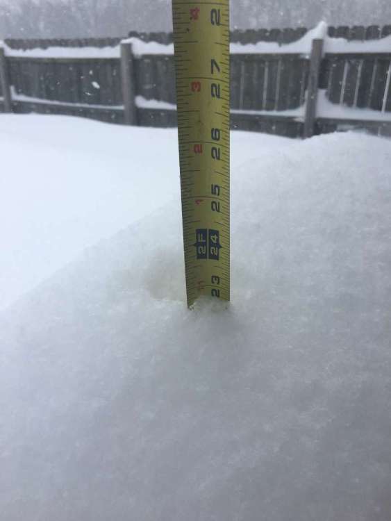
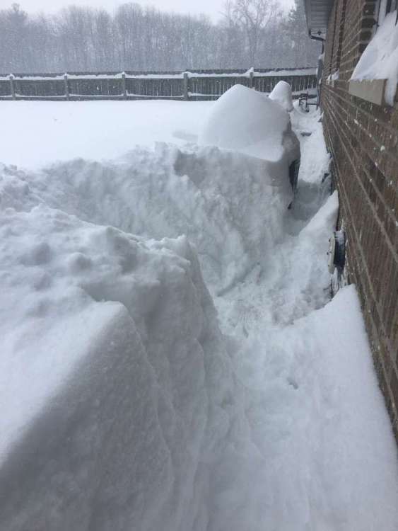
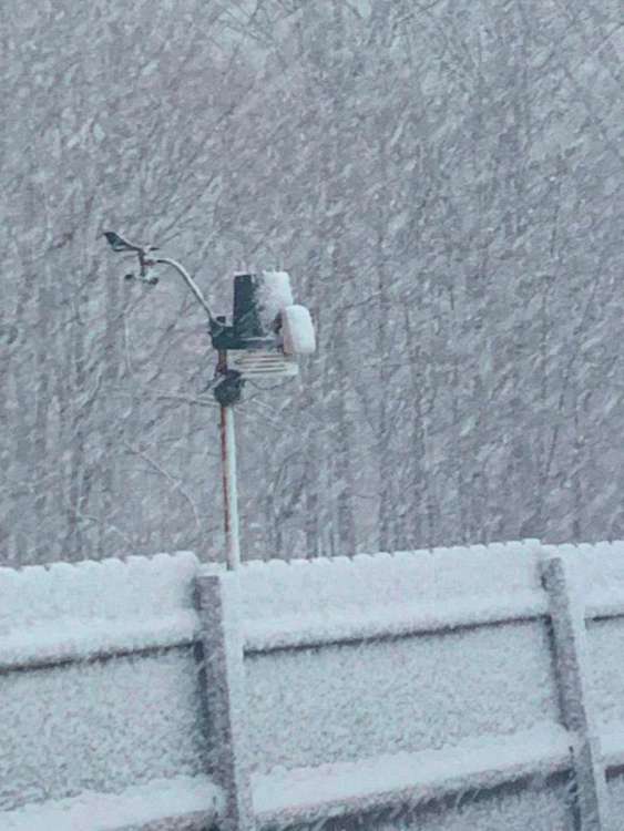
Ok, this is getting ridiculous. I measured the snow on top of my generator and it is 23" but I think the actual total is higher. Snow is up to and covering the generator and outdoor ac cooling unit. Had to clear the snow around my furnace intake/exhaust before it choked off the heat! It is still coming down I would say 1"/hr and if this plume shifts back west, snow will be up to my windows...
-
By WNDU.com Published: Jan. 19, 2024 at 1:05 PM CST|Updated: 55 minutes ago LAPORTE COUNTY, Ind. (WNDU) - Our First Alert Weather team is receiving several reports across northern LaPorte County of over two feet of lake-effect snow, and it’s not over yet! One of our viewers, Nancy Laughlin, has confirmed over two feet of snow has fallen as of 12 p.m. CST on Friday in Pinebrook subdivision on Oakmeadow Drive, which is just north of the city of LaPorte. According to our First Alert Weather team, a FEMA coordinator for this region also confirms over two feet of snow. https://www.wndu.com/2024/01/19/areas-laporte-county-see-over-2-feet-snow-friday/
-
Difficult to tell with the blowing but I would estimate close to 24" and it is still coming down...
-
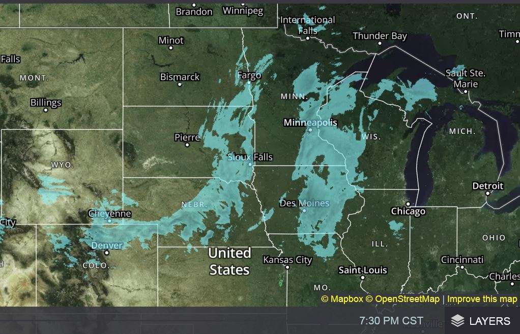
Been snowing hard since I got up around 7:30. Still coming down pretty good though doesn't show it on the radar.
-
IMG_1047.MOV
-
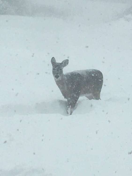
Snow is up to her belly...
-
Getting absolutely buried here in LaPorte County...
-
It is coming down like nobodys business here...
- 1240 replies
-
- 10
-

-

-
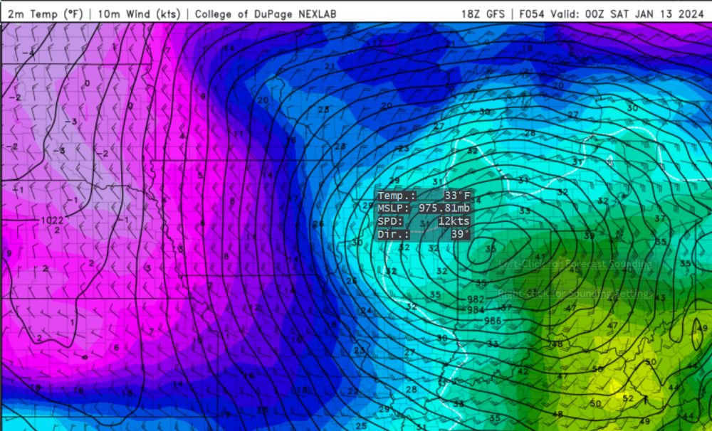
975.81mb, wow...
-
...WINTER STORM WATCH IN EFFECT FROM FRIDAY MORNING THROUGH SATURDAY AFTERNOON... * WHAT...Heavy snow possible. Total snow accumulations in excess of 6 inches possible. Winds could gust as high as 35 to 45 mph. * WHERE...Portions of northern Indiana and southwest Michigan. * WHEN...From Friday morning through Saturday afternoon. * IMPACTS...Travel could be very difficult. Areas of blowing snow could significantly reduce visibility. The hazardous conditions could impact the Friday evening commute. Gusty winds could bring down tree branches. * ADDITIONAL DETAILS...Conditions are expected to deteriorate through the day Friday. Wind gusts from the west of 35 to 45 mph are possible Friday night and Saturday.
-
Hi IJ. As someone who lived through and experienced the blizzard of 1978, that, was a generational storm. Fortunately, nothing like it since has occurred and I am fine with that. Bad storms cost money and potentially lives...
-
Pre-Christmas Storm Plains/MW/GL 12/21-12/22
tbone8 replied to bud2380's topic in East of the Rockies
It is really coming down here, darn near white out. Hard to tell how much has fallen, guess 4-6". Radar doesn't do justice to what is happening. Gonna start piling up if this rate continues... -
Pre-Christmas Storm Plains/MW/GL 12/21-12/22
tbone8 replied to bud2380's topic in East of the Rockies
Light grainy snow here by LaPorte, temp 32.0°, calm winds. Feels like it is gonna break loose, the calm before the storm so to speak...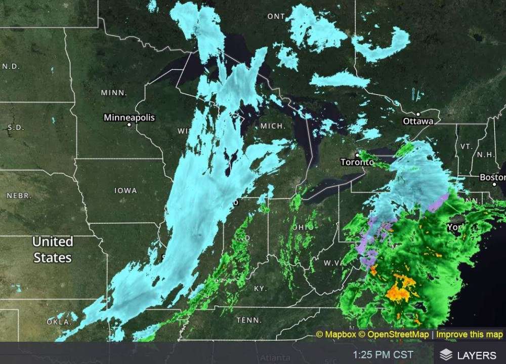
-
Pre-Christmas Storm Plains/MW/GL 12/21-12/22
tbone8 replied to bud2380's topic in East of the Rockies
Current radar
-
Pre-Christmas Storm Plains/MW/GL 12/21-12/22
tbone8 replied to bud2380's topic in East of the Rockies
For giggles I took a peak at the temp models around new years. On the plus side, models show darn near 60° on Jan 1 which will hopefully melt off a good share of what is coming. However, temps like that in January usually bring a friend with them to the tune of another big snow event...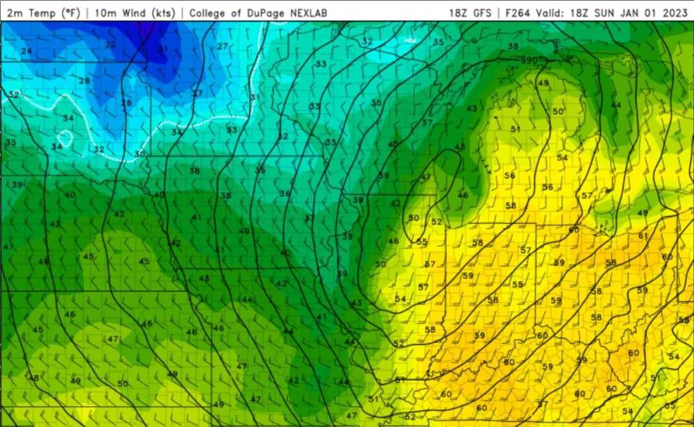
-
Pre-Christmas Storm Plains/MW/GL 12/21-12/22
tbone8 replied to bud2380's topic in East of the Rockies
IWX says this storm will not rival 1978... LOL
-
Pre-Christmas Storm Plains/MW/GL 12/21-12/22
tbone8 replied to bud2380's topic in East of the Rockies
I am very surprised you were plowed out the night the snow stopped. As I said before, you could not see our mailbox as it was a rural box on a post, approximately 4 foot off the ground. It was approximately 1 week after the storm ended that we were plowed out. A road grader with a V blade opened the road. The operator would gun it, hit the snow, move a few feet, back up, gun it and repeat. A Payloader came the next day or two and widened the road as it was only about 8-10 feet wide and snow piled up on both sides at least 10 foot high in places. I wish I had a cell phone back then and had more pics... -
Pre-Christmas Storm Plains/MW/GL 12/21-12/22
tbone8 replied to bud2380's topic in East of the Rockies
Yes, and a blizzard is a very dangerous situation. Watched a documentary a few yrs ago about the 77 or 78 blizzard where a fella got out of his stuck vehicle and attempted to walk home a relatively short distance. He got disoriented and froze to death only a stones throw away from his home. Back in 78, very few folks had 4wd vehicles and most were smart enough to shelter inside during that storm. I fear today with everyone having a cell phone and an suv, some will feel bulletproof with this dangerous storm potentially costing them their lives. I let people close to me know to be off the roads NLT 6pm and stay put till it is over!