


Hawkeye
-
Posts
7163 -
Joined
-
Last visited
-
Days Won
17
Everything posted by Hawkeye
-
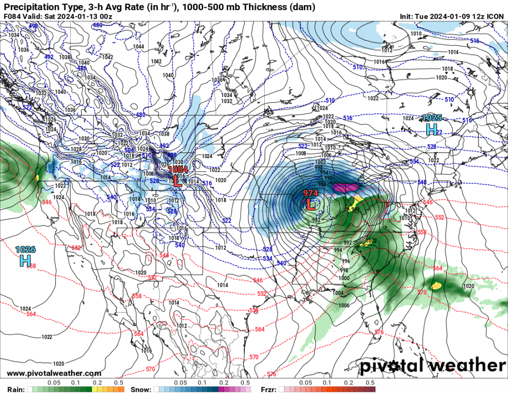
ICON
-
Yeah, a yellow band is about to move over Homestead. I am up to 6 inches. The snow has been a bit lighter than expected so far this morning, with too many breaks, but it's dumping now.
-

January 2024 Observations and Discussion
Hawkeye replied to Minny_Weather's topic in East of the Rockies
It appears it may be brutally cold for the Iowa caucuses next Monday evening. The Euro is showing a temp across the state of -10F and a wind chill of nearly -30F. -
The Des Moines/Ames area appears to be the overnight winner, with reports of 8-10".
-
I'm at 4.8" this morning, waiting for the defo zone to solidify. The ratio so far is 8.7 to 1. With another 12 hours to go, I should get another 4-6".
-
I'm up to 3.1".
-
I already have 2.1 inches, so it is accumulating efficiently.
-
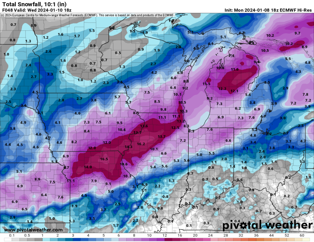
18z Euro... continues to shift the heaviest band southeast.

-
Models continue to fade southeast.
-
So even if we get a solid 10:1 ratio, the GFS says Cedar Rapids only gets 8". Meanwhile, DVN says 11-16". That just seems way overdone. I'm still only expecting 6-8". Tomorrow's wind will certainly not help ratios. I ALWAYS get garbage ratios when the snow is blows around and compacts in my yard.
-
So now it's 11-16" in Cedar Rapids? Jeez. I'm still going with 6-8". It will be interesting to see what the average ratios are. The models are consistently showing ratios in the good snow band only around 7 to 1, pretty awful. The NWS graphics suggest a ratio above 10 to 1.
-
The latest Euro is a bit messy with the energy, so it's kinda strung out until farther east.
-
12z GDPS slid a bit farther east, similar to the GFS.
-
Totals appear to be dropping for areas north and west of Waterloo.
-
Risk for Iowa continues to be too much of an eastward slide.
-
I've learned to be conservative. I'm discounting the higher end of the range being pushed by the NWS and local mets. I'll go with 6-8" for Cedar Rapids.
-
COD https://weather.cod.edu/satrad/nexrad/index.php?parms=EAX-N0Q-1-12-100-usa-rad
-
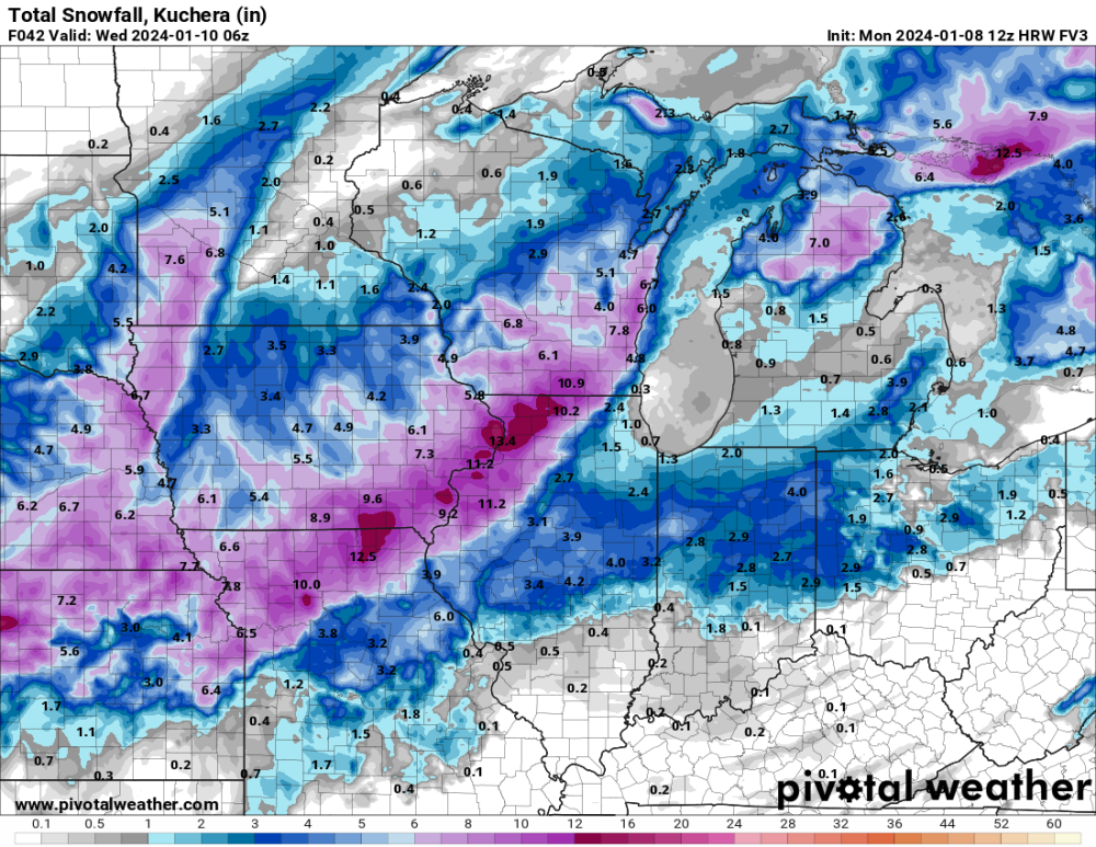
FV3 is southeast as well, much better for KC. In general, models are also dropping totals across northern Iowa.
-
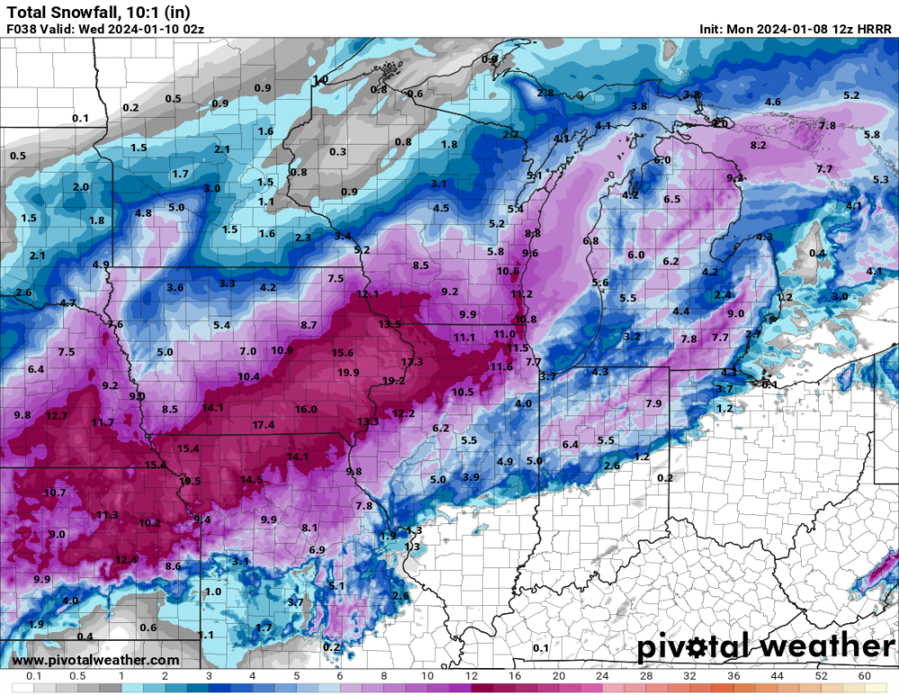
I'd say the 12z HRRR is a bit over-juiced.
-
Euro sliding a bit too far east for Iowa, but it's going big.
-
That map goes through Thursday morning and includes the next wave of snow not associated with this storm.
-
The GDPS continues to not even show warning snow across eastern Iowa.
-
This ICON run simply has the short wave flying eastward way too quickly. It needs to dig more and slow down.
-
I'm not sure how the model blend is coming up with 11" in Cedar Rapids. I don't think there is a single model showing that much. Using Kuchera, most models are 6-7".
-
That's interesting how the HRRR has shifted the heaviest snow band northwest of Cedar Rapids.


