Brian_in_Leavenworth
-
Posts
3545 -
Joined
-
Last visited
-
Days Won
7
Everything posted by Brian_in_Leavenworth
-
Euro was also a big letdown for them.
-
They are buying snow, except the Thursday system where there's a warmup. They weren't sure what areas would remain snow for that one.
-
-
Snyder will do a livestream between 5 and 6 this afternoon.
-
This run showed a lot less snow for the NE than before.
-
In late November 2008 people were already canceling winter. And others were putting a fork into it. Nothings changed.
-
Colorado ski areas are doing pretty well for snow so far. Breck has had 97 inches so far a 28" base.
-
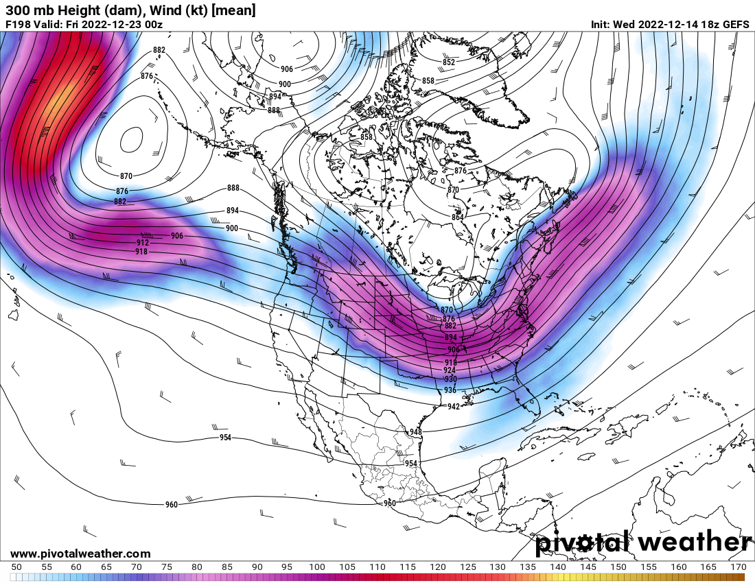
GEFS agreeing with the OP on a jet extension later on. Earlier this week it looked like an endless death ridge on the long range ensembles. Wish the weeklies didn't have the death won't for the next 6 weeks, but maybe the next one wont.
-
Hard to believe a system could punch through a fairly strong ridge and still pack a decent punch like that. Maybe it will be the "sacrificial lamb" storm that helps to beat down the ridge.
-
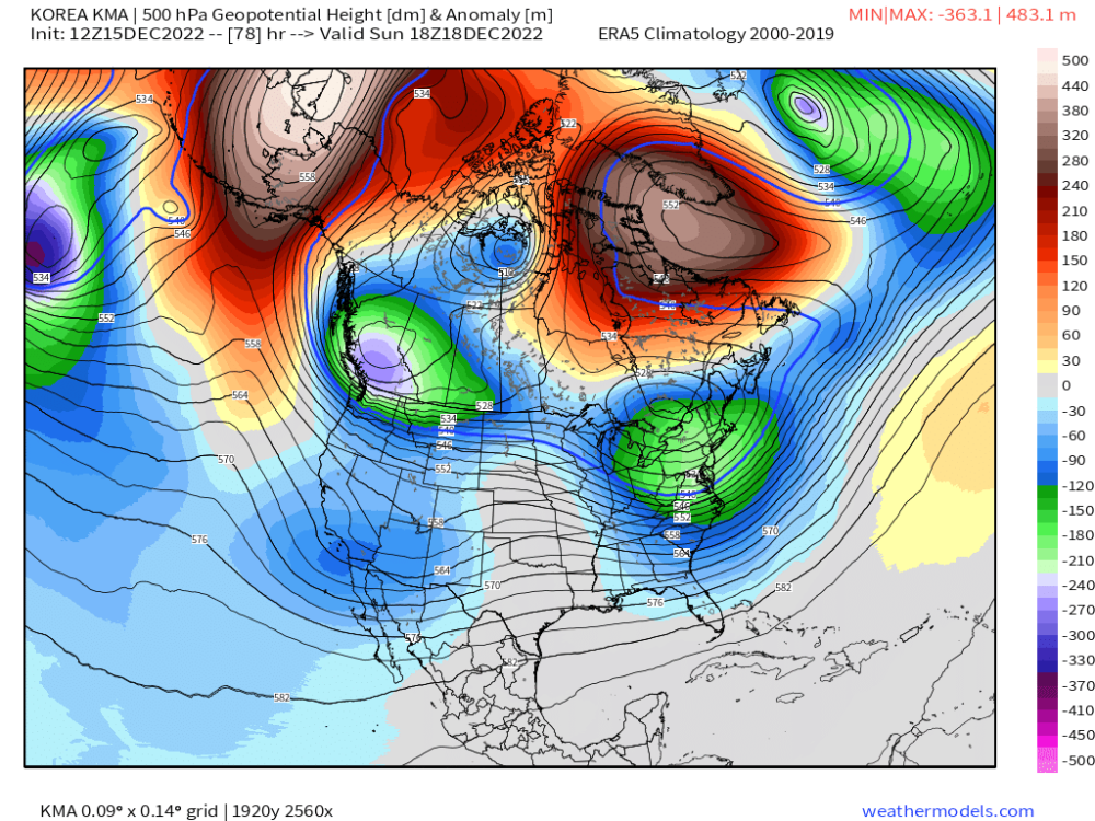
You want the Korean model? I'll give you the Korean model
-
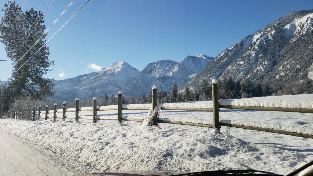
 Bellingham and Anacortes and I assume the rest of Skagit County had a white Christmas that year. I remember it started Saturday evening the 21st. We were just wrapping up our Christmas party with my friend group and someone came back inside and told everyone it was snowing. Great memory.
 -
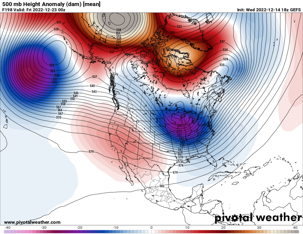
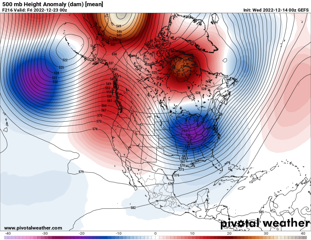
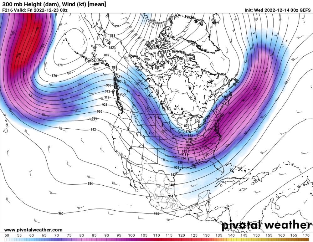
GEFS looks like it wants to have the Westerlies break through around day 9? Quite a change from other runs. 18Z vs 00Z And the Jetstream, same comparison

-
They are very good as far as their discussions. Someone said they have it easier, but it's not that simple. Obviously Seattle has very difficult forecasts in marginal situations, but there are marginal situations in the Spokane area too. And lots of different terrain, like in the Western zones like where I live and there are steep precip gradients and various microclimate and terrain. Then you have the lower basins, Northern Mountains and the Spokane, CDA and North Idaho areas, etc.
-
Yesterday's 12z chart was for 15 days, this is for only 6 days. So did you mean better for those 6 days?
-
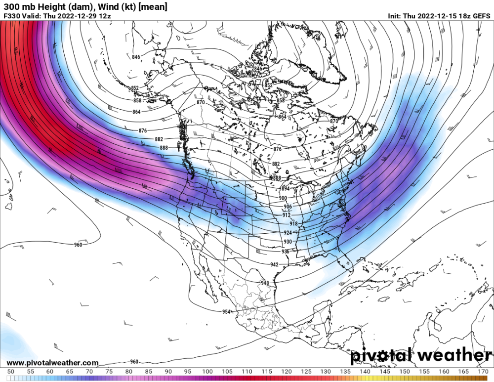
Not a massive improvement, but a step in the right direction. And a bigger step forward on the Canadian ensembles. After Day 10 it still looks like ridging but better short to medium gains than gains in the 12-15 day range l.
-
Later on in the run the 850s are colder by a bit compared to the 12Z. Talked about that earlier.
-
That's pretty significant.
-
Day 7 and 8 are a bit cooler on the 850s
-
Imagine forecasting for the NWS. People expecting definitive forecasts. What do you do? Don't envy them. EPS will be huge.
-
When was the last time you saw this much snow over the ocean?
-
Doesn't hurt either to leave the doors under your sinks or vanities open to allow for some heat to the pipes. But moving water is so much harder to freeze, so leaving a tap dripping is really important. And it should be the one furthest away from the hot water tank.
-
Interesting that it is colder for the West side compared to 00Z, but actually not as cold for the Eastern WA than the 00Z, though still extremely cold.
-
The 06z Icon was noticeably east on its run. Hopefully for you guys not a trend.
-
They can be accurate, and during benign weather they are OK, but during major weather events, useless. I remember the Microsoft weather app had Leavenworth once getting rain and Seattle getting snow when of course it was the other way around. Turns out the app was based out of Norway or some other really far away place. And of course there is nobody working for the app who is actually making these forecasts.
-
Weather apps are useless. Seriously.