bud2380
-
Posts
5976 -
Joined
-
Last visited
-
Days Won
11
Everything posted by bud2380
-
It's 539 miles (by highway miles) from St. Louis to Minneapolis. That's about the gap between the GFS and Canadian for the SLP.
-
D**n, that's one sweet map for my backyard.
-
GFS sticking with its far northerly solution for the midweek system next week.
-
Most of the AFDs I read today were pretty lame regarding this potential system, but DMX did have at least a little bit on it. By Thursday the long wave trough will mature through the Rockies, but as one would expect at Day 7 there are varied solutions among the ECMWF and GFS deterministic runs and their associated ensembles with uncertainty regarding short wave strength and timing. Thus confidence is fairly high in some form of precipitation around this time across the Midwest, likely snow of some degrees over portions of IA, especially north, but confidence in details is low. Confidence is also high in an associated nearby frontal system and baroclinic zone, but the aforementioned variability will result in low confidence down to the scale of our forecast area with the surface low track anywhere from IA to MO. This will result in a fairly wide range in potential temperatures. Although it will be beyond the forecast period, there is relatively high confidence in colder weather behind the passage of this system to end the work week with what would likely be the coldest temperatures of the season.
-
Definitely starting to look more promising for something to track anyways. Right now looks like some overrunning snows at the onset with the SLP coming in after. Those are always interesting with the areas that can get snow from both ends really scoring. GFS with plenty of cold air behind the system too.
-
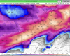
Total QPF from the GFS through the morning after Christmas. This encompasses the 2 storms showing up on the GFS during this time. One on the 20th/21st, and another on the 24th/25th. http://maps1.pivotalweather.com/maps/models/gfs/2017121412/288/qpf_acc.us_mw.png
-
yeah i'll take that CMC run all day. Too bad the Euro is going to be 400 miles further north http://maps3.pivotalweather.com/maps/models/ggem/2017121412/174/prateptype.us_mw.png
-
12z GFS shifted further south with the 20th/21st system. Looks a lot like it did 2 days ago. Gets snow as far south as southern MN.
-
GFS might not be showing much snow, but it's showing extreme cold in the day 9-10 time frame. http://maps1.pivotalweather.com/maps/models/gfs/2017121318/234/sfct.us_nc.png
-
Hey at least the Euro finally breaks down that western ridge at the end of the run. http://maps1.pivotalweather.com/maps/models/ecmwf/2017121312/240/500h.conus.png
-
also here is the Canadian. All the models are agreeing on a system in the 20-22nd time frame. The location and strength are just inconsistent as you would expect. I'm sure we'll see many more changes in the next several days. Hopefully it ends up trending the right way. http://maps3.pivotalweather.com/maps/models/ggem/2017121312/216/snku_acc.us_mw.png
-
There's a wonderful feature called ignore on here. I use it just for one person and one person only....

-
Well that run of the GFS looked a lot like the Euro. Crappy and dry. Canadian is a little better, but not much.
-
Back to back great runs by the GFS. Lock it in. Guaranteed white Christmas for all.
-
Seems to be related to this. http://maps1.pivotalweather.com/maps/models/ecmwf/2017121212/000/500h.conus.png
-
well the Euro was a total dud. Hopefully it stays wrong.
-
Canadian in almost lock step with the GFS for the storm around the 20th/21st time frame. Both hit central and southern MN the hardest then into Wisconsin and Michigan. Both pretty much miss on Iowa and Illinois and Nebraska.
-
Would this appease the Nebraska people on here? Or no?

-
Parade of storms on the GFS from the 20th on forward for the plains/midwest/lakes. Could finally get interesting???
-
GFS has no weekend system like the 12z Euro showed yesterday. Looks like that one isn't going to materialize. The GFS does appear to be showing a pattern shift to more zonal in the day 8-10 time frame. Then a solid looking system to affect areas north of Iowa. If that holds, there is only a couple days left after that system for a white Christmas in these parts.
-
I’m also getting a nice little burst of snow. Just enough to stick on the grass in spots. Nothing that you could call an accumulation but it’s still a nice site watching it come down.
-
Whether you believe in the LRC or not, one thing is pretty clear. We better hope it's wrong, or we may set records of futility snow wise for much of this forum. Still nothing remotely exciting on the horizon for anyone not near a great lake. If this cycle repeats itself, not sure where the snow will come from. Personally, i think eventually things will change, but more than likely it will be a slow winter and below average snow at this point.
-
 Looks good for the people in states that border a Great Lake. I'm still hoping to scrape out an inch at my parents house. I could see that area getting nothing or getting close to an inch. It will be close.
 -
these types of clippers always seem to over perform as well as long as they have any moisture to work with. Usually can get some quick fluffy snow. if trends continue I'll be most of WI and N IL get 1-3" with maybe even isolated higher. I'm praying we get 1" in far NE Iowa at my parents house, the kids would be very happy to see any snow.
-
That run of the Euro was disappointing for this weekend for me. The 00z run looked more promising for far NE Iowa, the 12z run misses Iowa altogether.