


jaster220
-
Posts
12213 -
Joined
-
Last visited
-
Days Won
59


jaster220's Achievements
")


-

May 6-9 Multi Day Severe Weather Outbreak
jaster220 replied to Black Hole's topic in East of the Rockies
@Tom Krazy right? Said I wouldn't be on here much unless there was an unusual wx event and that we rarely get much severe events anymore. That didn't age well as they say. I caught news the next morning and was quite shocked tbh since we were getting the cold rainy side up here I wasn't thinking TOR outbreak at all. I've seen some pretty good vid's online and ofc GRR's path map. That Fedex depot is just a very short 1500 feet north of where I was working in 2021. Portage area near Kzoo is a magnet. The May 2011 TOR that did a lot of damage in Marshall started there as well. That was a scary day, only topped by an EF3 heading straight for my place in S. Bend back in 2001. -
I saw dandelions in bloom today, so I'm calling the snow season officially over. Nature had it right as usual. After the early arrival of Robins, there was only one brief snowfall in March that lasted a day or two on the ground. As expected in a stronger Nino, this winter featured mostly a mild regime overall. The most notable stat was that the missing month of January actually showed up (now of all times) yielding the snowiest month (31.7") for mby since the historic January back in 2014. Also, while the 53.1" total was the fourth consecutive BN winter for my locale, at 90% of avg, it was considerably better than the previous three lackluster winters. The mentioned blooming "yard weeds" were actually down in Mt. Pleasant. Just 30 miles south, but it's like night and day the difference. They had mowed grass at their Panera last week and today's mid-70s with some trees already showing leaves and all the flowering trees in full bloom. Reminded me of April in Marshall. While here in the hills and forest lands of Harrison we finally have solid "green-up" of lawns as I look at my neighbors across the street, but only the early bulb flowers were up this week like daffodils and such. A few green buds on the bushes on the south facing rear of our place, and nothing yet on the trees out front. I'm sure this week's warmth will move things along a bit. Finally got my 70+ and really enjoyed to today - it felt great. As a footnote, driving home Friday evening during the Wind Advisory and heavy squalls with 37F on the car thermo it was hard not to realize that this would've been a really doozy of a bliz had it been cold enough. But, was yet another strong system wasted on the shoulder season timing as The Mitt continues its long wait for another wide-spread CAT-5 bliz or lore. As long-timers here know I am mostly active from pre-winter until early spring, and will pop in if something truly significant should arise during the warm months. I'm less of a severe wx geek the older I get (and there's just less of that to follow here tbh). If you don't hear from me for a while, enjoy your warm season everyone! I will be trying to find time for more golf.
-
I have not seen/felt a 70F+ day since Oct 27th last year in Detroit area. I'm beyond ready, lol
-
Forecast for a high of 69F here tomorrow. Might finally make progress on Feb's 68F, lol. And March was significantly AN across the state. I know it's not unusual for winter to linger into April (just see @westMJim's post above) like back in '82, but it's getting old seeing freezing or below temps every morning. When I was younger, it never bothered me that the majority of months in The Mitt are "cold months". The ratio is perhaps split 6/6 in the far south, while 8/4 in favor of cold way up at the Mighty Mackinaw bridge.
-
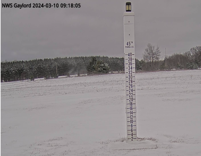
Just 3" up here with this one. Good for a very distant 4th place storm total of the winter.
-
-
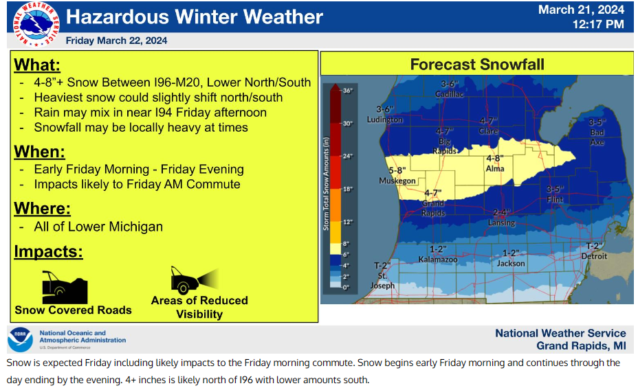
With a small patch/drift of snow next to my driveway, I'm looking at "snow-on-snow" to start off my spring right! (SMH) GRR's latest map with the heaviest about a county south of here, but we've been in a sort of sweet spot this mild winter, so I wouldn't be surprised if it bumped north, especially considering the time of year. Had 17F on my car dash heading to work this morning. Even our cove here at the lake has skinned back over with ice. Supposed to hit 50F by Monday at least, after yet another wintry weekend.
-
Happy St. Patrick's Day to all. There were grilled Reuben sandwiches for lunch Friday (on the house) in honor. Woke up to a dusting of fluffly LES making everything white again this morning. Went down to Rives Junction yesterday evening and it was still spring there with T-showers in the distance and green-up pretty noticeable about 40 miles south of Harrison. Bushes starting to get that green hue of early leaf-out. Have yet to see the early bulb flowers but I don't get into many places where I might see such tbh. Anyhow, have a great day whether you're Irish Catholic or not. I know it's the least desirable day of the week for the green beer drinking crowd.
-
Yep, gonna be interesting. Sunday I saw 10 Robins on my street, grass noticeably green about 1 county south, and small leaves seen here this evening walking the dog. See May 1923 for "I guess anything's possible" or even late April 2005. But 04-05 was a pretty harsh winter unlike this one.
-
Perhaps we just caught the right conditions up there but clearly July and August were AN. May must've been very forgettable, yuck!
-
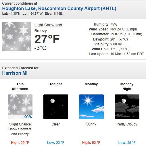
Going to be another astounding flip between today and 24 hrs later per my local forecast: Winter coat today...spring jacket tomorrow. Have to keep 'em both at hand lately, lol
-
At some point it must've flipped warm tho. I remember very warm Lake Michigan water that August all the way north of Petoskey, and that takes some doing. For the spring months, I do remember the 10" snowstorm in Flint on or about the equinox in March. After that I draw a blank until August, lol
-
Winter is back, just for the weekend tho. Looks pretty much like at my place this first morning of EDT. Blustery WC of 11F With piles and drifts melted-off, I do not foresee any sustained winter. Not ruling out random snow hits til late April up here ofc. Case in point, temps rebound here to above 60F most of the week. Hopefully, for not too long if/when it does. Thanks for the invite to AZ. Really like to get out there some time, just not going to be now unfortunately.
-
..and just like that, snow drifts and piles are on the endangered species list up here. The one that our contractor plowed up in an open spot along our street is down to about 18" by eye-ball gauge. Time to "spring forward" and Solar Summer is just around the corner. I'm fine with the shift. This is the time of year when I am pretty much done with winter (although last year we had our best month in March, lol). Not sure I can handle another 13-14 endless winter anymore, lol. @Tom I could use a little Pheonix about now.
-
Had to laugh. 82-83 was worse, lol. We not only got those 2 solid weeks of cold, it came with two big storms and my deepest snow in years. Strong Nino is almost always bad anyways. This sorta broke that for the first time since maybe 72-73.


