bud2380
-
Posts
5974 -
Joined
-
Last visited
-
Days Won
11
Everything posted by bud2380
-
Euro through 6am Friday.
-
Euro is off and running...
-
Canadian and GFS both very favorable for Iowa. The NAM and CAMs are further north. Typically not their best time frames for accuracy. The NAM sort of did good with the last storm showing further north earlier than most, but it was too far north as it had the SLP at one point going through Dubuque, IA. It ended up actually tracking through St. Louis, but it was on the right path with a further north snow shield that other models were not initially showing.
-
There is a tiny system today that looks like it may drop 1 to as much as 5" in isolated areas. The WRF-ARW shows this right over Cedar Rapids and Iowa City.
-
FV3 with Kuchera. This looks much better than the NAM for my area.
-
The RAP has the first round going way north. HRRR to a lesser extent too and NAM also a little further north.
-
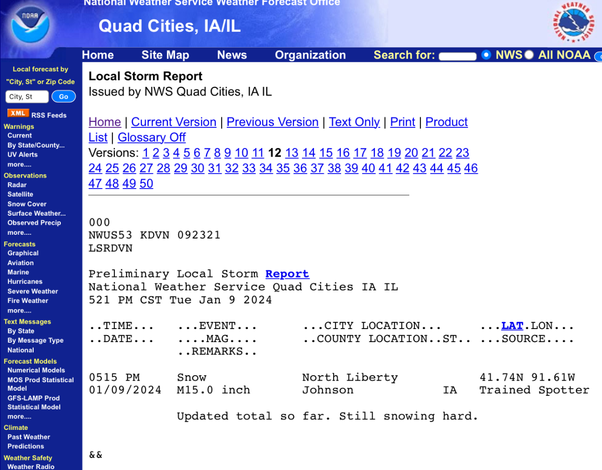
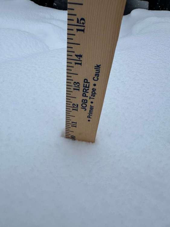
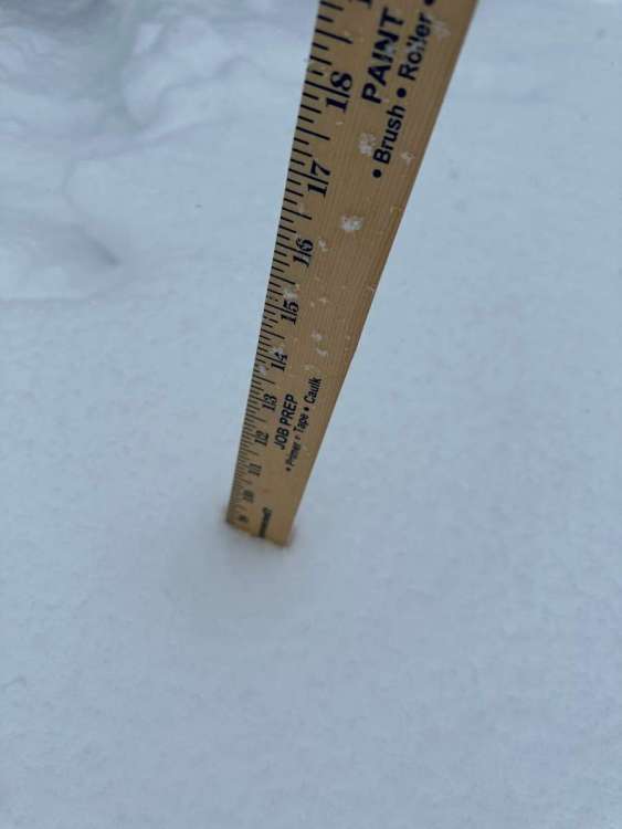
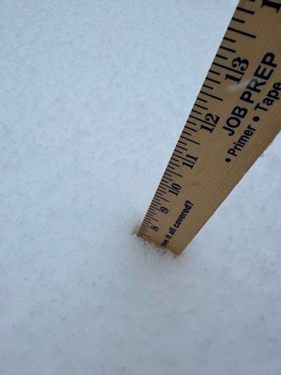
15” in North Liberty?? Man that’s 15 miles from me. I finished with 10.5”. It’s still snowing a little but it won’t really accumulate much more.

-
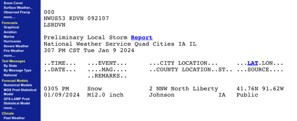
A foot in North Liberty where I lived for 15 years
-
Made it to 10”. Not sure we’ll get 11” though.
-
There is a report of 9.5" in Amana just a couple miles up the road from me. I assume that's about where I'm at now, since I was at 9.1" last time I measured.
-
Looks like the SLP tracked right over STL. Currently 982mb right near Indianapolis.
-
Snow is waning a bit at my house. I'm about 10 miles too far west for this current band of moderate to heavy snow. The wind has picked up though and visibility is poor. Measured 9.1" about 15 minutes ago. I expect I'll get to 10" but probably not 11".
-
8.5”
-
Gonna call this 7.3”. Got 6.5” on my lowest measurement and about 7.8” on my highest.
-
Ratios should be better than 10:1 with this one too.
-
Liking the looks of radar right now. There is a major band of dark green and yellow NW of the Quad Cities that is rotating this way, if it holds together or even strengthens, that band is definitely dropping 1-2" per hour rates. Overall everything seems to be strengthening right now. 8" is a minimum now, 10" is on the table still.
-
Took several measurements, all between 5.5 and 6.5". Very consistent measurements given the wet nature of the snow. The top layer is getting more fluffy though. I'll average those and call it 6" here and coming down moderately still. Looks like another 6 hours or more to go. I'm thinking we get to 9" here.
-
Yellow is parked overtop my house now, but the snow has only picked up a little bit. Flake size is just medium sized, no big flakes and not dumping down hard. I'd still call this moderate snow. Kind of disappointing.
-
I'm right in the heart of that. A heavy band is moving through Iowa City right now and heading right towards me. Fingers crossed we see 1"+/hour rates here.
-
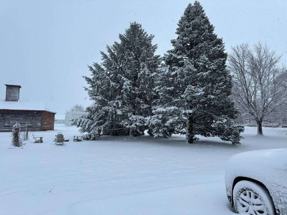
Such a long duration event again to try capture the whole thing in a 24 hour window is impossible. Looks like 4-6" in eastern Iowa is possible.
-
5” on the ground
-
I didn't realize there was nearly a 10" report when i posted that. Last I looked the report was 7" in central Iowa. Certainly they could end up with the highest total, but it wouldn't surprise me if someone in the Davenport area finishes with 12-15".
-
Just over 4" here. Range was 3.5-4.5" on my measurements. Most common were 4-4.3". It's snowing lightly now, but heavier bands are finally moving back in. Davenport is going to be the big winner in Iowa. Already over 5" as of 6am and they are getting rocked right now and have been for awhile with no end in sight. They will push well over a foot. I think 8" is our ceiling in my backyard unless some strong bands park overtop of us here.
-
3.5” down so far. Snow stopped for a bit overnight. Picking back up now. Decent rates right now but gonna need heavier rates to really push accumulations. 6-8” still seems on track.
-
This dry slot looks like it means business. Hope it fills in soon.