


Clinton
-
Posts
6522 -
Joined
-
Last visited
-
Days Won
28
Everything posted by Clinton
-
It will be. The NAM barely has a dusting here.
-
12z FV3
-
From Garys blog this morning: We had a similar issue with the last storm. In that one we wondered if the storm would stretch out and weaken too fast and lower snow totals, or would it hold together. We made the accurate prediction of it holding together. As it passed by it stretched out and weakened rapidly. This time we have similar issues, but instead of it having to hold together, we will be wondering if it will strengthen just a little bit. Seems to me there is a possibility of this strengthening overhead which would be good for us and real good for those further NE.
-
9z SREF in line with the GEFS on placement only weaker.
-
6z Euro Control and Mean are further south and weaker. 10:1 maps
-

February 2022 Observations and Discussions
Clinton replied to Grizzcoat's topic in East of the Rockies
Big change here from the 70's yesterday to frz drizzle this morning. Feels like March has already started. -
No significant changes with placement on the 6z GEFS but some ensembles are producing some bigger snows.
-
0z GEFS nudged NW better for KC. EAX mentioned ratios being 15:1 or better, could be a decent snow for some.
-
Dry air may be the problem, maybe some will make it to the ground.
-
I need 5 to get to 20 inches for the month, so I'm pulling for it lol.
-
0z RGEM and GFS in agreement for a widespread light snow event with a narrow band of higher totals. 0z GFS 0z RGEM
-
18z GEFS with a bump in totals for some.
-
It has a bit of an overrunning event. I wish all the energy would come out in 1 piece.
-
February 2022 Observations and Discussions
Clinton replied to Grizzcoat's topic in East of the Rockies
GEFS and EPS tank the EPO. We may have a brief warm up to start March but only brief imo. -
12z GFS much better
-
This storm looks to produces enough snow to get me to my season average. 6z GEFS would give Detroit, Chicago and myself a 2-4 inch snow.
-
0z GFS gets a little snow into KC.
-
President's Day - Washington's B Day Winter Storm
Clinton replied to Tom's topic in East of the Rockies
18z Euro -
18z GFS develops a larger snowfield further east, lays down decent snows from mby and points east. GFS is the furthest SE models as of now,
-
12z GEFS with another jump NW
-
12z GFS also further north this run. Also picking up on some les.
-
February 2022 Observations and Discussions
Clinton replied to Grizzcoat's topic in East of the Rockies
The warm windy conditions will make quick work of my snowpack today, highs are expected to reach 60. I could make a run at 70 tomorrow before temps come crashing down on Tuesday. -
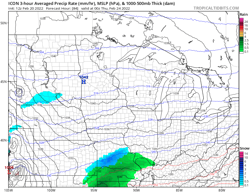
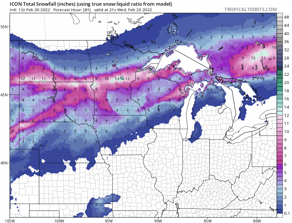
12z ICON continues to be further NW and stronger.
-
6z Euro Control very wet at 10:1. Euro ensembles shifted further NW
-
6z GFS and GEFS. The GEFS came in more juiced and a little further north.


