


Kayla
-
Posts
5926 -
Joined
-
Last visited
-
Days Won
14
Everything posted by Kayla
-
 Wow, outflow goes off on this run. 925mb temps drop down to -11c at hour 84 for PDX!
 -
In case anyone is wondering... GFS is NOT trending warmer on this run. Edit - Now it is!
-
Awesome. Getting a southerly breeze here currently but it hasn't affected my temp as I'm still holding steady at 31º. Should spell good news for everyone else later tonight.
-
You still seeing snow there? I'm honestly surprised I'm even seeing moderate sticking snow at 1,000ft this early in the evening.
-
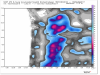
GFS continues the upward trend of snowfall for the PDX area. Shows a widespread area of 2-3" of snowfall now.
-
Latest 02z HRRR sure looks juicy and snowy for a lot of PDX peeps later tonight through the early morning hours.
-
Wow, looks like things are really overachieving so far. Sitting at 31º here currently, much colder than I thought I would be at this point tonight with a light dusting so far.
-
Down to 32 here now and beginning to accumulate.
-
Whatever blows your skirt up Indian head man.
-
Cute.
-
Yet the short term continues to improve but many continue to overlook it... Models are completely lost beyond day 3 so no reason to get too invested one way or another. Some snow tonight and 20's for highs is on the way for the next few days. Enjoy it!
-
Hard to believe anything beyond 84 hours these days. Tough time to be a TV Met...
-
Hmmm, maybe the NWS was onto something?? Big props to them if this actually ends up verifying.
-
Who pee'd in your Cheerios this morning?! Cheer up kid!
-
Wow, well this is pleasant surprise. Snowing moderately here now and sticking! Edit - Heavy snow here now.
-
Just saw a report of snowing in Hillsboro?! Can anyone confirm? Edit - Just started here now too!
-
Good sign for tonight.
-
Yeah. About the same as the last few runs. Edit - Final totals just came in and the ensemble mean went down to a little over 8" of snowfall.
-
Falling white!
-
Yeah, just insane outflow. Could keep PDX below 25º as early as Tuesday.
-
Ensembles still showing about 10" of snowfall for PDX. Still not really budging on that front.
-
12z low levels were definitely a lot colder than the 00z last night.
-
That's coming in the afternoon package.
-
They are either going to come out of tomorrow looking like geniuses or complete amateurs. Tough to see more than 1" of accumulations for anyone below 1,000'.
-
Oh don't worry, they were all over it this morning in the AFD. "Light rain ahead of the front will reach the SW WA coast early this afternoon and slowly move SW across the forecast area, reaching the Portland metro area around 4PM, Salem around 8 PM, and Eugene around 10 pm. The 12z model soundings show an interesting temperature and moisture profile mainly to the north when the precipitation first arrives. The surface is forecasted to be above warming, but the layer just above the surface is projected to be below freezing. This suggests that some snow could be mixed in with the rain initially. The precipitation will be light during this time, and do not expect any accumulations, but have updated this evening`s forecast to have a few hours of a rain/snow mix for parts of the Willamette Valley, the Columbia River Gorge, and the lower Columbia River Valley."

