


Cascadia_Wx
-
Posts
7050 -
Joined
-
Last visited
-
Days Won
25
Everything posted by Cascadia_Wx
-
Yeah. @SilverFallsAndrew’s split flow meltdown last week seemed to be in vain
-
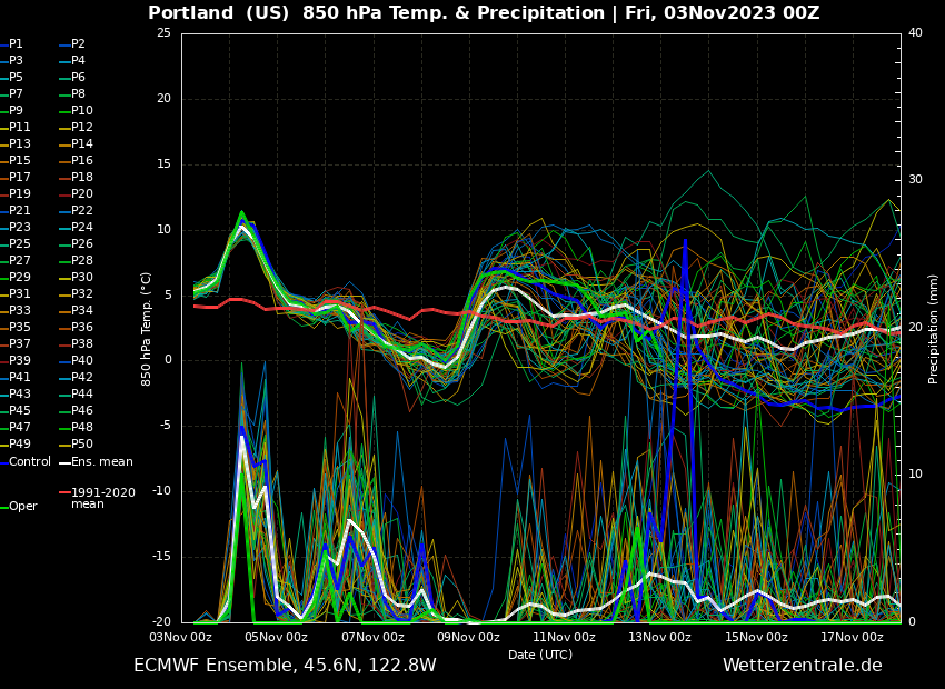
12z EPS looks pretty decent through at least the next 7-10 days

-
The warm blasts behind the last two systems have been stout. Seems like last half of October climo has been intruding into the first half of November in recent years. Glad we are gradually transitioning into a cooler and slightly more seasonable pattern starting tomorrow. I guess at very least warmth this time of year is anything but traditional El Niño timing.
-
These two statements seem to be wildly contradictory.
-
Last night’s EPS did not look too bad. On the wet side and near average temps overall. At least in the upper levels. Probably won’t be getting cold nights again anytime soon with such an active wavetrain.
-
November started out wet and cool with a 51/45 day on Wednesday, with just over an inch of rain out here. Classic warm front overriding cool air in place that day, with temps peaking late morning before the rain started, then falling into the mid-40s by late afternoon with evaporative cooling and Gorge winds holding on through midnight. Yesterday went from cool with light rain and drizzle in the morning (low of 48) to startlingly mild by noon or so, with sunbreaks and mild SSW winds pushing temps into the mid 60s. 64/48 day here. Overnight clearing has since allowed some of the densest fog of the season so far to form this morning. Visibility around 1/8 mile or less currently, with a temp of 46. Looking forward to another soaker starting later today.
-

October 2023 Weather in the PNW
Cascadia_Wx replied to TigerWoodsLibido's topic in West of the Rockies
Obs for the last two days of the month. Ended up with a 58/30 day on the 30th. Morning frost, clear skies and afternoon east winds. 56/34 day on Halloween. Light morning frost then high clouds drifting in at times, calmer afternoon winds. Overall a very visually appealing day sky-wise. -
October 2023 Weather in the PNW
Cascadia_Wx replied to TigerWoodsLibido's topic in West of the Rockies
Really stellar past few days here. I’ve been pleased by how nicely gradients have been relaxing at night, allowing much of the area away from the immediate Gorge to score multiple freezes. Friday was cool with morning fog and a chilly breeze in the afternoon. 53/35 spread (midnight low) Saturday was sunny and cool with a hard freeze in the morning then a somewhat breezy afternoon. 54/28 spread. Yesterday was a little milder but still cool, 56/32 spread. Afternoon east winds. This morning was a nice surprise with gradients relaxing enough for even colder temps than the night before. Clear and frosty with a low of 30. Currently sunny with light winds, and 42. -
October 2023 Weather in the PNW
Cascadia_Wx replied to TigerWoodsLibido's topic in West of the Rockies
Ended up with a chilly 49/41 spread yesterday. Socked in with low clouds much of the day until late afternoon, after which it cleared out for a very pretty evening. Low clouds hung around in spots much of the night, with fog developing toward morning. Foggy and 36 now which is my coldest low of the season so far. Hoping for a solid freeze tonight. -
October 2023 Weather in the PNW
Cascadia_Wx replied to TigerWoodsLibido's topic in West of the Rockies
Heavy rain and some rumbles of thunder. Temp dropped to 42 with this line of showers, which is the new low for the day. Even saw a few positive splats on the windshield pulling in. Picked up a quick 1/3” and it’s still coming down. 48/42 spread here so far. First sub-50 high since 4/20. -
October 2023 Weather in the PNW
Cascadia_Wx replied to TigerWoodsLibido's topic in West of the Rockies
I once drove to Hawaii and back in the same day with one arm tied behind my back. -
October 2023 Weather in the PNW
Cascadia_Wx replied to TigerWoodsLibido's topic in West of the Rockies
If I can’t fly there first class then have a vehicle of some sort haul me from the plane to the location in under 30 minutes, it’s not worth seeing. -
October 2023 Weather in the PNW
Cascadia_Wx replied to TigerWoodsLibido's topic in West of the Rockies
Think the moisture is just focused more to the south today. -
October 2023 Weather in the PNW
Cascadia_Wx replied to TigerWoodsLibido's topic in West of the Rockies
Warm day. 48 with moderate rain here. -
October 2023 Weather in the PNW
Cascadia_Wx replied to TigerWoodsLibido's topic in West of the Rockies
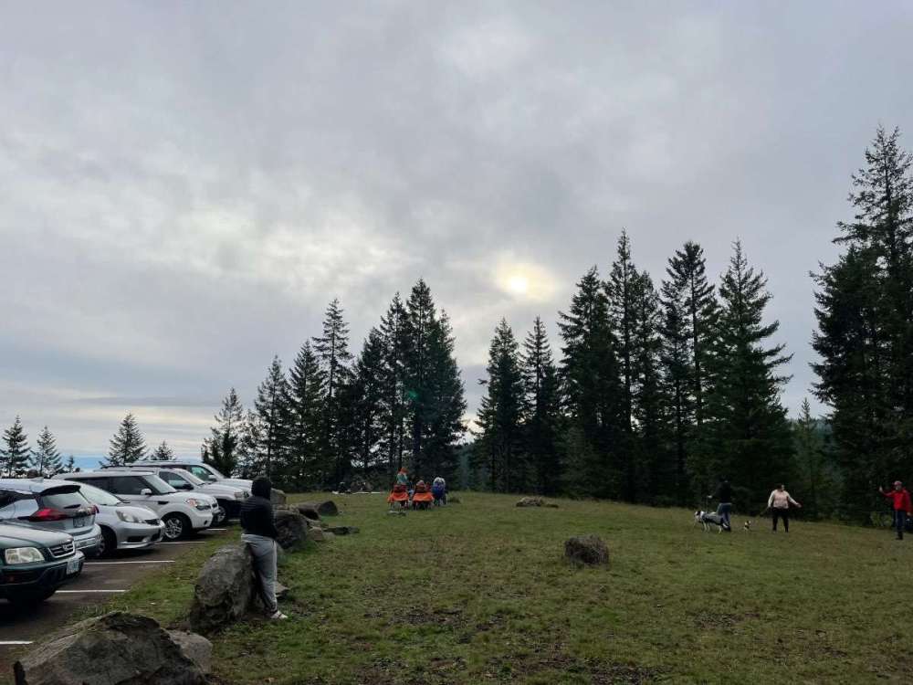
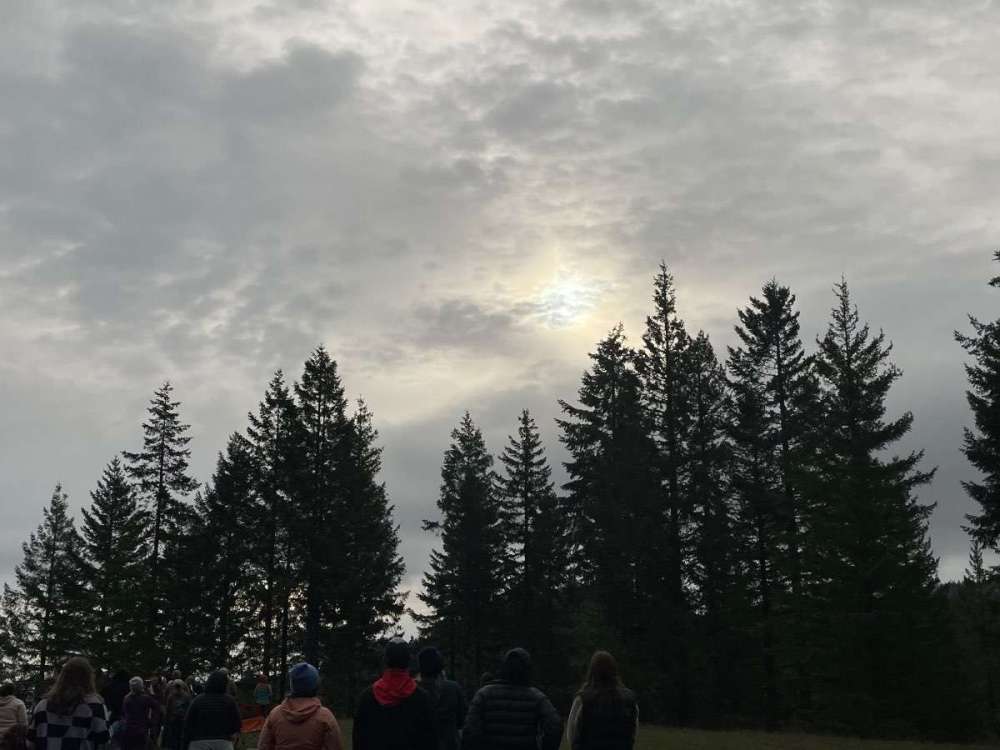
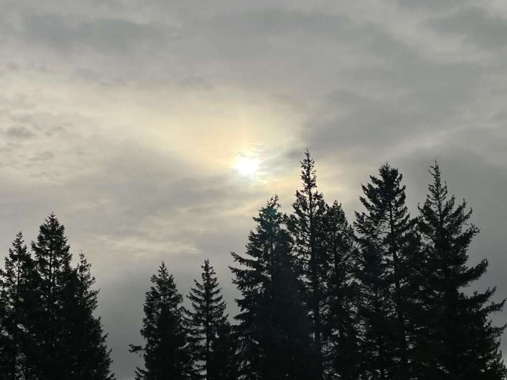
Forgot to mention, managed to get a great view of the annular eclipse from Mary’s Peak west of Corvallis a couple weeks ago. The weather forecast was pretty touch and go that day. Got really lucky with a thin spot in the clouds that persisted for a little while. Was able to see the ring of sun around the moon just with a pair of polarized sunglasses, and witnesses most of the moon’s transit. No great pics of the eclipse itself, but these show the weather conditions at least.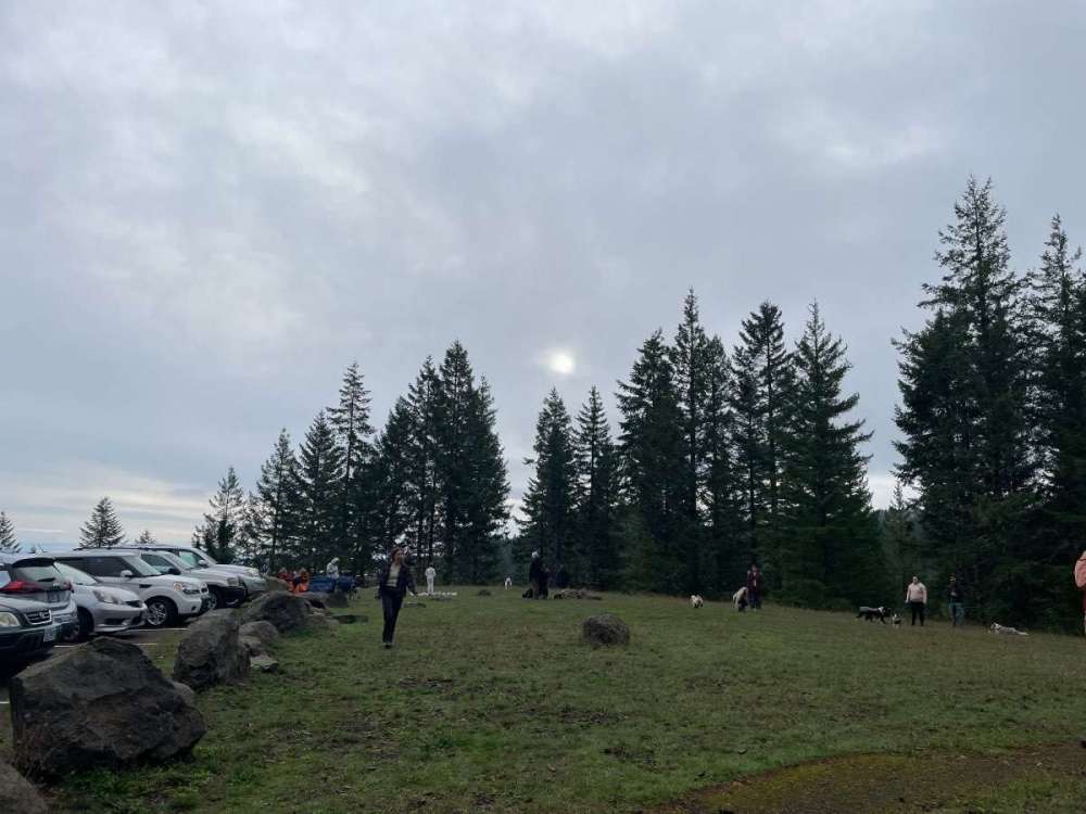
-
October 2023 Weather in the PNW
Cascadia_Wx replied to TigerWoodsLibido's topic in West of the Rockies
It was very nice, Andrew. -
October 2023 Weather in the PNW
Cascadia_Wx replied to TigerWoodsLibido's topic in West of the Rockies
Hope the mangos and pineapples are still thriving -
October 2023 Weather in the PNW
Cascadia_Wx replied to TigerWoodsLibido's topic in West of the Rockies
Spokane saw a 16/5 day with lots of sunshine this past February 23rd. Sun angles were higher than today at that point. -
October 2023 Weather in the PNW
Cascadia_Wx replied to TigerWoodsLibido's topic in West of the Rockies
Sun angles are at mid February levels at this point. Issue is more that airmasses are pretty marginal still this early in the season. It’s cool that you’re seeing it snow at all. -
October 2023 Weather in the PNW
Cascadia_Wx replied to TigerWoodsLibido's topic in West of the Rockies
Yes it has Andrew. Yes it has. -
October 2023 Weather in the PNW
Cascadia_Wx replied to TigerWoodsLibido's topic in West of the Rockies
Now for a weather roundup. Saturday ended up pretty decent, very dark with heavy drizzle in the afternoon and evening hours. A 59/52 spread, all told. Sunday was partly to mostly cloudy and milder, 63/51 spread. Monday was partly to mostly cloudy as well, cooler with a chilly NW breeze picking up later. 60/48 spread. Midnight low. -
October 2023 Weather in the PNW
Cascadia_Wx replied to TigerWoodsLibido's topic in West of the Rockies
First real chilly day of the season yesterday. Hit a high of 50 in the late morning before the rain started, fell to 44 by midnight. Moderate rain most of the afternoon, with some heavy downpours in the evening. Over 3/4” for the day overall, approaching 3” for the month. Scattered showers around this morning and cool, 46 currently after a low of 43 for the day so far. -
October 2023 Weather in the PNW
Cascadia_Wx replied to TigerWoodsLibido's topic in West of the Rockies
The setup this week would have been a little more fun if the lobe of cold air Friday was progged to dig farther west, as originally advertised. Could have scored some hard freezes and maybe some highs in the 40s. But as it stands, this pattern will still help many spots avoid a top or all-time record warm month, and that in and of itself is a feat these days. -
October 2023 Weather in the PNW
Cascadia_Wx replied to TigerWoodsLibido's topic in West of the Rockies
How does this rank with their latest? Also interesting, they made over to four months with no sub-60 highs (June 18th-October 24th) after coming off an historically long period with no 60+ highs last winter (November 4th-March 16th) -
October 2023 Weather in the PNW
Cascadia_Wx replied to TigerWoodsLibido's topic in West of the Rockies
Pretty remarkable how watered down this “event” has become. We’re back to high heights and ridging in about four days.


