

Tyler Mode
-
Posts
2376 -
Joined
-
Last visited
-
Days Won
34
Everything posted by Tyler Mode
-
January Weather In The PNW 2024 (Part III) - The Warming Shot
Tyler Mode replied to iFred's topic in West of the Rockies
A lady gave birth inside the Battle Ground fire station this morning. Couldn't get to the hospital. That'll be a story!- 6999 replies
-
- 12
-

-

-
January Weather In The PNW 2024 (Part III) - The Warming Shot
Tyler Mode replied to iFred's topic in West of the Rockies
27.7 and very heavy freezing drizzle right now. All the trees are starting to bow now. Haven't seen or heard of any damage yet though. It'll be close. -
January Weather In The PNW 2024 (Part III) - The Warming Shot
Tyler Mode replied to iFred's topic in West of the Rockies
Still 27, no big southerly push.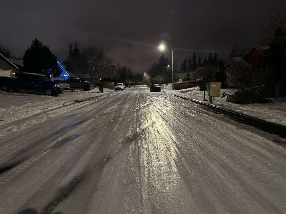
- 6999 replies
-
- 10
-
-

-
January Weather In The PNW 2024 (Part III) - The Warming Shot
Tyler Mode replied to iFred's topic in West of the Rockies
Slowly warming from up above...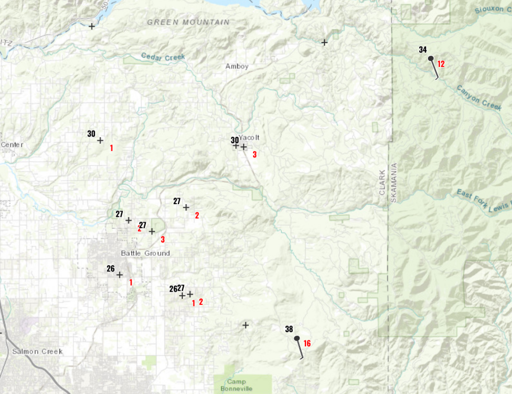
-
January Weather In The PNW 2024 (Part III) - The Warming Shot
Tyler Mode replied to iFred's topic in West of the Rockies
https://www.wrh.noaa.gov/map/?&zoom=11&scroll_zoom=false¢er=45.719124575395526,-122.32864379882814&boundaries=false,false,false,false,false,false,false,false,false&tab=observation&hazard=true&hazard_type=all&hazard_opacity=70&obs=true&obs_type=weather&elements=temp,wind,gust&temp_filter=-80,130&gust_filter=0,150&rh_filter=0,100&elev_filter=-300,14000&precip_filter=0.01,18&obs_popup=true&obs_density=60&obs_provider=ALL -
January Weather In The PNW 2024 (Part III) - The Warming Shot
Tyler Mode replied to iFred's topic in West of the Rockies
Precisely, rhodies do the same in the heat. This was from today. I watch my security cam timelapse and they do this every night, then pop back as it warms.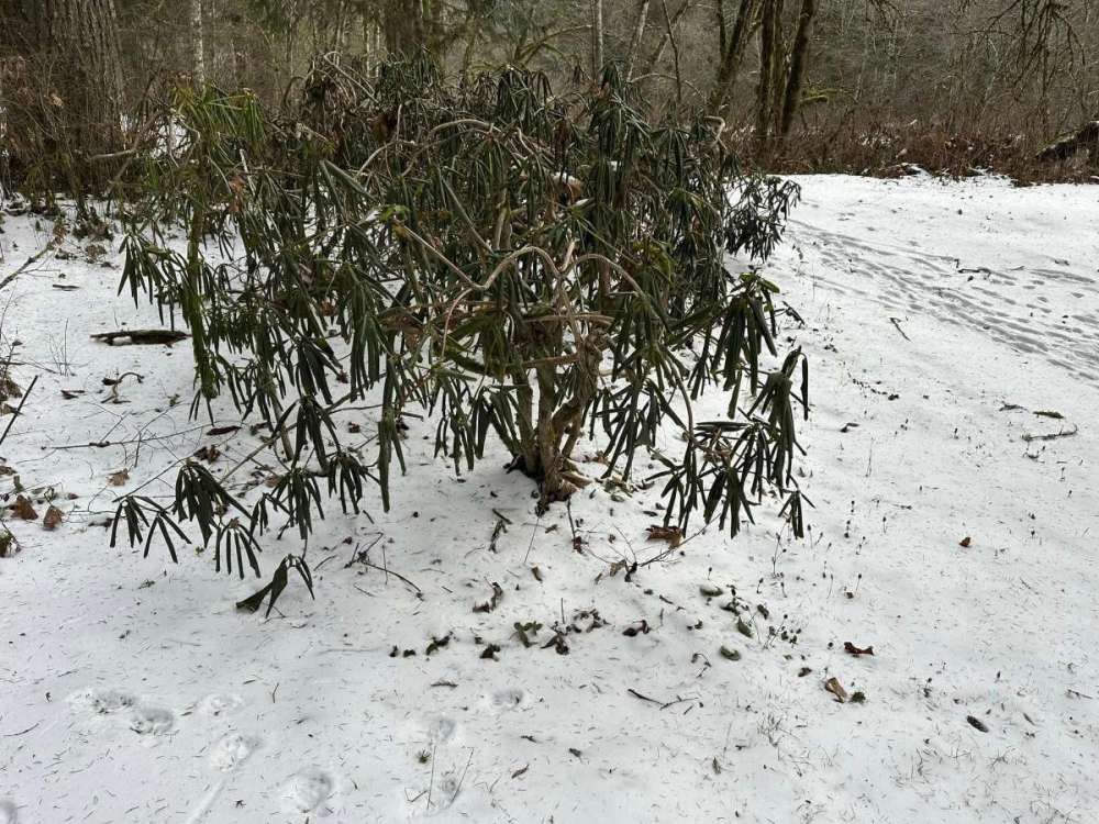
-
January Weather In The PNW 2024 (Part III) - The Warming Shot
Tyler Mode replied to iFred's topic in West of the Rockies
Euro doesn't show Eugene going above freezing until 9 PM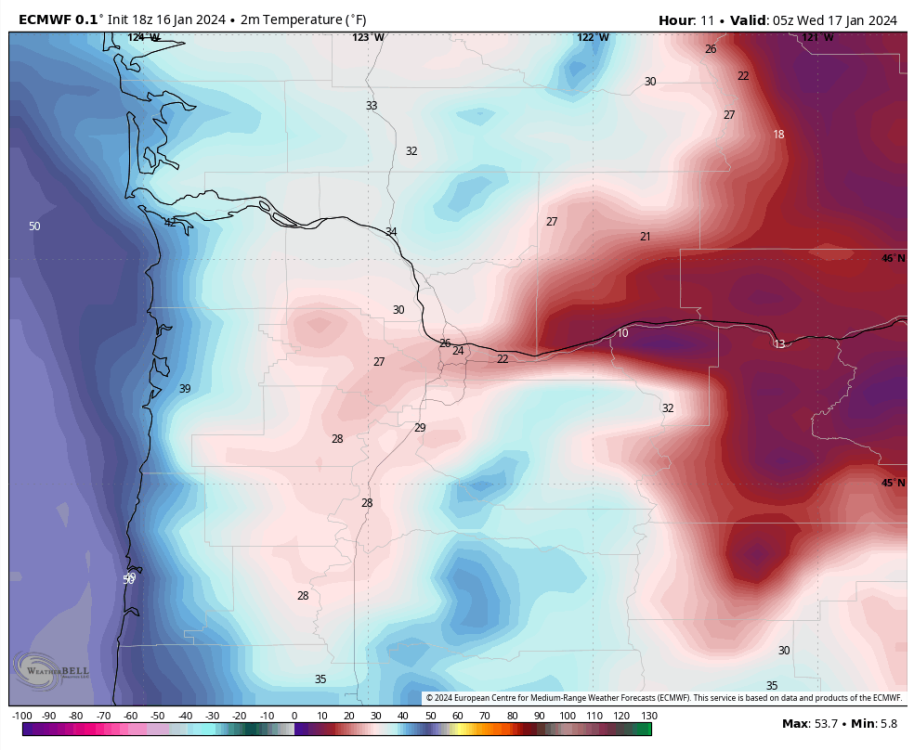
-
January Weather In The PNW 2024 (Part III) - The Warming Shot
Tyler Mode replied to iFred's topic in West of the Rockies


-
January Weather In The PNW 2024 (Part III) - The Warming Shot
Tyler Mode replied to iFred's topic in West of the Rockies
Closest I can find in valley is south of Eugene at Rice Hill, 34. Still a north wind though. -
January Weather In The PNW 2024 (Part III) - The Warming Shot
Tyler Mode replied to iFred's topic in West of the Rockies
Listening to the scanner and they are calling for a sand truck to "give people a fighting chance". They don't know where to close the freeway at this point. People can't make it up the exit they have them taking. -
January Weather In The PNW 2024 (Part III) - The Warming Shot
Tyler Mode replied to iFred's topic in West of the Rockies
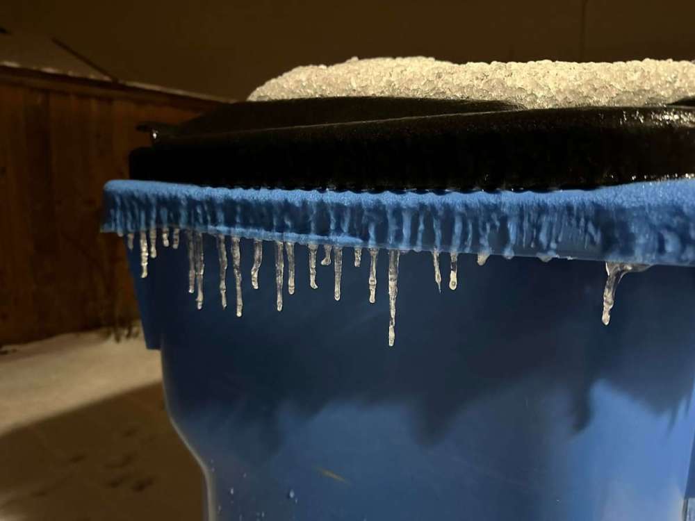
20 min of freezing rain...26 here, dewpoint 21.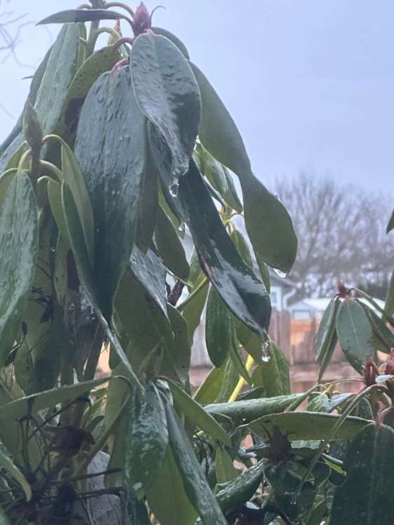
-
January Weather In The PNW 2024 (Part III) - The Warming Shot
Tyler Mode replied to iFred's topic in West of the Rockies
Already a roll over on I-5 at the fairgounds exit 9 in Clark County, driver is DOA- 6999 replies
-
- 12
-

-

-

-
January Weather In The PNW 2024 (Part III) - The Warming Shot
Tyler Mode replied to iFred's topic in West of the Rockies
Salem down to 25. -
January Weather In The PNW 2024 (Part III) - The Warming Shot
Tyler Mode replied to iFred's topic in West of the Rockies
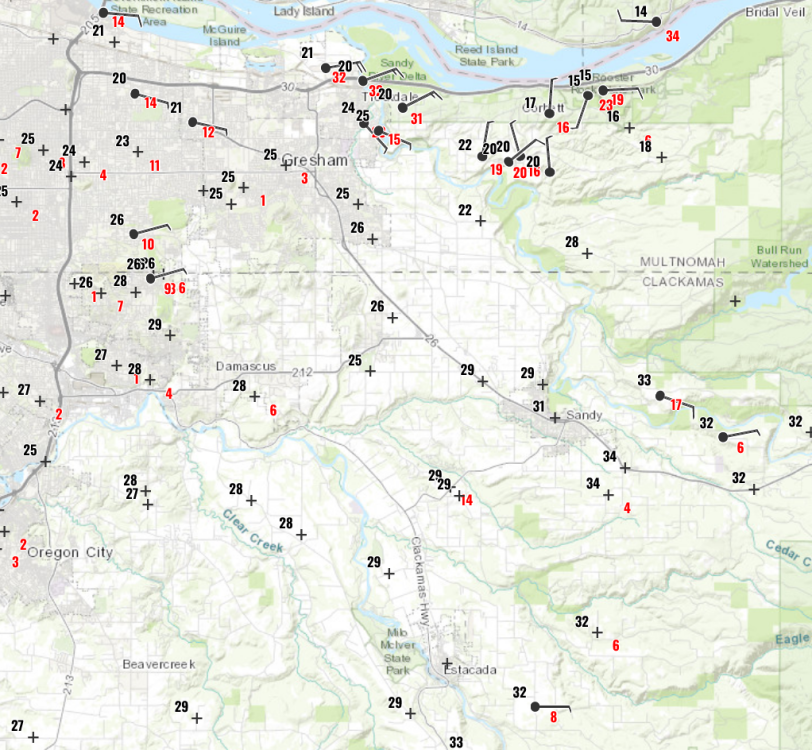
I saved this dewpoint map from earlier, you can see the cold air resurge out of the gorge. Will it be cold enough for freezing rain? Maybe right along the river.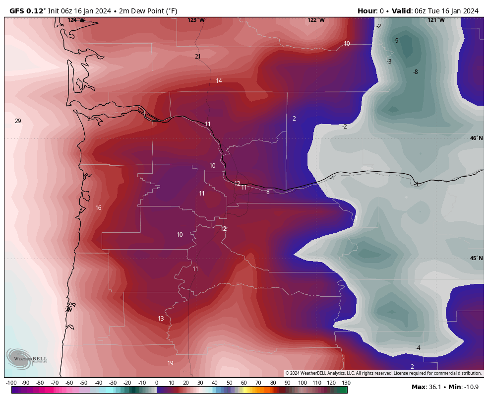
-
January Weather In The PNW 2024 (Part III) - The Warming Shot
Tyler Mode replied to iFred's topic in West of the Rockies
Already have seen this jump from 49 to 64,000.
-
January Weather In The PNW 2024 (Part III) - The Warming Shot
Tyler Mode replied to iFred's topic in West of the Rockies
About as low as this is gonna go...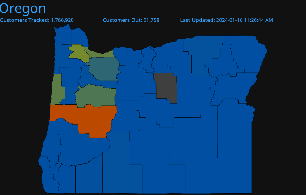
-
January Weather In The PNW 2024 (Part III) - The Warming Shot
Tyler Mode replied to iFred's topic in West of the Rockies
Don't they have to compensate you when it's been that long? They should if they don't! Just deplane! -
January Weather In The PNW 2024 (Part III) - The Warming Shot
Tyler Mode replied to iFred's topic in West of the Rockies
6z Euro is significantly cooler for PDX, but also warmer late Wednesday into Thursday. Edit: this is 6z to 6z comparison. It is also a little cooler than the 0z.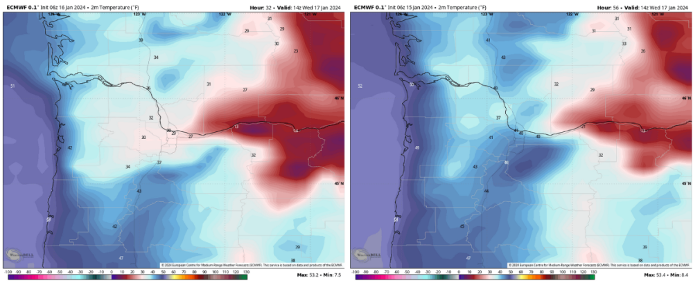
-
January Weather In The PNW 2024 (Part III) - The Warming Shot
Tyler Mode replied to iFred's topic in West of the Rockies
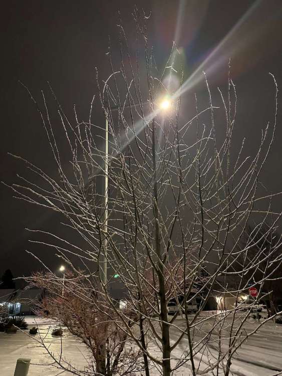
Loving the satellite showing the cold air, rivers in eastern Washington etc. Down to 11 here.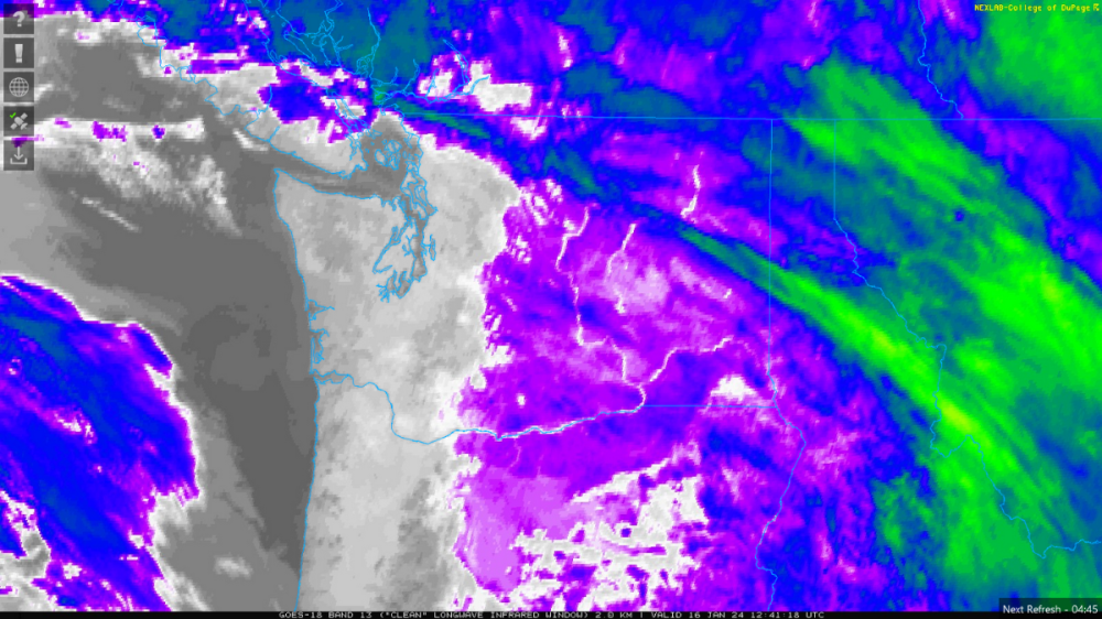
- 6999 replies
-
- 11
-
-
January Weather In The PNW 2024 (Part III) - The Warming Shot
Tyler Mode replied to iFred's topic in West of the Rockies
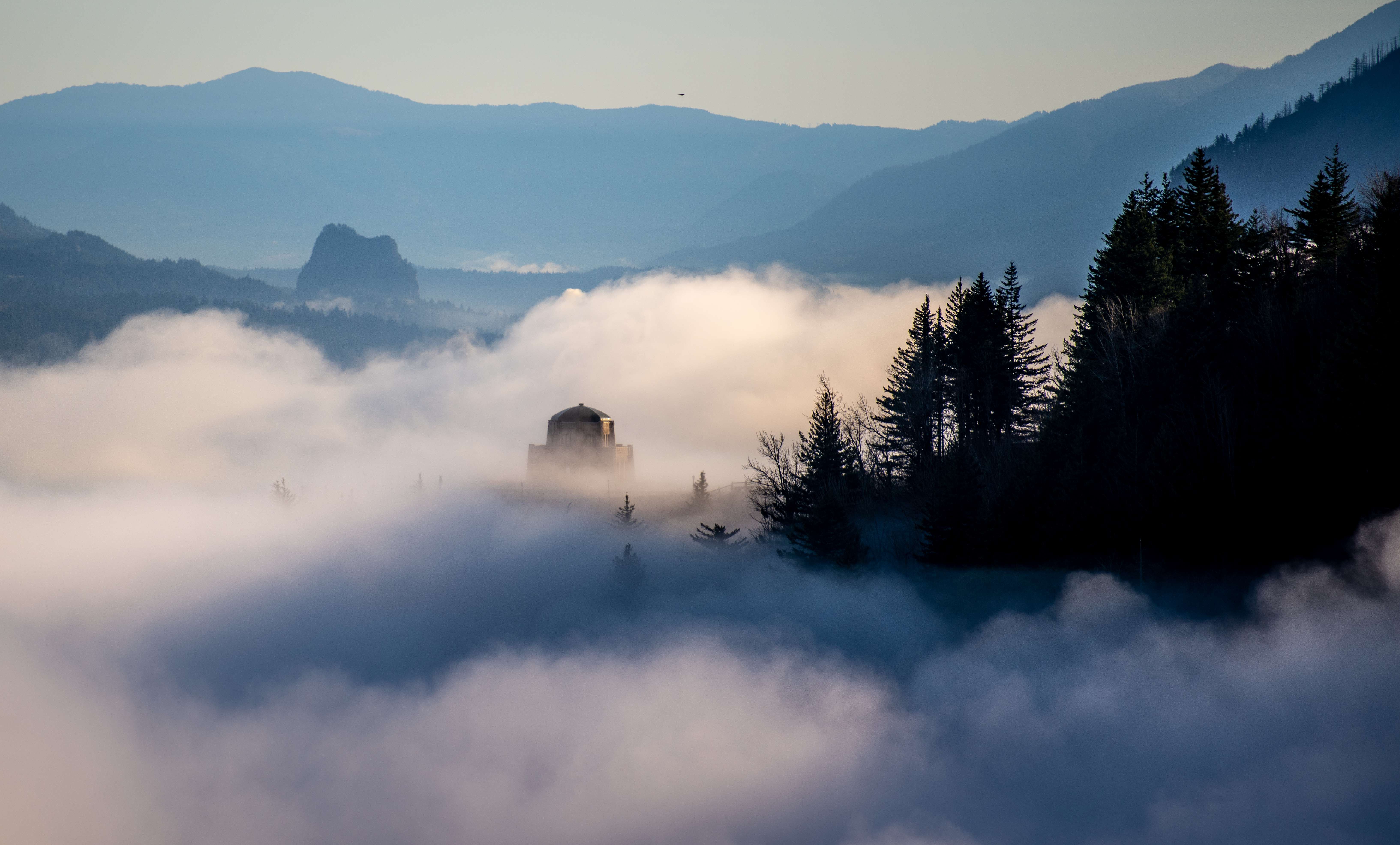
Short time lapse from Saturday- 6999 replies
-
- 13
-
-
January Weather In The PNW 2024 (Part III) - The Warming Shot
Tyler Mode replied to iFred's topic in West of the Rockies
Agreed! A few years ago my friend in Hot Springs said it was -2, suppose to get below 10 in a few nights. -
January Weather In The PNW 2024 (Part III) - The Warming Shot
Tyler Mode replied to iFred's topic in West of the Rockies
22 as of 1215. Dang cold! My record low high for today is 34, so that's going bye bye. -
January 2024 Weather in the PNW (Part II)
Tyler Mode replied to Meatyorologist's topic in West of the Rockies
14 degrees with moderate snow. It's a beautiful winter night. Just over 3" right now. -
January 2024 Weather in the PNW (Part II)
Tyler Mode replied to Meatyorologist's topic in West of the Rockies
Heaviest snow of the day and down to 14.9, making this my coldest temperature since 2017, and my coldest day ever. -
January 2024 Weather in the PNW (Part II)
Tyler Mode replied to Meatyorologist's topic in West of the Rockies
From the NWS in Portland... Much of the hires guidance is showing the low coming onshore this evening somewhere between Waldport and Florence. The frontal boundary will lift north and stall producing a deformation band somewhere over the northern Willamette Valley to just north of the Columbia River. The atmospheric column will remain saturated and cool as the low tracks southeast, dragging cold air further south. This will transition sleet to snow for areas in the deformation band. Ensemble guidance continues to show a quick moving shortwave that will move onshore the Pacific NW late Tuesday into Wednesday. The low will bring widespread stratiform rain and bring snow levels up to around 4000-5000 ft. But, the overriding warm air will not be able to push the cold air out of the central and northern Willamette Valley. This will bring chances for freezing rain to much of the aforementioned areas. Long-range ensemble guidance is showing a mean 6 hour freezing rain accumulations ranging from 0.25-0.50" across much of the major cities during this time. This will be the primary focus after the current system comes to a close.


