
SilverFallsAndrew
-
Posts
56583 -
Joined
-
Last visited
-
Days Won
403
Everything posted by SilverFallsAndrew
-

December 2018 Weather in the Pacific Northwest
SilverFallsAndrew replied to Tyler Mode's topic in West of the Rockies
I for one enjoy Tim's snow maps. -
December 2018 Weather in the Pacific Northwest
SilverFallsAndrew replied to Tyler Mode's topic in West of the Rockies
As we head towards Christmas I think we are going to start seeing a western ridge/cold east pattern start to emerge. -
December 2018 Weather in the Pacific Northwest
SilverFallsAndrew replied to Tyler Mode's topic in West of the Rockies
FV3 is further north with that low, but does show some snow showers in W. Washington in the post frontal airmass. Shawnigan Lake still looks to do well though. -
December 2018 Weather in the Pacific Northwest
SilverFallsAndrew replied to Tyler Mode's topic in West of the Rockies
This front is much more vigorous than I was expecting. -
December 2018 Weather in the Pacific Northwest
SilverFallsAndrew replied to Tyler Mode's topic in West of the Rockies
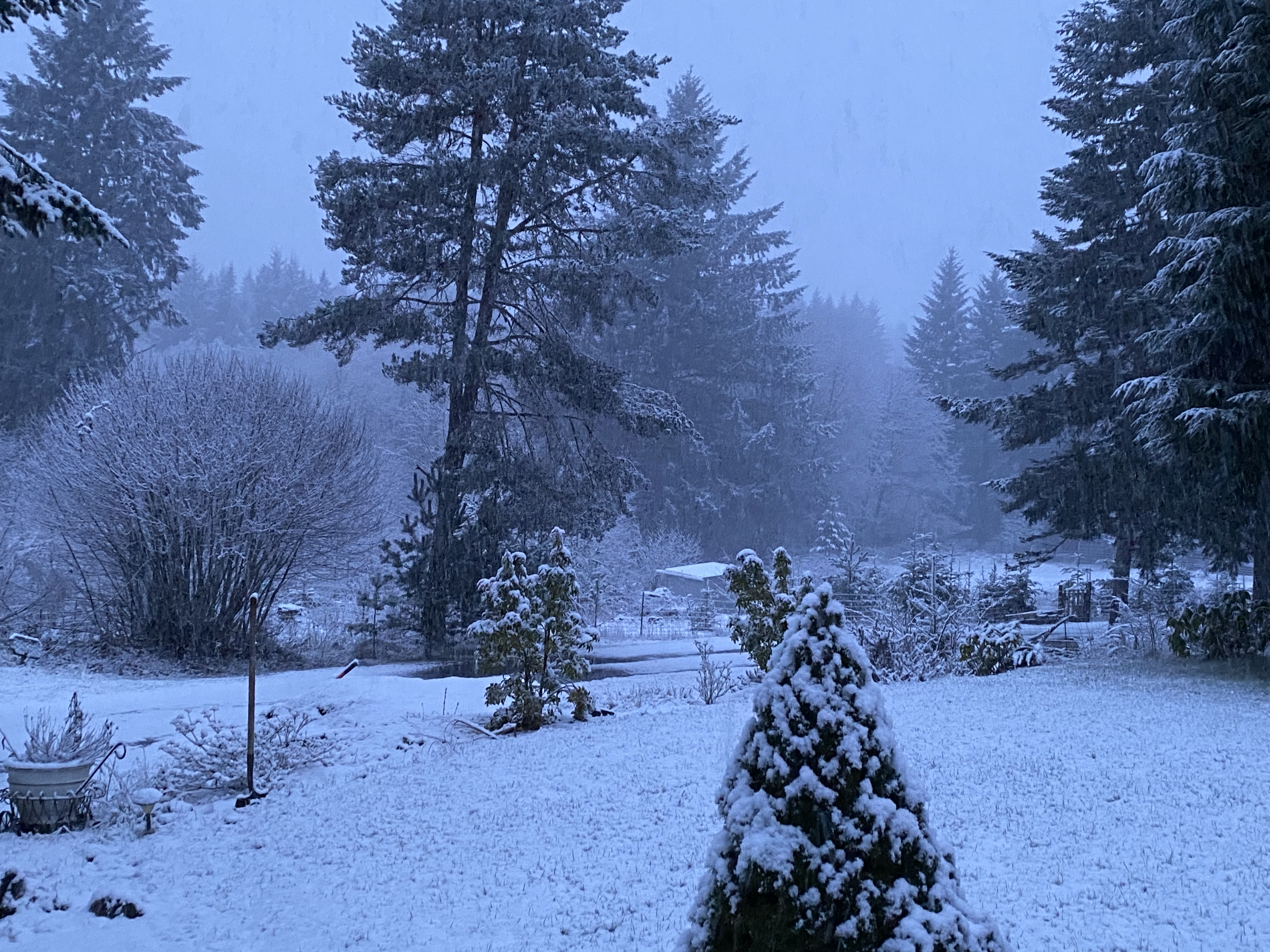
Snow at Shawnigan Lake -
December 2018 Weather in the Pacific Northwest
SilverFallsAndrew replied to Tyler Mode's topic in West of the Rockies
Well if it doesn't look good for 1600' chances are it won't look good for the valley. -
December 2018 Weather in the Pacific Northwest
SilverFallsAndrew replied to Tyler Mode's topic in West of the Rockies
Looks whet -
December 2018 Weather in the Pacific Northwest
SilverFallsAndrew replied to Tyler Mode's topic in West of the Rockies
The devils in the details and the details have been steadily regressing since about the 18z yesterday. Very wet, very active, lots of mountain snow, but trending in the wrong direction for anything for about 99% of us. Looks like a good arctic air dump around Christmas into the middle of the country. By that time the pattern is such we don't need to worry about any cold air within about 1,000 miles! -
December 2018 Weather in the Pacific Northwest
SilverFallsAndrew replied to Tyler Mode's topic in West of the Rockies
This season causes me to be a bipolar mess. I should probably just stick to digging up stats from past events. -
December 2018 Weather in the Pacific Northwest
SilverFallsAndrew replied to Tyler Mode's topic in West of the Rockies
GFS was a hot turd aside from maybe a little snow up here next Saturday. Some cold ensembles towards Christmas at least. -
December 2018 Weather in the Pacific Northwest
SilverFallsAndrew replied to Tyler Mode's topic in West of the Rockies
Great holiday pics guys! -
https://www1.ncdc.noaa.gov/pub/orders/IPS/IPS-FA0A62D8-0540-4FCE-8981-8B33D657B3D5.pdf
-
December 2018 Weather in the Pacific Northwest
SilverFallsAndrew replied to Tyler Mode's topic in West of the Rockies
Love how active the GFS is looking. BRING IT! -
December 2018 Weather in the Pacific Northwest
SilverFallsAndrew replied to Tyler Mode's topic in West of the Rockies
Trying to get some people to look into this. -
December 2018 Weather in the Pacific Northwest
SilverFallsAndrew replied to Tyler Mode's topic in West of the Rockies
Really embarrassing that the record lows listed for Salem and Eugene for today's date are from 2013 and the -12's from 1972 have been completely purged from the climate record. Not hard to understand why people don't trust scientists on climate change when they fudge and skew the data warmer. I think I'm going to write a few emails. -
December 2018 Weather in the Pacific Northwest
SilverFallsAndrew replied to Tyler Mode's topic in West of the Rockies
Yeah I've noticed that many times. And then they'll be a run that's pretty meh, but some inaccurate snow map shows a dusting somewhere and people go bonkers over it. -
December 2018 Weather in the Pacific Northwest
SilverFallsAndrew replied to Tyler Mode's topic in West of the Rockies
A lot of total degeneracy in our major cities. Portland MAY be worse than Seattle. -
December 2018 Weather in the Pacific Northwest
SilverFallsAndrew replied to Tyler Mode's topic in West of the Rockies
The Willamette Valley is hanging onto the low level cold pretty well. Up here, not so much. We are at 42 right now. Looks like Salem is 37. -
December 2018 Weather in the Pacific Northwest
SilverFallsAndrew replied to Tyler Mode's topic in West of the Rockies
Really liking that active look on the 12z GFS! Snow level may dip down to my elevation a couple times, but a couple tweaks and it could be better for everyone. 06z ensembles are intriguing. -
December 2018 Weather in the Pacific Northwest
SilverFallsAndrew replied to Tyler Mode's topic in West of the Rockies
Noon obs 43 PDX 38 SLE 34 EUG 34 CVO -
December 2018 Weather in the Pacific Northwest
SilverFallsAndrew replied to Tyler Mode's topic in West of the Rockies
Yeah no clear signals for anything though. I'll be traveling a lot the next couple of weeks so I'm not that worried about weather or not I see snow at my place since I won't be there much. After about the 20th I'll take a much keener interest. -
December 2018 Weather in the Pacific Northwest
SilverFallsAndrew replied to Tyler Mode's topic in West of the Rockies
Just looking at Burns for January 2017. It was their coldest month on record at Burns Municipal, but they only have solid records back to about 1980 for that station. About half a degree colder than December 1985 there and easily the coldest January in that era. -
December 2018 Weather in the Pacific Northwest
SilverFallsAndrew replied to Tyler Mode's topic in West of the Rockies
Maybe today. I doubt this weak system is going to bring a huge push of warm air. We probably just won't see temps drop at all overnight. -
December 2018 Weather in the Pacific Northwest
SilverFallsAndrew replied to Tyler Mode's topic in West of the Rockies
Burns started having real winters again during the winter of 2010-11. -
December 2018 Weather in the Pacific Northwest
SilverFallsAndrew replied to Tyler Mode's topic in West of the Rockies
https://twitter.com/NWSBoise/status/1070482599968165888
